REMSEM
72 posts

REMSEM
@ODnature_REMSEM
The REMSEM team makes use of remote sensing tools to carry out fundamental scientific research and provide management advice to governmental organizations.
Brussels, Belgium Katılım Mayıs 2019
13 Takip Edilen180 Takipçiler
The REMSEM team is looking for a new colleague to join us in developing operational ocean color products/services to support marine management activities: naturalsciences.be/en/about-us/or…
English
Interested in joining the REMSEM team at developing ocean color products/services to support marine management activities? Please have a look at our open position: naturalsciences.be/en/about-us/or…
English
REMSEM retweetledi

More data coming!
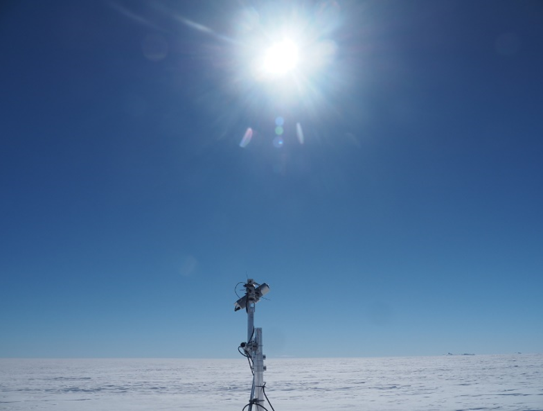
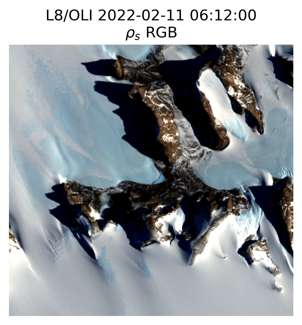
At the request of the @RBINSmuseum, @esa temporarily increased the frequency of @CopernicusEU #Sentinel2 B acquisitions collected over the Princess Elisabeth Antarctica, a Belgian Antarctic research station situated in the Sør Rondane mountains in Antarctica.

English
REMSEM retweetledi
Also very interesting: @PolarFoundation is supporting cal/val activities taking place at the @AntarcticBaseduring the #Sentinel2 acquisition campaign. The Princess Elisabeth Antarctica was chosen as a HYPSTAR validation site.
English
REMSEM retweetledi

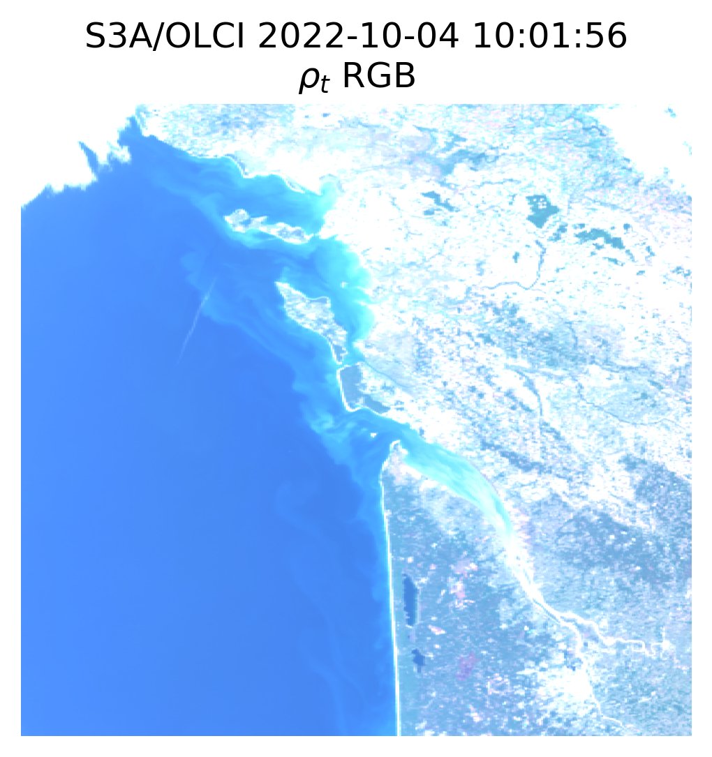
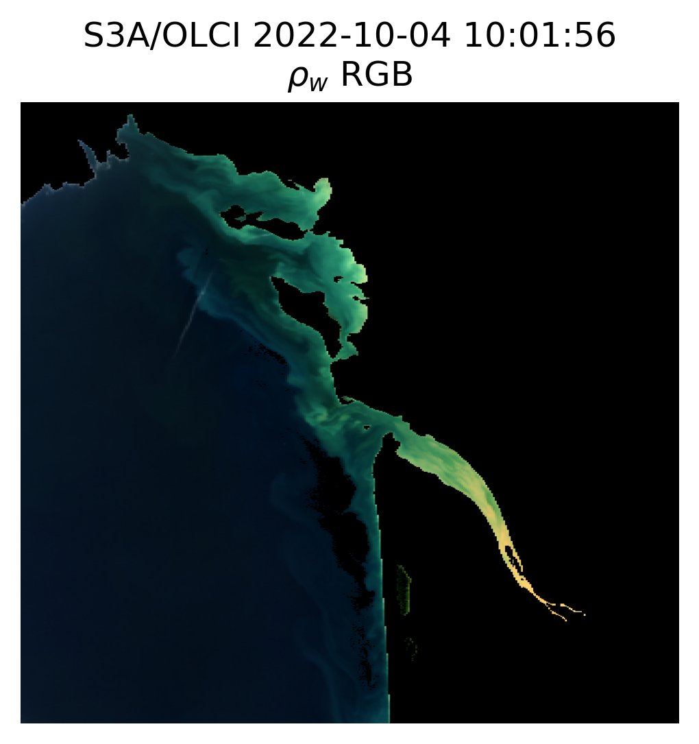
New ACOLITE release available at github.com/acolite/acolit… This release fixes some issues with OLCI processing and includes EUMETSAT TOA gains. Here an example RGB composite of top-of-atmosphere and water reflectances over the Gironde estuary and French Atlantic coast.
English
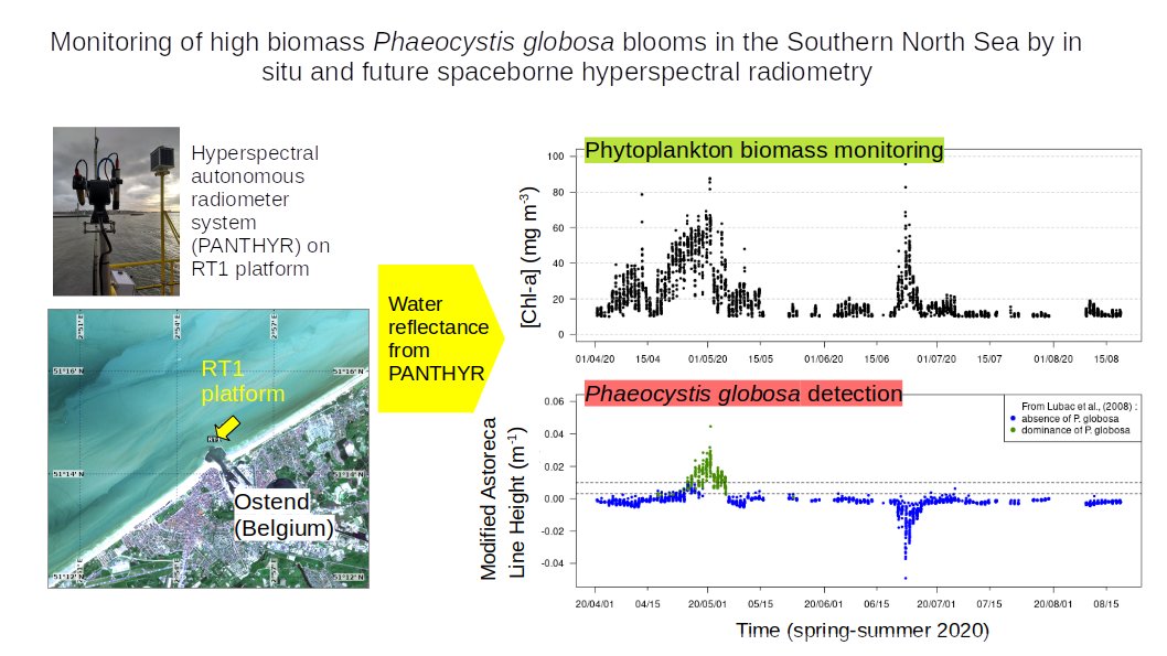
In the Southern North Sea, PANTHYR autonomous hyperspectral radiometer is used to monitor blooms of Phaeocystis globosa, an algae with negative environmental impacts. Performance of future hyperspectral satellites could also be simulated. More info here : #f0070" target="_blank" rel="nofollow noopener">sciencedirect.com/science/articl…
English
REMSEM retweetledi

Great news after the summer break! What are the performances of @SatellitePrisma Level 2D and ACOLITE derived water reflectance over two optically diverse inland and coastal sites? Read here 👇 authors.elsevier.com/a/1fcEx3I9x1j9…
English

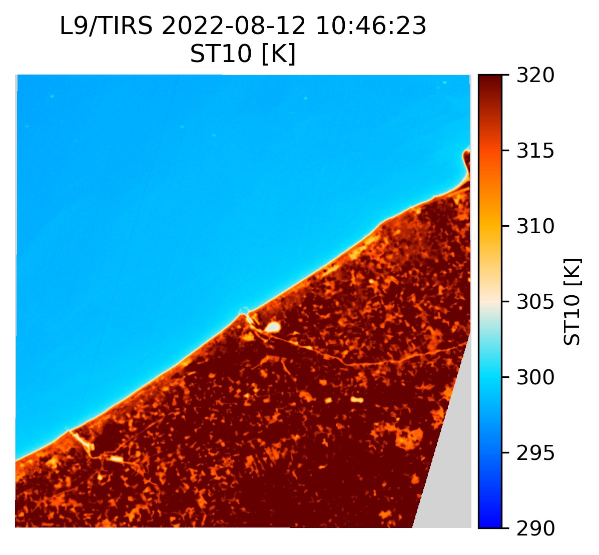
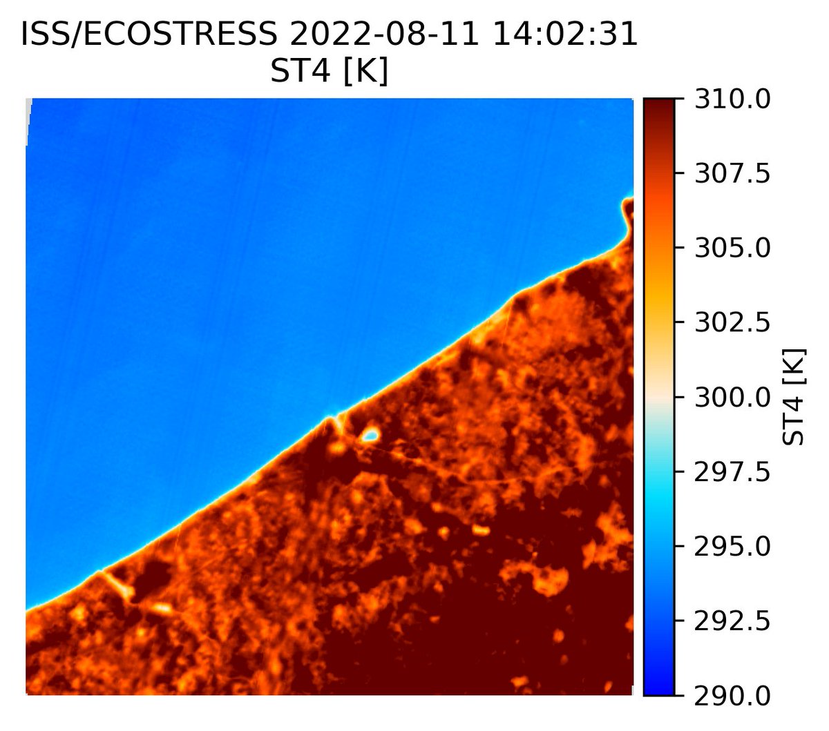
ECOSTRESS processing added to ACOLITE/TACT! Here two images of the Belgian coast taken one ISS orbit (about 90 minutes) apart on 2022-08-11. Note the stable, lower temperature of the sea, and the more rapid cooling of land areas closer to the sea from 14:30 to 16:00 local time.

English
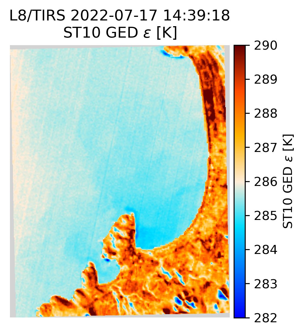
Added ASTER Global Emissivity Dataset as option to ACOLITE/TACT for better surface temperature retrievals over land. Here a comparison of Landsat 8 TACT outputs using unity emissivity and GED emissivity for La Serena, Chile. GDAS1 atmospheric profiles for NRT processing.


English
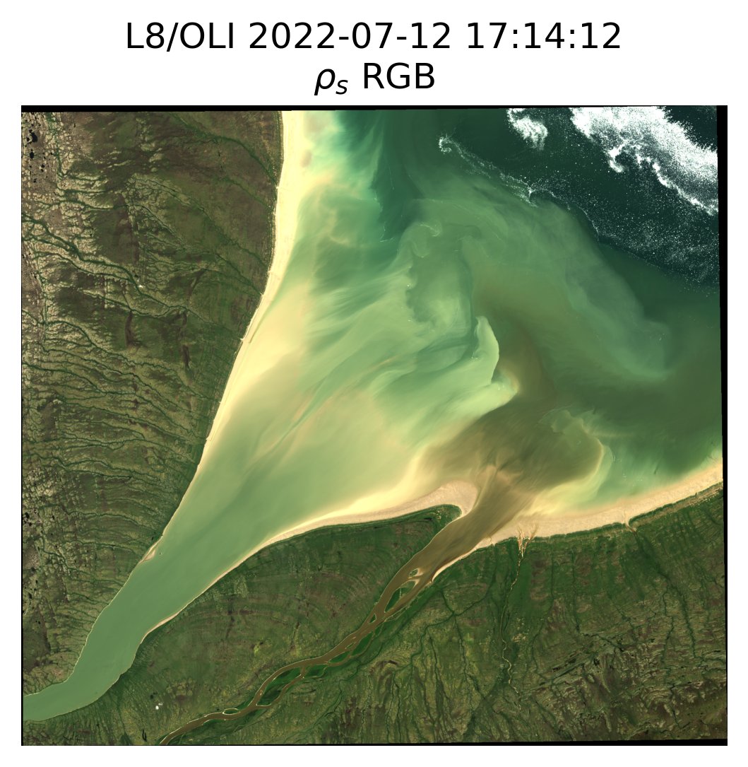
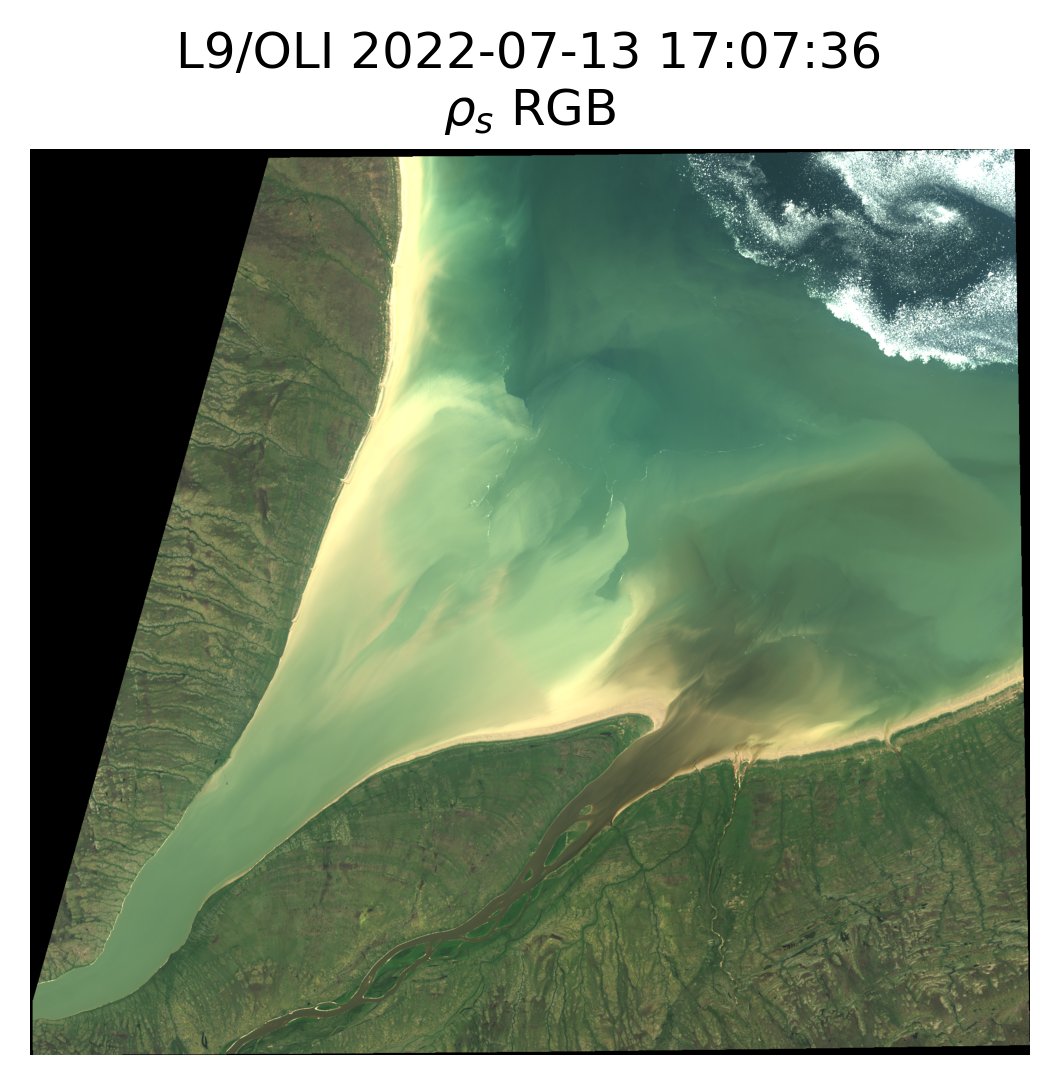
ACOLITE/TACT near-realtime processing using GDAS1 forecast profiles! For scenes older than 90 days the default ERA5 reanalysis is recommended. Here the Nelson and Hayes rivers bringing sediments and warm water into Hudson Bay as imaged by L8 and L9 on 2022-07-12 and 2022-07-13.


English
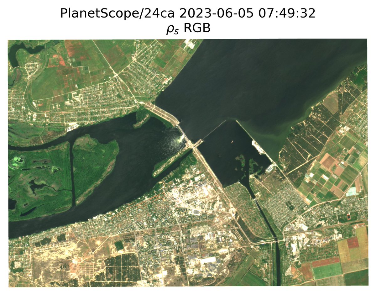
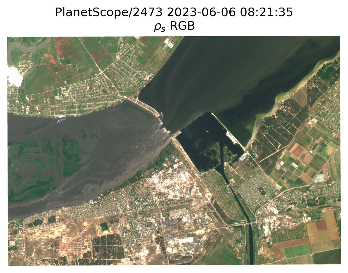
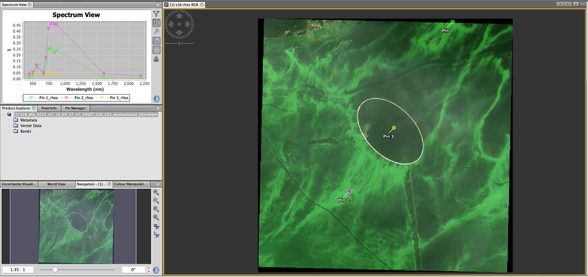
An artificial elliptical island under construction by Poland in the Vistula Lagoon, tentatively named Wyspa Estyjska / Aestian Island. Imaged here by Sentinel-2B on 2022-07-19. The strong red edge peak indicates these are floating scums in the lagoon surrounding the island.
English

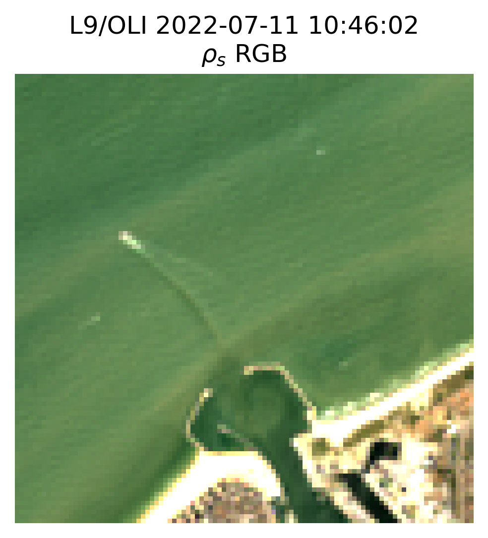
Pansharpening of Landsat 7/8/9 data for visualisation was added to the ACOLITE Github code, and will be available in the next binary release! Here a surface level reflectance RGB image from L9/OLI of Oostende, Belgium at 30 metres and at 15 metres pixel size after pansharpening.

English
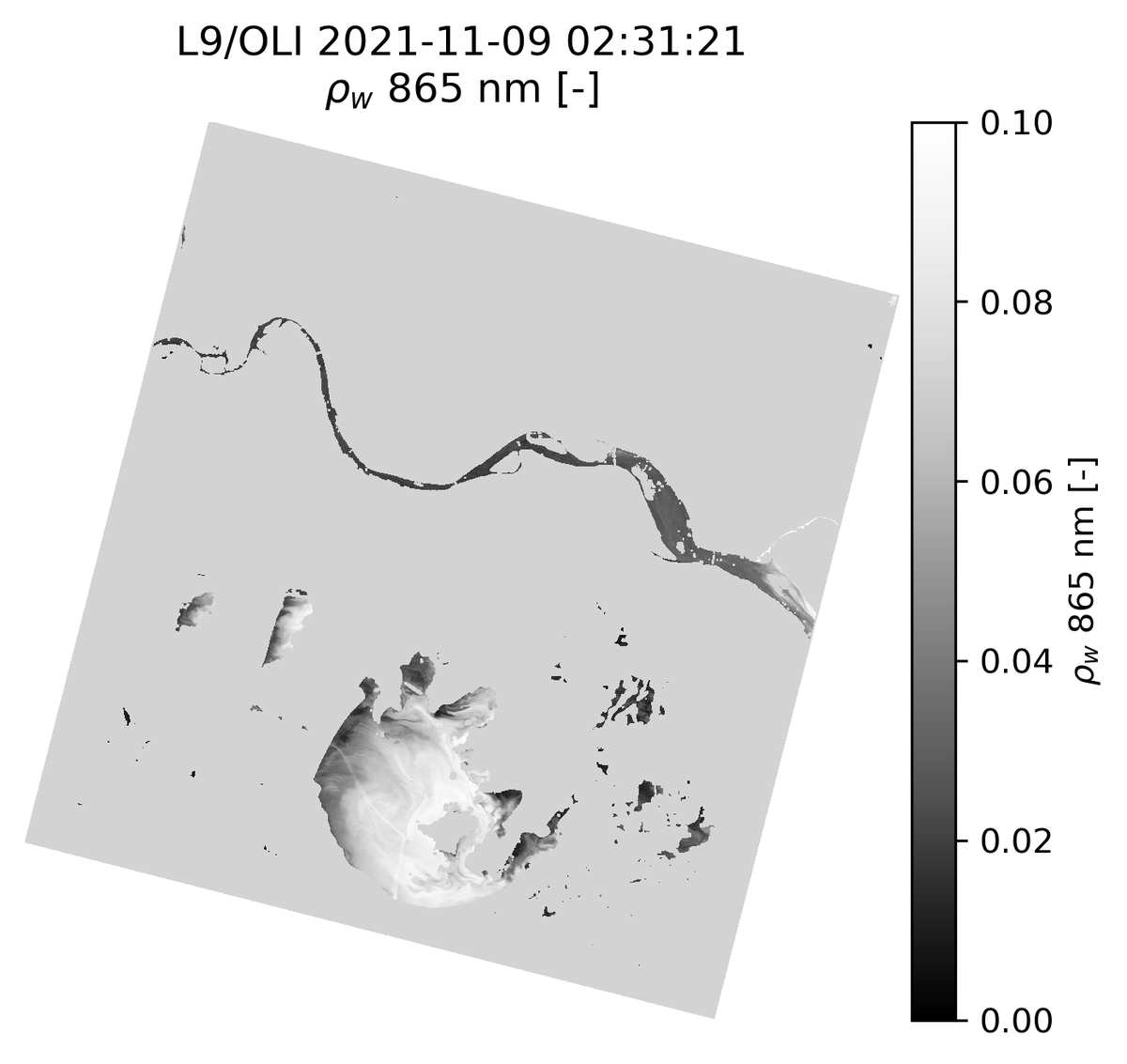
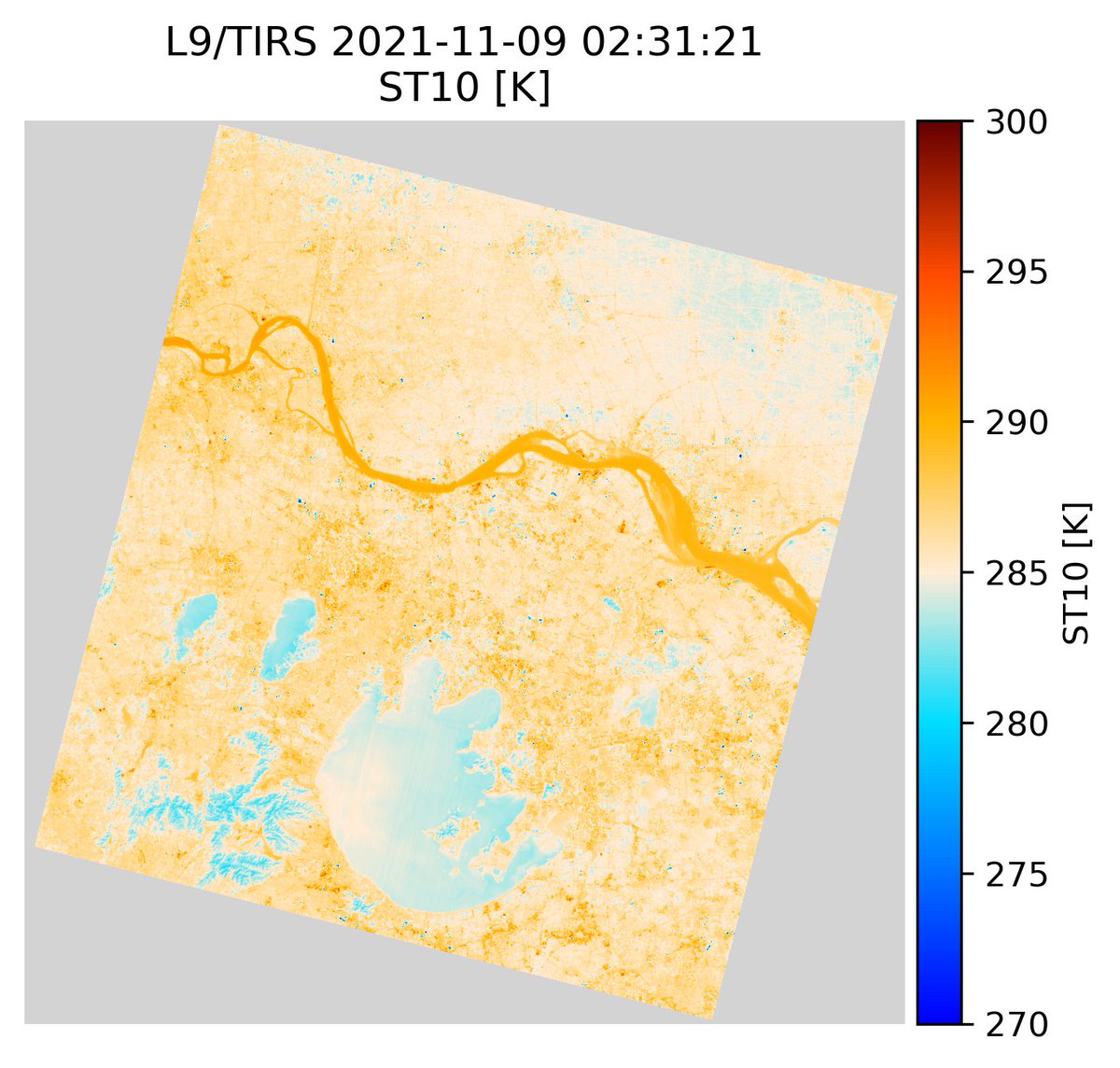
ACOLITE Docker images at hub.docker.com/r/acolite/acol… have also been updated to the latest version! Easily run DSF and TACT on your imagery using Docker. Here the 2021-11-09 L9/OLI and TIRS image of the Yangtze river and lake Taihu as processed with ACOLITE Docker!

English
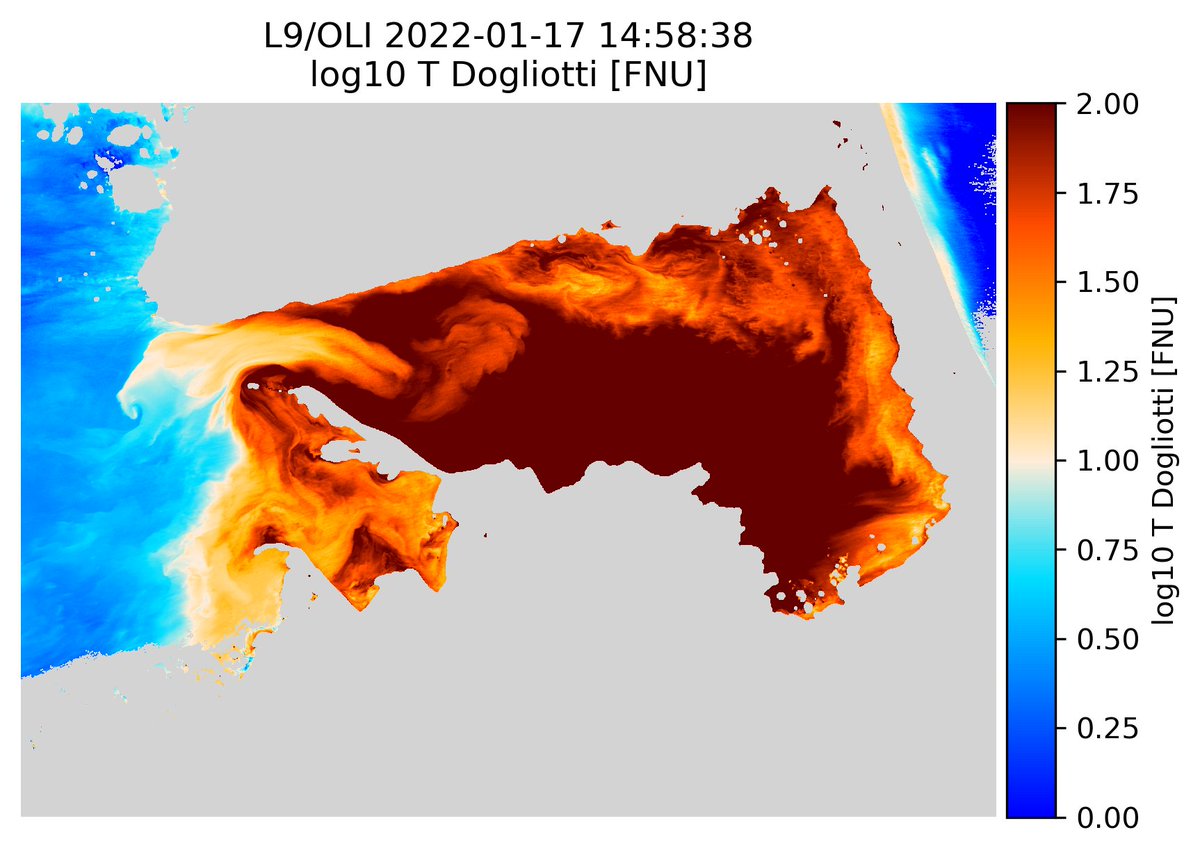
New ACOLITE binaries are available! Now includes support for Landsat 9 and SuperDove data! Here a 2022-01-17 L9/OLI image of Gulf Coro, south of the Paraguaná peninsula in Venezuela, with RGB, turbidity, and red band Kd outputs. Check it out: odnature.naturalsciences.be/remsem/acolite…


English
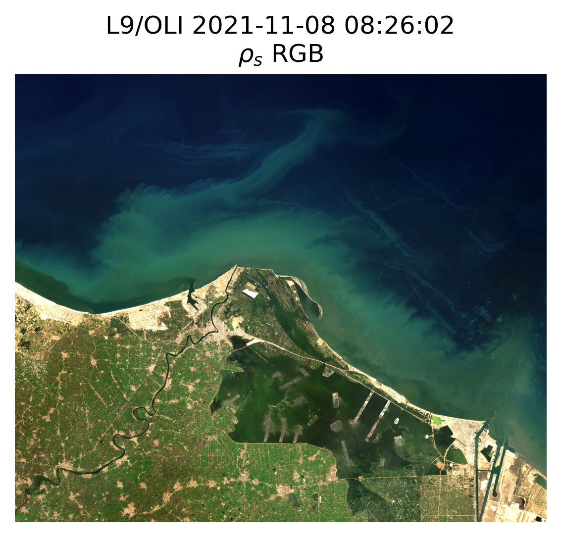
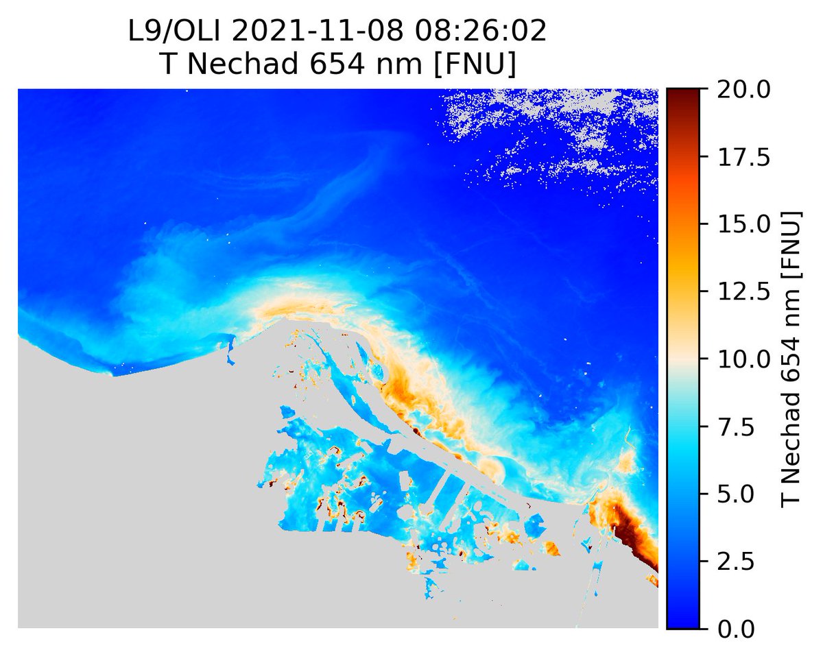
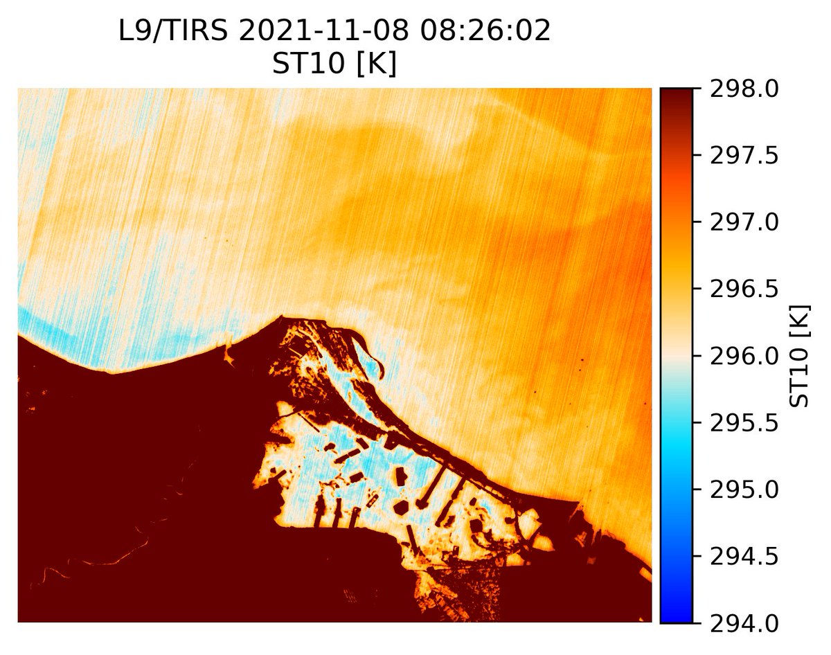
L9/TIRS processing added to ACOLITE/TACT! Here a 2021-11-08 image of the Mediterranean side of the Suez Canal (at Port Said and Port Fuad), and the brackish Lake Manzala. L9/OLI derived RGB and water turbidity. Some along track striping is visible in the TIRS data.
English