0MPGRUSH
463 posts


0MPGRUSH
@Rush3601
FOLLOW ME ON MY SOCIALS https://t.co/mjZTHijJdi
Katılım Temmuz 2021
170 Takip Edilen72 Takipçiler


5:15AM: really coming down here at @WFMY ❄️🌨️
Ed Matthews & I will be tracking the snow with you all morning!
English
0MPGRUSH retweetledi


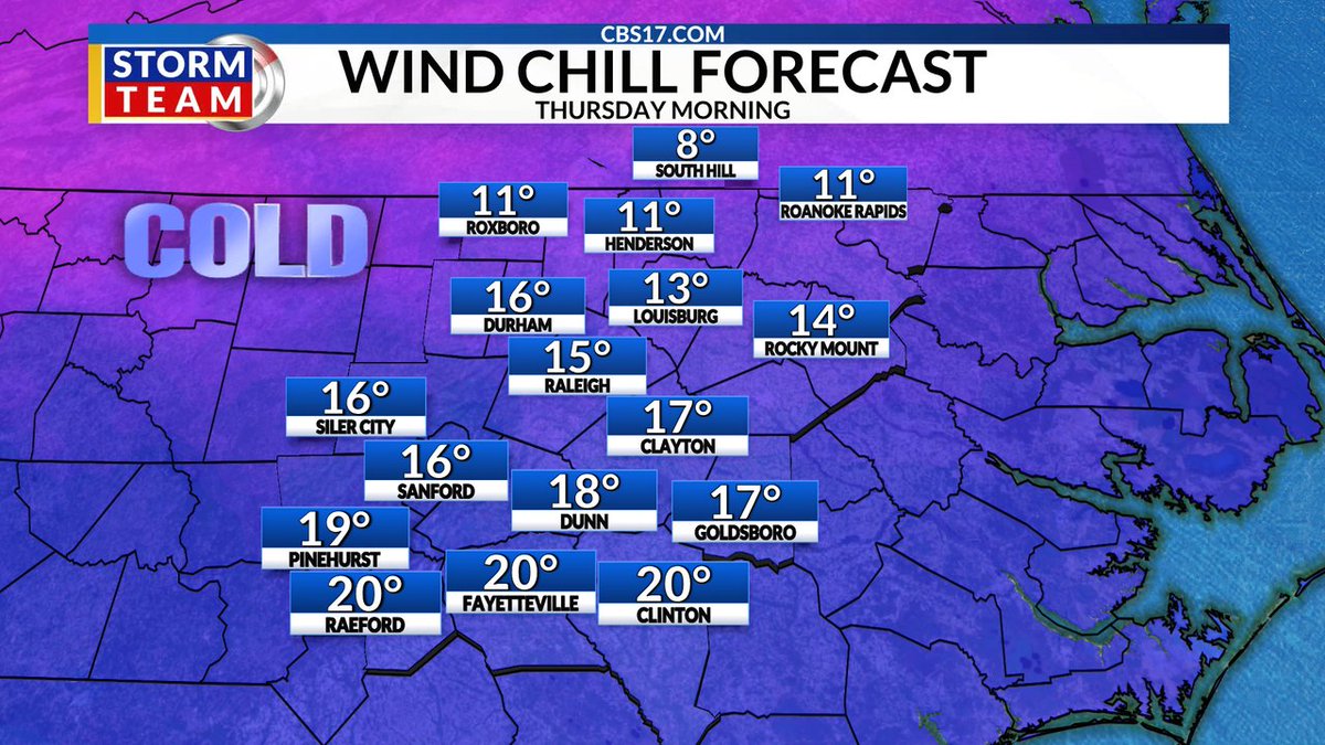
Snow is still the big headline this weekend, but don't forget how cold it will be Thursday morning! Wind chill temps will be in the teens in most spots, but no snow yet. Bundle up and get ready for the possibility of snow as early as Friday night in central NC.
English
@SCweather_wx I personally think the GFS will win out on this one. The only model that hasn’t really budged
English
How about the CMC be right & everybody in the Carolinas are happy! Deal?
English
@SCweather_wx I can’t see how the Carolinas miss this opportunity. It’s literally a classic Carolina snowstorm.
English
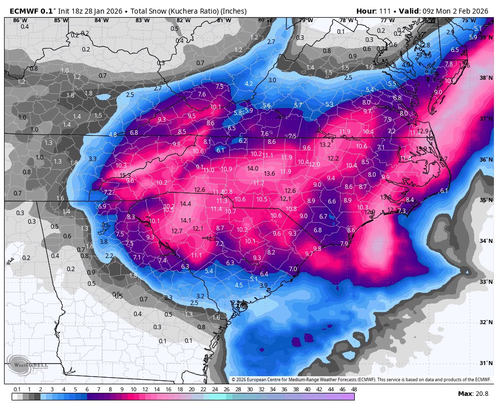
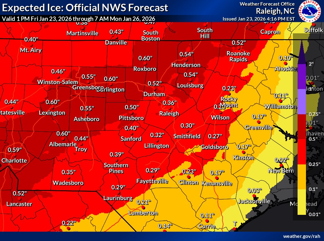
Afternoon update on our snowstorm potential for this weekend.
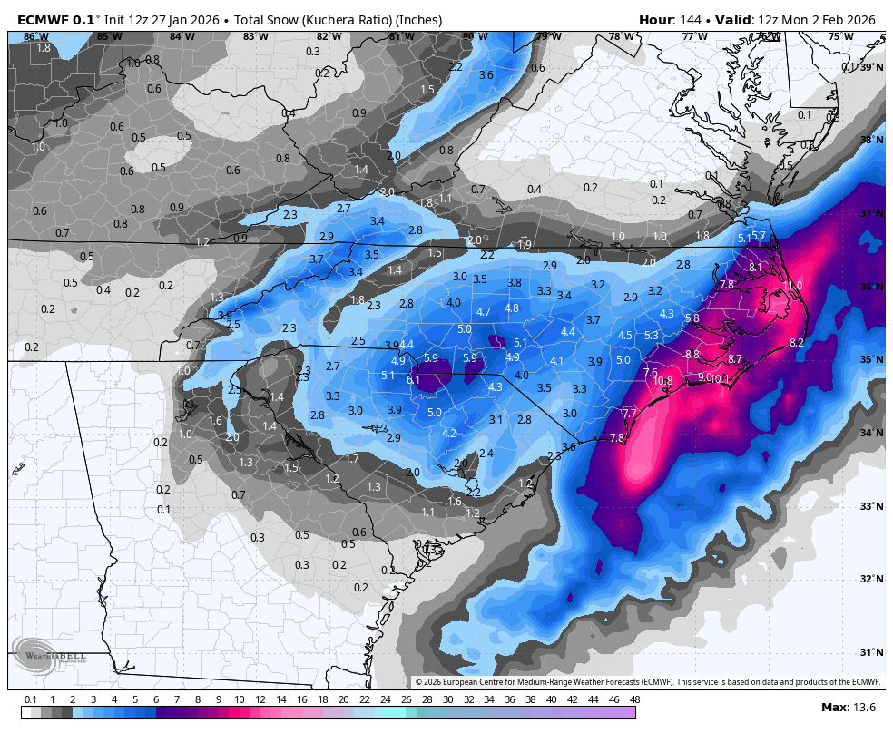
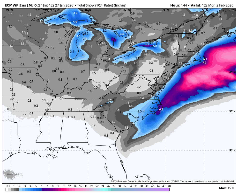
No real trend today with model guidance. It looks to me like a two part storm. The first part being the ULL (Upper level low) which is the main energy diving down. This alone will likely produce accumulating snow for someone. The second part is the development of a coastal low. This will likely happen, but how close to the coastline will it happen? If it's close, this event has high end potential. Some of these outrageous totals being thrown around by individual model runs can't be totally ruled out. If it's to far away, then snow will be confined to the immediate coastline. It could be too far East altogether.
Below is the 12z Euro & EPS. I think it does a great job showing ULL action & coastal low action. You can see in the Carolinas how snow extends back West then you can see an enhancement of snow along the coast. That's the coastal low cranking up at the last minute. This is NOT forecast snow totals. This just shows a possible scenario. But to me with what we are seeing, it's a realistic scenario & I think highlights the two section part of this system well.
As always, expect wild shifts. But the "boom" potential with this is high.. Very high.
English


GIVE US A BREAK
Can I catch my breath? 🤦🏼♂️
Marcos W@HockeyTarheel
@TimBuckleyWX Euro is conspiring to fool me again
English


@GoorooWinter I’m I looking that the new HRR right? Looks super south at the start
English


@SCweather_wx Mitch HRR is super south looks like at the start? I’m I looking at that right?
English
This is the timeframe to watch for the South for another Winter Storm risk. It’s a suppressed look. Let’s see what we can do.
English

I wonder how we manage to mess up next weekend? Probably going to cut over the Apps by Wednesday.
English