Sabitlenmiş Tweet

SPC Nation⚡️ The job's not done until we bring back a High Risk! 🟪
I'm staying home!🌪
DMs are closed Please respect my decision 🙏
-Lyons
#AGTG✝️
#blessed
#stayinghome

English
TwisterKidmedia
8.6K posts
@TwoDogsWx
fcstr. Opinions are my own. https://t.co/0wxuEYdkPs https://t.co/HKIZQfBKBl


THIS, people gatekeeping having a good time now. I’ve never met a chaser who actually is out and about NOT enjoying themselves!

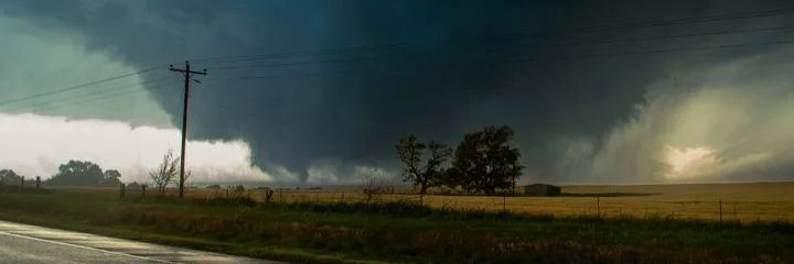
MASSIVE WEDGE #TORNADO southeast of Bude, Mississippi with tornado emergency through Premtiss