Sabitlenmiş Tweet
Trey Tonnessen
755 posts


Trey Tonnessen
@WXTonn
Meteorologist - ⛈ Mississippi State - Native Arkansan
Panama City Beach, FL Katılım Aralık 2021
154 Takip Edilen146 Takipçiler
The Arkansas connection to this @Lakers @okcthunder NBA playoff game is wild. Off the top of my head:
Jaylin Williams
Isaiah Joe
Austin Reaves (Cedar Ridge H.S.)
Adou Thiero
Nick Smith Jr.
English
Trey Tonnessen retweetledi

Given the deep-storm look (here is lowest-beam SRM sample from Hammond 106Z), & favorable along-boundary supercell movement, I would not be surprised if this contains a big, significant (EF2+) tornado. Monticello is in trouble, and we hope it cycles down before it arrives.
#mswx
English
Trey Tonnessen retweetledi
Tornado Emergency continues for Monticello MS, New Hebron MS and Silver Creek MS until 9:00 PM CDT

English
There is an enhanced risk of severe thunderstorms this afternoon into tonight across parts central and southwestern Wisconsin... Southeastern Minnesota...Eastern Iowa...Much of northern and central Illinois...Northern and central Missouri...Eastern and southern Kansas...And northern Oklahoma...
Per the SPC: Widespread strong to severe thunderstorm development appears possible today into tonight across parts of the upper Midwest southward across the lower Missouri valley into central great plains. Initially this may be accompanied by a risk for large hail and a few strong tornadoes, before damaging wind gusts become the most prominent hazard by this evening.
English
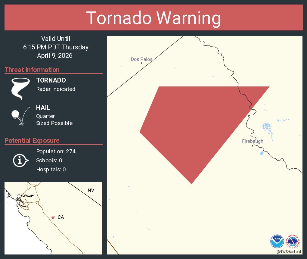
Interesting weather out west tonight. Tornado warning in California. Here is the radar view from Fresno County.
English
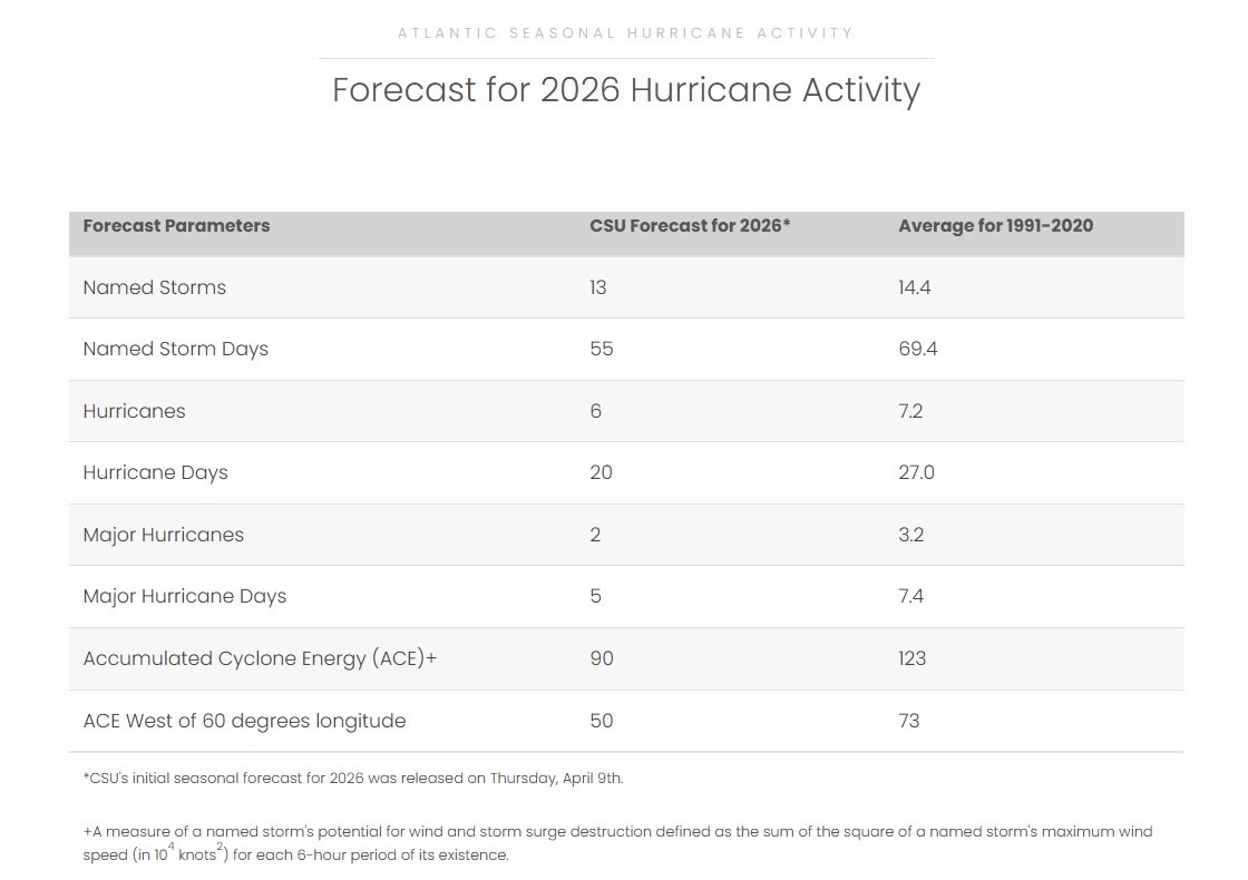
One of the more trusted institutions for hurricane research, Colorado State University, has released their initial forecast for Atlantic Hurricane Season 2026. Here are a few of the initial forecasting thoughts.
Initial anticipation is that the 2026 Atlantic basin hurricane season will have somewhat below-normal activity. Current weak La Niña conditions are likely to transition to El Niño in the next few months, with the potential for a moderate/strong El Niño for the peak of hurricane season. Sea surface temperatures in the western tropical Atlantic are warmer than normal but slightly cooler than normal in the eastern and central tropical Atlantic. We anticipate El Niño being the dominant factor for the upcoming hurricane season, driving increased levels of tropical Atlantic vertical wind shear. We are forecasting a below-average probability for major hurricane landfalls along the continental United States coastline and in the Caribbean. As with all hurricane seasons, coastal residents are reminded that it only takes one hurricane making landfall to make it an active season. Thorough preparations should be made every season, regardless of predicted activity.
English
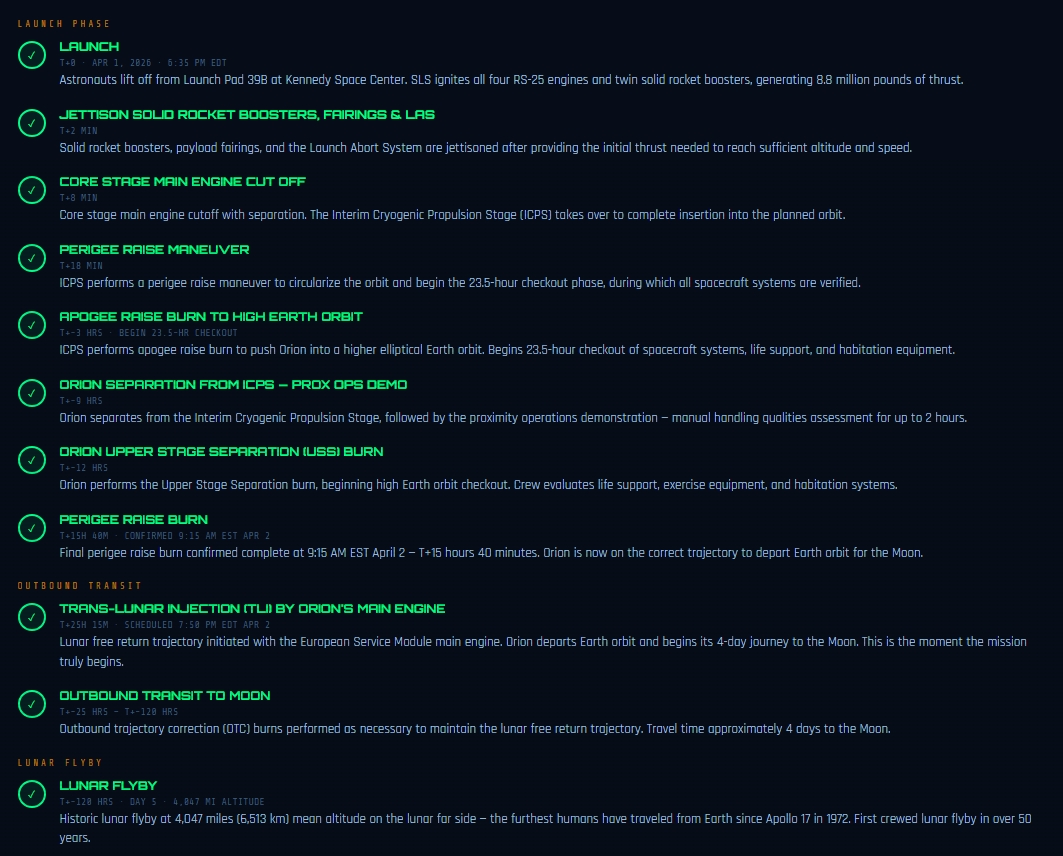
----> Latest NASA Mission Summary:
The Artemis II crew completed their first return correction burn at 8:03 p.m. EDT on Flight Day 7, with Orion's thrusters firing for 15 seconds to produce a 1.6 feet-per-second velocity change guiding them toward Earth. The crew is preparing for Flight Day 8 activities including testing orthostatic intolerance garments and conducting a manual piloting demonstration scheduled to begin at 9:59 p.m.

English
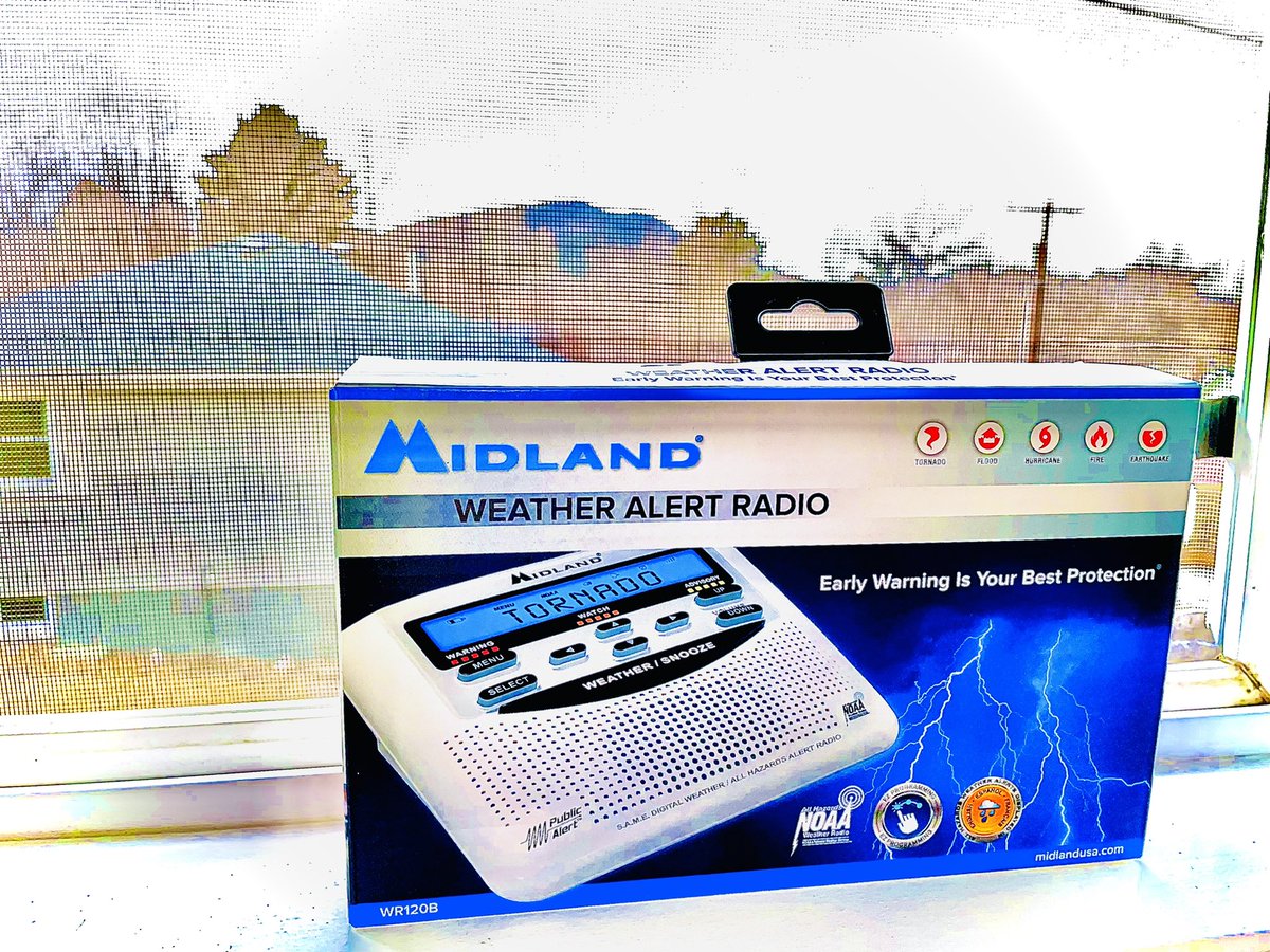
Today is National Safe Place Selfie Day - send us your #SafePlaceSelfie in your weather safe rooms and learn how to prepare and react to your area's more frequent weather hazards.
English
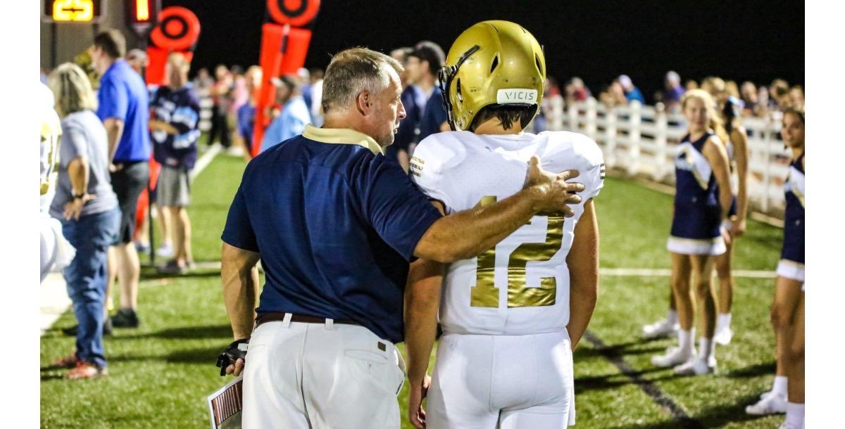
A potent line of severe thunderstorms with pre-frontal supercell development appears likely this afternoon and overnight into Monday. The line will intensify over Arkansas, Tennessee, Kentucky, and Mississippi this afternoon. Portions of the Florida panhandle are already included in a level 3 of 5 enhanced risk Sunday night.
1: Updated severe weather outlook from the Storm Prediction Center for SUNDAY
2: Updated severe weather outlook from the Storm Prediction Center for MONDAY
3: Estimate on severe thunderstorm arrival times as of 2:40 pm CST.


English
It absolutely is the place to be. I’m soaking up this warmth before that front plows through here next week!🤣
Brandon Orr@BrandonOrrWPLG
Big delays at Florida airports not from the weather, but the sheer volume of planes. Apparently Florida is the place to be right now.
English
Sea fog is rolling in fast here in Panama City Beach. Dense Fog Advisory is in place overnight.
English
Luckily we warm up this week!
WJHG-TV@WJHG_TV
A glass half full look at the forecast with Meteorologist Trey Tonnessen. #WX #FLWX
English
English
English