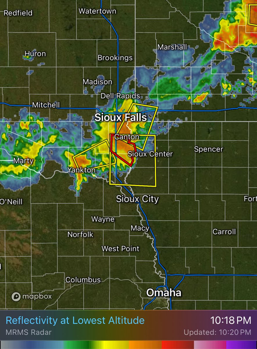
@MJ33Wx What are the biggest differences in terms of performance between the HRRR and RRFS that you have noticed?
English
Jon Marker
12.2K posts

@WX_Marker
Operational Meteorologist @empirewx | BSU grad | #Weather | #Climate | #Sports #SufferingRedsFan. James 1:2-4


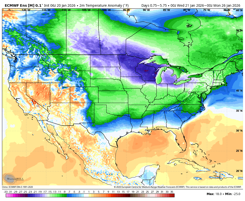
Pretty strong signal of a heavy snow band from the Euro with its' Extreme Forecast Index. Values of 2 or more are very significant and a strong indicator of a highly anomalous event. #kywx