All eyes on #Lee as its completed a >DOUBLE rapid intensification cycle going from 80mph at 11pm yesterday to 160mph at the 11pm tonight. RI usually is 35mph in 24 hours... That's 80mph in 24hours. Incredible. This is our 8th Cat5 since 2016. According to @philklotzbach only these hurricanes have intensified >=80mph in 24hours in the modern satellite era:
Wilma (2005), Felix (2007), Ike (2008), Matthew (2016), Maria (2017), Eta (2020)
The peak of Atlantic hurricane season is approaching!
If you haven’t yet, go through your emergency kit to ensure everything is in working order and not expired. Don’t forget about items for your pets.
Review your evacuation zone & more tips here. #hpg" target="_blank" rel="nofollow noopener">charlestoncounty.org/departments/em…
#ChsWx
Air quality across the area is approaching code orange, or “unhealthy for sensitive groups,” due to wildfire smoke mixing down. If you have a sensitivity to particulate matter and must be outdoors, a KN95 or better mask can be a big help.
We done enough talking about this site for a lifetime. The only question is whether we believe West Ashley deserves more than gas stations and storage units. I think we do and I’m supporting Option 1 postandcourier.com/opinion/commen…
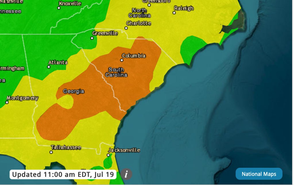
A low pressure system will track NE across the region today. Rounds of light rain showers will pass over SE GA & SC Lowcountry through this afternoon. Click on your location on this map for a detailed forecast: weather.gov/chs/
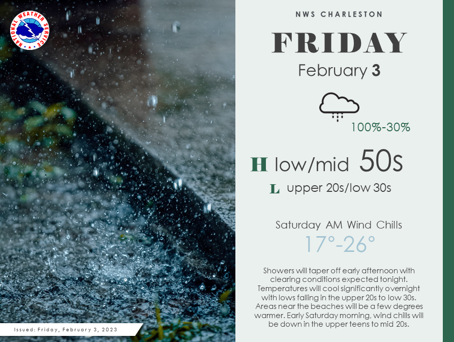
Showers will taper off over the next few hours, clearing by this evening. Tonight we will see a rapid cool down with lows in the upper 20s/low 30s. Wind chills Saturday AM could get down into the teens across some places!
Details on your specific location: weather.gov/chs
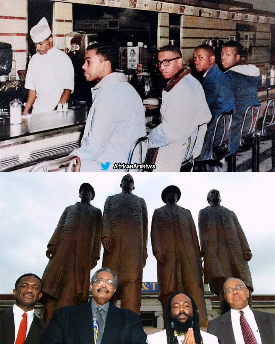
On this day in 1960, four black college students staged a sit-in at a whites-only lunch counter at Woolworth's in Greensboro, NC.
They sparked a national movement across the country. Instructions were simple: sit quietly and wait to be served. #BlackHistoryMonth
Our Emergency Management Dept. is closely monitoring Tropical Storm Nicole. Currently, we expect heavy rainfall beginning Thursday evening into Friday & some coastal flooding during high tides in low-lying areas. Please be cautious when traveling & avoid flooded roads. #chsnews
Model guidance with the track for #Nicole remarkably close together. Impacts will be felt through the rest of the week in the Lowcountry. Heaviest rain & strongest winds are expected late Thursday into Friday here. #chswx
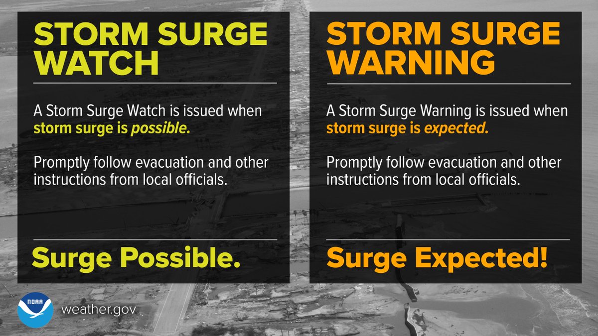
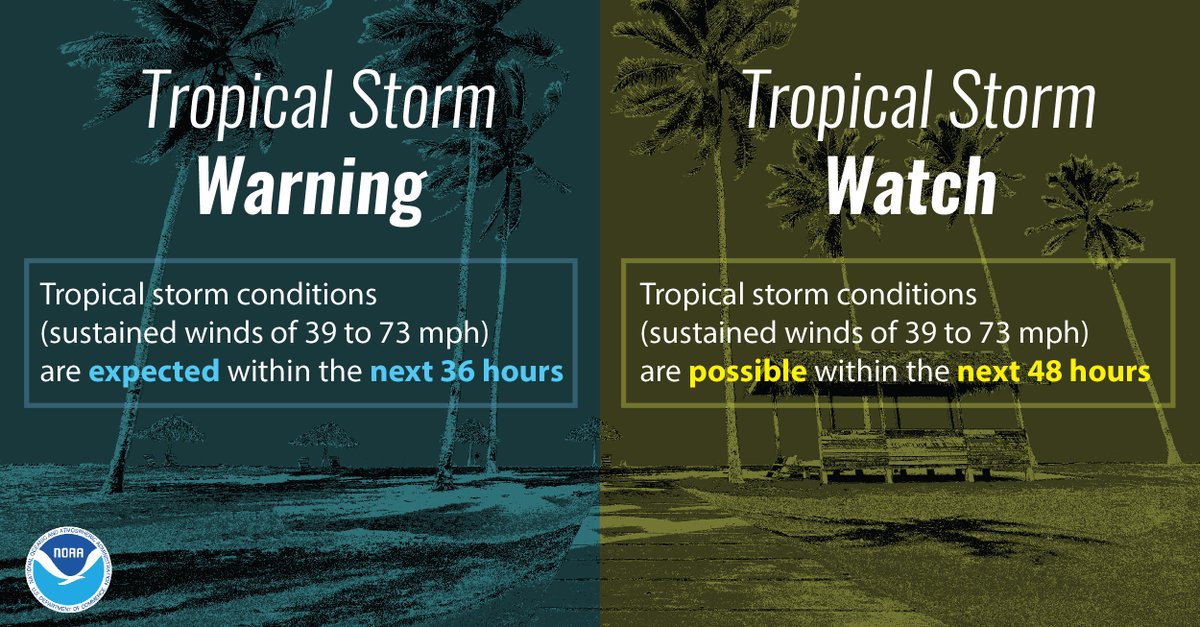
ATTN Mariners: A Tropical Storm Watch has been posted for the coastal waters, not including Charleston Harbor. Tropical storm conditions are possible as Nicole approaches the Southeast U.S. coast. Now is the time to prepare for tropical storm conditions. #chswx#scwx#gawx#savwx
@Weaver69B Hi Darrell,. Not sure what type of warning you are expecting but we don't issue Flash Flood Warnings every time it rains hard. There must be a serious threat to life and/or property. We did have Flood Advisories in effect however.
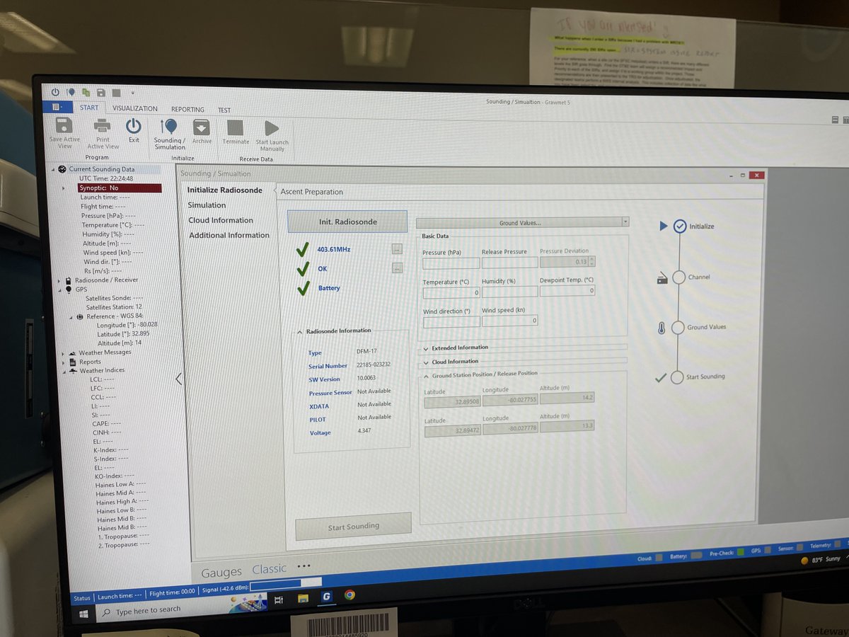
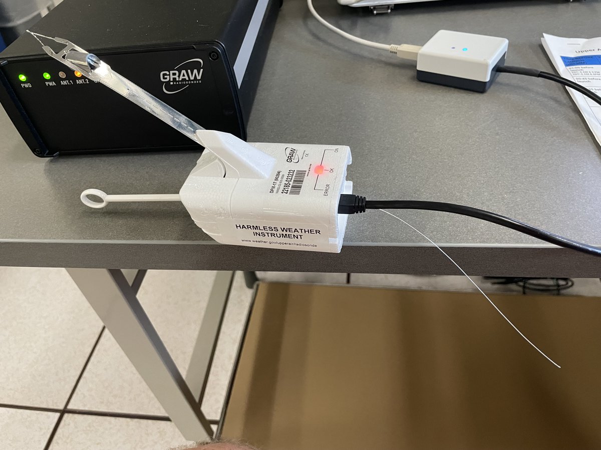
We are getting ready to release our evening weather balloon. The balloon is prepped & we're configuring the instrument that will measure a number of elements such as moisture, temperature & wind. Balloons are released 2x day, more frequently if needed. #chswx#scwx#gawx#svawx