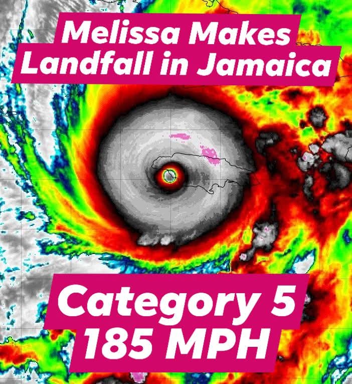
Jim Dickey retweetledi

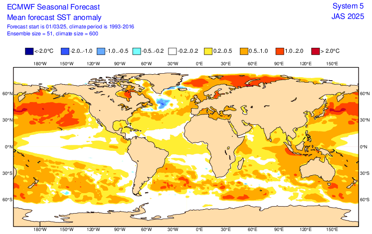
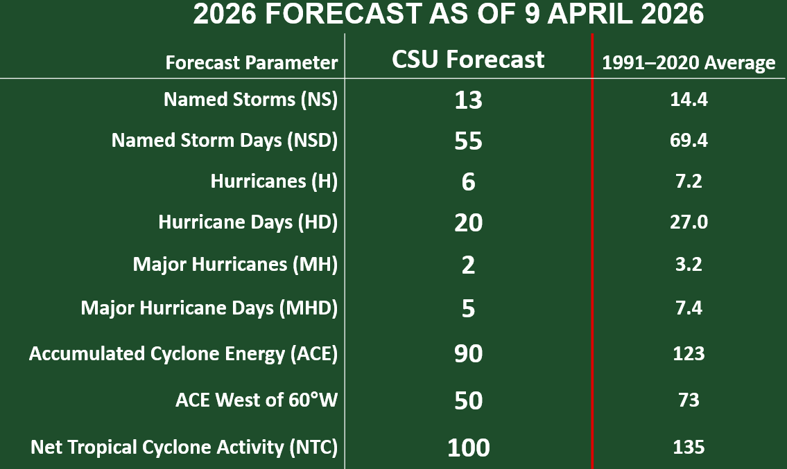
Atlantic seasonal #hurricane forecast from @ColoradoStateU calls for somewhat below-normal season: 13 named storms, 6 hurricanes & 2 major hurricanes. High likelihood of robust #ElNino and associated increases in vertical wind shear the primary factor.
tropical.colostate.edu/Forecast/2026-…
English