Gavin McGough
1.3K posts


Gavin McGough
@ZER0D0TS
Exploring the world of GIS 🌐 @[email protected]
Katılım Haziran 2009
690 Takip Edilen139 Takipçiler

Some fun papers from this year’s OSDI and Usenix ATC
It’s also kind of sad, because 5 years ago, there entire program would’ve been systems and infrastructure; now is almost entirely LLMs and AI infra.

English
English

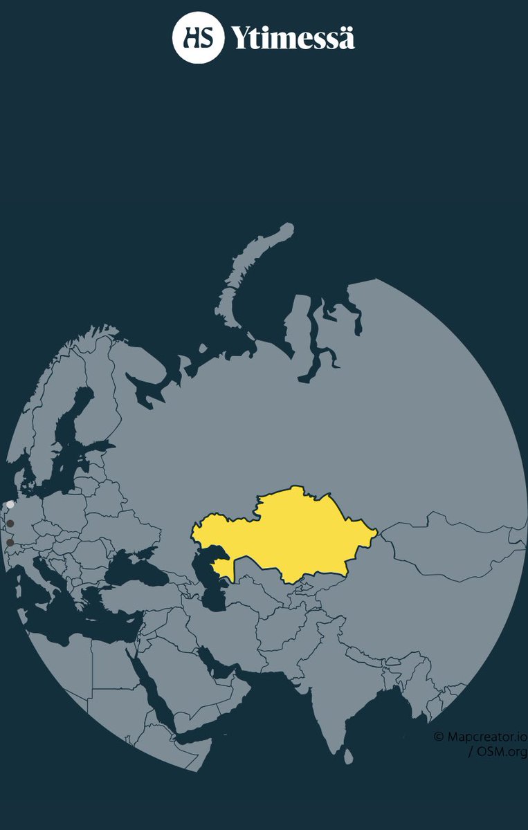
Today @hsfi had an article with this map of Kazakhstan. Just leaving this here for other mapmakers to judge.
English

@ZER0D0TS @MerginMaps QGIS 3.32 which will be released in late June.
English
We have added a brand new algorithm for your #QGIS processing toolbox: Download vector tiles. This will allow you to create a local tile from an online vector tile service (e.g. for an offline use):
GIF
English
@lutraconsulting @MerginMaps What version of QGIS do I need for this?
English
@ZER0D0TS @MerginMaps This is not actually a plugin, it is a core QGIS processing. But will be used in MM plugin for automating offline map generation AND we will have our own vector tile service for MM users!
English
@lutraconsulting @MerginMaps AH HA! Oh that is really cool, on all of the levels! :D I was meaning to upgrade my QGIS before, but now I gotta!
English
@lutraconsulting @MerginMaps Ah ha ok, cool :) so this plugin + the example online service from the doc just above the one I linked before (which is qwant.com - #online-services-2" target="_blank" rel="nofollow noopener">merginmaps.com/docs/gis/setti…) = new hotness?
English
@ZER0D0TS The existing docs shows you how to create it from from OSM data. This algorithm will allow you to download from an existing Vector Tile online service and cache it locally. We will provide an automated way to create offline maps for our @MerginMaps users based on the new tool.
English

🚨 BREAKING NEWS: the drama gets interesting. There are publications citing "Arc" from "ArcGIS" stands for "Aeronautical Reconnaissance Coverage" while longtime Esri users/employees say it comes from what line features were called in ARC/INFO.
WHICH IS IT? #gischat
🥔🗺️ ᴘᴏᴋᴀᴛᴇᴏ ᴍᴀᴘs@pokateo_maps
I can't believe I've never thought about this before! Any friends know if "Arc" actually stands for something? #gischat
English
@SwiftOnSecurity The short answer is no, and the longer answer is something about fractals
English

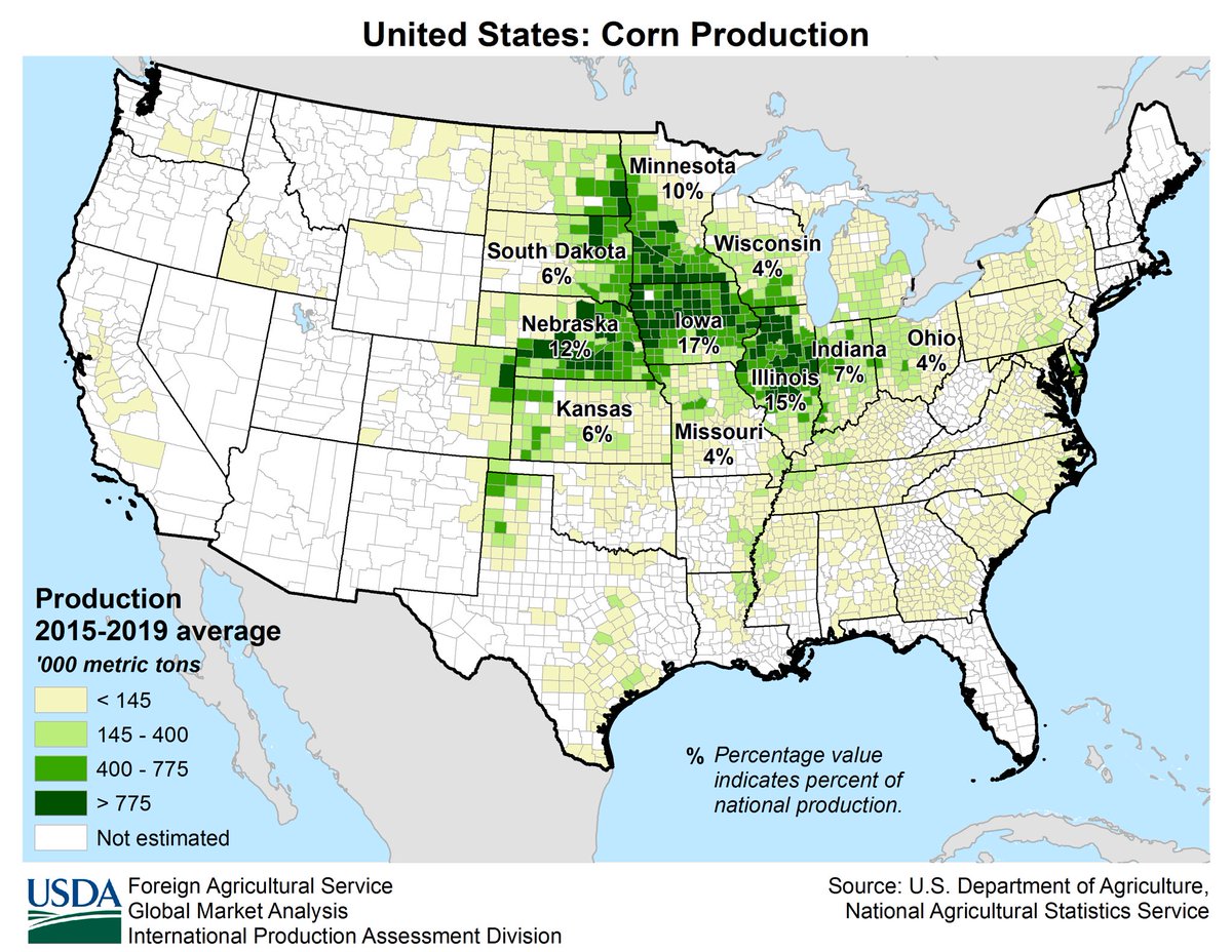
The US planted 363,812 km^2 of corn in 2021. This would make those fields alone the 63rd largest country in the world, slightly larger than Germany and over 100,000 square kilometers larger than the United Kingdom. Soybean plantings were close behind.
nass.usda.gov/Newsroom/2022/…
English
#30DayMapChallenge and finally that blog post I mentioned!
If you have any questions about my maps don't hesitate to ask :)
osgav.run/blog/30daymapc…
English
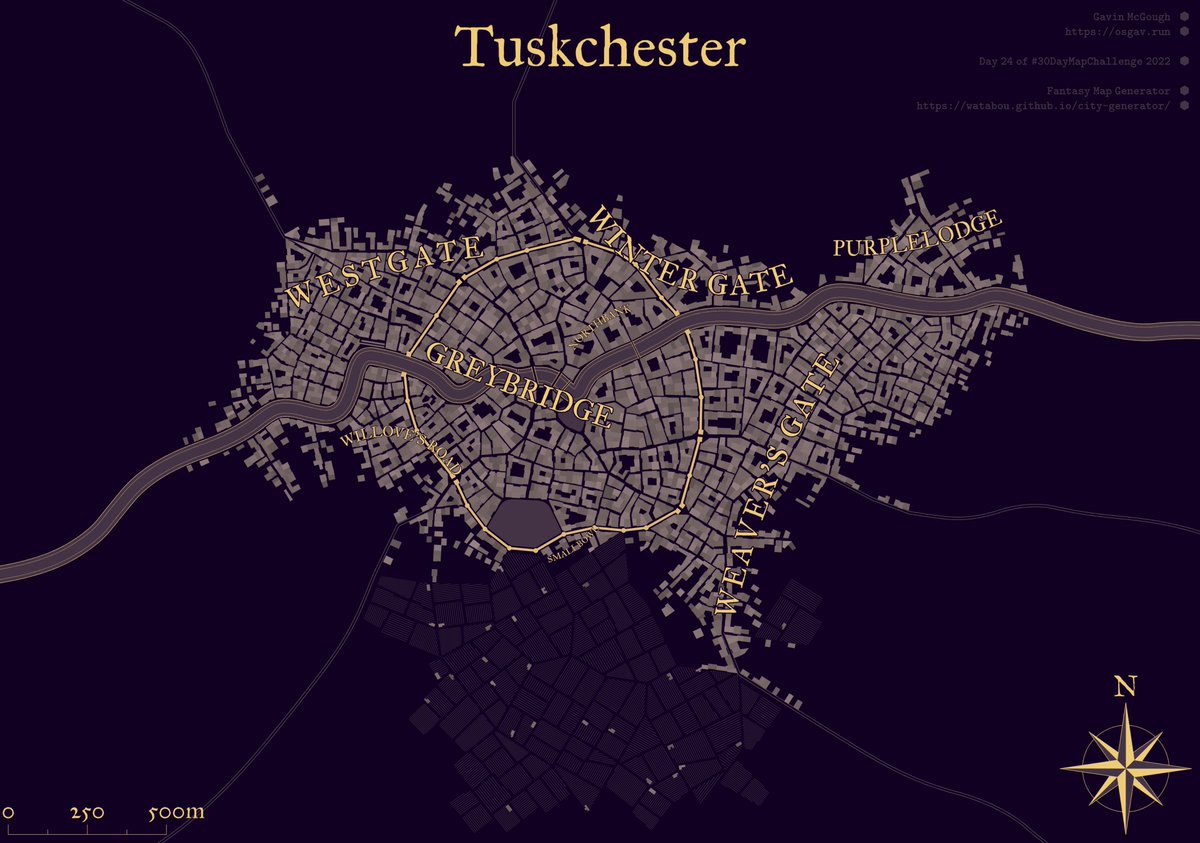
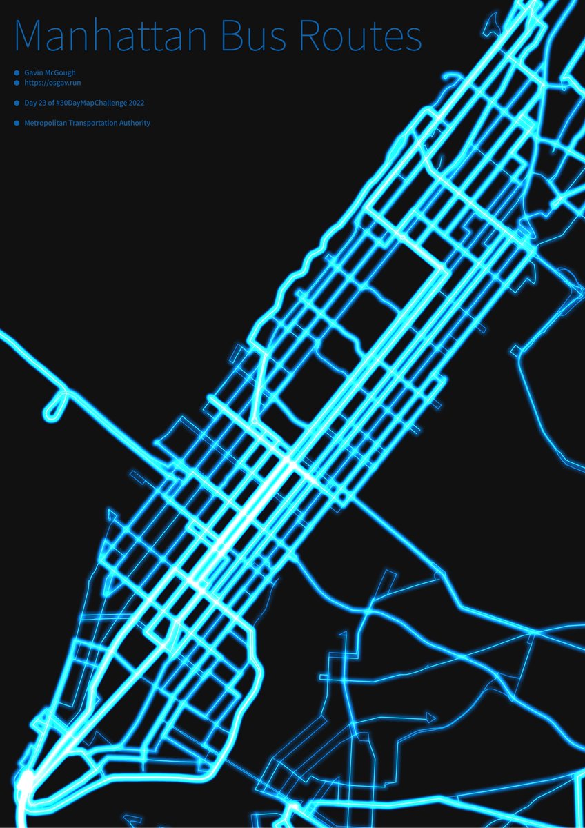
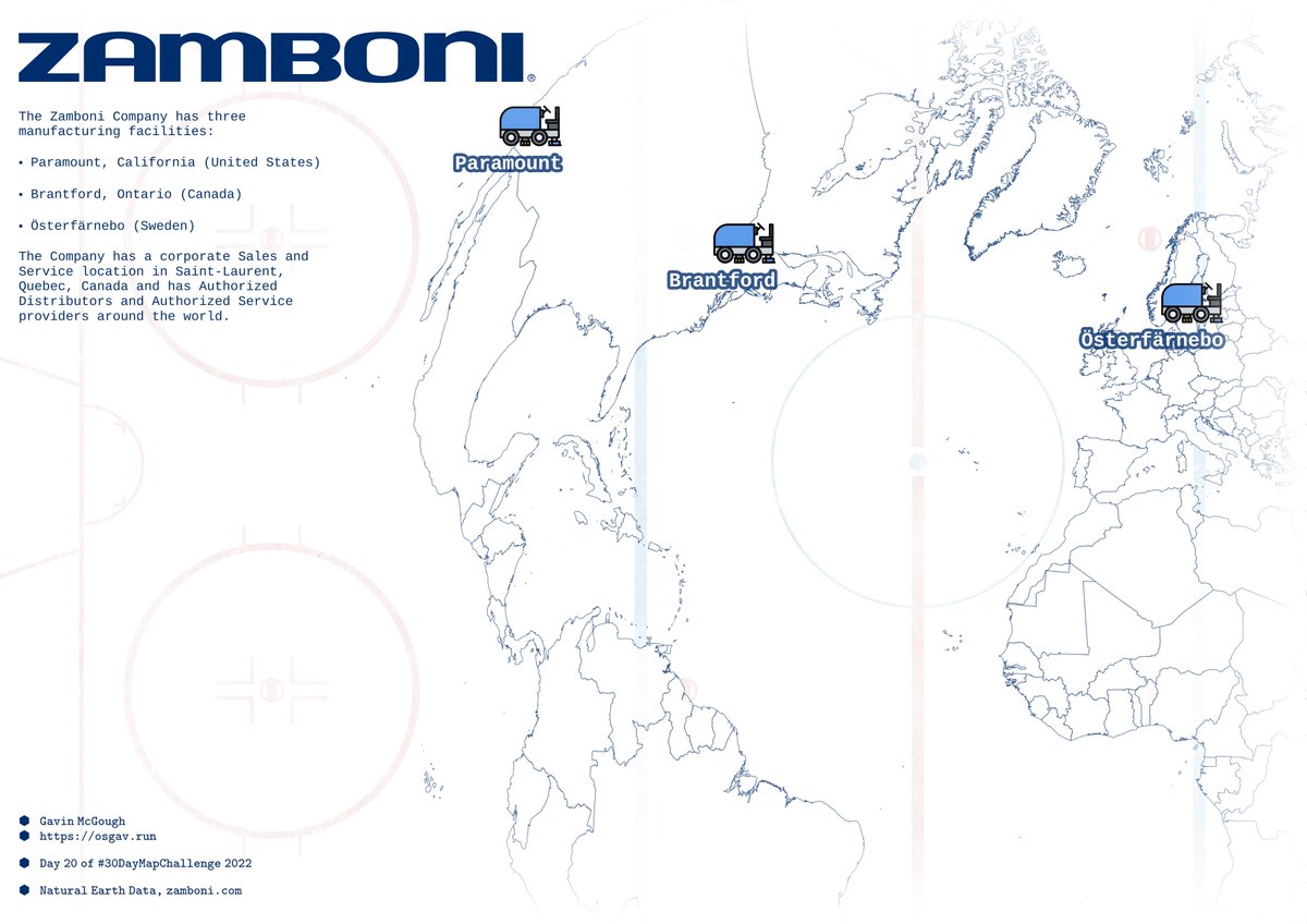
#30DayMapChallenge well that was fun!
I thoroughly surprised myself by posting on 20 of 30 days, thought I'd only make a handful of maps. Roll on next year!
If you liked any of my maps and wondered how they were made, I'll be posting a blog with some notes soon™

English

@_jsolly Thanks! Ahh fair point, indeed that text could be a bit less prominent. geoBoundaries is geoboundaries.org - the source for the country polygons I used. Don't know why I didn't slap .org on the end haha!
English