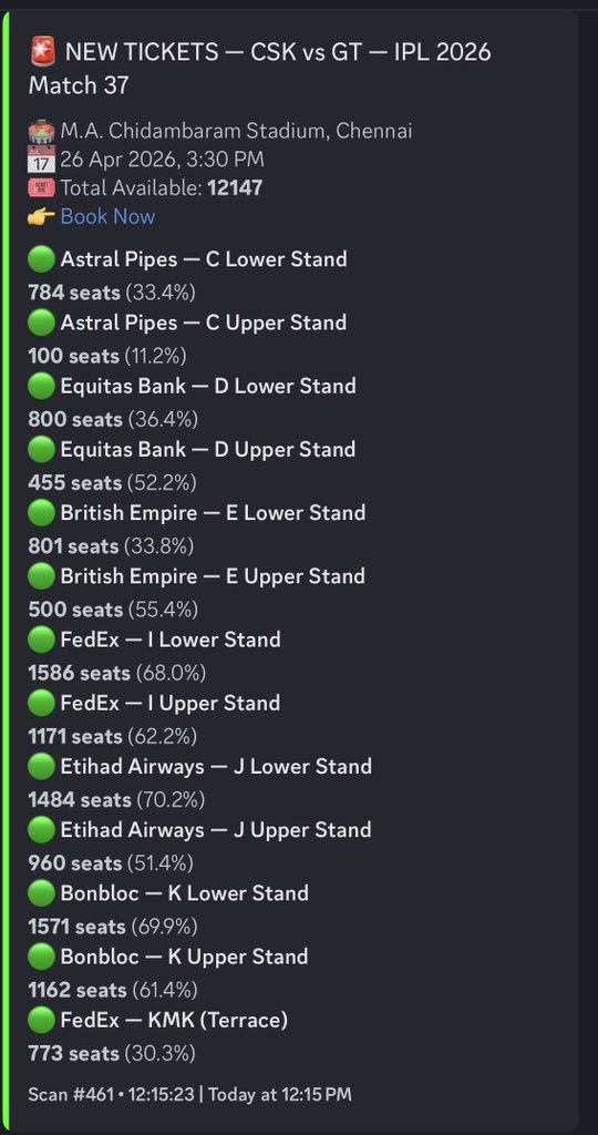
BIG UPDATE ON CSK 🚨
Ruturaj Gaikwad hasn’t travelled to Chennai due to a family emergency.
MS Dhoni is likely to playing as Captain against GT.
*Will Ms Dhoni take charge as Captain or will he give it to Sanju Samson* 🤔
#JanaNayagan PONGAL UPDATE: Justices Dipankar Datta & Augustine George Masih of the Supreme Court are yet to come to the court hall.
(@actorvijay 's movie may not have got released this Pongal but he will remain in the news all day! I wish his fans all the best.)
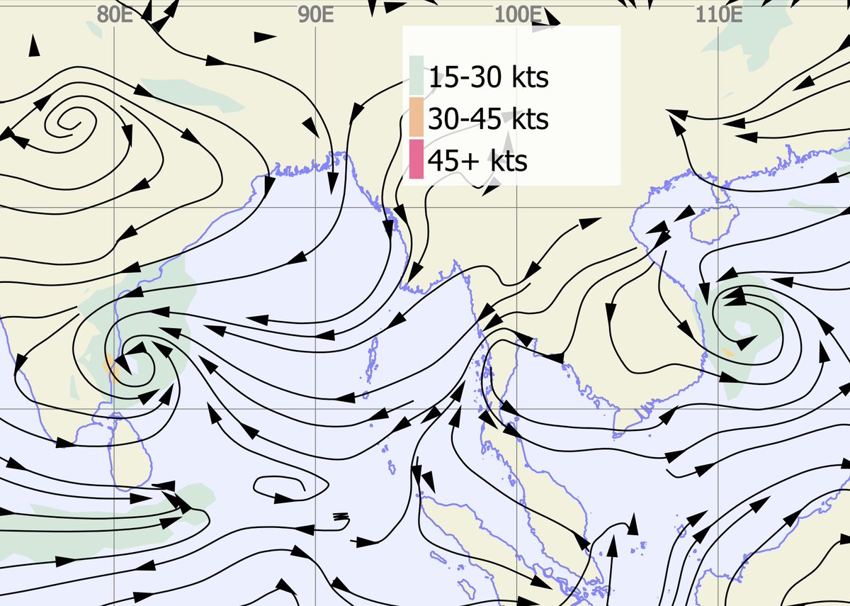
Ex-cyclone Ditwah's BOM (Australian Met Agency) 00z analysis plot showing the system very close to Chennai. Dry air could well be from the outflow axis, but the N/NE quadrant is getting good moisture support from the presence of moist easterly wave.
#Monsoon2025#NEM2025#Chennairains#Tamilnadu#CycloneDitwah
@jhrishi2 If it possibly intensifies into a cyclone again, will be Ditwah itself or a new name will be given 😂 are there any previous history in this scenario
Ditwah has intensified again close to Chennai coast. Increase in sustained wind speed from 25 knots to 30 knots. Sat image animation clearly shows severe deep convective storms engulfing the core which was completely dry yesterday. Just amazing how these systems function!!
#Monsoon2025#NEM2025#CycloneDitwah#Chennairains
Ditwah high resolution animation. CC gradually drifting north with intense convection blooming along KTCC coast and in Bay as well!! Upper-level support is strong now and we will see such intense storm development in these setup. Luckily, we are caught in that band!! Deserving for all the misses.
#Monsoon2025#NEM2025#Chennairains#Cyclone_Ditwah
@chennaiweather Hi, a small doubt - why is the system not moving north? If it was any other system would we have expected dumps of rains with this kind of setup where the system stays straight adjacent to the coast or the system would’ve moved north? Anyways happy for some rains in Chennai!
Bands are confined to the core places of #Chennai city. The coastal region is getting better rains as the system's outer band skirts the #Chennai city.
System is expected to weaken gradually and more rain is possible next 2-3 days #Chennai
@praddy06 We see only the consolidation in northern bands, do we still expect the rains till tomorrow evening as the system keeps moving up and the consolidation is difficult ?
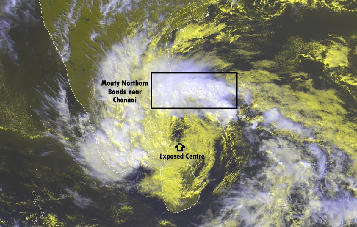
Cyclone Ditwah update - Meaty Northern bands close to Chennai now. Rains to start in Chennai with increasing intensity in southern areas.
No clouding around the centre of the cyclone, but it is expected to gain more clouds in the coming hours.
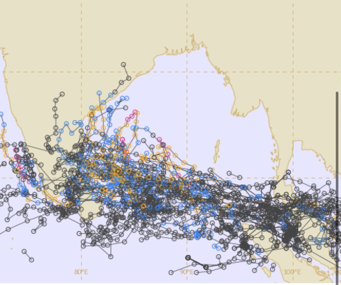
Latest ensemble outlook now has aligned properly and shows Cyclone Ditwah having proper poleward flow along the coastal parts of #Tamilnadu, weakening later & guided back towards the coast once westerly trough impact reduces.
#Monsoon2025#NEM2025#Chennairains#Tamilnadu
This week marks the 16th anniversary of the @chennaiweather account — the first X handle dedicated exclusively to #Chennai weather. Heartfelt thanks to all our followers for the continuous support!
இந்த வாரம் @chennaiweather கணக்கு 16ஆம் ஆண்டைக் கடக்கிறது — #Chennai வானிலைக்காக உருவான முதல் X சேனல். தொடர்ந்த ஆதரவுக்கு இதயம் கனிந்த நன்றி!
@Selwyyyyn@grok explain if this increases or decreases the possibility for rain in Tamil Nadu over the course of next one or two weeks. There are certain news regarding formation of a DD or CS in Bay. Comment on that too
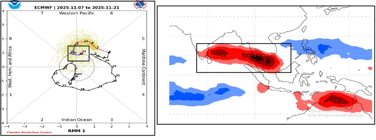
Signal losing eastward projection in RMM plot which means some westward moving signal (Tropical disturbances/ER wave)interfering & countering ...
Already walker cell sinking motion would weaken the MJO signal in pacific..
ECM,CFS clearly weakening the #MJO signal so focus shifting Negative IOD/LaNina area..
#MJO#Indianocean#NEM2025#WeatherUpdate#ER#Rossbywave#ECMWF