Andres Moreno Vasquez

7.5K posts

Andres Moreno Vasquez banner
Andres Moreno Vasquez

Andres Moreno Vasquez

@amorenva

GIS Analyst 🏗 AEC/RED industry 💼 @the_IDB

Washington, DC Katılım Ekim 2015
2.5K Takip Edilen294 Takipçiler
Andres Moreno Vasquez retweetledi
solst/ICE of Astarte
solst/ICE of Astarte@IceSolst·
I wrote Task Unmanager: keeps killing processes Russian Roulette style, until your machine crashes
English
518
4.4K
61.2K
1.8M
Andres Moreno Vasquez retweetledi
Bilawal Sidhu
Bilawal Sidhu@bilawalsidhu·
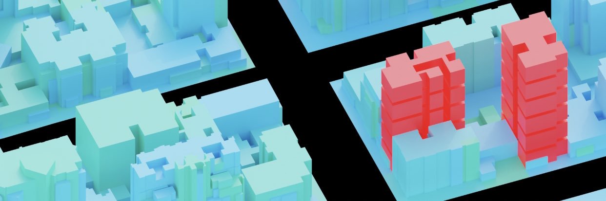
So these researchers figured out you can basically hallucinate 3D cities into existence using just satellite photos & a diffusion model. The problem's pretty straightforward: satellites only see rooftops. Building facades? Invisible. Street-level detail? Doesn't exist. But people want flyable 3D environments, which means you need all that occluded geometry. When I worked on google maps photogrammetry, we could only use satellite-based 3D for isolated stuff like the pyramids - anything city-scale required airplane flyovers. Which is fine until you hit aerial-denied regions where you literally can't fly. Huge chunks of the world just unavailable. Their trick is honestly kind of beautiful. They train gaussian splats on satellite views, but as it descends toward ground level, the renders turn to absolute garbage - artifacts everywhere. Instead of fighting this, they just treat those nightmare renders as the input to a diffusion model. Basically - "hey FLUX, fix this mess." Then here's where it gets clever: they generate multiple diffusion samples per view instead of committing to one. Because any single denoising path is probably wrong in 3D space, but if you generate a couple and let the GS optimization find consensus across them, you get actual geometric consistency. They do this in episodes, curriculum style - start high, gradually descend (hence the name Skyfall-GS!). With each iteration the ground-level views get less fucked. By the end you've got real-time flyable cities that look surprisingly real, and the geometry still matches the satellite input. No 3D training data. No street-level photos. Just satellites + diffusion doing what it does best - filling in the blanks. It's like neural scene completion but actually practical, and it unlocks basically the entire world.
English
48
233
2.7K
241.7K
Andres Moreno Vasquez retweetledi
Mo Sarwat
Mo Sarwat@MoSarwat·
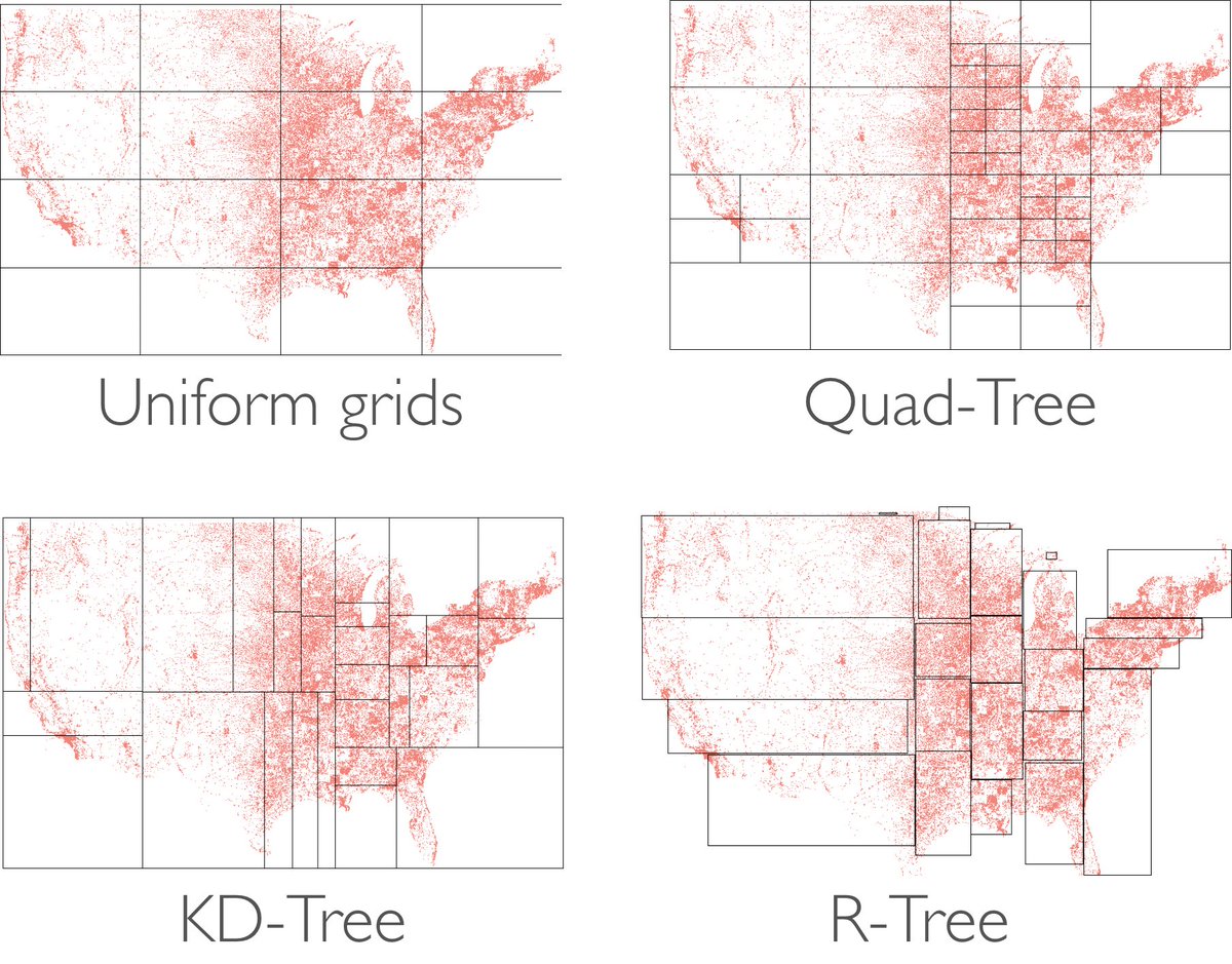
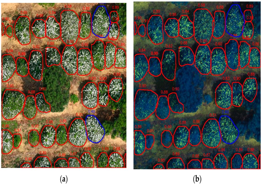
Spatial index structures are crucial for fast and efficient processing of geospatial data. Here is a summary of what, how, and why: #gischat #geospatial #DataScience #Database
Mo Sarwat tweet media
English
4
87
465
0
Andres Moreno Vasquez retweetledi
MATLAB
MATLAB@MATLAB·
Run MATLAB programs right from Visual Studio Code ➡️ spr.ly/60130vnIb
English
5
40
296
12K
Andres Moreno Vasquez retweetledi
AK
AK@_akhaliq·
SpatialLM just dropped on Hugging Face Large Language Model for Spatial Understanding
English
116
1.2K
10.4K
673.4K
Andres Moreno Vasquez retweetledi
Massimo
Massimo@Rainmaker1973·
NASA recently published one of the most detailed maps yet of the seafloor based on data captured by the SWOT satellite .
English
53
594
3.8K
335.8K
Andres Moreno Vasquez retweetledi
JJ Santos
JJ Santos@jjsantoso·
Well, it turns out that this approach used by @sidahuj (genius!) for Blender CAN ALSO BE USED WITH QGIS!!!! So, my friends, I present to you "MCP QGIS," which gives Claude access to use QGIS directly! The era of "vibe mapping" begins. See how it works: #QGIS #AI
siddharth ahuja@sidahuj

🧩 Built an MCP that lets Claude talk directly to Blender. It helps you create beautiful 3D scenes using just prompts! Here’s a demo of me creating a “low-poly dragon guarding treasure” scene in just a few sentences👇

English
21
87
425
166.8K
Andres Moreno Vasquez retweetledi
Ifeoma C. N
Ifeoma C. N@__iffff·
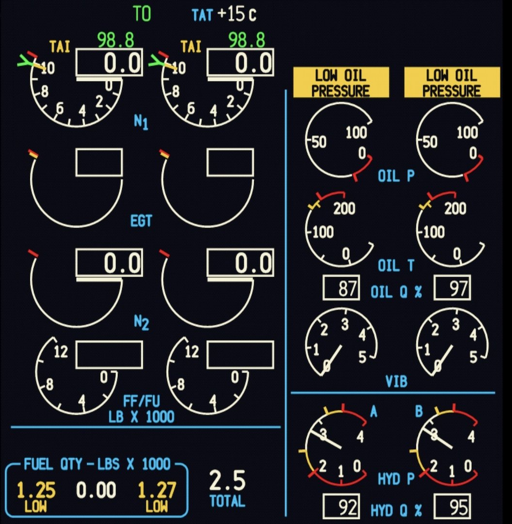
This looks like something everyone else knows but me, but I’m going to share it anyway.
English
51
504
7.2K
4.3M
Andres Moreno Vasquez retweetledi
Andrew Reed
Andrew Reed@andrew__reed·
🚨 NEW INVESTMENT 🇺🇸 Sequoia led a $190M Series C in Peregrine. Peregrine makes software that helps mission-critical organizations (public safety, law enforcement, government, enterprises) integrate and analyze their data, and build operational applications on top of it.
Andrew Reed tweet media
English
12
16
452
113.3K
Andres Moreno Vasquez retweetledi
Wevolver
Wevolver@WevolverApp·
RailScan Multi-Function Robot: Railway Surface Inspection The RailScan robot is designed for track inspection, using a self-moving platform and precise sensors to quickly detect track defects. It assists track inspectors with nighttime inspections, addressing challenges in traditional manual inspections such as heavy workload, missed detections, and difficult tasks. The robot helps reduce inspection costs, improve efficiency, and enhance safety by identifying potential hazards in the rail track. Video source: @ShenhaoRobotics #robotics #inspection #RailwayRobot #technology #engineering #stem #innovation #robots #automation ----------------------- Wanna get your company on Wevolver too? Learn how: wevlv.co/get-your-compa…
English
12
89
456
26.5K
Andres Moreno Vasquez retweetledi
GitHub
GitHub@github·
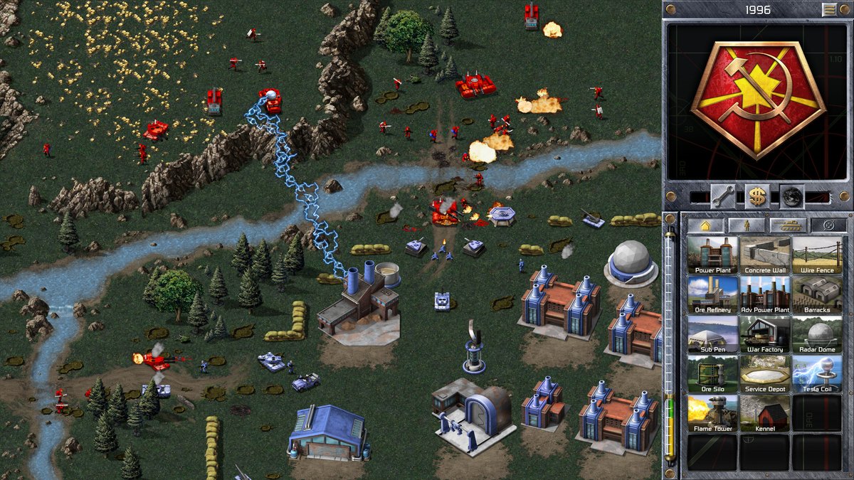
"Incoming transmission!" 📡 Classic Command and Conquer games are now open source—ready for modding, preservation, and innovation! Read more: ea.com/games/command-… Dive into the code: github.com/electronicarts
GitHub tweet mediaGitHub tweet mediaGitHub tweet media
English
97
719
4.6K
392.1K
Andres Moreno Vasquez retweetledi
Josh | Map Effects
Josh | Map Effects@MapEffects·
Why do school maps have to be so ugly? My kids have been filling out maps as part of their homeschool curriculum…but they just look so sterile. So, dad can’t help himself and is stepping in! I won’t be going all out with mountains and jungles and such because it needs to stay clean enough that you can easily write in names without too much visual chaos. But, I want to also add some banners to make it easier for them to see what needs to be filled in. Because that was an issue on the original map. Let me know what you think so far!
Josh | Map Effects tweet media
English
7
5
102
2.6K
Andres Moreno Vasquez retweetledi
Kolusu Trinadh Kumar
Kolusu Trinadh Kumar@KolusuTrinadh·
🔹Git is a tool, version control is a concept. 🔹Docker is a tool, containerization is a concept. 🔹Kubernetes is a tool, container orchestration is a concept. 🔹SQL is a language, relational databases are a concept. 🔹TensorFlow is a library, machine learning is a concept. 🔹Kafka is a tool, event streaming is a concept. 🔹REST is an architecture, APIs are a concept. #Java
English
4
119
807
39.3K
Andres Moreno Vasquez retweetledi
S@{I-I{00
S@{I-I{00@Sachcoo_thearty·
8-bit Legacy
GIF
English
71
1.3K
7K
182.3K
Andres Moreno Vasquez retweetledi
░ perfectloop ░
░ perfectloop ░@PERFECTL00P·
/rĕz″ə-loo͞′shən/ /stŭd′ē/
GIF
Català
55
1.5K
12.9K
244.7K
Andres Moreno Vasquez retweetledi
Sahn Lam
Sahn Lam@sahnlam·
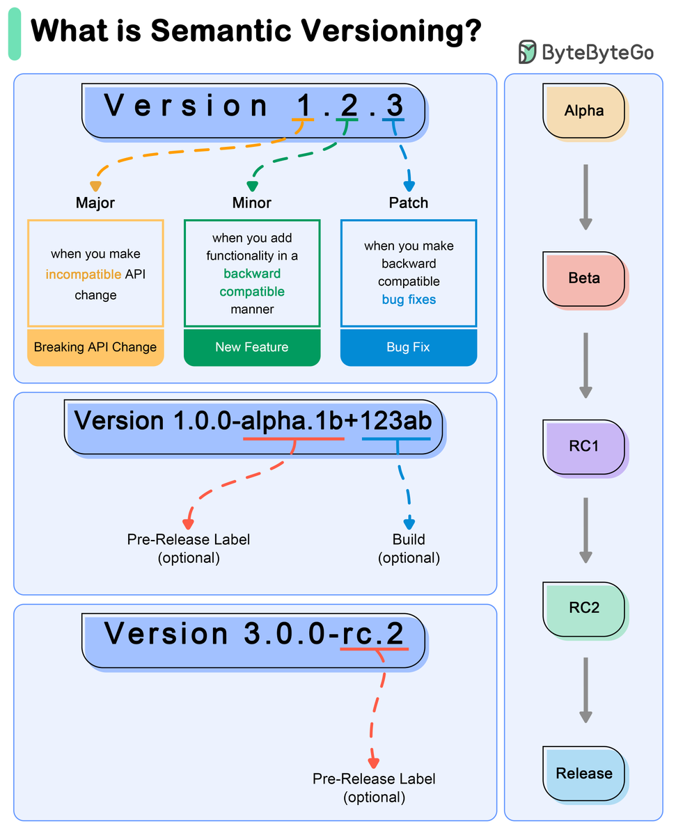
Semantic Versioning explained
Sahn Lam tweet media
English
3
116
605
44.9K
Andres Moreno Vasquez retweetledi
Math Cafe
Math Cafe@Riazi_Cafe_en·
MIT's "Street Fighting Mathematics" This course teaches the art of guessing results and solving problems without doing a proof or an exact calculation. Book: ocw.mit.edu/courses/18-098…
Math Cafe tweet media
English
15
341
2.8K
175.7K