⚠️ FLASH FLOOD WARNING issued for DELTA, HOPKINS, and HUNT counties through 9pm. 1-3 inches of rain have fallen along the I-30 corridor and additional rainfall of 2 inches is possible. This will lead to flooding. DO NOT CROSS FLOODED ROADS! #TXwx
Today kicks off our cooler and more active pattern! Isolated showers will be possible through lunchtime, before activity ramps up this afternoon. A few isolated strong storms will be possible - gusty winds, small hail, and isolated flooding are the primary threats
(5:44pm) SEVERE T-STORM WARNING issued for HILL county through 6:30pm. Potential for strong downburst winds with this storm that could reach 60mph along with penny to nickel sized hail. Head indoors and away from windows in Hillsboro! #TXwx
SEVERE T-STORM WATCH issued through 10pm for parts of North Texas including the Metroplex. Strongest storms will be capable of quarter hail and 60-65mph winds. We'll keep you 4-warned through the afternoon. Remember, with FIFA on, KDFI 27 & FoxLocal will have more updates. #TXwx
Breaking: Folarin Balogun will be available to play in USA's Round of 16 match against Belgium on Monday, FIFA announced.
The FIFA Disciplinary Committee has suspended the red card issued to the USA striker during their Round of 32 win over Bosnia and Herzegovina.
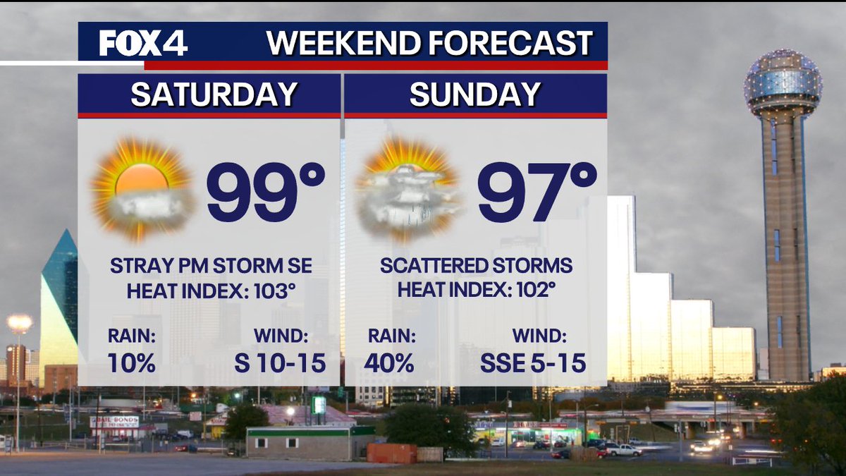
Norway vs Ivory Coast for North Texas' first knockout match! It's going to be HOT! The match kicks off at noon with temperatures in the low 90s and breezy south winds. The heat peaks as fans exit Dallas Stadium, our forecast high is 97°.
It could be worse... On this day in 1980, DFW recorded its hottest temperature EVER when the mercury jumped to 113°! Today's temps will run about 20° cooler, with afternoon highs settling in the upper-90s.
Hot days ahead! Temperatures are expected to climb into the upper-90s and triple digits over the next week, with no real sign of relief! Sunshine dominates the forecast, with only a very slim chance of rain by the end of next week. Here's a look ahead:
Tropics Update: An area of low pressure is expected to form off the southeastern coast of the U.S. early next week. The National Hurricane Center has tagged it with a 20% chance for tropical development in the next 7 days.
[5:35PM RADAR UPDATE] Showers and thunderstorms are continuing to scatter across North Texas, with one Severe Warned storm in effect in Jack County. The flood threat continues for Red River Counties as heavy rain dips south of the Sooner State.
[5:00PM] A FLOOD ADVISORY has been issued for Fannin and Lamar Counties until 8:00pm this evening as heavy rain is moving into areas that were saturated by this morning's rain and storms. These are sub-severe for the time being, but gusty winds and hail will be possible.
[9:05AM] A SEVERE THUNDERSTORM WARNING has been issued for Lamar County until 10AM. This storm is located over Paris and is moving slowly to the southeast at 10mph. Flooding, damaging winds, and quarter size hail will be possible. Stay safe!
The afternoon update from the NHC has upped the chance of development for the disturbance in the Gulf. This system is expected to bring widespread heavy rain and flooding along the Gulf Coast this week. North Texas will stay largely rain-free until the end of the week.
(7:49pm) Significant Heavy rain is falling in the storm near Athens. Multiple gauges have reported up to 4 inches in the last hour. Even spots that aren't typically trouble spots may see issues. Stay off the roads if possible. #TXwx