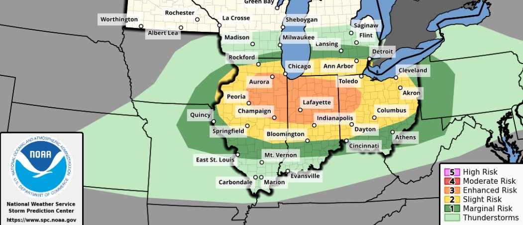
Tomorrow is shaping up as a quite significant threat for severe weather! All hazards are likely and all significant hazards possible! Very large hail up to 3-inches in diameter, Damaging winds up to 80mph, and a few tornadoes, maybe one or two strong, will all be possible...
9:55pm Wednesday: Get ready for a chilly NE wind on Thursday. We might briefly warm to near 60 inland, but hold in the mid-40s to low 50s closer to the lake. Expect a chilly tailgate with a chance for rain showers (especially closer to 1pm). Steadier rain Thursday afternoon/evening. Go Brewers!!
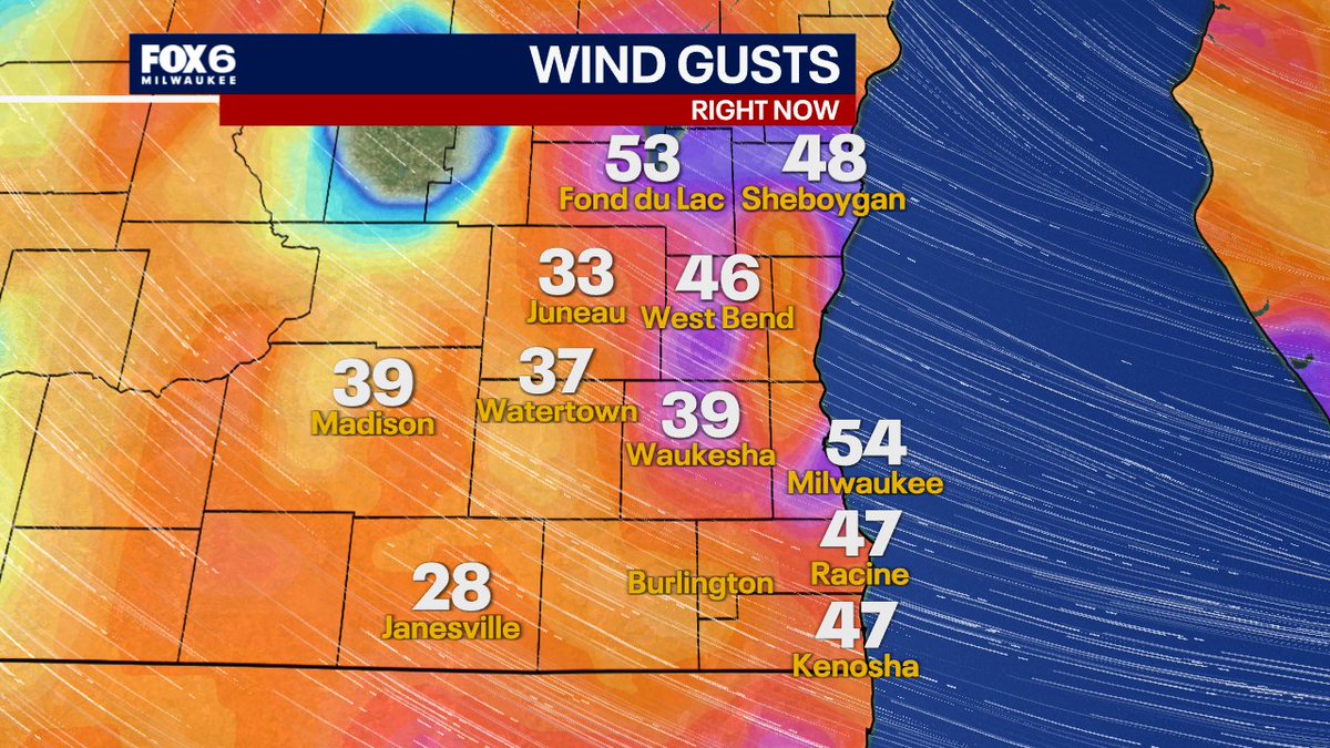
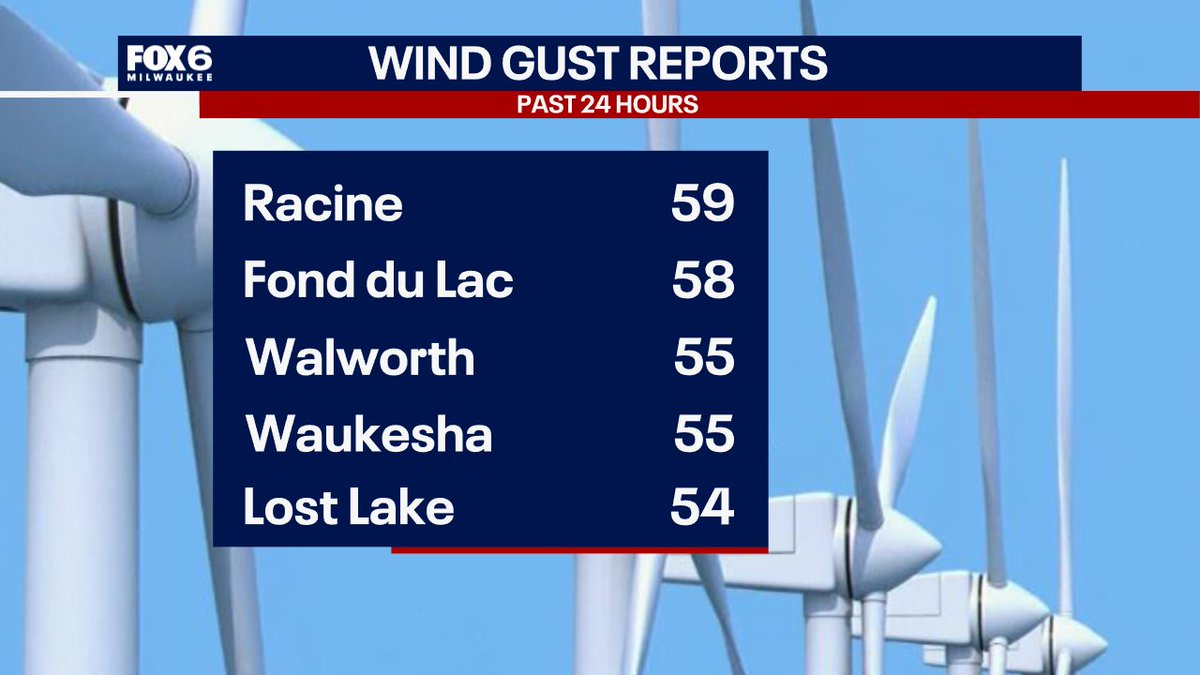
4pm Friday: Insane wind gusts today. The wind will settle down after 9-10pm. Nearly 80,000 without power at the time of this post per WE Energies. Do you have power and do you have any tree damage?
High Wind Warning for Oak Creek: Northwest winds 20 to 30 mph with gusts up to 45 mph. Where: Portions of east central, south central, and southeast Wisconsin. When: Until 7 PM CDT this evening. Impacts: Gusty winds will blow around unsecured objects. Tree limbs could be blown...
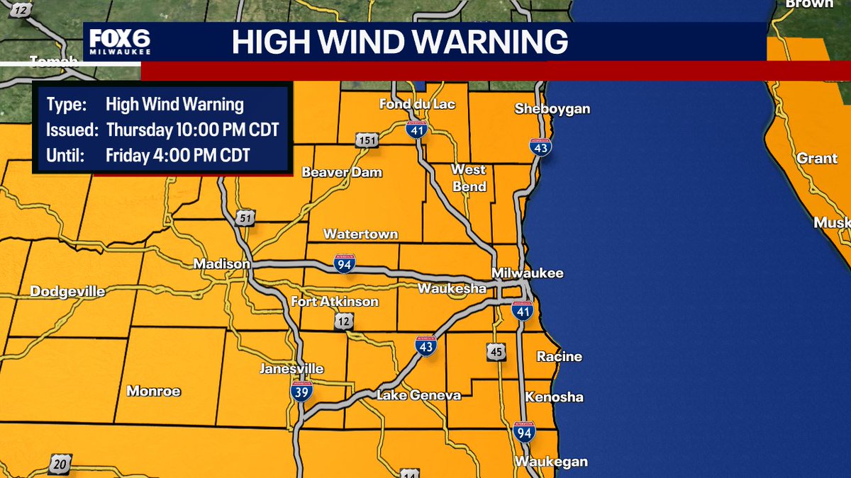
8:06pm Thursday: Heads up. The High Wind Warning is starting earlier. It now takes effect at 10pm tonight and runs until 4pm on Friday. Wind gusts out of the SW overnight shifting to the WNW on Friday up to 60 mph. Tree damage and power outages are possible.
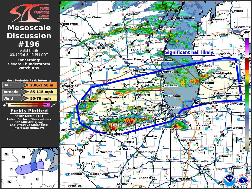
Strong to severe thunderstorms will move through the area over the next 2-3 hours. Significant hail is likely up to the size of golf balls (~1.75” diameter) or potentially larger. Widely scattered damaging winds up to 60 MPH will remain possible. Tornadoes are not expected.
The highest risk for the significant hail will be along and south of the US-18 corridor.
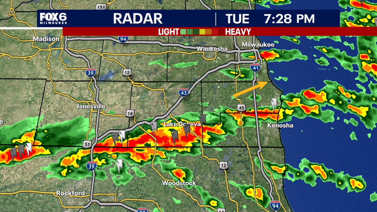
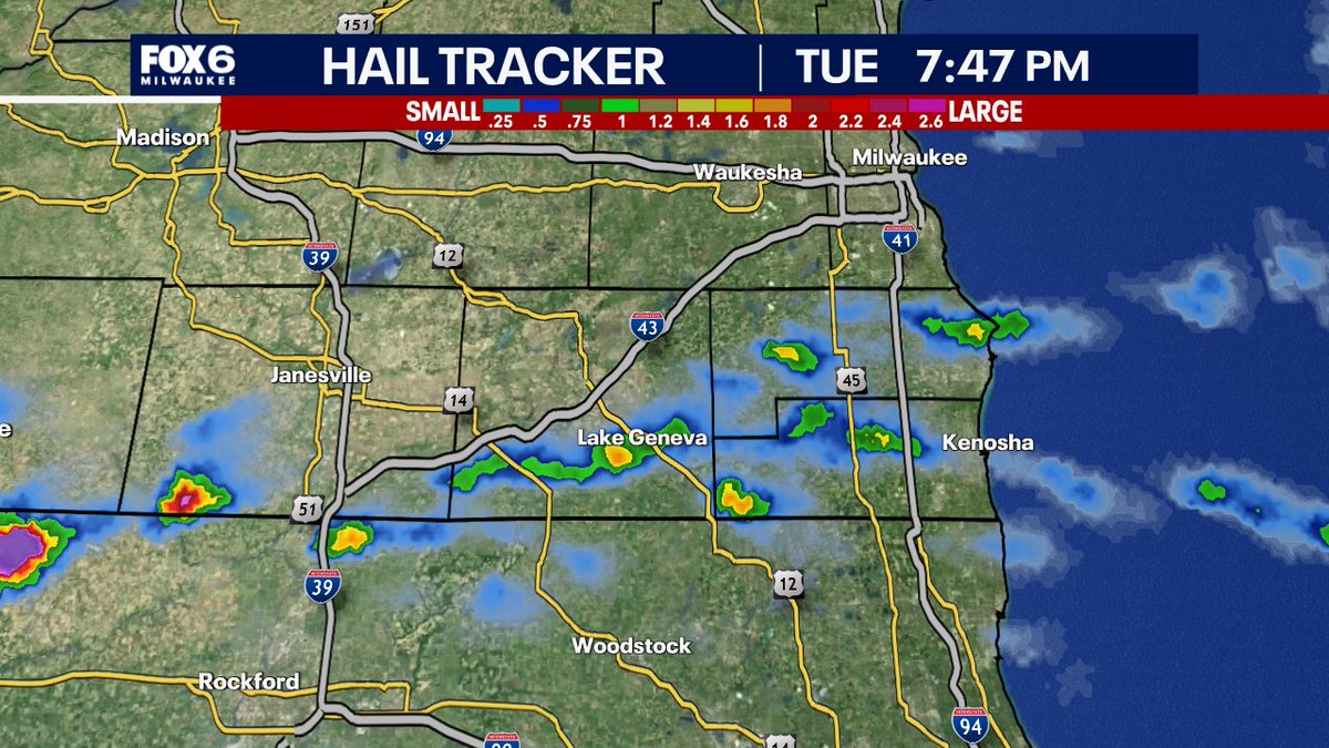
7:28pm Tuesday Storm Update: Hail has perked up in southwestern Walworth county moving ENE. This will impact Lake Geneva with hail to the size of pennies. This entire line is lifting ENE with hail being the primary threat along with gusty winds and heavy rain. No warnings right now, but if hail size estimates reach the size of a quarter, a severe t-storm warning will be issued.
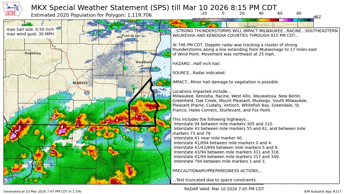
7:47pm Tuesday: No warnings right now, but a lot of rain and some hail in these storms. Storms are moving ENE which means the heaviest rain will train near the IL border and north toward Racine. It will also creep into southern Waukesha and Milwaukee counties as well. We are continuing to watch for warnings should the hail size get a little larger.
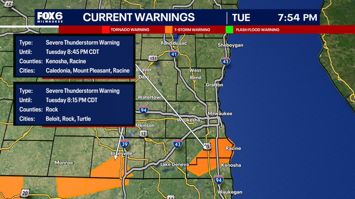
A Severe Thunderstorm Warning has been issued for parts of SE WI until 3/10 8:45PM. Make sure your cell phone emergency alerts are set to "ON." Tune into FOX6, Download the FOX6 Storm Center App & FOX Local App for the latest information.
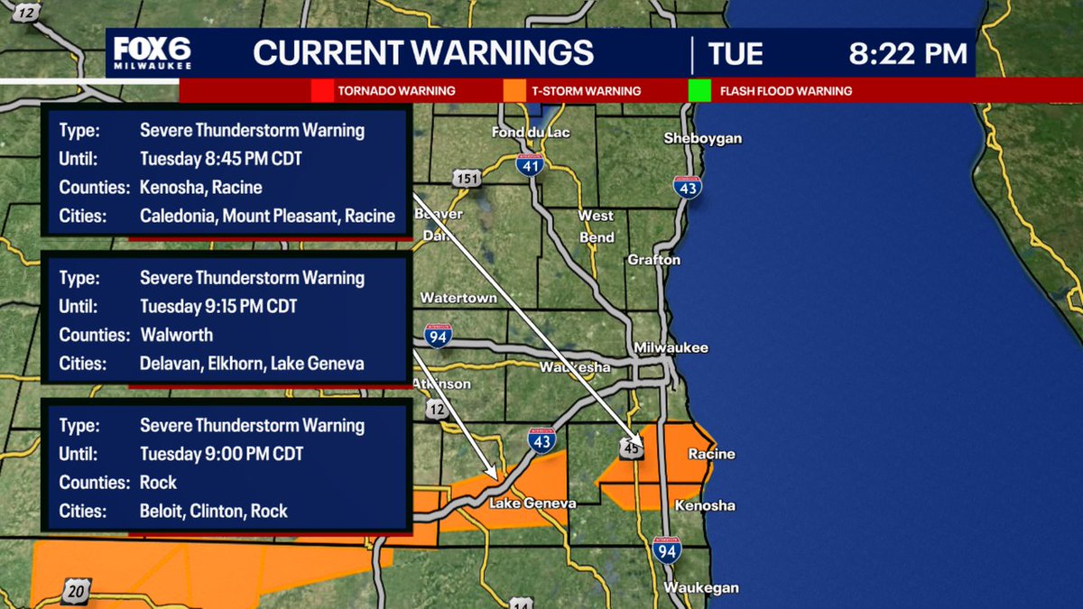
A Severe Thunderstorm Warning has been issued for parts of SE WI until 3/10 9:15PM. Make sure your cell phone emergency alerts are set to "ON." Tune into FOX6, Download the FOX6 Storm Center App & FOX Local App for the latest information.
We are in a Level 2 of 5 slight risk for severe weather tomorrow. Multiple rounds of storms are likely, so it may get messy and uncertainty is above average.
All hazards will be possibly, including a couple tornadoes, scattered damaging winds up to 65 MPH, and large hail up to the size of quarters.