EliasWx retweetledi
EliasWx
6.7K posts

EliasWx
@intrepidweather
15Y/O, big weather nerd. Follow for more weather posts
Columbus, OH Katılım Eylül 2023
2K Takip Edilen729 Takipçiler


Interesting tornadoes have been around ever since tropical storms could form however it wasn’t until the age of dinosaurs where tornado activity picked up because of low pressure systems high heat humidity and flatter surfaces etc etc.
mads 🌪️@dubsinfive
big things happening over on r/dinosaurs. so if anyone has any insight please let me know.
English
EliasWx retweetledi


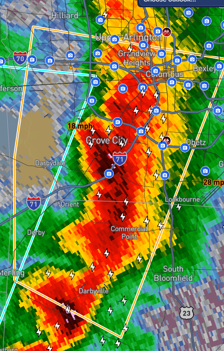
@PayTelevision @matty78961 @TylerSebreezy I disagree, it has significant wind and maybe some hail potential still. But tornado risk fades fast around I-70
English

Probably gonna become a sloppy shop of post-frontal special weather statements by the time it arrives at I-70.
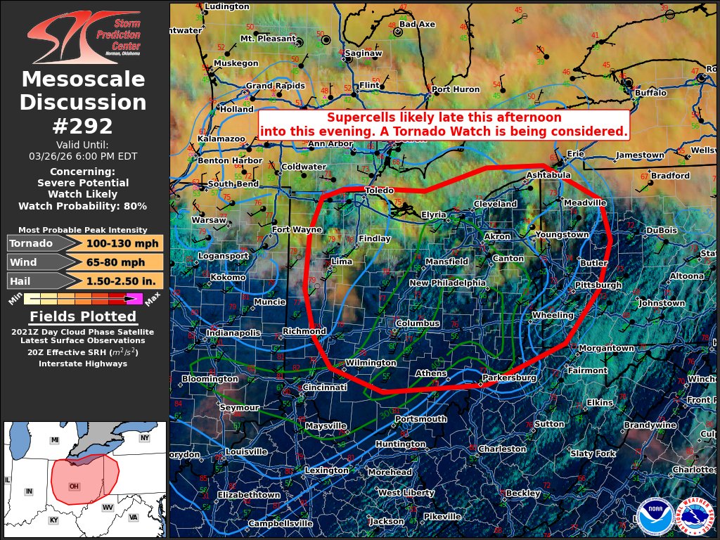
I’m surprised the tornado watch was accepted as far South as it was. SPC MD wanted to take it all the way into Southern Ohio, but looks like the local office only accepted it for the far Northern 1/3rd of the WFO.
English

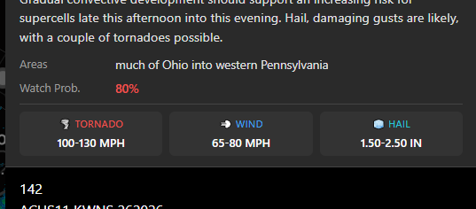
A Tornado Watch is in effect for the northern half of Ohio, western Pennsylvania and the northernmost part of West Virginia. This goes until 11 p.m. A Severe Thunderstorm Watch is in effect for a large portion of Indiana and Illinois, and a small part of southeastern Iowa.

English

@intrepidweather @TylerSebreezy hmmm, SPC showing Franklin is still under enhanced risk, I guess we will see.
English
@matty78961 @TylerSebreezy From what I’ve heard it is supposed to weak around I-70 but severe potential will still almost certainly make it in some capacity to southern Ohio
English
@intrepidweather @TylerSebreezy I was wondering the same thing. Also wondering why they did not include Franklin county but included Licking county.
English

EliasWx retweetledi

English
@RotomBurgers @FickleWX Yeah Andrew Tate responded to Matthew’s post 😭💔
English


The Saudi Arabian government upon seeing Matthew Cappucci's forecast:

English

Today is #MathDay everyone!! What is your favorite thing about math? Mine would be stats! Very important in meteorology!!
English

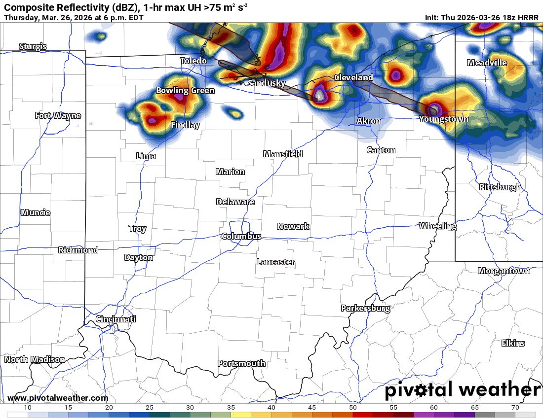
Target location change. Recent model runs suggesting discrete supercells firing in northern areas of Ohio, so we will now sit in Van Wert to monitor the situation. If storms look good, we will book it east! Discrete cells could still fire in NE Indiana, but Ohio is eroding the capping fast.
#OHwx
English


I no longer feel this way
Andrew Guidarelli 🌪️@a_guidarelli
I’m starting to think NW PA is going to be the tornado sweet spot.
English
@a_guidarelli I’m just south of area 1 (Columbus area)
Wouldn’t be surprised to see some stuff hold together as it progresses south more than models say
English
I’m going to take target 1 today
-less driving distance from home
-better terrain
I think meteorologically it’s a toss up, with better moisture west but more SRH east

English
EliasWx retweetledi
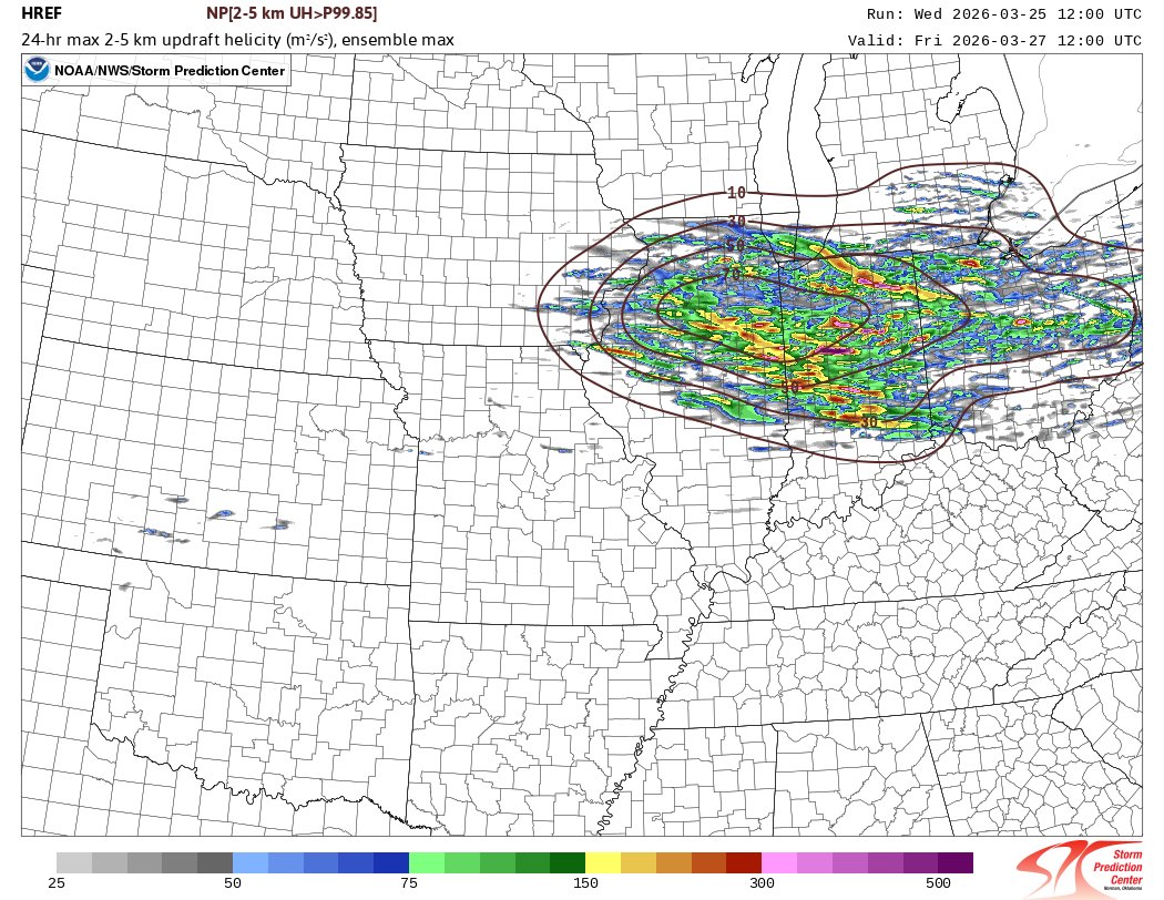
The HREF is focusing on Illinois, Indiana and Ohio -- particularly north of I-70 -- for the late Thursday-Thursday night severe threat. It's important to note updraft helicity tracks don't always represent tornadoes. These are rotating thunderstorm tracks and show hail/wind too.
Lincoln Village, OH 🇺🇸 English
@PettusWX @brandonwxOK Bros kinda right though
Not that my Columbus Ohio ass can be talking
English


EliasWx retweetledi

@intrepidweather supercells missing to the north is where you get the best structure known to man
you dominated 💪
English