@ConsumerSOS What's the vibe there about gasoline prices?Is there talk of shortages or rationing ? I will be there in a couple weeks (unless flight gets canceled 🙄)
English
KS
811 posts
@kimrmt
weather obsessive, litter intolerant, movement promoter,a vessel for my microbial overlords


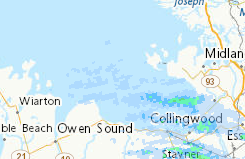
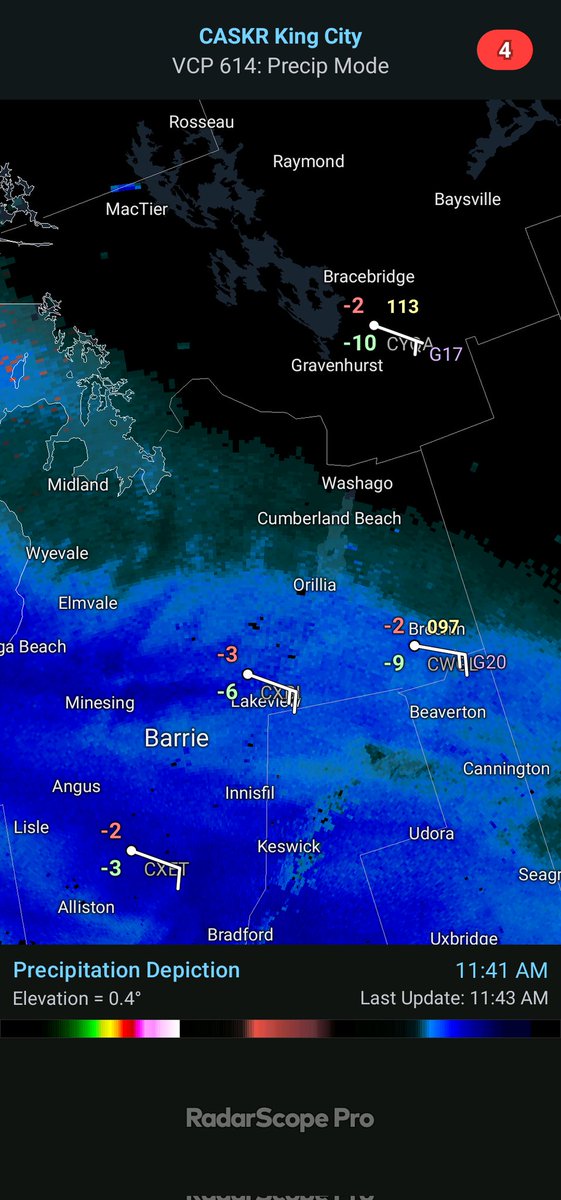
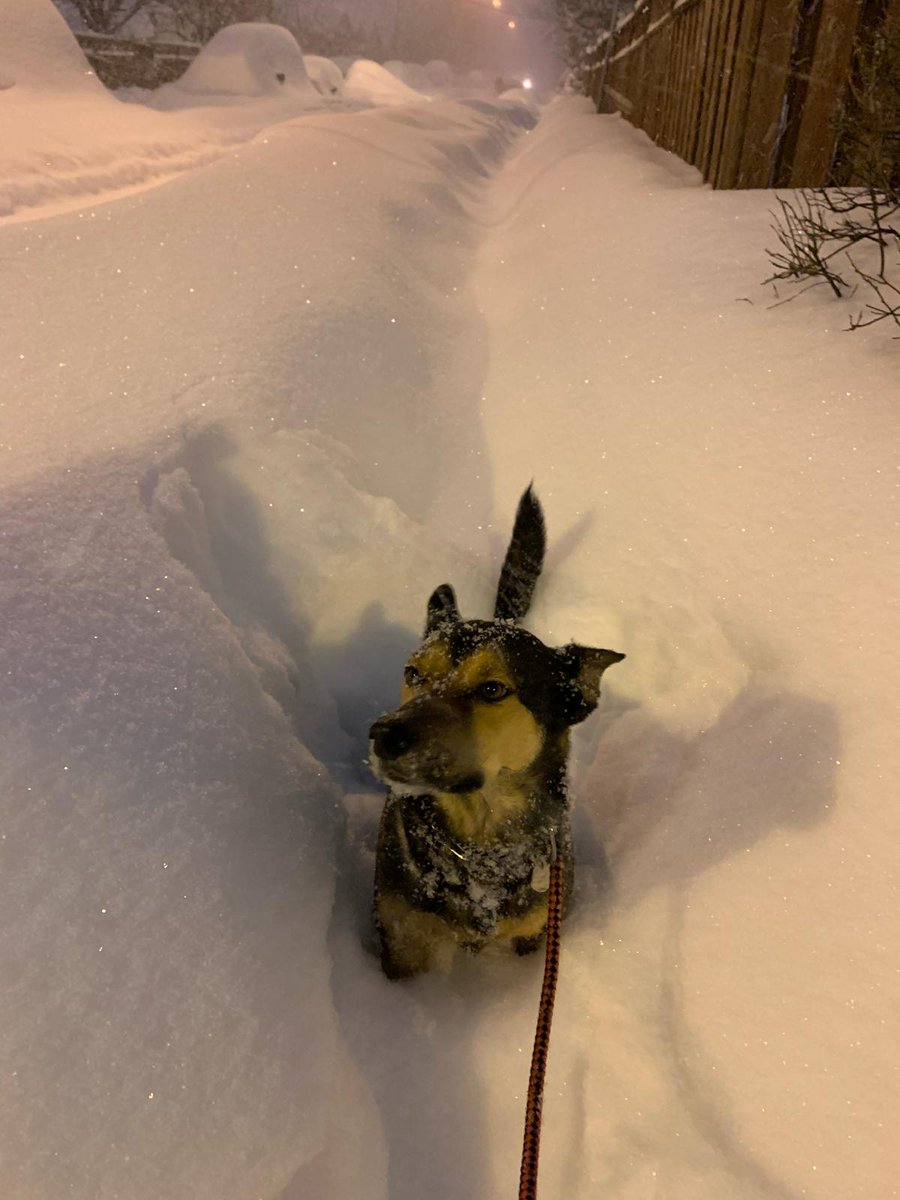
Persistent moderate/ heavy snow across parts of #Bruce/ #Huron and #Perth Counties will lead to significant blowing/ drifting snow tonight Traffic cams in the area show poor road/ weather conditions, and they expected to deteriorate through the night #OnWX #ONStorm

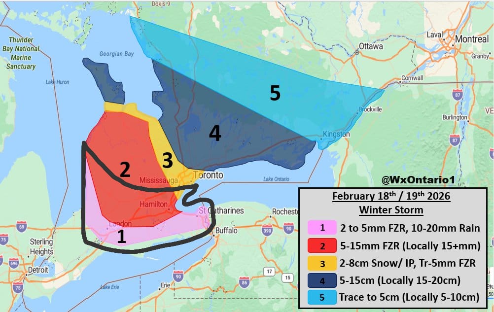
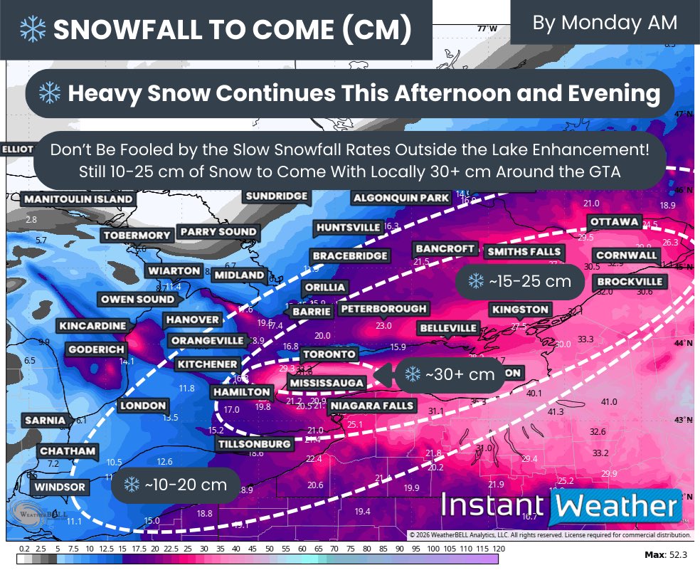
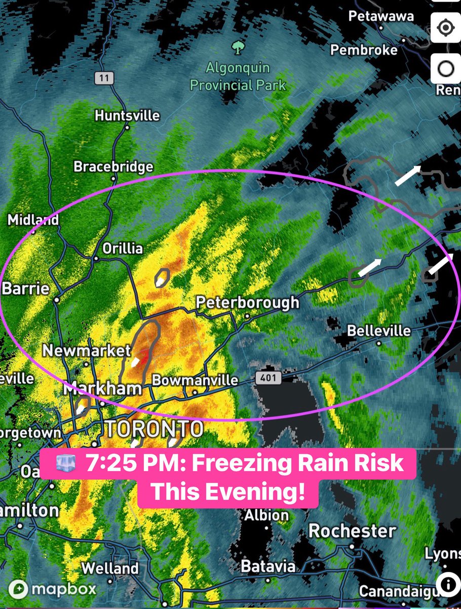
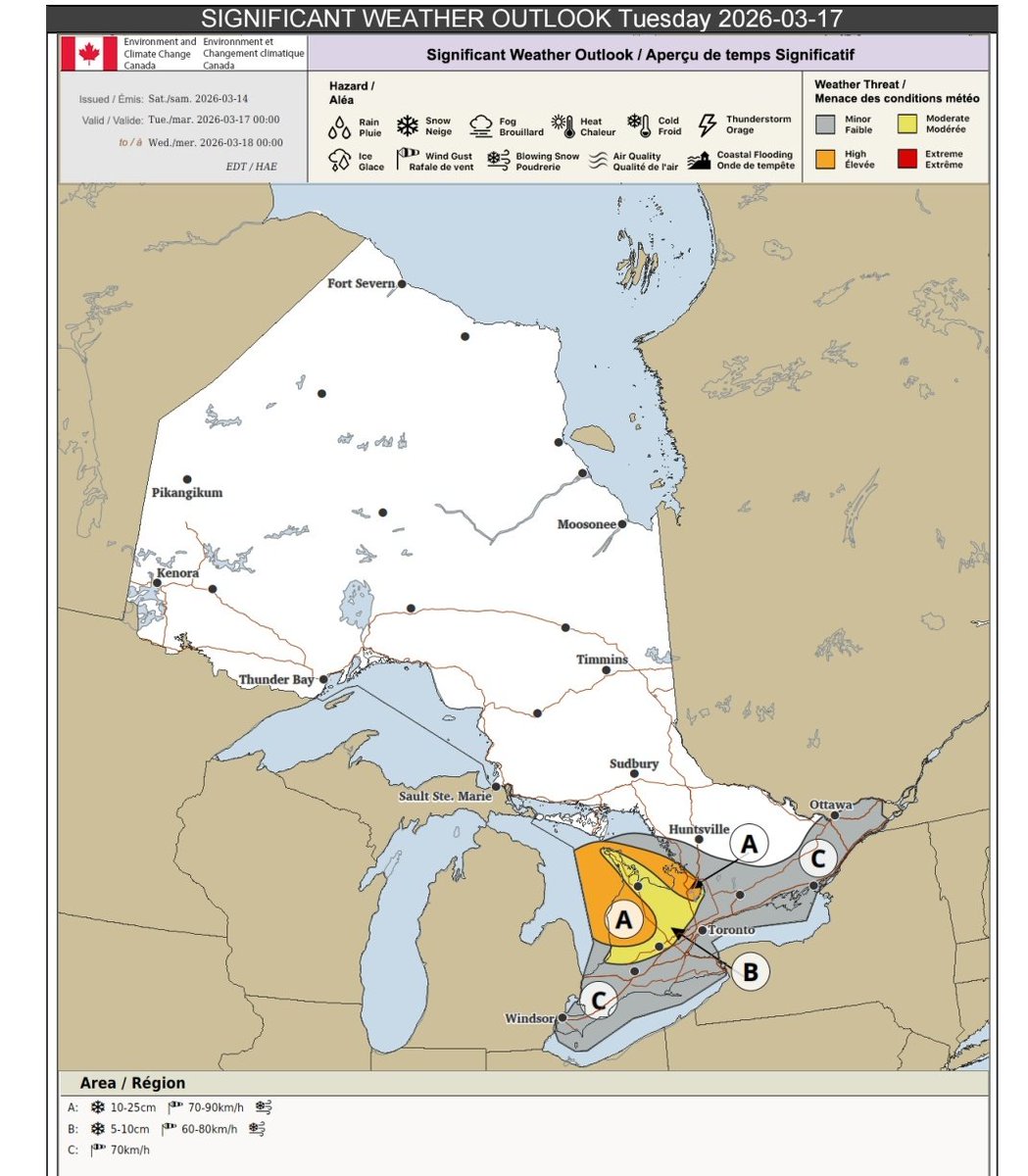
🌨️🧊🌧️Final Forecast for tomorrows (Feb 18th) Messy Winter Storm - Mid Western #Ontario will be hardest hit with significant Freezing Rain expected (5-15+mm) along side 60+km/hr wind gusts (Zone 2) - Further south across Zone 1 brief Freezing Rain is likely before a changeover to rain as temps warm - Zone 3 will feature the battle ground between Ice pellets/ Snow and Freezing Rain. At this point Ice Pellets and Freezing Rain look to win out with 2-8cm of IP/ Snow expected and possibly a trace to 5mm of Freezing Rain - Further NE, mostly snow is expected with 5-15cm expected, locally higher amounts possible (Zone 4) - Most of Eastern Ont will be on the Northern fringe of the storm. Slight shift north will bring heavier snowfall to the region * If temps remain a tad cooler than expected across Zone 3, expect more snow than IP/ FZR with 10+cm of snow possible* - All in all, a messy high impact storm for many - Strong winds will likely lead to power outages and tree damage across Zone 2 - If traveling tomorrow, be prepared for a slow and slick commute #OnWX #ONStorm
Significant travel impacts across rural areas of SW #Ontario are looking likely on Friday Snow associated with the clipper + 50-60km/hr gusts will lead to significant blowing/ drifting snow With snowbanks so high already, near whiteout conditions are possible Widespread bus cancelations likely, road closures possible Will update in the days to come #OnWX #ONStorm