Philippe Papin retweetledi

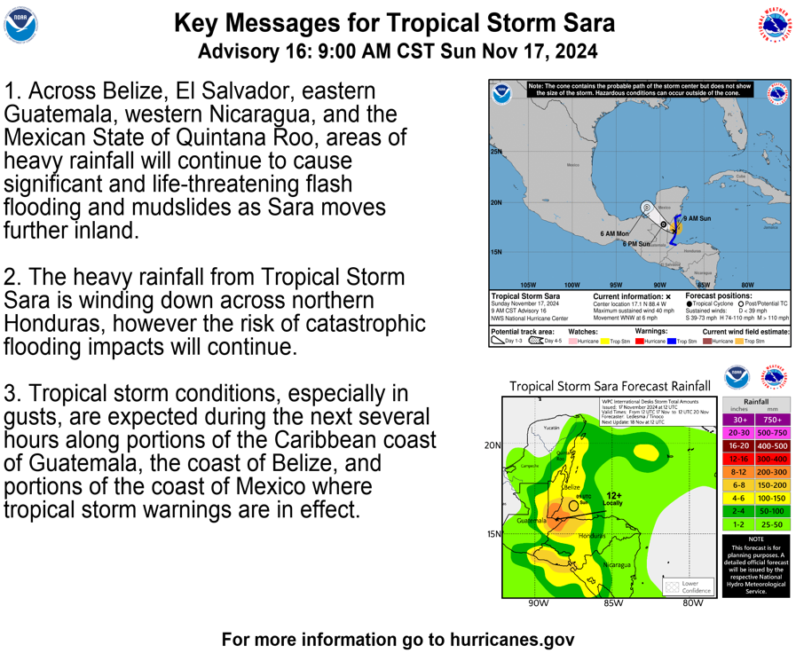
In addition to the winter storm in the Northeast, another winter storm may develop and impact much of the Deep South early next week. Here is our first Key Message about that potential winter storm.

English
Philippe Papin
12.6K posts

@pppapin
Sr. Hurricane Specialist at @NWSNHC | Ph.D + M.S. via @UAlbanyDAES & B.S. via @UNCAweather | All kinds of weather 🌤❄️⛈🌪| Thoughts are my own |
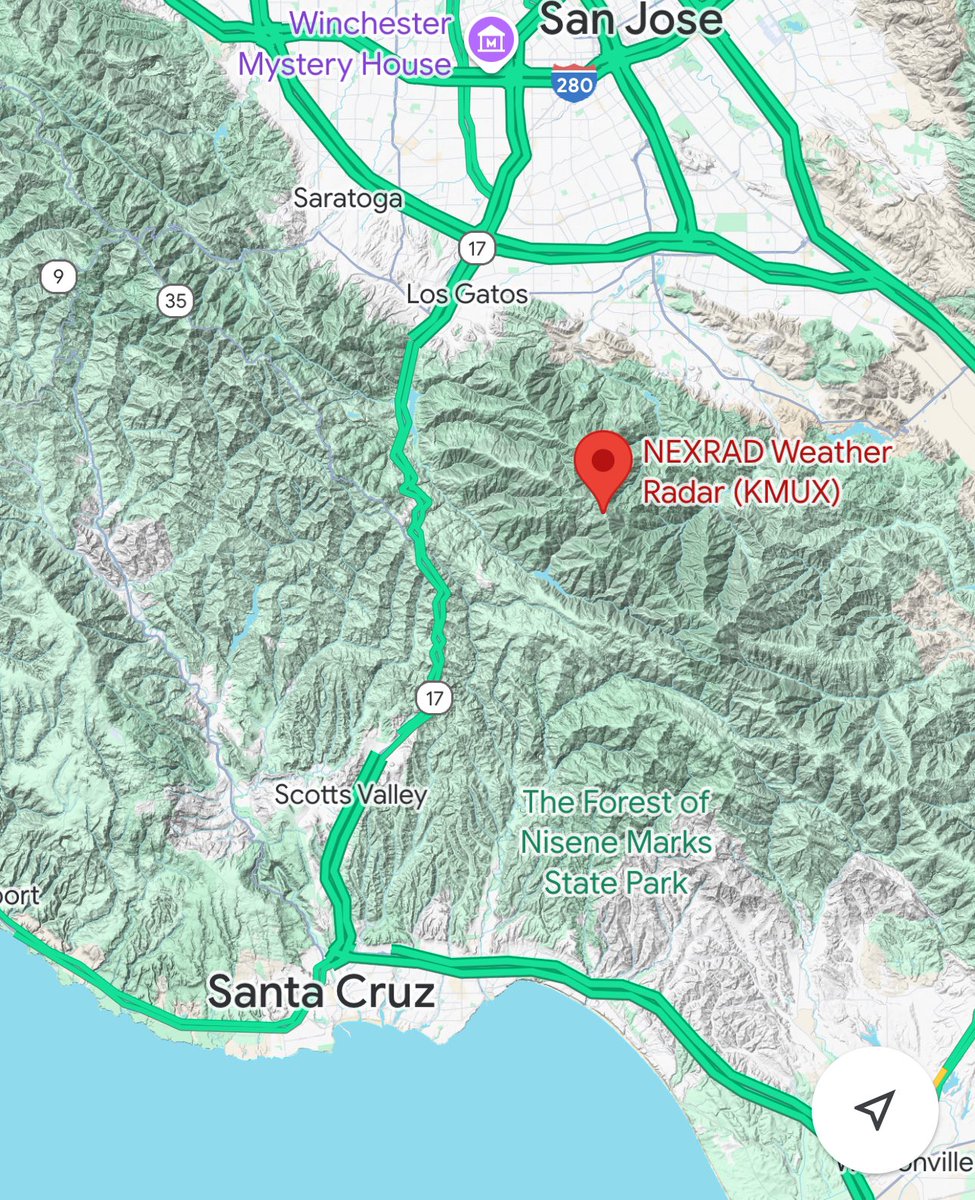
📃Preliminary Damage Survey Conducted. EF1 tornado observed in Scotts Valley this afternoon, December 14, 2024. The most severe damage was observed along Mt Hermon Rd. Full info: partnerservices.nws.noaa.gov/products/a1fbe… #cawx #scottsvalley


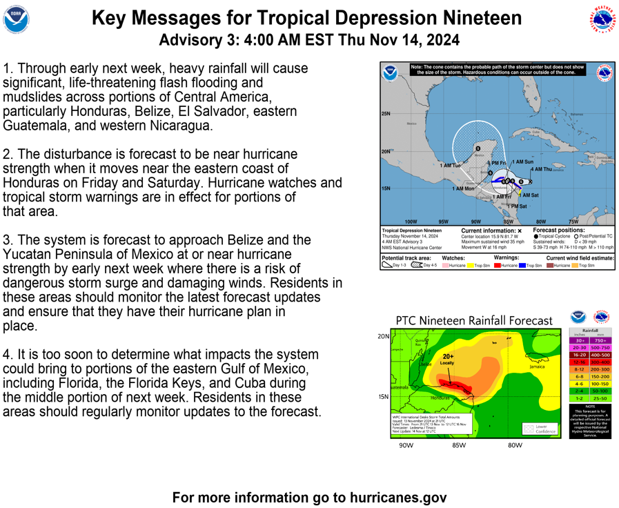


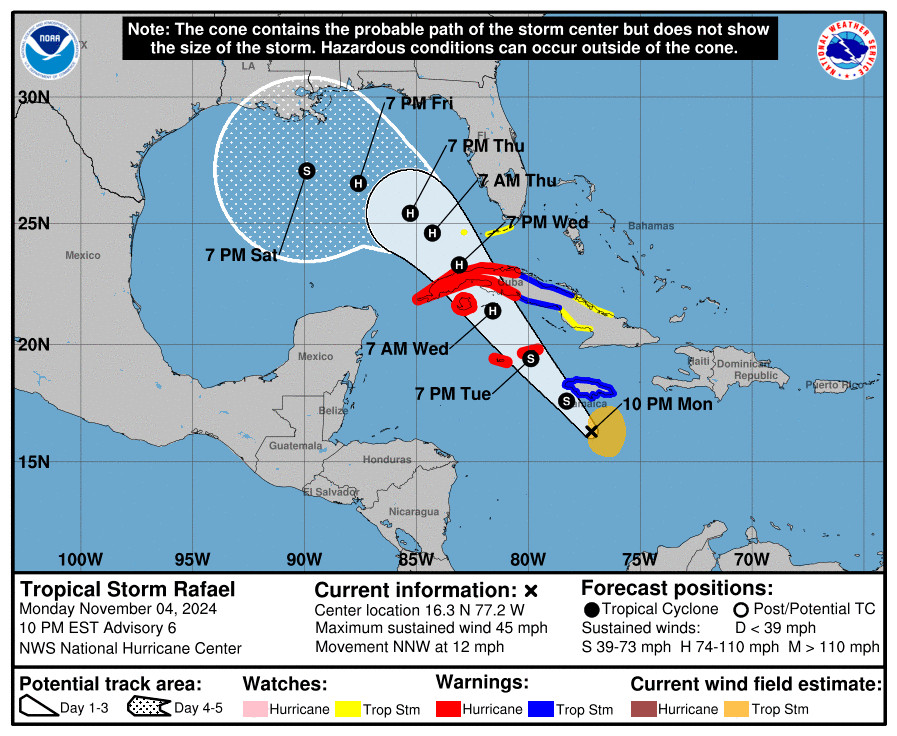
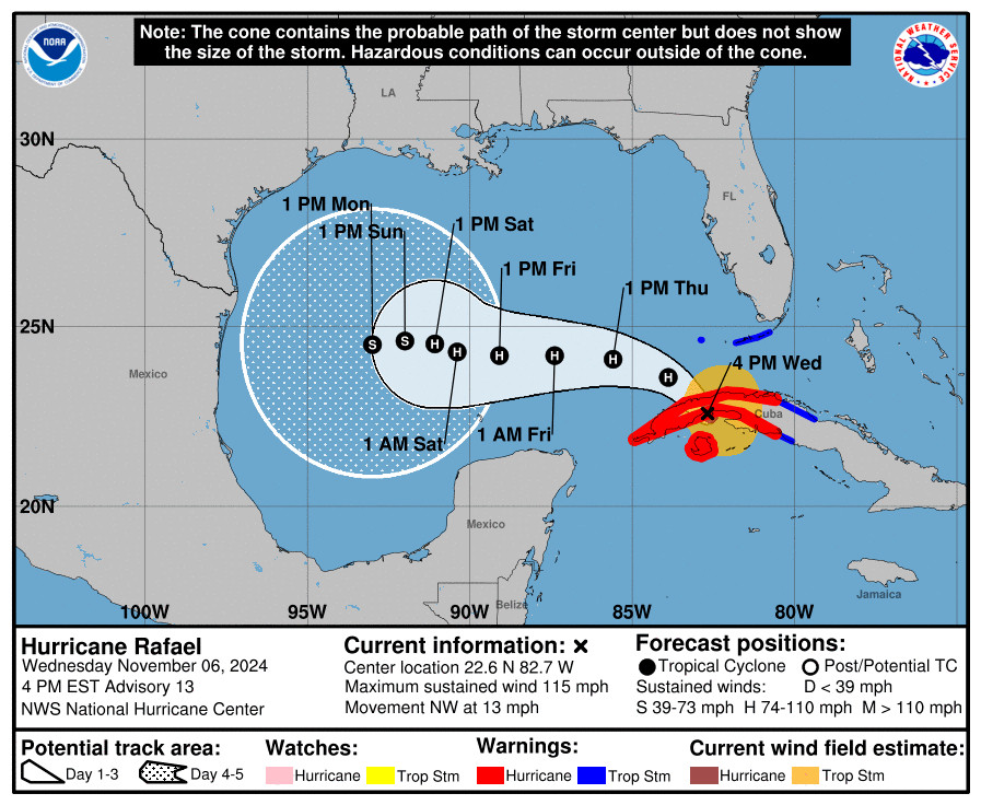

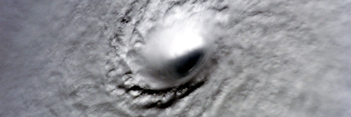
Sometimes when I write up a TC discussion, in this case #Rafael, I wish I could include visual aids to help describe what I am trying to say in the text. Take for instance the passage below. This wall of text tries to say a lot about track, but is pretty dense for most folks.