Project '44

5.2K posts

Project '44 banner
Project '44

Project '44

@project4_4

We map the Second World War. 🌍 Expand our bio to explore all our interactive maps, resources, and projects. Links below! ⬇️

Katılım Eylül 2019
545 Takip Edilen19K Takipçiler
Sabitlenmiş Tweet
Project '44
Project '44@project4_4·
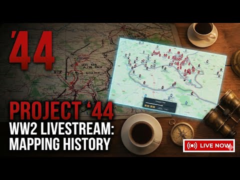
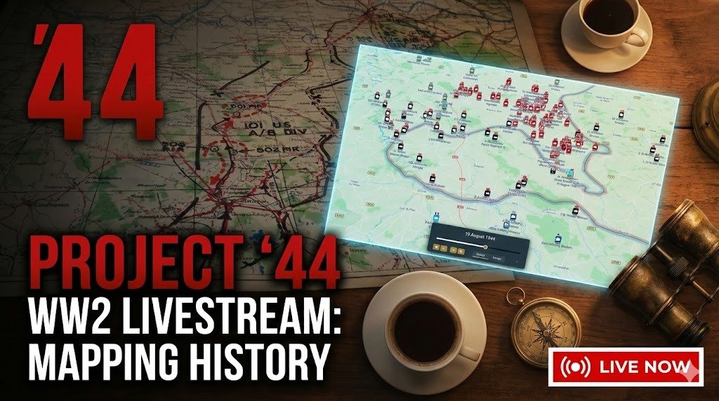
Tomorrow at 1:00 pm, the Project ’44 team will be live on YouTube for a special livestream update. We’ll be walking through the new Beta Map, discussing why the platform was rebuilt, and outlining what comes next for Project ’44 in 2026. Multiple members of the team will be on screen to talk about research, mapping, and development. If you follow Canadian military history or use Project ’44 for research and education, this stream will give you a behind-the-scenes look at what we’ve been building. youtube.com/live/Cazq6kP_S…
YouTube video
YouTube
Project '44 tweet media
English
1
7
30
6K
Project '44
Project '44@project4_4·
Snipers of the R22eR walking in the Liri Valley. Snipers of the Royal 22e Régiment (R22eR) are shown moving through the Liri Valley during the Italian Campaign. By 1944, Canadian infantry battalions typically maintained a sniper section within their support company. These men, often drawn from the best marksmen in the battalion, were trained not only in precision shooting but also in camouflage, observation, and reconnaissance. Their role was to harass enemy positions, eliminate key targets like machine-gunners or officers, and provide valuable intelligence on enemy movements. For the R22eR, one of Canada’s most storied francophone regiments, the fighting in the Liri Valley was among their hardest experiences of the war. In May 1944, Canadian forces broke through the Hitler Line as part of the Allied drive on Rome. The valley, flanked by mountains and cut with rivers, had been turned into a strong defensive belt by German forces. Snipers and forward scouts were critical in locating well-hidden positions and helping guide infantry attacks through this difficult terrain. The work of the sniper sections was often solitary and dangerous, but their precision fire and reconnaissance supported the battalion’s advance in battles where every strongpoint had to be carefully identified and reduced. For the R22eR, their actions in the Liri Valley contributed to one of the key Canadian victories of the Italian campaign, clearing the path toward Rome.
Project '44 tweet media
English
0
3
13
584
Project '44
Project '44@project4_4·
Gunners of the 12th Field Regiment, Royal Canadian Artillery (R.C.A.), with the Victory issue of the Maple Leaf newspaper, Aurich, Germany, 20 May 1945. In May 1945, with Germany surrendered and the war in Europe over, Canadian troops found themselves in occupied territory, shifting from combat to stabilization duties. At Aurich in northern Germany, gunners of the 12th Field Regiment, Royal Canadian Artillery, gathered to read the “Victory” issue of The Maple Leaf, the Canadian Army’s overseas newspaper. The Maple Leaf had been published since 1944, bringing news, features, and a touch of home to Canadian servicemen across Europe. The Victory edition marked the end of years of fighting, announcing the defeat of Nazi Germany and the final triumph of the Allied cause. For the men of the 12th Field Regiment, who had fought through Normandy, the Scheldt, and into Germany, it was both a moment of relief and reflection on the heavy cost of victory. Scenes like this underscored the transition from war to peace. Even as soldiers read of victory, many still faced weeks or months of duty abroad before demobilization.
Project '44 tweet media
English
1
2
18
1.4K
Project '44 retweetledi
Project Athena
Project Athena@TFProjectAthena·
Project Athena is a living archive dedicated to preserving the personal stories and photographs of Veterans who served in Afghanistan during Operation Athena (2001–2021). Built by veterans, for veterans — the platform lets anyone who was there pinpoint exactly where their photo was taken on an interactive map, attach a date and personal story, and contribute to a shared record of service that will never be forgotten. Every submission helps ensure the human side of Canada's longest military mission is preserved for generations to come. 📸Canadian Forces soldiers grab a moment of normalcy at the Tim Hortons on Kandahar Airfield's famous fast-food row, just steps from the base hockey rink — December 2006. 📸Ontario reservists serving with the OMLT pose at COP Lion in the village of Nakhonay, the same soldiers who would later be featured in the documentary Desert Lions: Canadian Forces Mentors in Kandahar — August 2010. 📸Soldiers from Task Force 1-07 head out to Tarnak Farm to zero their weapons in the final days of February 2007, surrounded by the ruins of destroyed compounds that defined the early days of the mission. Have a photo from your time in Afghanistan? Upload your story today at projectathena.ca and help keep the memory alive
English
2
11
41
4.2K
Project '44
Project '44@project4_4·
Gen. Erwin Rommel with the 15th Panzer Division between Tobruk and Sidi Omar, 1941. In 1941, General Erwin Rommel, commander of the German Afrika Korps, gained international fame for his bold manoeuvres across the deserts of North Africa. Here he is seen with the 15th Panzer Division, one of his key armoured formations, during operations between Tobruk and Sidi Omar. The 15th Panzer Division, newly arrived in North Africa that year, became central to the Axis effort to push British and Commonwealth forces back toward Egypt. Under Rommel’s leadership, it spearheaded offensives that encircled Allied troops, threatened supply lines, and turned the desert war into a fast-moving campaign of attack and counterattack. Rommel’s ability to inspire his men and outmanoeuvre his opponents earned him the nickname “the Desert Fox.” Yet his daring tactics also came at a cost—his forces were often stretched thin and reliant on precarious supply lines across the Mediterranean. This photograph captures Rommel during the height of his reputation as one of the most formidable battlefield commanders of the war.
Project '44 tweet media
English
0
5
36
970
Project '44
Project '44@project4_4·
USS Bunker Hill burning after a Japanese suicide attack. Near Okinawa, May 11, 1945 On 11 May 1945, while supporting operations off Okinawa, the aircraft carrier USS Bunker Hill (CV-17) was struck by two Japanese kamikaze aircraft in quick succession. The planes, each carrying bombs, crashed into the flight deck within 30 seconds of each other, igniting massive fires among fully fuelled and armed aircraft preparing for missions. The destruction was catastrophic. Explosions tore through the hangar and upper decks, and burning aviation fuel spread uncontrollably. Despite heroic damage control efforts, the carrier lost 389 men killed, 264 wounded, and 43 missing—one of the single deadliest kamikaze attacks of the war. Though heavily damaged, Bunker Hill did not sink. She was able to steam back to the United States under her own power, but she never returned to combat. The attack illustrated both the ferocity of the Okinawa campaign and the desperate intensity of Japan’s kamikaze strategy in the final months of the war.
Project '44 tweet media
English
0
1
16
820
A Street Near You
A Street Near You@AStreetNearYou·
@project4_4 I haven't looked at Second World War mapping, but having built some experimental tools to map First World War aerial photos of trench systems. I was fascinated and impressed by your write up of what you're doing. Do you have anything like a @geomob community in Canada?
English
1
0
0
34
Project '44 retweetledi
Project '44
Project '44@project4_4·
One of the challenges that makes mapping from Second World War unit war diaries particularly difficult is the mapping system itself, specifically the coordinate grids and map projections used at the time. The British relied on several different map projection systems, each built on geodetic datums that were, by modern standards, imprecise. For northwest Europe, the two most relevant are Lambert Zone I, based on the Nouvelle Triangulation Française (NTF) datum and the Clarke 1880 ellipsoid, and Nord de Guerre, an older WWI-era grid based on the Ancienne Triangulation Française (ATF) datum and the Plessis 1817 ellipsoid. By 1944, Nord de Guerre was technically obsolete, but it still appeared as marginal reference ticks on many British-issued map sheets. These datums were derived from earlier triangulation surveys and predated the computational methods that would later allow for globally consistent, satellite-verified reference systems. Geodesy as a discipline was still maturing, and without computers, producing and correcting large-scale surveys was slow, laborious work, made harder by the fact that a war was actively being fought. The practical consequence for a theatre like Normandy was that available map coverage relied on conical projections, specifically Lambert Conformal Conic, rather than the narrower strip-by-strip Transverse Mercator projection that underpins the modern Military Grid Reference System (MGRS). Transverse Mercator projections perform well over narrow north-south bands but distort rapidly as you move east or west. Lambert Conic projections handle wider east-west extents better, which is why they were preferred for covering broad operational theatres. The tradeoff is that both introduce distortion of different kinds depending on where you are on the sheet, and that distortion was baked into every map issued to every unit. Layer on top of that the generalisation inherent in the most commonly available wartime maps, the GSGS 1:100,000 series. At that scale, features must be simplified: roads straightened, villages approximated, contours smoothed and errors compounded. In practice, positional inaccuracy across these sheets typically falls in the range of 100 to 200 metres, with worse outliers possible depending on the area and the source survey data. By modern standards that is significant. GPS-guided munitions rely on sub-metre accuracy, and calling close artillery fire with that margin of error would be genuinely hazardous to friendly troops. In the Second World War, those errors were real and unavoidable, and commanders and surveyors simply had to account for them operationally. When we mapped Project '44, we manually georeferenced each GSGS map sheet and stitched them together, tying the sheets to known, identifiable features on the ground. Done carefully, this process keeps positional accuracy near the lower end of that 100 to 200 metre range, but it cannot push below it. The original datum and projection errors, the generalisation of the source maps, and the inevitable human error in the georeferencing process all combine in ways that cannot be fully eliminated. There is a floor, and that floor is set by the accuracy of the original surveys. Over the last several days I have been working on a new approach to reduce that residual uncertainty and speed up the mapping workflow. It is a system of systems that brings together three reference layers in one interface. The first is the wartime grid systems, specifically the coordinate grids actually used in the war diaries, enabling direct input and plotting of grid references as they appear in the source documents. The second is the georeferenced GSGS basemaps, the original wartime maps georeferenced to a modern coordinate system, so a plotted grid reference can be visually cross-checked against the map the unit itself would have been reading. The third is a modern accurate basemap, a contemporary mapping layer using current satellite-derived data, for ground truth comparison. The idea is convergence across three independent references. Where all three agree, you have high confidence. Where they diverge, a human mapper can apply contextual judgment, drawing on terrain, road networks, and the unit narrative, to make the call on where the position actually was. The goal is faster, more efficient mapping without sacrificing interpretive rigour. Rather than automating the decision, the tool gives the mapper the best possible information to make an informed judgment about where a unit was and what they were doing.
English
12
18
181
24.4K
Project '44
Project '44@project4_4·
Thank you! My biggest motivation was making my life easier. I'll do some more tweaking, but testing last night on known points vs automated mapping and the results were not bad. Some tweaking and I'll be able to take a war diary, map the points then quickly verify and update. Will be a huge mapping difference
English
0
0
2
64
Project '44
Project '44@project4_4·
The errors in these maps are baked into the original surveys from the 1800s. No software can fix that, and an LLM is no different. It doesn't have access to mathematical parameters that were never calculated to begin with, and if you ask it to just figure it out, it will make numbers up. The tool we built works precisely because it doesn't try to solve the unsolvable. It puts three references in front of a human and lets them make the call.
English
2
0
5
273
Ian Gunn
Ian Gunn@_Gunzo_·
@project4_4 Feed the different mapping systems into your favourite LLM. Then the coordinates.. See if it can help you. You may have to update your prompt a few times. The LLM should be able to help you.
English
1
0
0
299
Clint Warren-Davey
Clint Warren-Davey@Clint_Davey1·
The biggest German defeat in Normandy was the Falaise Pocket. The actual closing of the Pocket was largely done by the Poles and Canadians, who had also done a lot of the hard attritional fighting around Caen, alongside the Brits. I like it when these "minor" nations pull off decisive victories that decide the fate of a campaign. And this wasn't the only example. Poles and Canadians were top-class soldiers in WW2. Fought well in Holland, in Italy, in France and in many other campaigns.
Clint Warren-Davey tweet media
English
185
319
3.3K
197.4K
Project '44
Project '44@project4_4·
Lt Gen Charles Foulkes receives the surrender of the German twenty-fifth army at the Hotel de Wereld, Wageningen, Netherlands. On 5 May 1945, at the Hotel de Wereld in Wageningen, Netherlands, Lieutenant-General Charles Foulkes, commander of I Canadian Corps, received the surrender of the German Twenty-Fifth Army from Generaloberst Johannes Blaskowitz. This act formally ended hostilities in the Netherlands, bringing relief to a population that had endured years of occupation and the privations of the “Hunger Winter.” The negotiations took place in the hotel’s dining room, where maps of Dutch territory were laid out on the table to clarify the positions of German forces and the logistics of their surrender. Foulkes was accompanied by senior Allied officers, while the Germans came under strict orders to comply with Allied demands to avoid further bloodshed. The surrender at Wageningen remains one of the defining moments of Canada’s role in the Second World War. Canadian forces had led the liberation of much of the Netherlands, and their presence at the ceremony underscored both the military victory and the lasting bond forged between Canada and the Dutch people during those final weeks of the war.
Project '44 tweet media
English
0
8
26
1.2K
Project '44
Project '44@project4_4·
Lance Corporal Wrightman of the Canadian Provost Corps standing next to a sign warning soldiers not to fraternize with the enemy. The Canadian advance into Germany in 1945 was guided by a network of named supply and march routes, each marked with distinctive signs. Here, Lance Corporal Wrightman of the Canadian Provost Corps stands beside a sign warning troops not to fraternize with the local population, a regulation strictly enforced in the first months of occupation. The sign also marks Onyx Route, one of the designated roads used to channel traffic and control the flow of men and equipment. The Provost Corps played a critical role in this system. Military police directed convoys, maintained order, and ensured soldiers followed regulations as they pushed deeper into Germany. Signs like this were part of that wider effort—reminding soldiers that despite victory, they were still in enemy territory. The most famous of these arteries was the Maple Leaf Route, which ran from the Normandy beaches through Belgium and the Netherlands into Germany. Onyx Route, like many others, was a branch of this larger supply network, part of the carefully organized lifeline that sustained Canadian operations in Northwest Europe to the war’s very end.
Project '44 tweet media
English
1
2
17
1.1K
Project '44 retweetledi
Canadian Warplane Heritage Museum
It took about 10 gallons of product to repaint the top of our Lancaster's wings. Huge thanks to KF Aerospace for the excellent work - and the timelapse!
English
31
184
1.5K
71.8K
Project '44
Project '44@project4_4·
Well maybe we can share notes on things we've learned. I think for the most part we have gotten it to do everything we used to be able to do. In fact, up until 1.5 weeks ago MapLibre didn't support pinch zoom, which we needed for touch screens... And voila they released it. Was perfect timing
English
1
0
1
33
ORBAT Mapper
ORBAT Mapper@orbatmapper·
@project4_4 I didn't know that you have switched to maplibre. It has some rough edges, but I've enjoyed the ride so far.
English
1
0
0
53
ORBAT Mapper
ORBAT Mapper@orbatmapper·
The migration from OpenLayers to MapLibre is progressing nicely. Full draw support is almost done. Even drawing across the dreaded anti-meridian works. That means I’ll finally be able to support Pacific Theater scenarios properly.
English
3
2
32
2.4K
Måns
Måns@spatialillusion·
What if, we could do viewshed analysis in the web browser… I did not need another project… (Just a proof of concept at the moment, will need lots of more work.)
English
9
5
135
7.5K
Project '44
Project '44@project4_4·
Happy 2nd Lieutenant William Robertson and Lt. Alexander Sylvashko, Russian Army, shown in front of sign [East Meets West] symbolizing the historic meeting of the Russian and American Armies, near Torgau, Germany. April 25, 1945. In late April 1945, American and Soviet forces converged on the Elbe River near Torgau, Germany, cutting the country in two and sealing the fate of the Nazi regime. On 25 April, patrols from the U.S. 69th Infantry Division and the Soviet 58th Guards Rifle Division met near the destroyed Elbe bridge at Torgau. The moment, soon dubbed “Elbe Day,” symbolized the closing of the Allied ring around Hitler’s Germany. The meeting was both a tactical success and a powerful political gesture. For the soldiers involved, it was the culmination of a long and costly advance from opposite directions—Americans driving east from Normandy, Soviets west from Stalingrad. For the world, the handshake at Torgau demonstrated Allied unity and underscored that the war in Europe was rapidly approaching its end.
Project '44 tweet media
English
2
5
43
1.7K
Project '44
Project '44@project4_4·
Another day another touchscreen running @project4_4. This time at the sacred Holten Canadian War Cemetery.
Project '44 tweet mediaProject '44 tweet mediaProject '44 tweet mediaProject '44 tweet media
English
0
2
20
994
Steve None
Steve None@Mrwashburn1983·
@project4_4 It's too small to read. But unmistakable .Eindhoven, Nijmegen, and Arnhem (Renkum and Oosterbeek)
English
1
0
36
9.4K
Project '44
Project '44@project4_4·
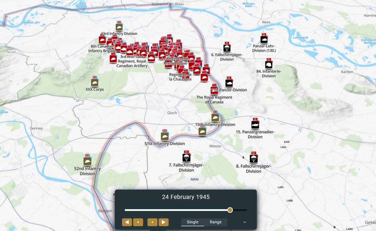
How many could guess what battle this is without seeing any of the units and without knowing what date the map is?
Project '44 tweet media
English
486
18
529
143.4K