Sabitlenmiş Tweet

A little rain here earlier, but has moved out of the midland SC area and is now located southeast of my area.
Ed Piotrowski@EdPiotrowski
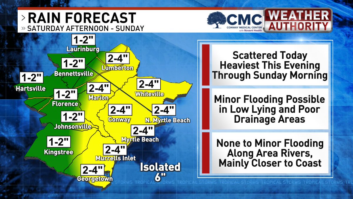
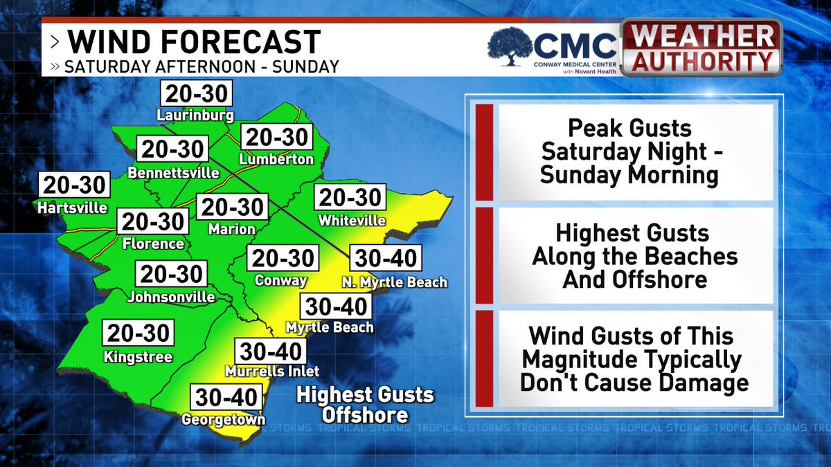
6 AM SUNDAY CHANTAL UPDATE Tropical Storm #Chantal made landfall near Litchfield early this morning around 4 a.m. and is now weakening as it moves through Horry County. Most of the heavy rain is falling north of the storm's center. As the system continues tracking northward, rainfall will shift in that direction as well. Expect rain to increase over the next few hours in Robeson, Scotland, Marlboro, and Dillon counties, where an additional 1–2 inches is possible. The heaviest rain should exit the area by around 1 p.m., leaving a few scattered showers and a few thunderstorms. Winds will continue to gust between 20 and 30 mph throughout the morning before gradually weakening this afternoon.
English