DarkSharkWX

6K posts

DarkSharkWX banner
DarkSharkWX

DarkSharkWX

@shark_wx

weather enthusiast, winter lover, lives in Maryland Spotter ID: MO536 head forecaster at @mococlosures 2025-26 snowfall: 3.6”

DMV Katılım Ocak 2022
540 Takip Edilen1.1K Takipçiler
DarkSharkWX
DarkSharkWX@shark_wx·
@blizzardof96 how much of this could just be attributed to overall agw? although iirc the wpac/io is warming disproportionately faster than the epac (since its a region of mean upwelling), so maybe that cancels out or even increases maximum potential
English

1
0
1
359
Ethan Sacoransky
Ethan Sacoransky@blizzardof96·
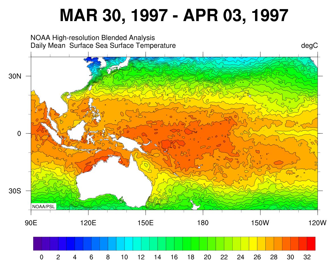
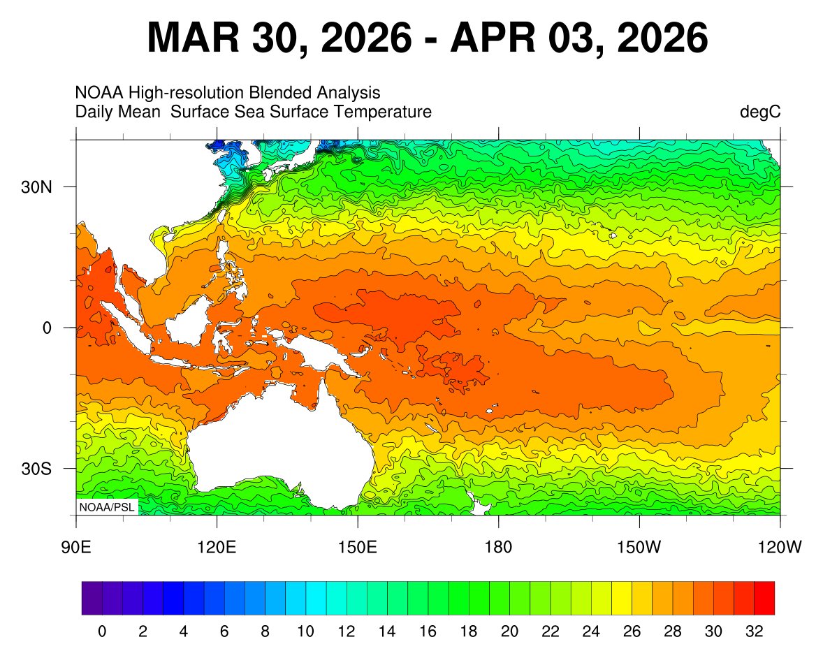
Good comparison of the western Pacific warm pool between 1997 and 2026 (5-day mean). The 2026 panel shows a broader and more intense warm pool. This suggests greater upper-ocean heat content and a more expanded reservoir of warm water, which is consistent with stronger subsurface preconditioning despite the eastern Pacific not yet fully responding. @PaulRoundy1
Ethan Sacoransky tweet mediaEthan Sacoransky tweet media
English
6
28
113
7.6K
DarkSharkWX retweetledi
Paul Roundy
Paul Roundy@PaulRoundy1·
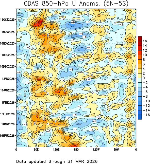
CPC had to re draw their 850 hPa wind colorbar for the westerly wind burst event, and the next week takes it beyond even that level. It's astounding.
Paul Roundy tweet media
English
5
14
76
14.9K
DarkSharkWX retweetledi
Nikhil Trivedi
Nikhil Trivedi@DCAreaWx·
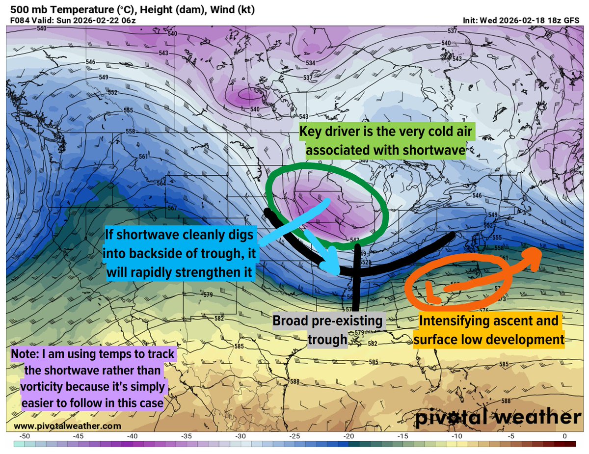
...that isn't immediately apparent on usual metrics. This is important because it means we have the energy to force an intense cyclone and snowstorm, *if* we can phase our shortwave in early/cleanly. The euro (weakest model) is an outlier, so I would lean towards a storm. (2/2)
GIF
English
1
7
48
6.3K
DarkSharkWX retweetledi
Nikhil Trivedi
Nikhil Trivedi@DCAreaWx·
Although the vorticity associated with our primary shortwave is messy until the last second, the feature is sneakily strong. The 500mb temp associated with it over the Midwest is a frigid -38C, which is 15C colder than average! This indicates a high baroclinic ceiling...(1/2)
Nikhil Trivedi tweet media
English
1
12
63
11.1K
DarkSharkWX retweetledi
Nikhil Trivedi
Nikhil Trivedi@DCAreaWx·
After a week of quiet and mild weather, the return of an active storm track will bring winter back for some. This is driven by a series of intense Pacific troughs crashing into the Western US and ejecting eastward. Aside from much-needed mountain snow in the Western US,... (1/4)
Nikhil Trivedi tweet media
English
1
4
42
5.9K
DarkSharkWX retweetledi
Andrew Markowitz
Andrew Markowitz@amarkowitzWX·
Today is the first time in 3,655 days where DC, Baltimore, Philly, NYC, and Boston all received at least 6” of snow.
English
21
322
5.3K
137.1K
DarkSharkWX
DarkSharkWX@shark_wx·
@wxmvpete when's the last time we snowed with a negative dewpoint? it was -2 on onset lol
English
0
0
1
130
Peter Mullinax
Peter Mullinax@wxmvpete·
Pretty certain it is the first time in my life that I have seen 10 degrees and heavy snow (northern VA/MD native). Never seen it that cold before. Maybe it was in the early 90s but I cannot recall being that cold and heavy snow.
English
7
1
24
3.1K
DarkSharkWX retweetledi
Ryan Kane
Ryan Kane@ryankanerWX·
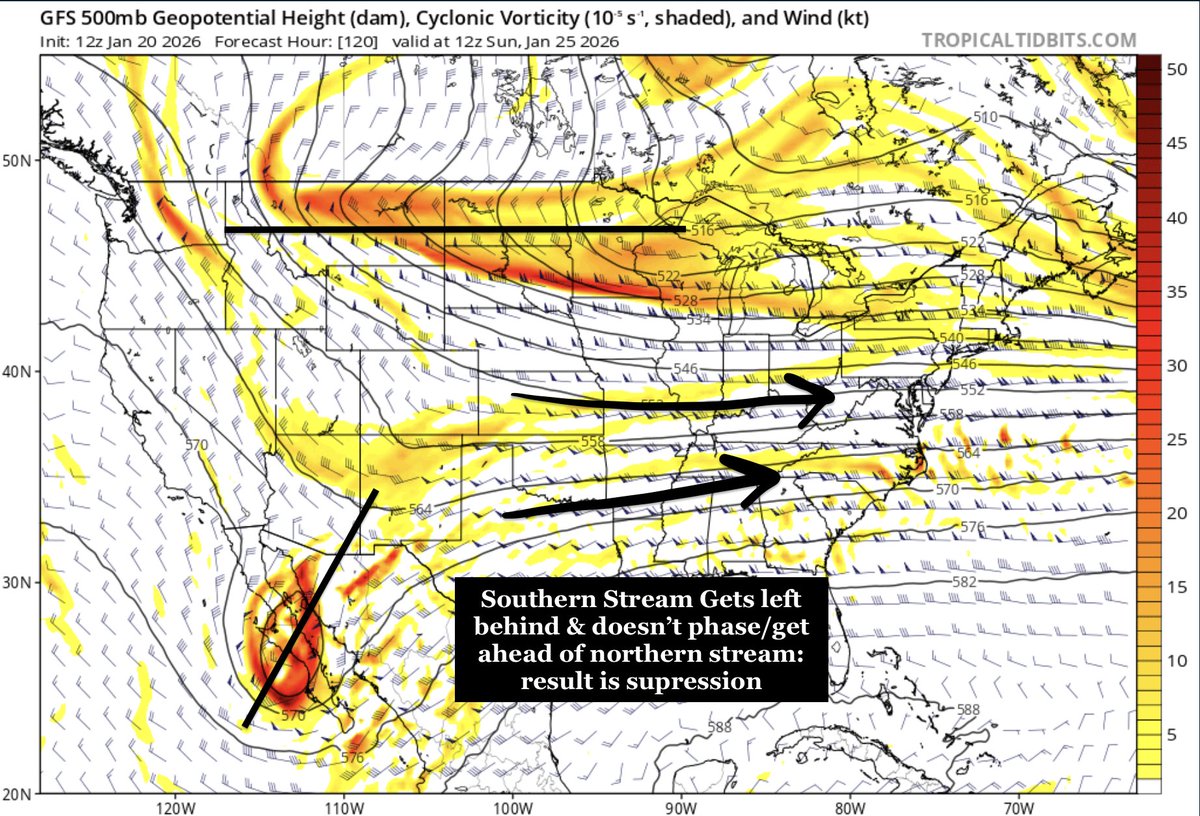
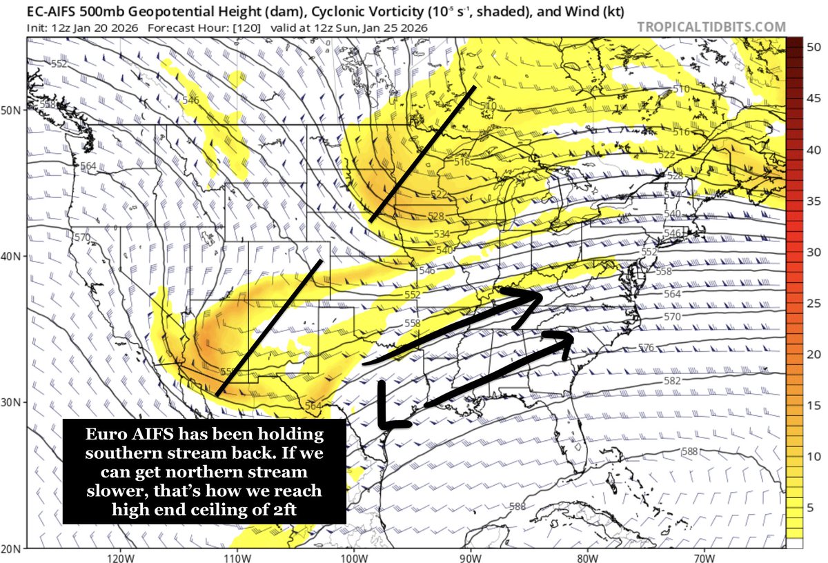
Watching ensembles closely which are slowly bumping north. The key to this system is how the northern stream & southern stream interact. The faster the southern energy ejects east & gets ahead/phases w northern stream -> higher end potential. GFS holds it way back (don't buy it).
GIF
GIF
Ryan Kane tweet mediaRyan Kane tweet media
English
6
10
79
11.5K
DarkSharkWX retweetledi
Tomer Burg
Tomer Burg@burgwx·
[Monday, January 19 Analysis] A major cross-country snow and ice storm is increasingly likely this weekend. Confidence is growing in a widespread swath of over 12" of snow & a significant ice storm. I'll cover the big picture & forecast uncertainties in this thread:
GIF
English
2
35
217
33.1K
DarkSharkWX retweetledi
Tomer Burg
Tomer Burg@burgwx·
If you’ve seen people throwing around the February 5 2010 blizzard as an analog for the upcoming weekend storm… don’t be so quick to dismiss it as hype/clickbait I am not one to exaggerate for clicks. This upcoming pattern might very well be the real deal for major snowstorms
English
13
35
632
134.2K
DarkSharkWX retweetledi
Nikhil Trivedi
Nikhil Trivedi@DCAreaWx·
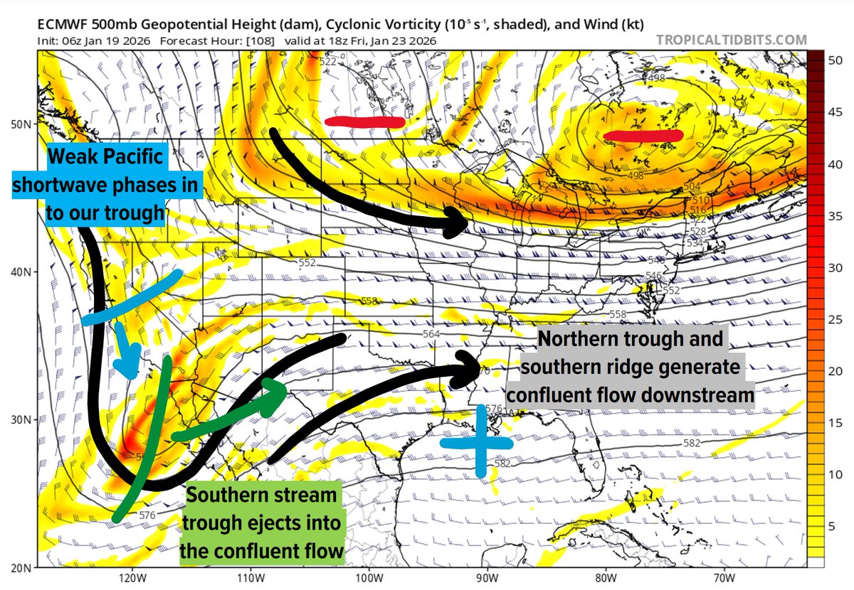
Next weekend's overrunning snow setup is fairly simple with a rather high ceiling. We have a rather strong southern stream trough that crashes into Baja California, which subsequently phases with another shortwave. The combined system ejects eastward into the intense... (1/3)
Nikhil Trivedi tweet media
English
1
8
74
19.8K
DarkSharkWX retweetledi
Mike Thomas
Mike Thomas@MikeTFox5·
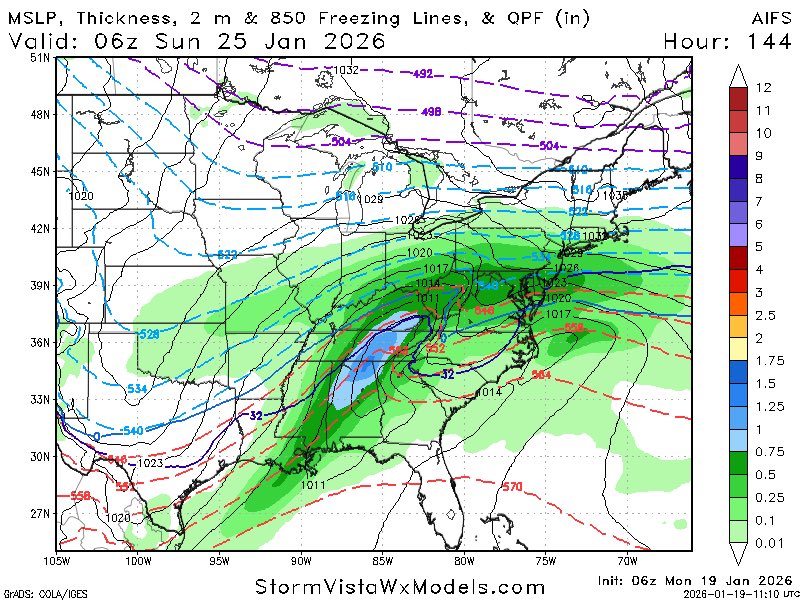
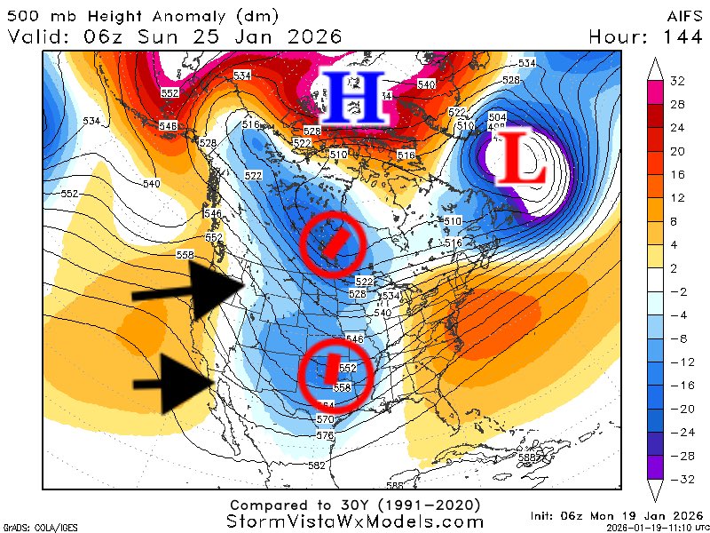
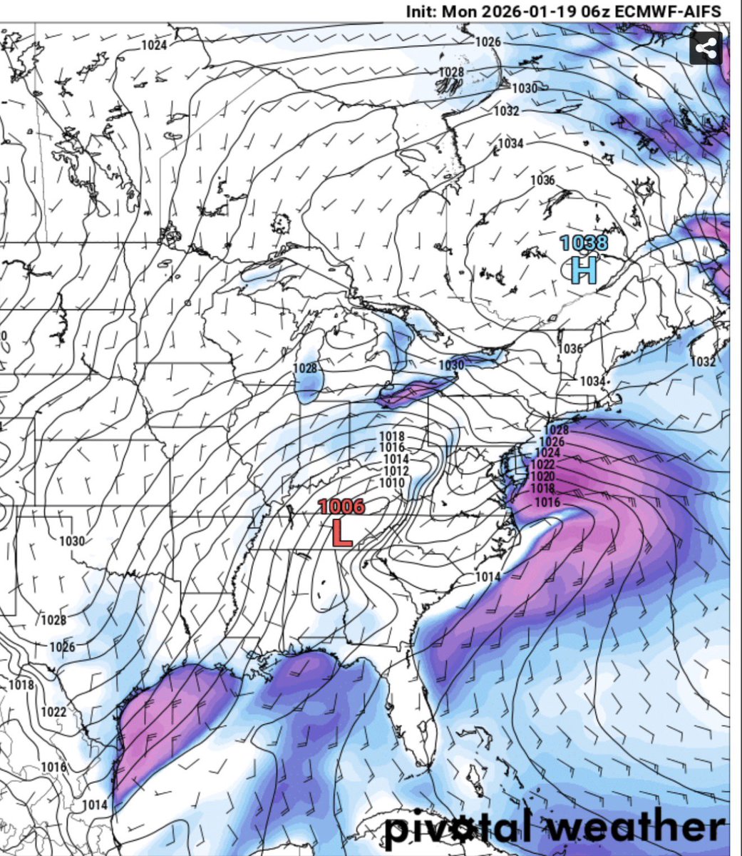
Alright doing this from the airport so excuse the messiness, more detail to come when I get back to the office this afternoon! ✈️ There is storm potential for the region this coming weekend. Strong cold air supply powered by a strong ridge pulse in the Bering Sea coupled with Arctic Blocking is a promising start. Just looking at the AIFS at the moment here (more later just limited on my phone!) You do have a lot to like about the setup off the bat. You have absolutely classic west based -NAO (image 2, Blue H) and key 50/50 Low (image 2, Red L) showing up early. You have two branches, nothing and southern (image 2, red circles) with the southern branch leading the northern one. Great start if you like snow on the 500mb. Now we do have to hold it steady for a week of course. If I’m being picky, +PNA (black arrows) is a little soft and the trough (blue circles with red circles again) is a little far back west from what you’d typically like to see for us in DC…but I believe this is being balanced by the strength of the 50/50 and the -NAO block. At the surface (image 3) you have a beautiful strong Arctic high north of New England helping trap the cold south. Now…if I’m being picky again…you’d probably want it a bit more south. But it’s early…these are just trends to monitor in the days ahead. But yes, multiple models do suggest we have a shot this weekend for some snow around here! Let’s see how this plays out! See you back in DC in a few hours! 🛫
Mike Thomas tweet mediaMike Thomas tweet mediaMike Thomas tweet media
English
9
12
130
18.9K
DarkSharkWX retweetledi
Nikhil Trivedi
Nikhil Trivedi@DCAreaWx·
It's time to look at the synoptic pattern evolution from now through the next two weeks, which could enhance significant snowstorm potential at the end of Jan. On the Atlantic side, we currently have a Scandinavian ridge, which will amplify and retrograde into a strong...(1/5)
Nikhil Trivedi tweet media
English
1
14
86
25.7K
DarkSharkWX retweetledi
Tomer Burg
Tomer Burg@burgwx·
Talk about an impressive short-range forecast adjustment... This weekend's trough trended substantially deeper, leading to increasing probabilities of a southeast US snowstorm, with the 12z GFS only a few ticks away from a major I-95 snowstorm
GIF
English
4
15
114
33.1K
DarkSharkWX retweetledi
Nikhil Trivedi
Nikhil Trivedi@DCAreaWx·
Looking forward, strong baroclinicity and Pacific trough will likely be a recipe for a more moisture loaded storm system in the following week. No clue where it goes at this range, but it's an actual storm signal in what's been a very quiet winter for the US thus far. (3/3)
Nikhil Trivedi tweet media
English
1
3
25
1.6K
DarkSharkWX retweetledi
Nikhil Trivedi
Nikhil Trivedi@DCAreaWx·
Thursday's snow threat was already marginal thanks to a bad downstream pattern (no Greenland ridge or 50/50 low), and the fact that it is purely northern stream doesn't help either, but the model trend towards de-amplification really puts a nail in it. Development is just.. (1/3)
Nikhil Trivedi tweet media
English
2
3
42
6.1K
DarkSharkWX
DarkSharkWX@shark_wx·
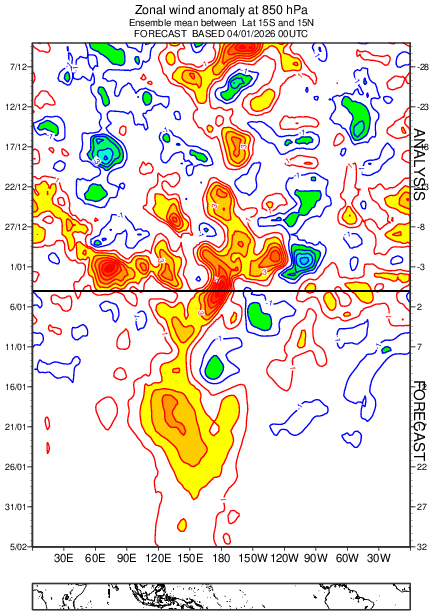
@PaulRoundy1 What exactly is causing the MJO to reemerge like this? Is it because of one of the KWs slowing and amplifying? I’m aware that the MJO is a couplet of an ERW and KW, but not fully sure if the interaction there is causing the MJO to re-emerge
DarkSharkWX tweet media
English
0
1
3
218
DarkSharkWX
DarkSharkWX@shark_wx·
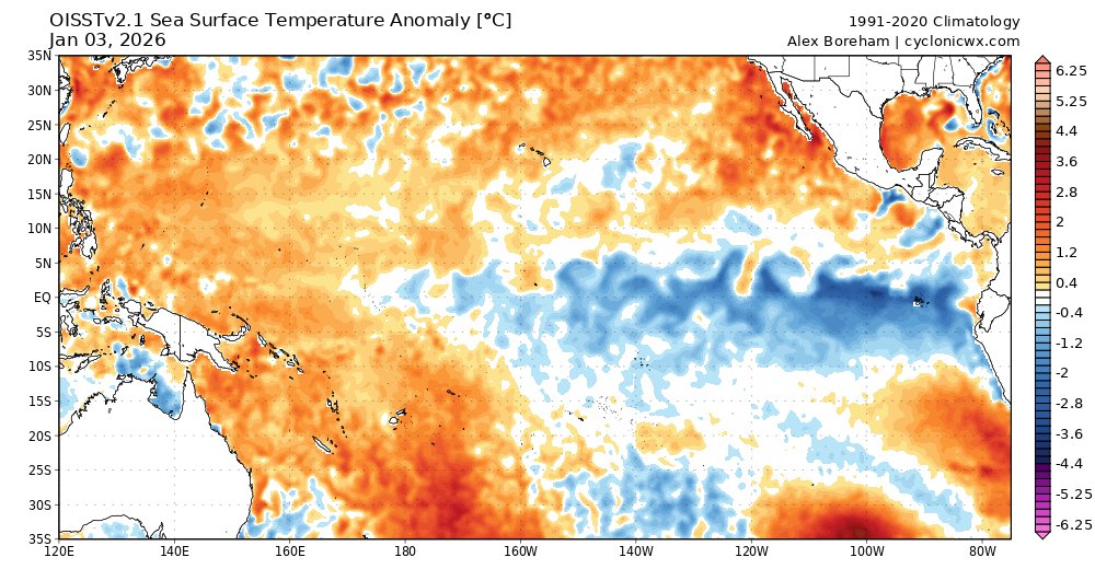
@PaulRoundy1 As you mentioned, the lower tropospheric part of the KW would slow down once it reaches the EP nina, leading to a slow-moving WWB from 120E-IDL, but the MJO would probably constructively interfere with the WWB as well
DarkSharkWX tweet mediaDarkSharkWX tweet media
English
0
0
3
137
DarkSharkWX
DarkSharkWX@shark_wx·
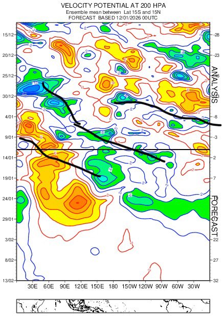
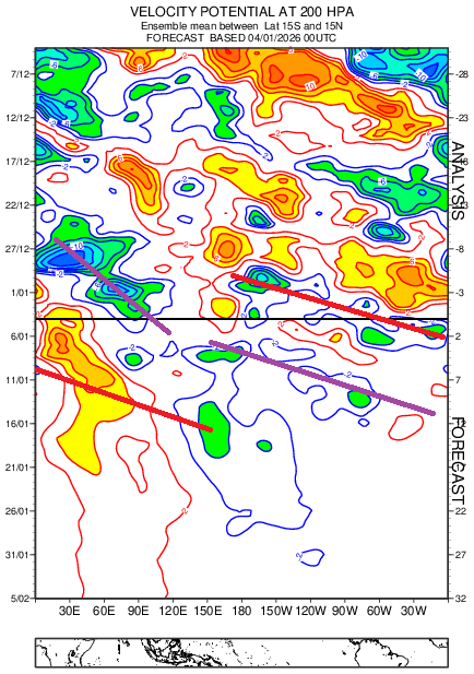
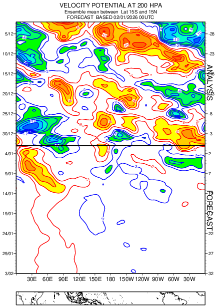
@PaulRoundy1 Given that the MJO could gain more coherence mid-late Jan (with a walker cell like signature), and with two Kelvin waves passing through the Pacific, would the KWs constructively interfere with the MJO? There are some UL easterlies over the IO-MC, and UL westerlies ahead.
DarkSharkWX tweet media
English
1
0
2
153
DarkSharkWX
DarkSharkWX@shark_wx·
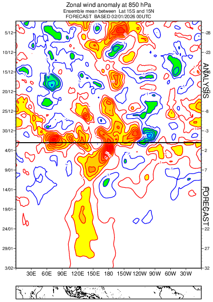
@PaulRoundy1 Given the high-frequency state of tropical variability that looks to be continuing for the rest of the month, is there a way to see where the actual MJO envelope is (what's driving the anomalous/stationary WWB over the W Pacific)?
DarkSharkWX tweet mediaDarkSharkWX tweet media
English
1
0
2
483
DarkSharkWX retweetledi
Ryan Kane
Ryan Kane@ryankanerWX·
Upcoming pattern reminds me a lot of Jan/Feb 2014. Lots of overrunning potential with a strong arctic boundary & lots of cold air with a cross polar flow. Will it work out for a big system? We’ll wait & see but things become more favorable for snow in the east after Jan 12 #EcWx
English
10
5
92
7.4K