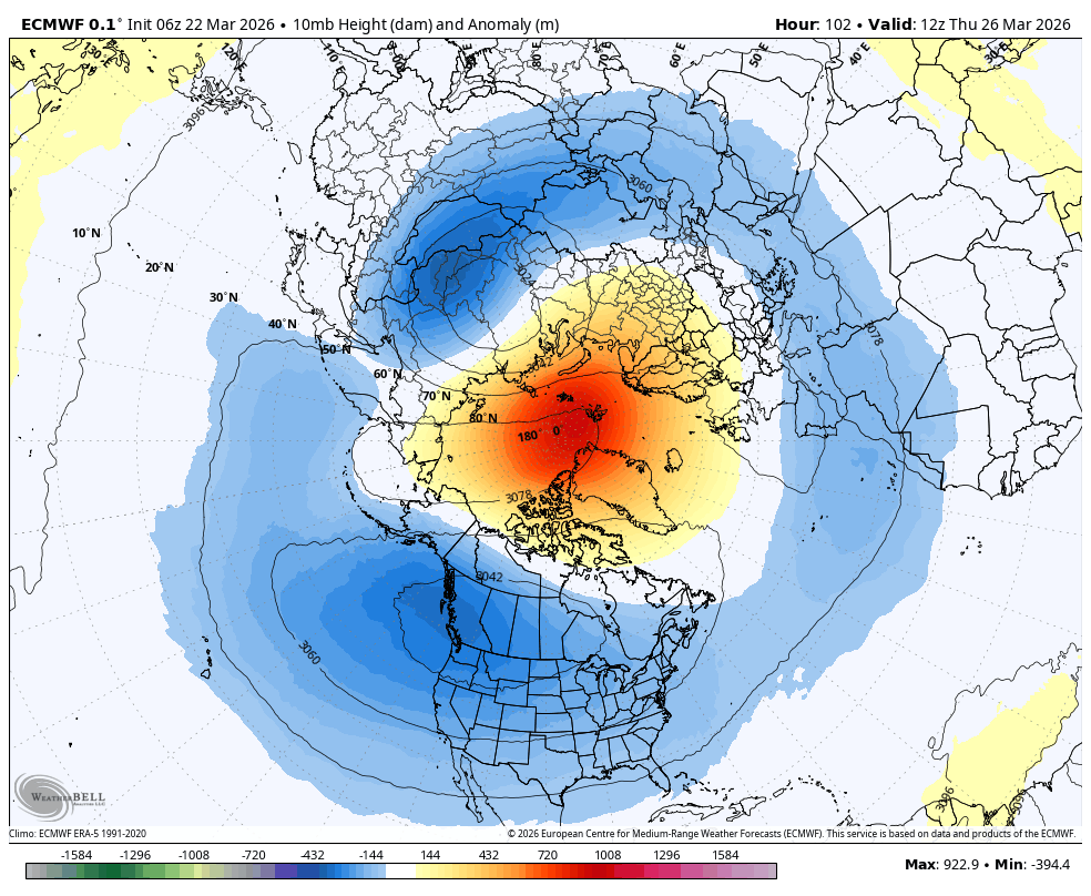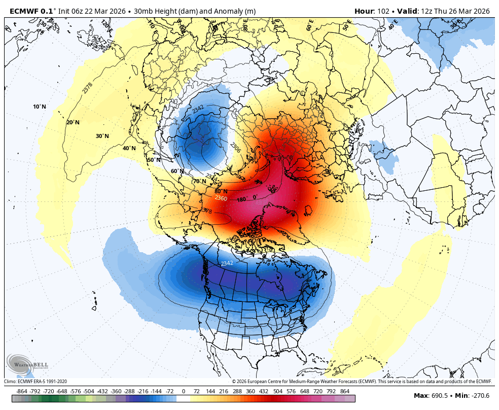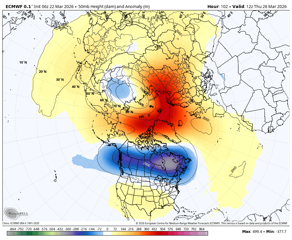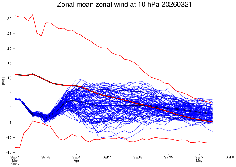
@TrackerSacker A moderate event is possible, though I think a strong event is more likely given current data
English
Ethan Sacoransky
8.6K posts

@blizzardof96
Diagnostic Radiology Resident @usask | Physician & Meteorologist


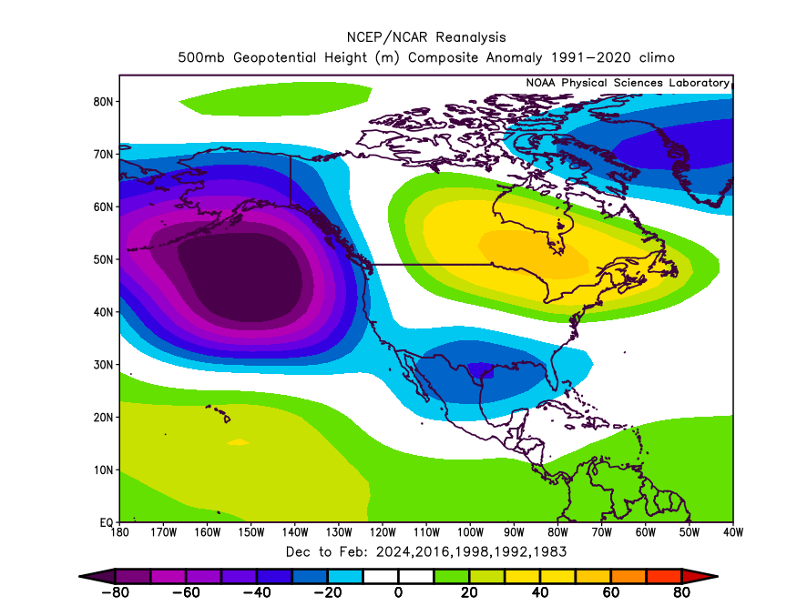
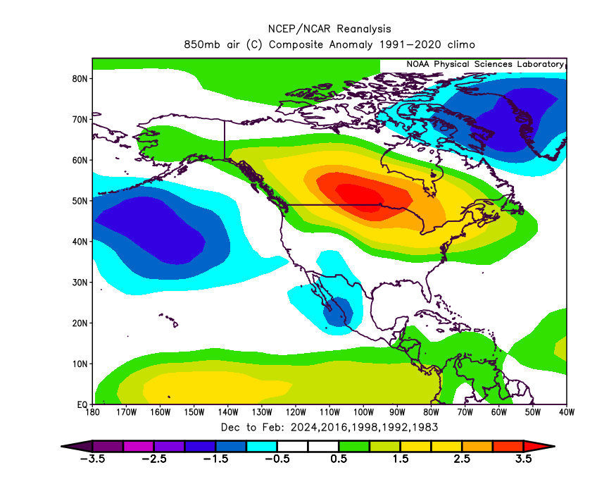
rONI is an important metric, but as a three-month average (December–February), it does not accurately reflect the current state of the tropical Pacific given the large temporal changes we’ve been seeing. This averaging introduces a lag, particularly when conditions are transitioning from a previous base state.