Sabitlenmiş Tweet
widowson
477 posts

widowson
@widowson146
Rebellion to Tyrants is Obedience to God
Turtle Island Katılım Temmuz 2024
383 Takip Edilen31 Takipçiler


widowson retweetledi


If all humans suddenly lost the ability to lie, what industry would collapse first?
English
widowson retweetledi

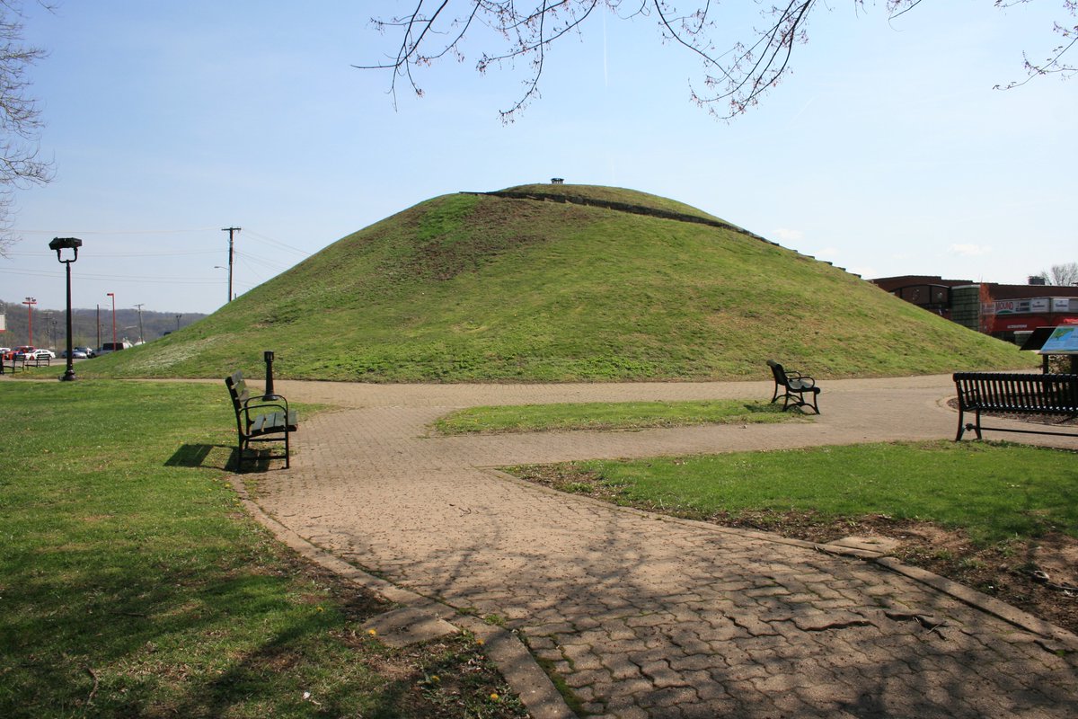
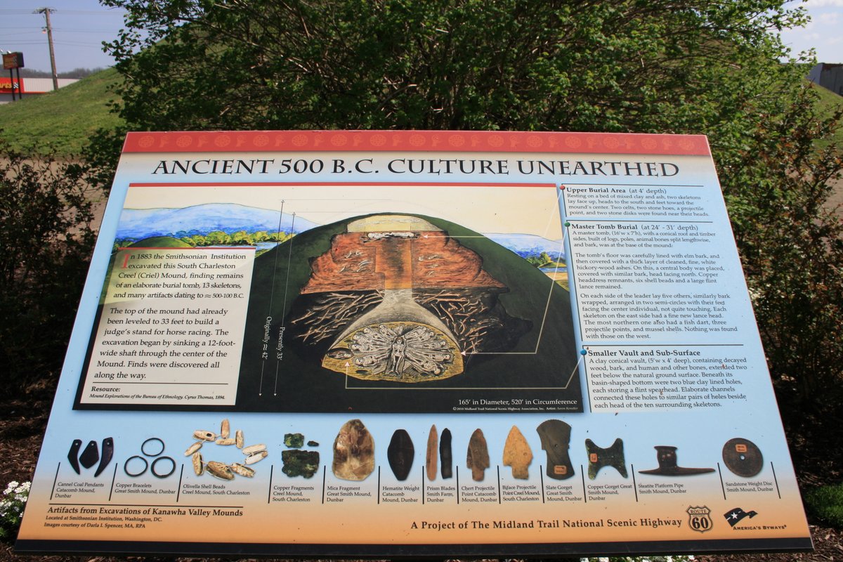
The Criel Mound in South Charleston, West Virginia and a display sign next to the mound. In 1883 the Smithsonian's Bureau of Ethnology excavated this and other nearby mounds, and the sign shows what was found in the Criel Mound.
English
widowson retweetledi
Incised shell mask from a Native American burial mound in Virginia. A few dozen or more of these have been found at mound sites in the Eastern Woodlands. They all have a very similar appearance and design.

English
widowson retweetledi
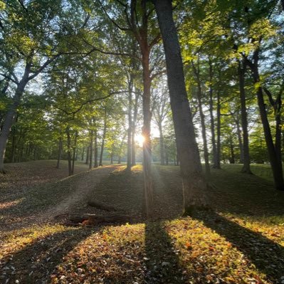
This sketch records the Poland Center mound in Chautauqua County, New York.
Early accounts describe a large conical mound set within a ditch and embankment, with a clear opening and signs of heavy timber use. Burials inside were described as seated and placed in a circular arrangement.
That layout matters.
It points to planning and sequence rather than simple burial.
By roughly 500 BC, burial practices across the Ohio Valley begin showing structured space, repeated form, and attention to placement. Those practices did not stop at the Ohio line. They appear farther east in thinner, local expressions. Poland Center sits in that zone.
Artifacts recovered in the surrounding area… celts, gorgets, pipes, stone tubes match wider Eastern Woodlands forms. Familiar shapes, adapted locally.
When Arthur C. Parker revisited the site in 1905, it had already been disturbed by digging and plowing. Even then, the mound and associated features were still visible.
Most New York mounds did not disappear because they were insignificant. They disappeared because they sat on productive land.
This drawing survives where the site largely does not. It preserves the shape, the layout, and the intent.
Western New York was not outside these traditions.
It was part of them.
What’s missing now is the ground itself.

English
widowson retweetledi


widowson retweetledi

That water clarity is an engineering decision, and the math behind it is wilder than the video.
Roman aqueducts ran on gravity alone. No pumps, no pressure systems. Engineers carved channels with a gradient so shallow it borders on absurd. The Pont du Gard in southern France drops 2.5 centimeters over 275 meters. That's roughly the thickness of a coin over the length of three football fields. They surveyed that accuracy with plumb lines and wooden leveling instruments.
The clarity you're seeing is a direct product of flow velocity. Too steep and the water erodes the channel walls, picks up sediment, turns brown. Too flat and it stagnates. Roman engineers targeted a slope of about 20 centimeters per kilometer, which kept the water moving fast enough to stay fresh but slow enough to stay clear. Before the water reached the city, it passed through multi-chamber settling tanks where velocity dropped near zero. Suspended particles sank. Clean water flowed out the top into the next chamber. Repeat three or four times.
Pliny specified the minimum slope in writing. Vitruvius published the exact mortar ratio for hydraulic cement: one part lime to two parts volcanic ash for underwater work. The pozzolana from Pozzuoli reacted with water to form a calcium-aluminum-silicate compound that actually gets stronger the longer it sits submerged. Modern concrete degrades in water. Roman concrete bonds with it.
Scale the whole system and it gets harder to process. Eleven aqueducts fed Rome at its peak. Combined output: roughly 1 million cubic meters of water per day. That works out to about 250 gallons per person for a city of one million. Modern New York delivers about 125 gallons per person per day. Ancient Rome had access to double the per capita water supply of the largest city in the United States, running entirely on slope and stone.
The Trevi Fountain in Rome is still fed by one of them. Two thousand years, same source, same gravity, same water.
Ulises@UlisesDavid__
🚨| La claridad de un acueducto del imperio Romano, de hace 2000 años
English
widowson retweetledi

widowson retweetledi

widowson retweetledi
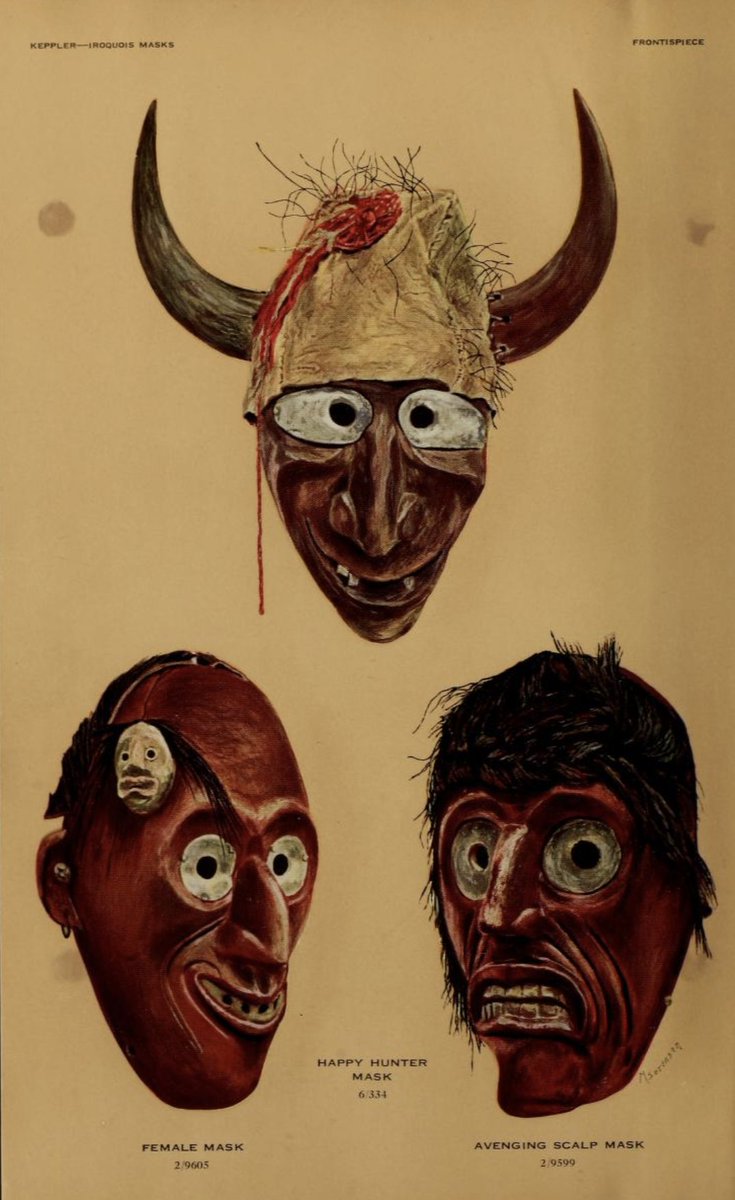
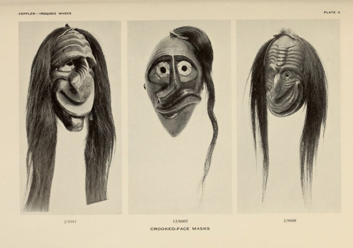
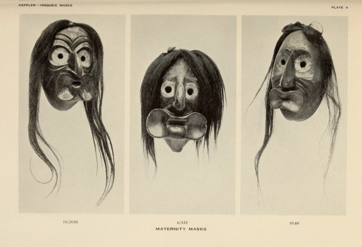
Iroquois Masks (mainly Seneca) from northeast areas. From: Keppler (1941) Heye Foundation.

English
widowson retweetledi
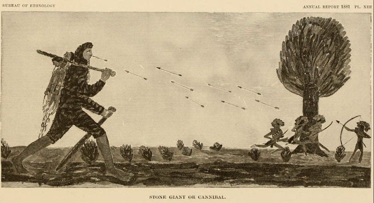
1883 illustration by the Smithsonian's Bureau of Ethnology depicting the killing of the last of the "stone giants," a cannibalistic group that came from the "west" to Seneca lands. This is a legend of the Iroquois.
English
widowson retweetledi
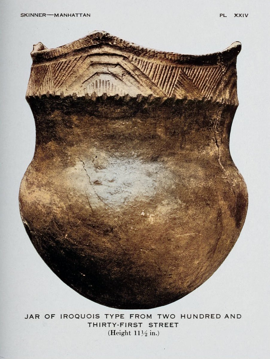
Iroquois pottery vessel excavated from a village site on Manhattan Island in the late 1800s. From: Skinner 1920.
English
widowson retweetledi

🌎🇹🇷 An 1803 map of North America issued in the Ottoman Empire.
🇺🇲 On it, the United States is referred to as the "Land of the English People" (İngliz Cumhurunun Ülkesi).
The map also marks the Iroquois Confederacy, named the "Government of the Six Native American Nations." Other tribes are also indicated, including the Algonquins, Chippewa, Western and Eastern Sioux, and the Black and White Pawnee.

English
widowson retweetledi

widowson retweetledi

Reminder that Osama bin Laden had this image saved on his hard drive.

English
widowson retweetledi


widowson retweetledi

widowson retweetledi