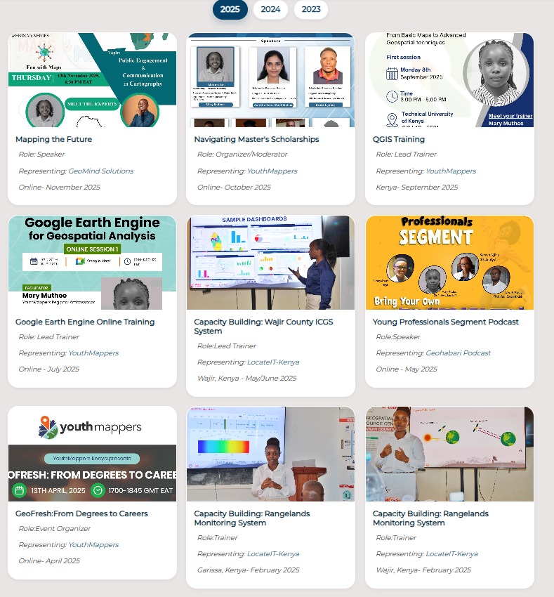
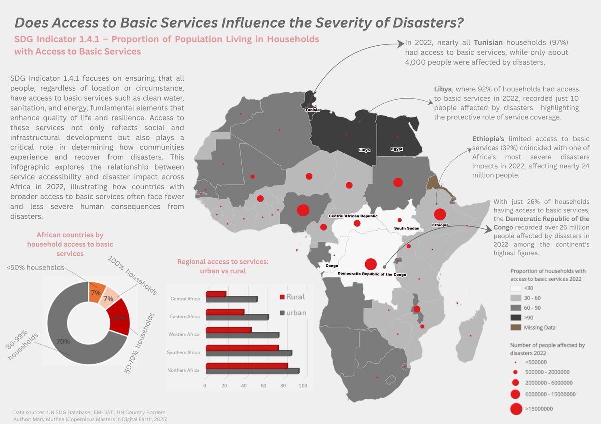

Mary Muthee
353 posts

@_marymuthee
Erasmus Scholar (@MSc_CDE)-Copernicus Master in Digital Earth (Geoinformatics and GeoData Science). Tweeting:#gis #geospatial #programming #RemoteSensing #map


20/10/2025..As a way of using #cartography in storytelling, I explored #SDG 1 (Indicator 1.4.1) and linked it to #disasters. Does access to #basic #services affect disaster severity? I overlaid the two layers to visually inspect the relationship and to show how access to basic services is distributed across #Africa. Tools used: 1.R – #Data preprocessing and cleaning 2.QGIS – #Map design and #spatial visualization 3.Excel – Chart creation and #statistical breakdowns 3.Canva – #Infographic layout and #storytelling #geospatial #gischat


8/10/2025. Women representation in #parliament in 2020. #Geospatial #Cartography #GIS


