Qiusheng Wu@giswqs
GeoLibre v1.4.0 is here!
GeoLibre is a free and open-source, lightweight, cloud-native GIS platform for visualizing, exploring, and analyzing geospatial data. It runs everywhere you do, in the web browser, on the desktop, on mobile, and inside Jupyter notebooks, all while keeping your data local and private.
This release brings field data collection, image georeferencing, and a full Jupyter notebook experience right next to the map.
What's new in v1.4.0
- Jupyter beside the map: Run notebooks alongside your map (JupyterLite in the browser, JupyterLab on the desktop).
- Field data collection: Capture point observations in the field with custom, configurable forms.
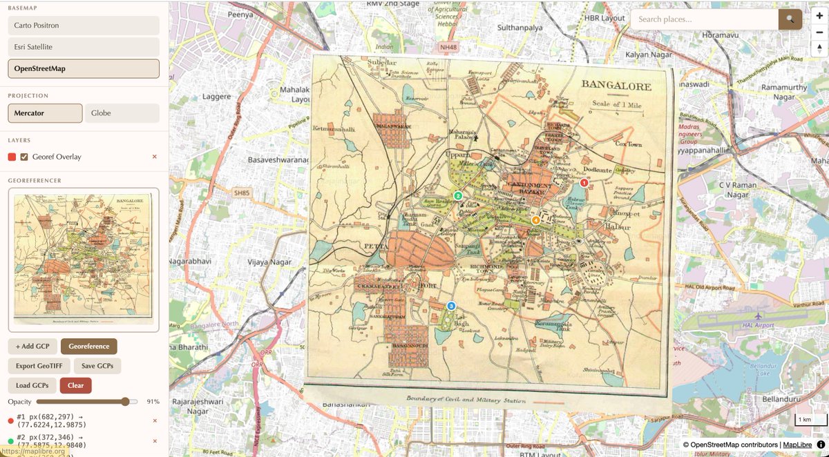
- Georeferencer: Pin a scanned map or image to the map using ground control points.
- Spectral Index toolbox: Compute NDVI, NDWI, EVI, and more directly from your rasters.
- Better internationalization: Correct rendering of right-to-left basemap labels (Arabic, Hebrew).
- More reliable data handling: Render GeoPackages without GDAL's WASM thread crash.
Try it out
- Live demo: viewer.geolibre.app
- GitHub: github.com/opengeos/GeoLi…
- Documentation: geolibre.app
- Release notes: github.com/opengeos/GeoLi…
#GIS #GeospatialData #OpenSource #RemoteSensing #DataVisualization #MapLibre #Python