
jwilliams
2.1K posts
jwilliams
@geteach
Geography teacher (20 yrs) | Geo + EdTech nerd | Creator of https://t.co/iWHaCBzCQ5 | Turning maps + code into curiosity | Always wandering, always mapping
Austin, Texas เข้าร่วม Temmuz 2012
571 กำลังติดตาม790 ผู้ติดตาม
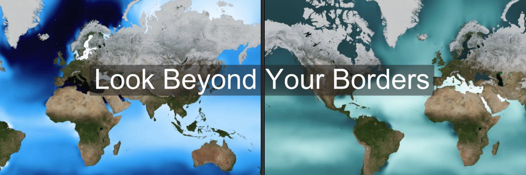
A change in scale changes the story!
2k views in 7 days as classrooms globally explore the world. With the light traffic of Easter Weekend.
4 donors gave $110 to keep us ad-free & private! $5 covers ~1k map loads. Please share/RT!
buymeacoffee.com/geteach
#geography #geogchat

English
New Bivariate Climate layer - geteach.com
Temperature AND precipitation in one 2D color map. Pair it with Cropland and explore.
Full lesson at the link: geteach.com/blog/2026/04/0…
Open this view: geteach.com/?m1=1004&l1=1&…
#geography @GMapsPlatform

English
Updated geteach.com to balance costs with classroom experience.
New: Donation prompt with 24-hr "snooze" and 1-yr "thank you" flags, stored in your browser... sticking with the site's "no login" feature. #geography #maps
Explanation + Costs:
geteach.com/blog/2026/04/0…
English
15 years. 1.3 million map views. $400 to keep it running. geteach.com is a free, no login interactive map platform for K-12. Free for you = out-of-pocket for me. Support if you can ->buymeacoffee.com/geteach
#APHuG #GeographyTeacher #EdTech #GoogleMapsPlatform
English
I scored 22,035 on the @geteach Climograph Challenge! #Geography #ClimographChallenge geteach.com/ClimographChal…
youtu.be/nBqx5sgNR-8
YouTube

English
🌍 I scored 22,131 on the @geteach Climograph Challenge! #Geography #ClimographChallenge geteach.com/ClimographChal…

English
New Layers (Climate Graphs and Climograph Challenge) from geteach.com using @googlearth engine with @GoogleMapsPlatform. Read the post here: geteach.com/blog/2026/03/1…
#Geography #GoogleMapsPlatform #GoogleEarth #geoEducation #GoogleEarthEngine @AmericanGeo
English
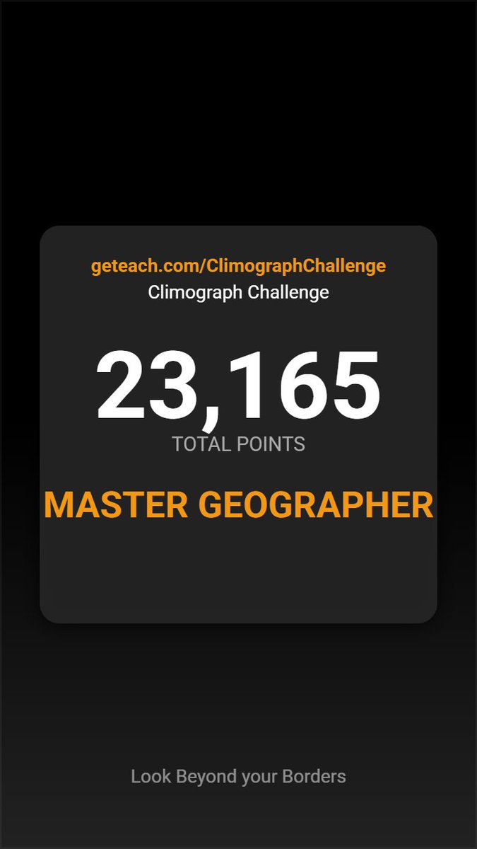
🌍 I scored 23,165 out of 25,000 on the @geteach Climograph Challenge! #Geography #ClimographChallenge
geteach.com/ClimographChal…
I created this game, and this is officially the 1st time I’ve managed to hit the highest rank (>22,000 pts).
English
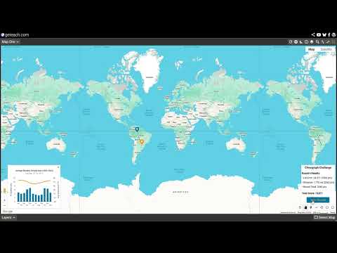
Working on a new way to interact with climate data:
A 5-round exercise in spatial reasoning. Analyze the temperature and precipitation patterns, then identify the region on the map. Watch to see how I fared.
Not optimized for phones
Try it here: geteach.com/ClimographChal…
#Geography
English
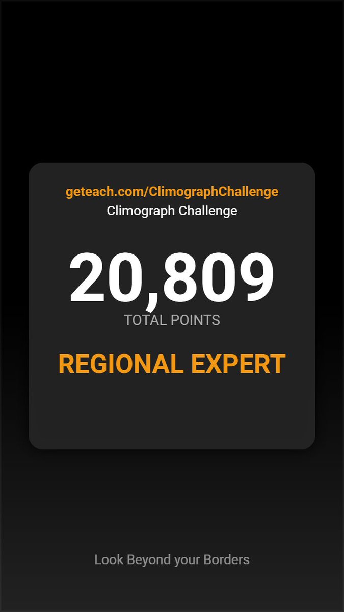
🌍 I scored 20,809 on the @geteach Climograph Challenge! #Geography #ClimateGuessr geteach.com/ClimographChal…
English
🌍 I scored 20,809 on the @geteach Climograph Challenge! #Geography #ClimatographChallenge geteach.com/ClimographChal…

English
Created a new Earth-Sun layer on geteach.com
Solar angle, daylight, and vegetation—linked month by month. #geography #maps #earthscience
English
Toponym & Border Differences: See the world from different regional perspectives. geteach.com/boundaries/ An @GMapsPlatform experiment. #Maps #Geography #Toponyms #Map3D
English
Try it here: geteach.com/maps3d/worldcu…
Take a quick tour of the 16 stadiums hosting the 2026 FIFA World Cup across the U.S., Mexico, and Canada—mapped in 3D with @GMapsPlatform.
Click to fly, view Street View, see match schedules, and explore host cities.
English
jwilliams รีทวีตแล้ว

Map of the Month!
Check out this amazing @NASA animation that reveals the extent of the Mississippi Watershed! svs.gsfc.nasa.gov/4493
Teachers, tell us how you would use this in your classroom!
English
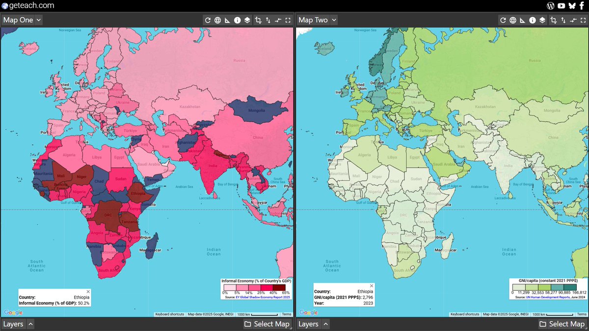
Here’s a new geteach.com layer I’ve been building for #TCSS2025 — Informal (Shadow) Economy. Join me Sat, Nov 1 (1:50–2:50 PM) in Frisco to explore health, knowledge, living standards & equity through maps.
txcss.net/conference
#txcss2025 #txcss
English
🔗 Explore more maps: geteach.com
New population density layers now available on geteach.com.
Data from the Gridded Population of the World (GPWv4.11) and Global Human Settlement Layer (GHSL) via @googlearth engine #geoeducation #geography #googlemaps
English
Presenting at Texas Council for the Social Studies Conference in Frisco, TX! Join me Sat, Nov 1, 1:50–2:50 PM for “Mapping Human Development with geteach.com ." Explore development from multiple perspectives using interactive maps & HDI data. #txcss2025 #txcss

English
Try it out at geteach.com?
This quick video shows how to select a map and add layers to explore spatial patterns. Great for classrooms or anyone curious about geographic data. #GoogleMaps #geography
English