ทวีตที่ปักหมุด
Mapillary
4.7K posts


Mapillary
@mapillary
Mapillary, a Meta company, is the street-level imagery platform that scales and automates mapping using collaboration, cameras, and computer vision.
เข้าร่วม Ağustos 2013
489 กำลังติดตาม11K ผู้ติดตาม

1.5M images. 4 vehicles. 1 mission. 🛣️
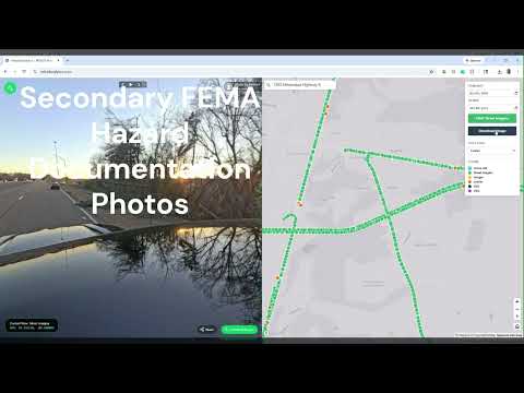
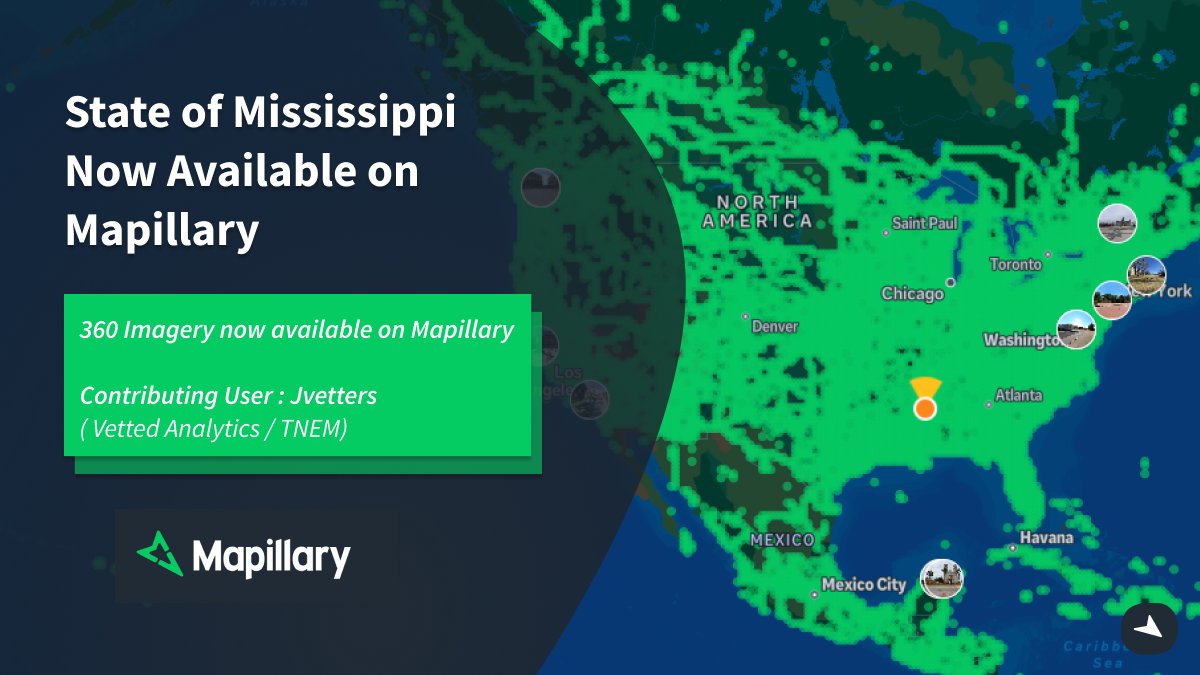
Check out our latest Spotlight: Josh Vetters & Vetted Analytics - @mapillary + @GoPro to secure FEMA funding for MS & TN DOTs.
Providing a "driver’s eye view" for disaster recovery.
Watch: youtube.com/watch?v=h6YMLm…
#GIS #Mapillary #FEMA
YouTube
English
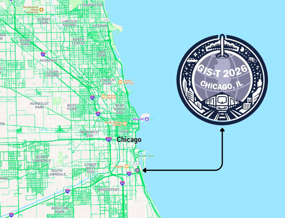
Next stop: Chicago!
The Mapillary team is headed to #GIST2026.
We’re ready to talk all things street-level imagery and transport innovation. Stop by our booth to see how we’re scaling GIS workflows with the community.
See you there! 🌎
#GIST2026 #Mapillary #GIS #Chicago
English
But that's just the start. Here's what's new:
📷 Pinch-to-zoom on camera:
🔍 Zoom & pan on captured images
🧭 Map rotation
🗣️ Siri & Shortcuts integration
Whether you're mapping by car or bike, this update makes capturing street-level imagery on iOS easier than ever.
GIF
English

Going Fast : Reserve Your Spot for the 3B Celebration! 🌍
Limited spots are going quickly for the Mapillary 3Billion Celebration. Sign up to reserve your spot.
Come and meet the team in Zurich!
Sign up: eventbrite.co.uk/e/mapillary-ce…

English
Exciting to see our community capturing around the world in 2026! - Check out the awesome captures by @josephkerski
Tag @mapillary in your captures to get featured!
josephkerski@josephkerski
My Mapillary track at Sombrero Marsh in Boulder Colorado youtu.be/RyHjEjGXEp8?si… via @YouTube. Thanks @mapillary
English
Get the Street Level View : Capture with Mapillary 🌍
While Satellite data sets the stage, for ground-truth data, you need immersive high-resolution street level imagery.
Get started with Mapillary : mapillary.com/app
#Mapillary #GIS #Transportation #Surveying

English
Mapillary is coming to #FedGIS2026 🌎
Come and say hello to the team in Washington DC at the largest event for federal GIS professionals!!
If you’re attending and want to discuss all things Mapillary, reach out!
#Mapillary #GIS #GEOINT #AI #FederalIT

English
🌍GeoDC Meet-up with @mapillary !
We are excited to be teaming up with GeoDC at the Meta DC Office to host an evening of lightning talks and networking with other geospatial professionals around DC.
Sign up here: meetup.com/geo-dc/events/…
#Mapillary #GeoDC #GIS #Geospatial

English
🌍 @mapillary x @timmonsgroup 🛣️
See how Andrew Barron & Brian Kingery use sensor trucks + @Mapillary + @Esri to create a "virtual window" into road conditions and build custom management solutions.
Read more: blog.mapillary.com/update/2026/01…
#GIS #Mapillary


English
🌍 Play GeoGuess Lite – Powered by Mapillary!
Thanks to Akinori Hoshina for this GeoGuessr-style game using Mapillary JS and our API. Great showcase of our developer tools!
Join and test your skills! 📍
Check out the game : geoguesslite.com
#Mapillary #GeoGuesser
English
💡Mapillary Tips: Add Nadir Cover to your 360 Imagery.
Capturing 360 imagery for Mapillary and want to cover your camera equipment or add your brand logo? Use a nadir cover!
Check out this tutorial on how to add a Nadir cover : help.mapillary.com/hc/en-us/artic…
#Mapillary #GIS
English
Detecting Building Entrances with @mapillary 🌍
Researchers at UC Santa Cruz have created a method to detect building entrances using Mapillary imagery, part of @OvertureMaps Foundation : Project Terraforma.
Read our blog post: blog.mapillary.com/update/2026/01…
#ComputerVision #Ai

English
@mapillary December Top Contributors 🏅
Thanks to your dedication, we’ve expanded coverage to new regions, mapped countless features, and shared our journeys from every corner of the globe.
Let’s keep up the great work and continue mapping the world together! 💚
#Mapillary

English
Mapillary for iOS - Updates! 🌍
Import Images from Any Camera App or Device to Mapillary.
UI tweaks and improvements, including Liquid Glass.
Mapillary iOS App Complete guide: help.mapillary.com/hc/en-us/artic…
Download Mapillary iOS :apps.apple.com/us/app/mapilla…
#Mapillary #IOS #Mapping

English
Integrate Mapillary directly with #leafmap and #MapLibre 🌍
Create your own web map application for viewing street level imagery.
Try the API here, completely free : mapillary.com/developer
Guide by Qiusheng Wu : youtube.com/watch?v=OIFQXd…
#Mapillary
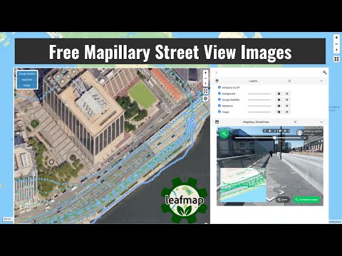
YouTube
English
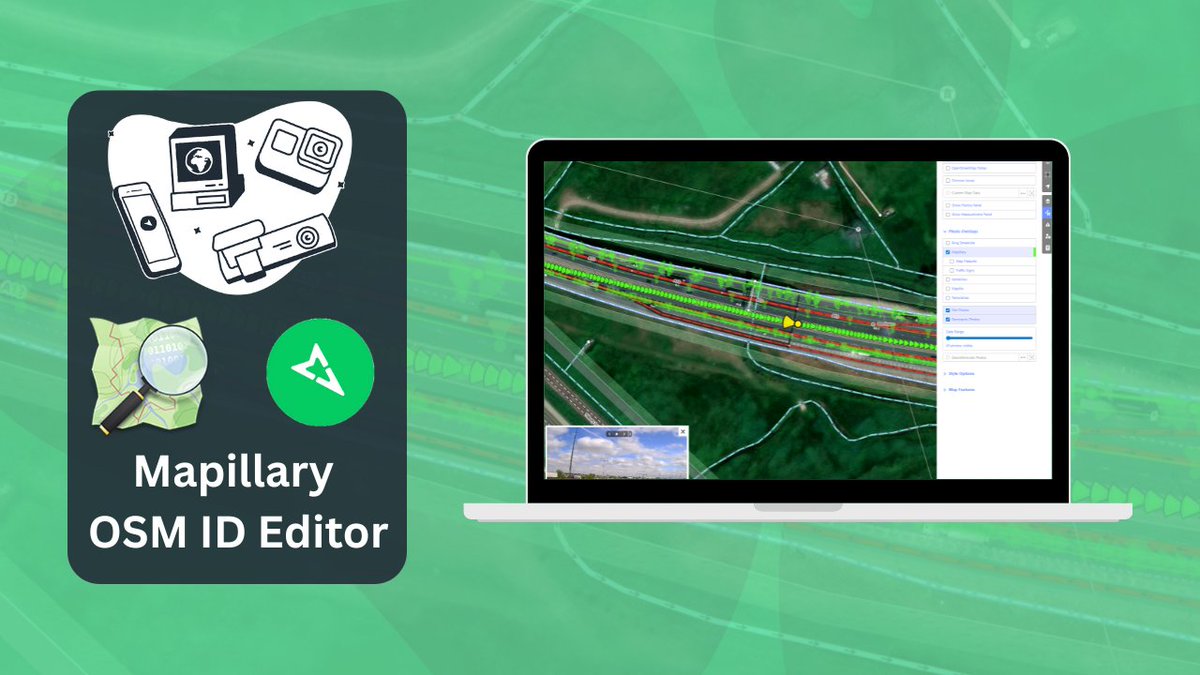
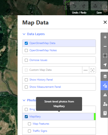
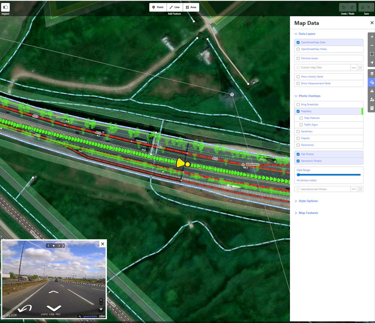
Mapillary 💚 @openstreetmap
Use Mapillary directly with the OpenStreetMap iD editor!
Bring the latest street-level imagery from Mapillary to achieve greater context and detail when editing features on OSM.
Help Page : help.mapillary.com/hc/en-us/artic…
#OSM #Mapillary #OpenData

English
Mapillary Blog : Travel to Turks and Caicos with World Travel in 360 🌍
Follow World Travel in 360 as they captured 360° imagery across Turks and Caicos, covering 1,000+ km in three weeks.
Checkout the Latest Blog here : blog.mapillary.com/update/2025/12…

English