Angehefteter Tweet

Big thanks to the @FoxWeather team and @AriWeather for having me on tonight! Always an honor to share in the science with such an incredible group of meteorologists. 🌀✨⚡️
You can find my full interview below!
English
Andrew Austin-Adler
1.7K posts
@WeathermanAAA_
Student Meteorologist specializing in Tropical Cyclones and public weather communication.

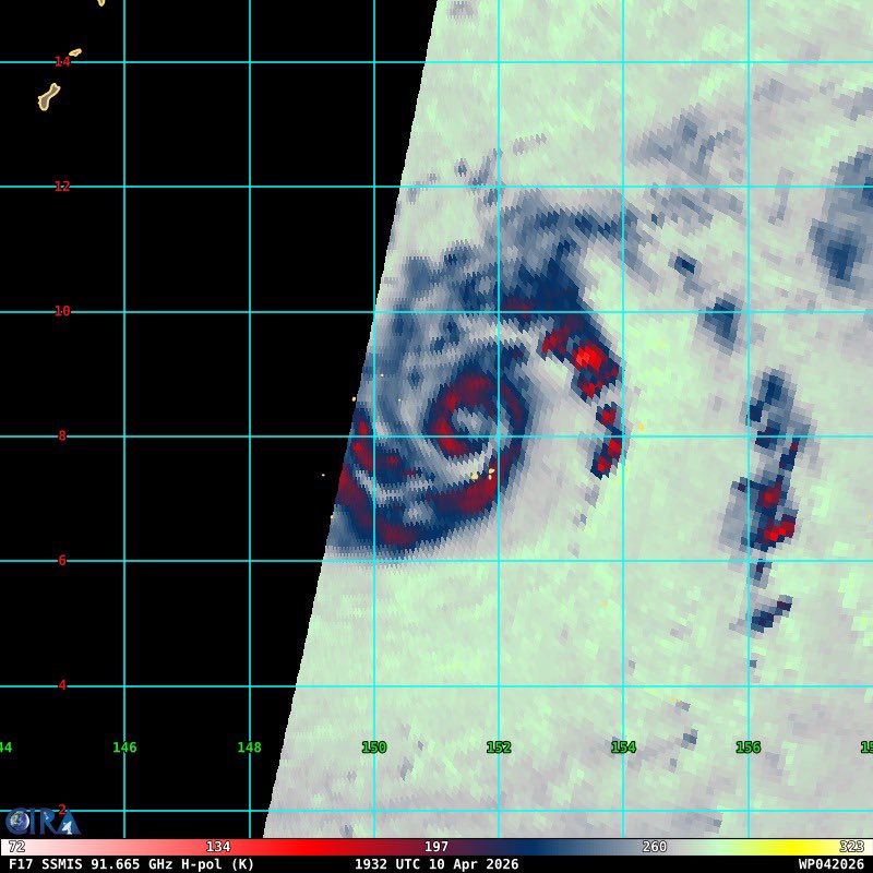
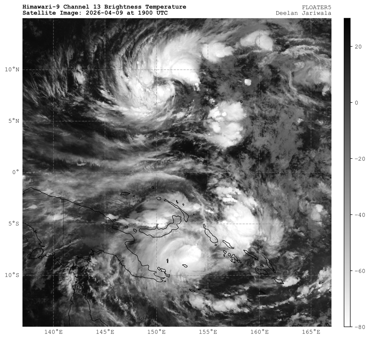
#Sinlaku (#04W) was upgraded to #typhoon status at 18Z, and it appears to be poised for rapid intensification. Microwave satellite imagery from about 1930Z suggests that an inner core has formed with a very small eye feature. This is bad news for #Guam.


A multi day severe weather sequence is on tap, really getting going on Saturday and lasting through most of next week. Here is a loop of GEFS mean 500mb winds along with the SPC outlook (slight risks/15% risks) from Saturday through Wednesday.
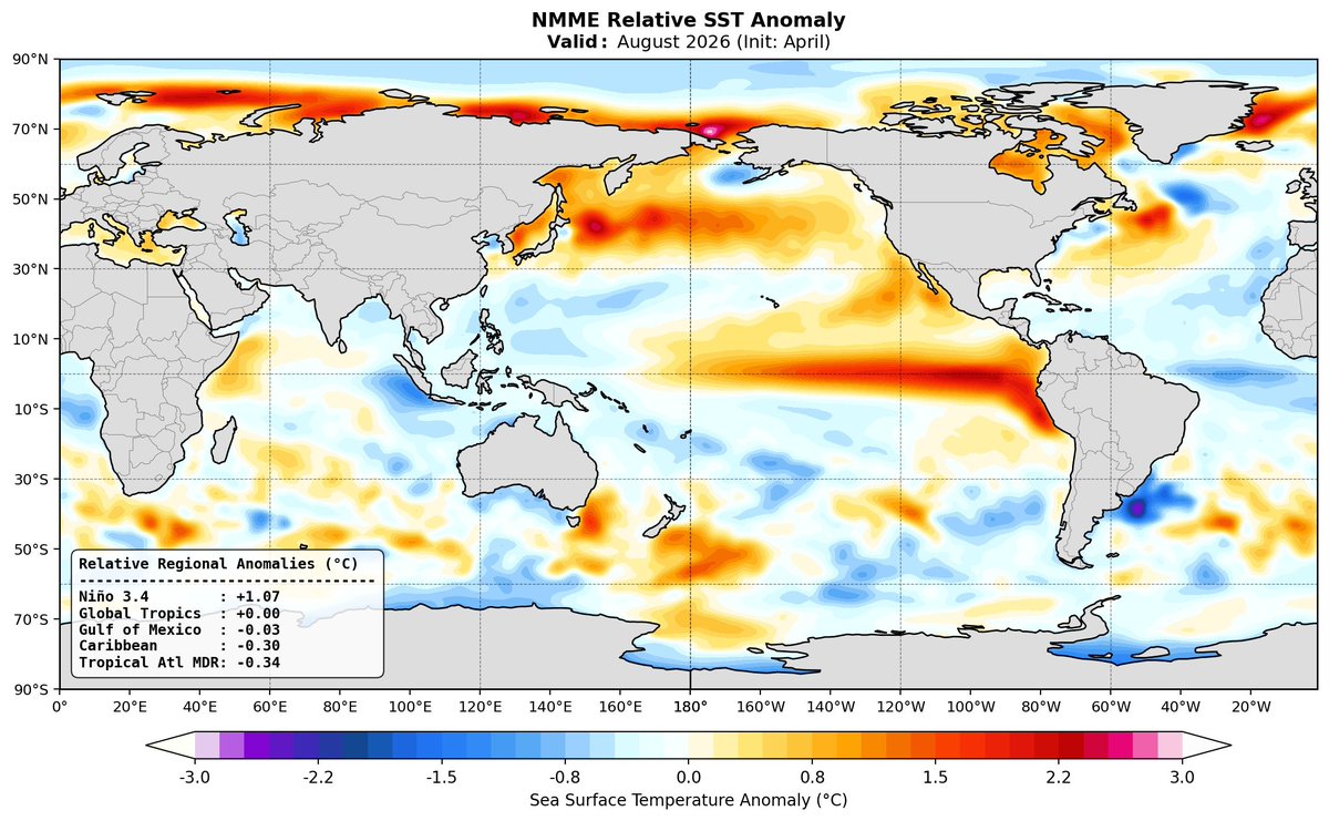

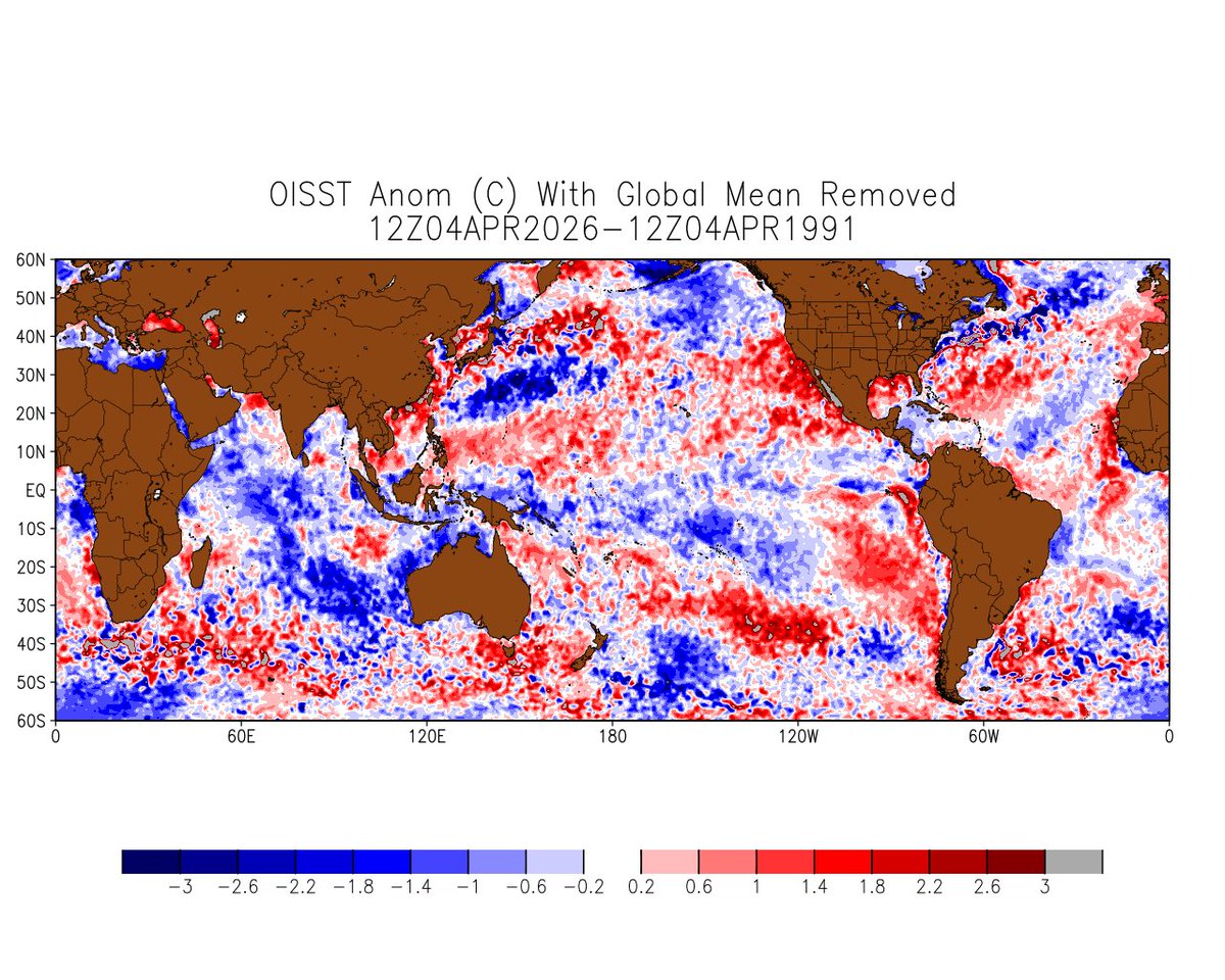
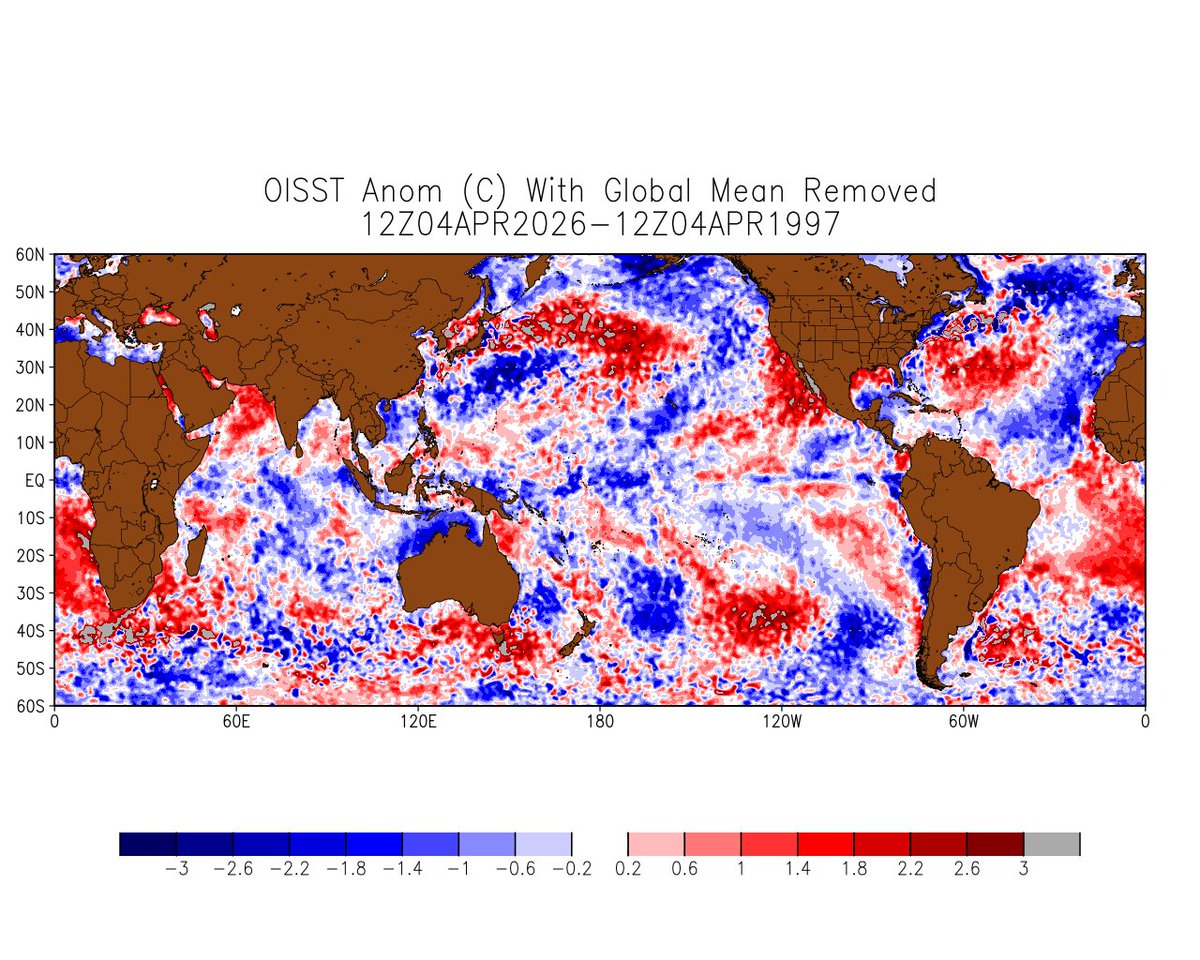
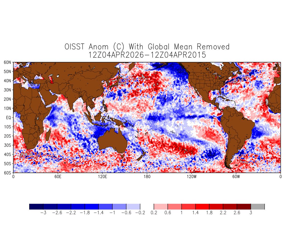
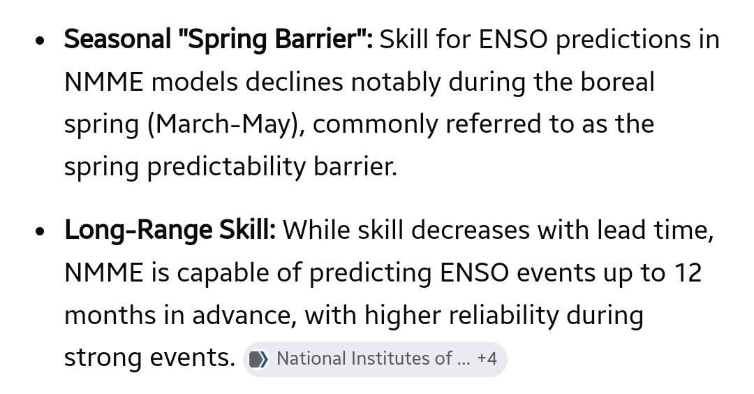
I'm just curious, what if the "Super El Niño" fails to develop? Would your trust in seasonal forecasts decline? Would an approach that explains an El Niño is developing be a more responsible approach than aggressively advertising a historic event based on model data alone? #weather #wxtwitter #ElNiño


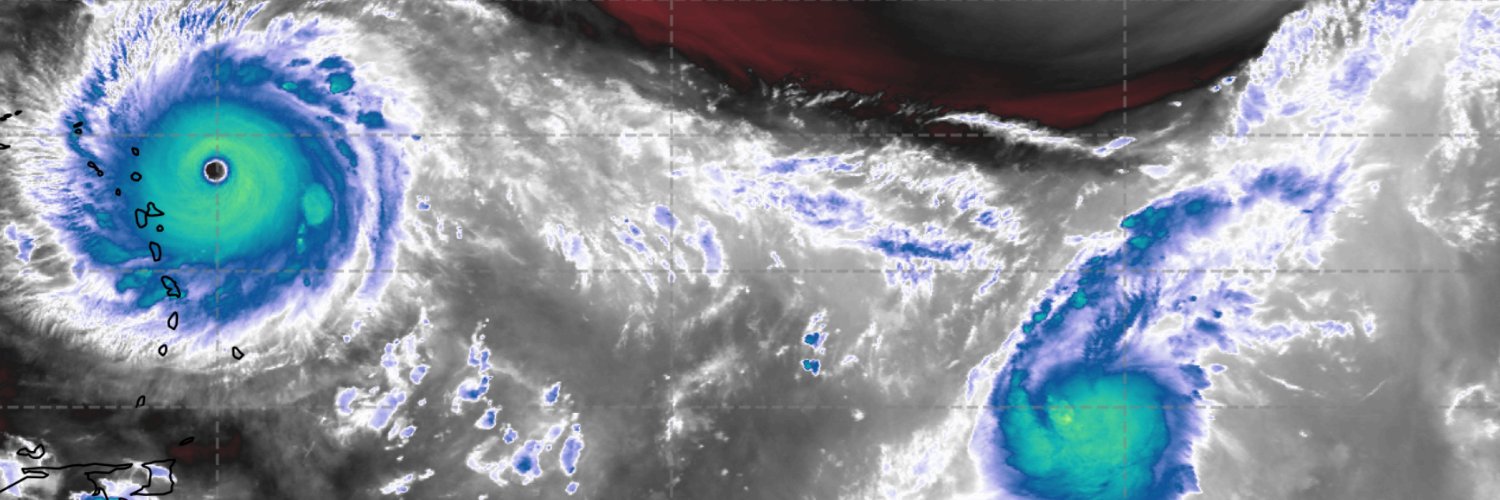
This is what it looks like when you begin to verify those bullish ENSO forecasts. #90W is knocking on the door of TC status whilst major cyclone #Maila churns directly to the south; in the opposite hemisphere. The projection of their circulations on the equator will generate an enormous westerly wind burst, likely leading to significant warming in the West/Central Pacific. Its worth noting that twin TCs have been consistent with super El Nino events in the past.

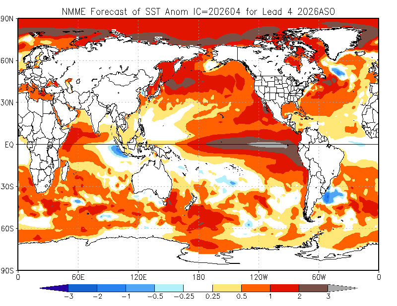
@AndyHazelton Ensemble mean up to +2.6˚C by the end of the year! Some stark increases this month (right) compared to last month (left).