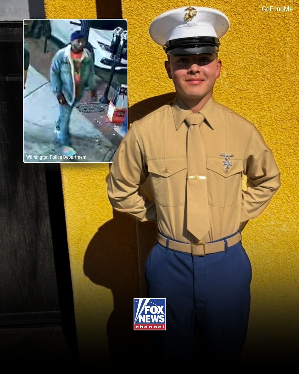
A U.S. Marine is dead after a brutal street fight — and the police response on scene is now under fire.
21-year-old Lance Corporal Daniel Montano was stabbed to death after a large brawl broke out on the streets of Wilmington, North Carolina.
Responding officers are facing scrutiny after video surfaced showing them using pepper spray to break up the fight, while critics claim they were slow to provide medical aid.
Another stabbing victim was rushed to the hospital with life-threatening injuries.
The suspect is still at large as law enforcement is asking the public for help identifying the person of interest.
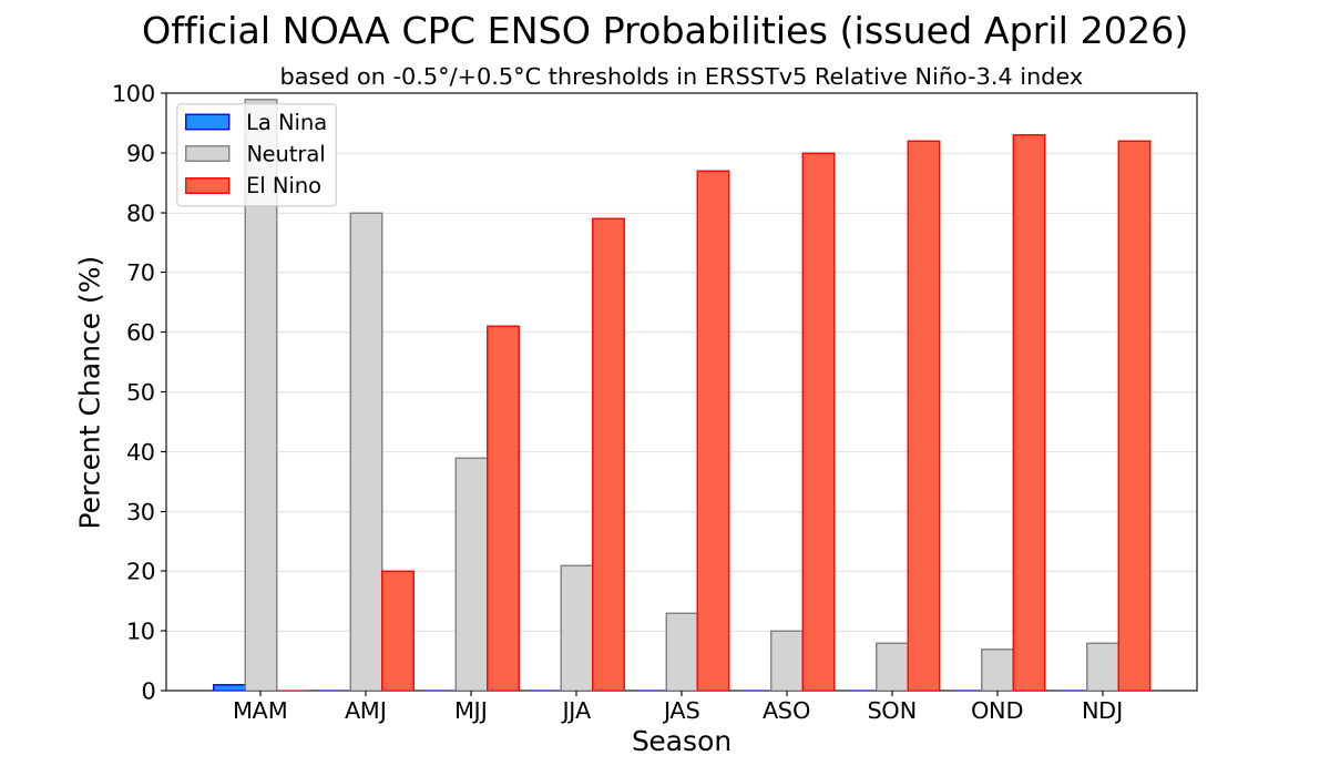
#ENSO-neutral conditions are present and are favored through April-June 2026 (80% chance). In May-July 2026, El Niño is likely to emerge (61% chance) and persist through at least the end of 2026. (1/2) cpc.ncep.noaa.gov/products/analy…
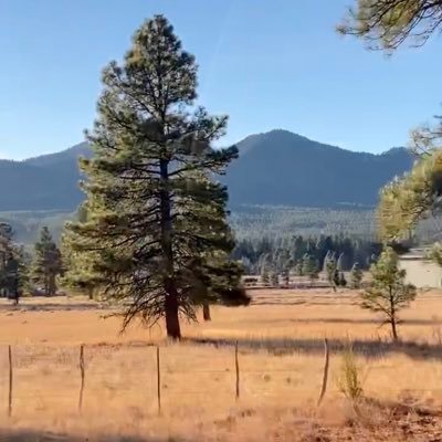
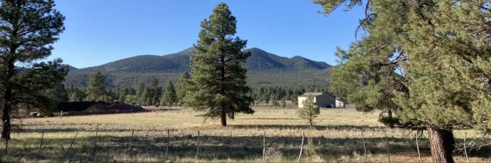
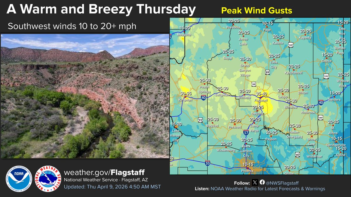
Well, we did some Granite Dells yesterday, now let's do some VERDE! Wild and Free, some say it's dirty, but only when it rains. Don't have to worry about that today, just warm and breezy. #azwx
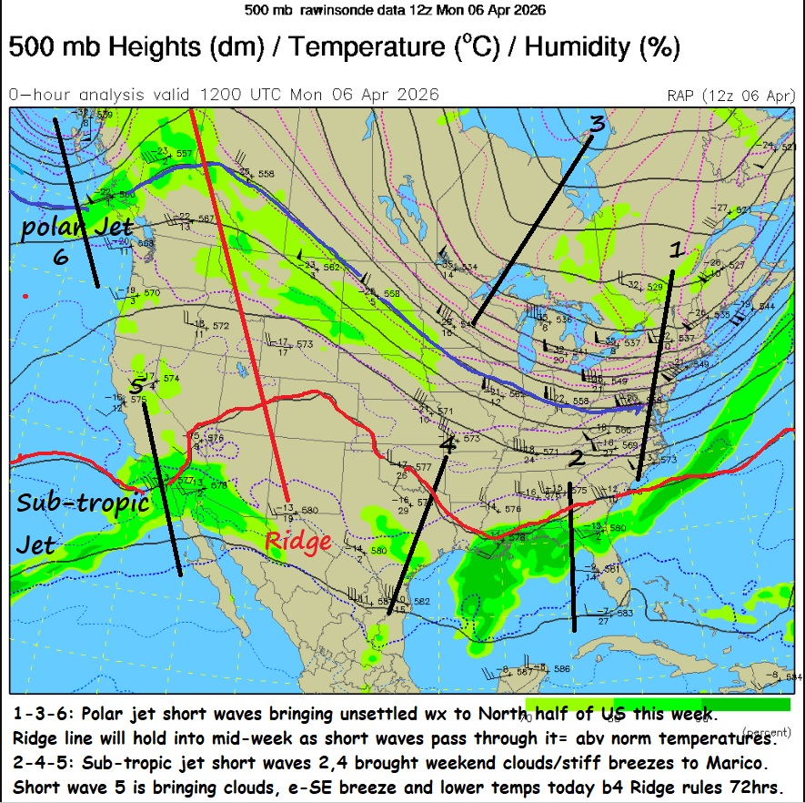
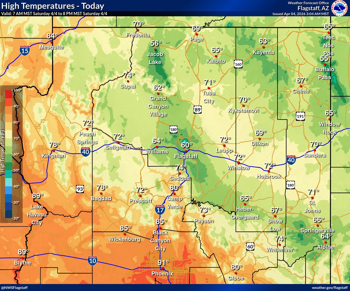
Quiet, hot AZ days for next 72hrs b4 Pac storm system brings desert rain/mtn snow(?). AM WV loop shows lingering t-showers/rain in White mtns but sunny skies elsewhere. Highs of 90-96F likely - no records just hot. Weekend holds promise of t-storms/showers in deserts/ mtns. #azwx
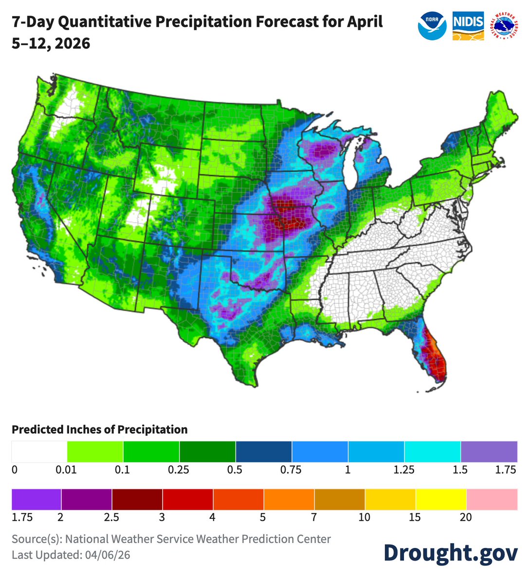
This week's precip forecast by @NOAA's @NWSWPC
A large part of the FL peninsula is expected to see over 3” of precip. TX up to the Upper Midwest, parts of CA, and few other areas may see over an inch.
Dry for the rest of the Southeast (+MS/KY) and most of the Mid-Atlantic. @NWS
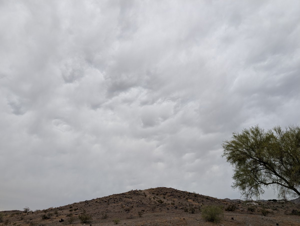
Virga/ mammatus skies cover N MariCo but squeezing rain out of clouds belonged to mountains. At 530PM AZ radars showed most rain activity in Coconino and Apache Counties. NWS-Flagstaff offered precip probs lasting into this evening as sub-tropic disturbance spun across AZ. #azwx
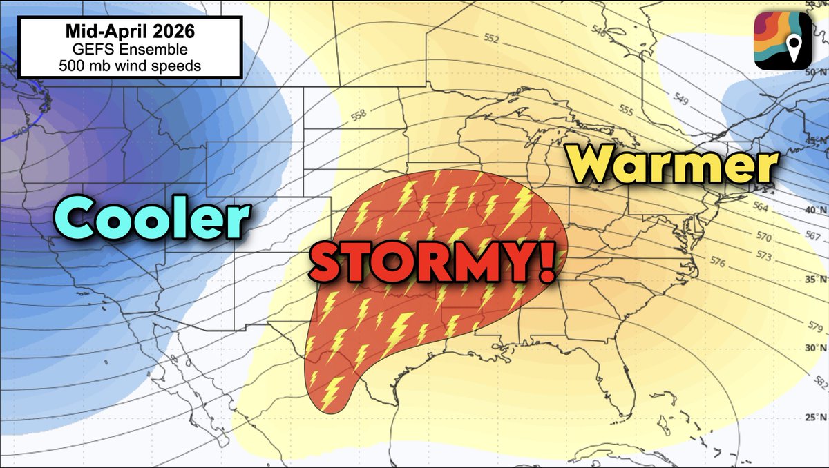
Western troughing is expected to dominate in mid-April.
That means that the jet stream will dip over the western U.S., allowing cold air to spill south over the Rockies.
The eastern U.S., meanwhile, will be warmer than average.
In between, clashing air masses – brewing storms.
Mountain rumbling possible, especially in NW-NCen mountains 200PM-800PM. Deep midlvl unstable air is moving across AZ high country bringing chc for t-storms. If outdoors, keep eye on sky as storms could form quickly. Sat/radar loops show action areas for low top mtn storms. #azwx
Stream of sub-tropic moisture/short wave/jet streak held AM temps 75-82F. Perfect for outdoor activities like golfing, hiking, walking, swimming. Look for slow clearing today with high nr 90F. Ridge rules Tue-Thu = 90-95F highs. Pattern change brings cooler wet wx Apr10-19. #azwx
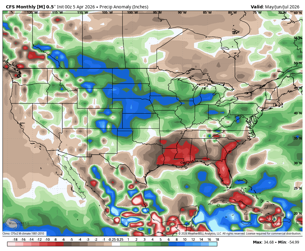
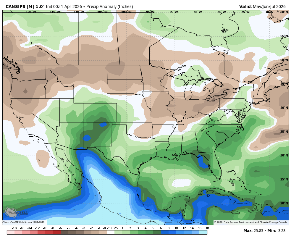
Pretty strong signal for above average summer precip from Euro/CFS/CANSIPS seasonal modeling.
I've said before that I'm *cautiously* optimistic about a potentially stormy May/June, but a fast-developing El Nino could shunt the start of the monsoon in July/August.
#COwx
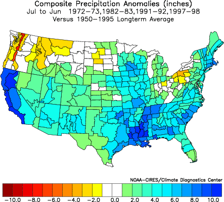
@webberweather STRONG EL-NINO likely will give us huge SNOW totals 4- Strongest EL NINO's
1972-1973 Mammoth - 370"
1982-1983 Mammoth - 546"
1991-1992 Mammoth - 226"
1997-1998 Mammoth- 542" Looks like we will have a wetter year since already at 18.36" and counting here in Garden Grove CA
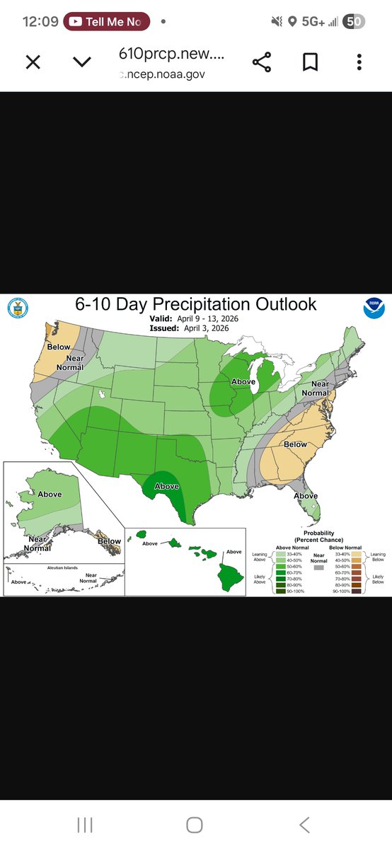
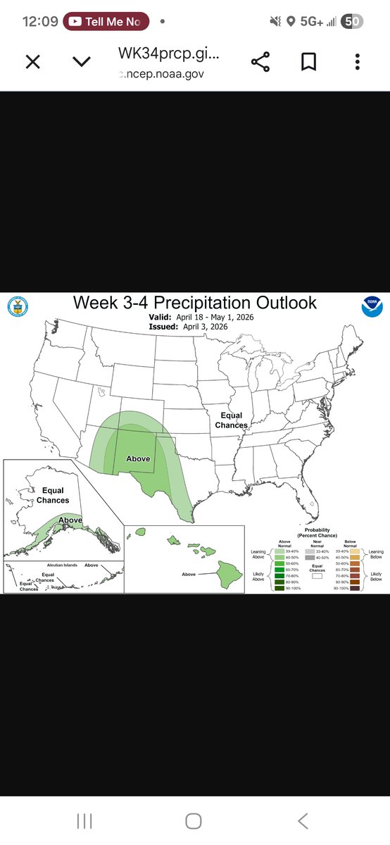
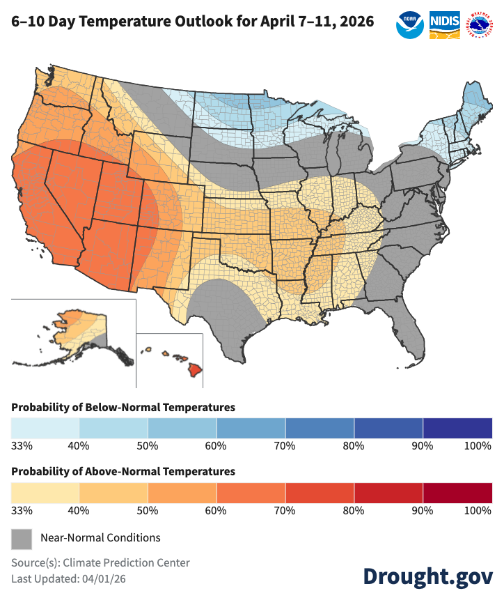
The signal for some rain in the Southwest has gotten stronger with the last several model runs and this is reflected in CPC's 6 to 10 day outlook released today. Also, the week 3 to 4 outlook is also leaning wet. April showers bring may flowers. #azwx
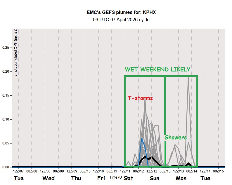
Slow warming into mid-week b4 next cooling period arrives. Late AM wv sat loop shows sinking motion/clear skies over Desert SW. Over E Pacific subtropic jet stream poised ti influence AZ while Polar jet stays N. GEFS model ensemble 7-day temp/precip plumes show the trend. #azwx
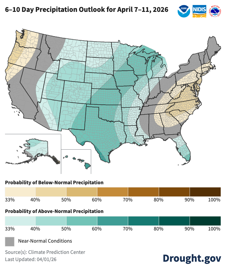
Next week's outlook by @NOAA’s @NWSCPC shows below-normal precip chances for parts of the Far West and East, and greater than normal precip chances for the Central US, FL, AK, and HI.
Temps lean normal or warmer than normal for most of the US. drought.gov/forecasts@NWS