

jake kovalcik がリツイート

SUNDAY MIDDAY UPDATE ON BLIZZARD/ MAJOR SNOWSTORM FOR NE CONUS
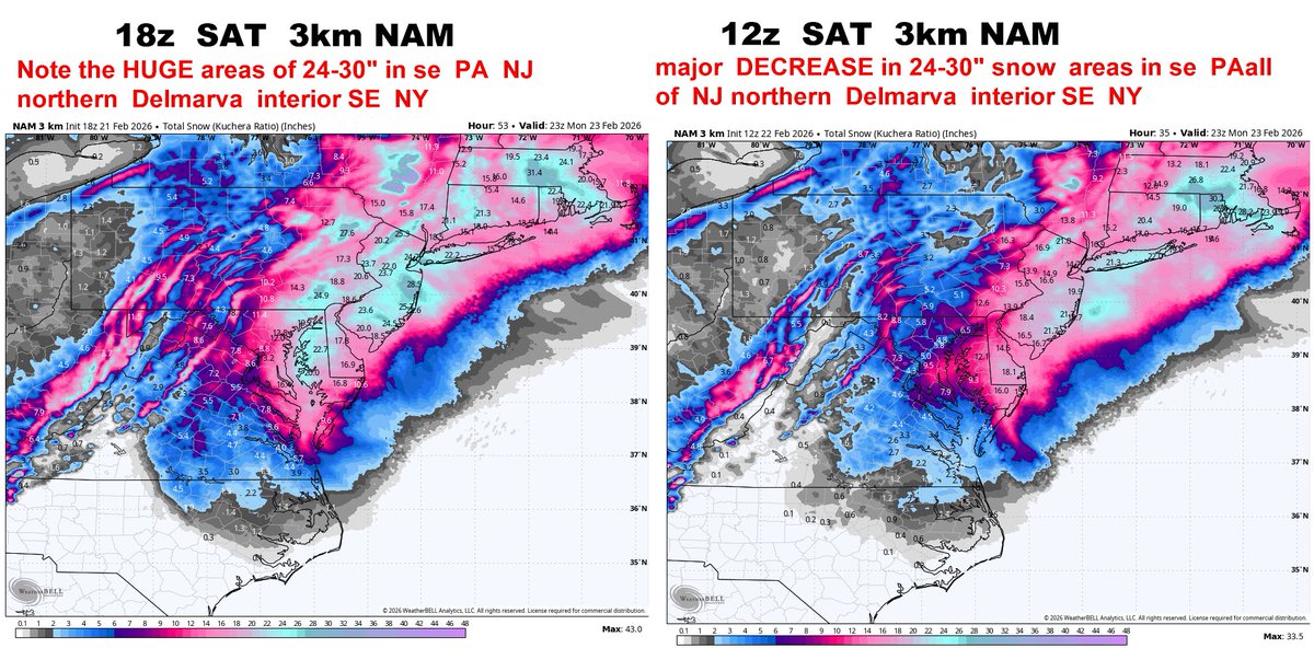
say good bye to 24-30" in NJ eastern PA northern Delmarva
1. The late East shift and most of the high resolution short Range model is not a surprise for me. I have been talking about this now for more than 24 hours.
The argument that many have made on Saturday and Friday that it was the European versus GFS NAM is disingenuous if not outright deceitful. As I have tried to State several times on Friday and Saturday there are a whole bunch of other models which had much less snow in New Jersey and Philly and eastern Pennsylvania and Delaware then the historic records shattering amounts shown up on the GFS NAM .
It is NOT the case of the European scenario versus the GFS NAM. In fact anybody making that kind of argument is just a weenie or a very bad neurologist.
The actual debate has been GFS & NAM vs EURO/ EURO AI EPS ICON CMC UKMET RRFS RGEM
2 big changes on new 12z 3km NAM. say good bye to the 30" snow ideas.
DC shifts from almost 9" to 4.3"
Baltimore from 12” to 5.8..
York Pennsylvania 24.9 to 12.6
Philly 18.6 drops to 13.9.
Glassboro NJ 23.6 to 18.4
Toms River from 28.5 to 19.9
Allentown Pennsylvania 17.3 to 7.3"
Scranton Pennsylvania 27.6 down to 16.3
New York City 24.7 to 14.7.
Newburgh NY 17.4" down to 11.3"
Interestingly the 24-in snow amounts areas in Eastern Long Island and interior Southeast New England have held for the most part and I'm not shown any changes.
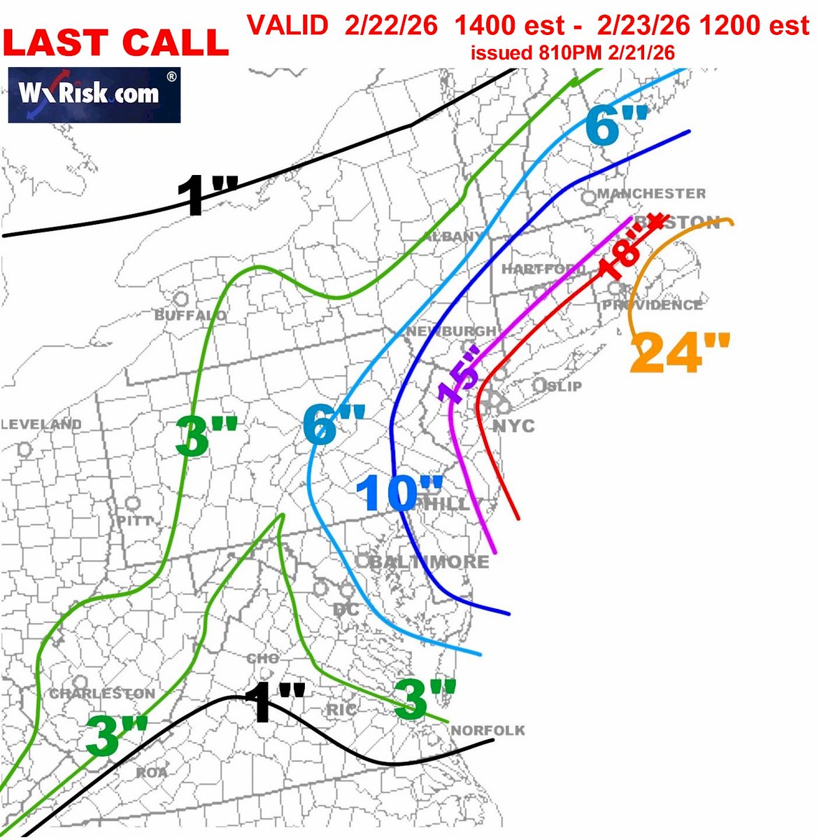
At this point I think my last call map is going to work out very well.
#Winter2026 #SnowLovers #EastCoastWeather #Snowfall ##Snowstorm #wxtwitter #vawx #mdwx #wvwx #dcwx #pawx #phlwx #rvawx #ncwx #rduwx #njwx #mass #ctwx #nywx #nycwx
English