
DixieChasing
2.2K posts

DixieChasing
@DixieChasing
Weather Enthusiast ⛈🌪+ Severe weather coverage & News + Firefighter/EMT⚕️+ AL raised
Alabama 가입일 Mayıs 2022
103 팔로잉892 팔로워

Would have made for a long night back home, but I should have went for it.
Mitch West@SCweather_wx
Man... I ain't even going to lie, part of me wants to go see the snow in Eastern TN. I just got a feeling it's going to do something wild up that way.
English
How’s everyone ? Did we all make it through the night. I hope everyone stayed safe🙏
English
@JoshPateCFB @spann That’s why they call him the 🐐 to be able to stand all night at his age . Respect✊🏼
English


Great listen for a in depth break down ⬇️
Mitch West@SCweather_wx
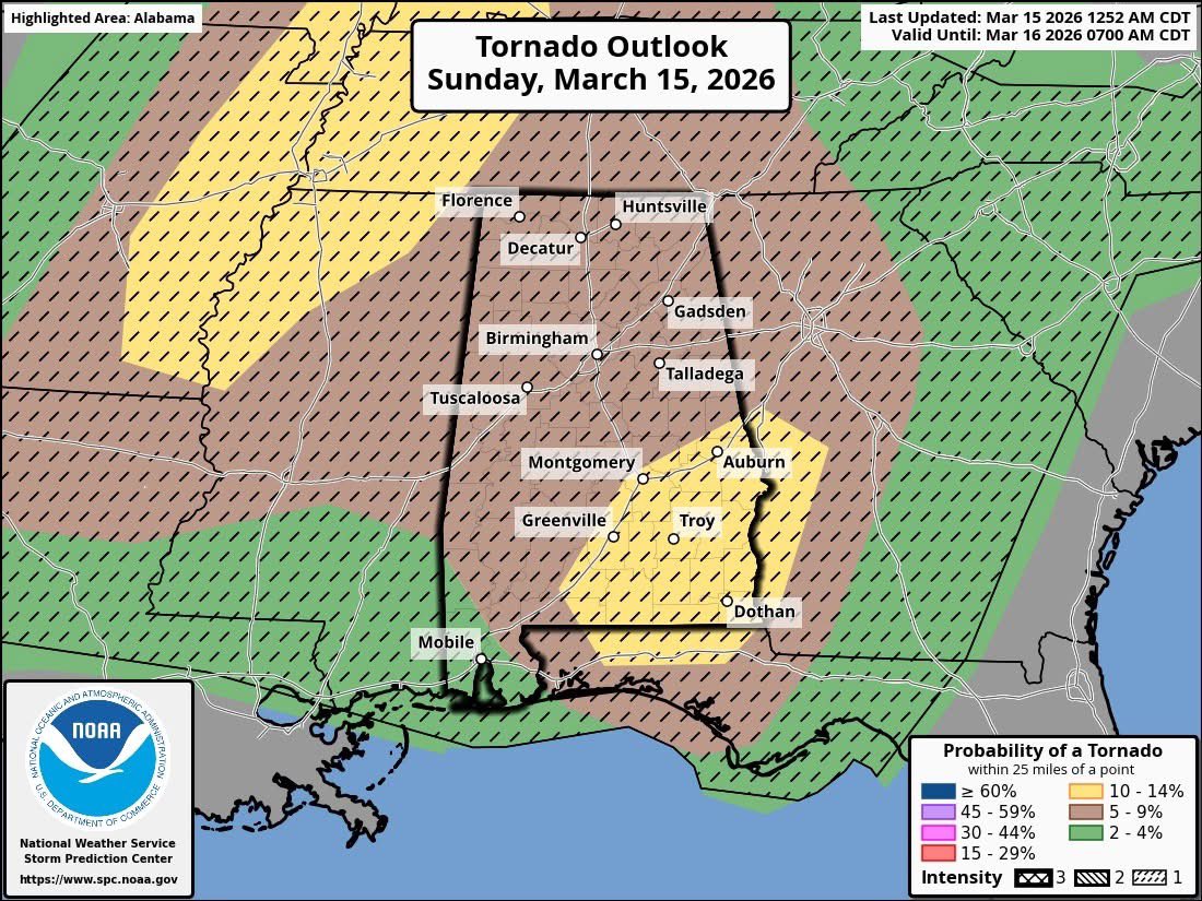
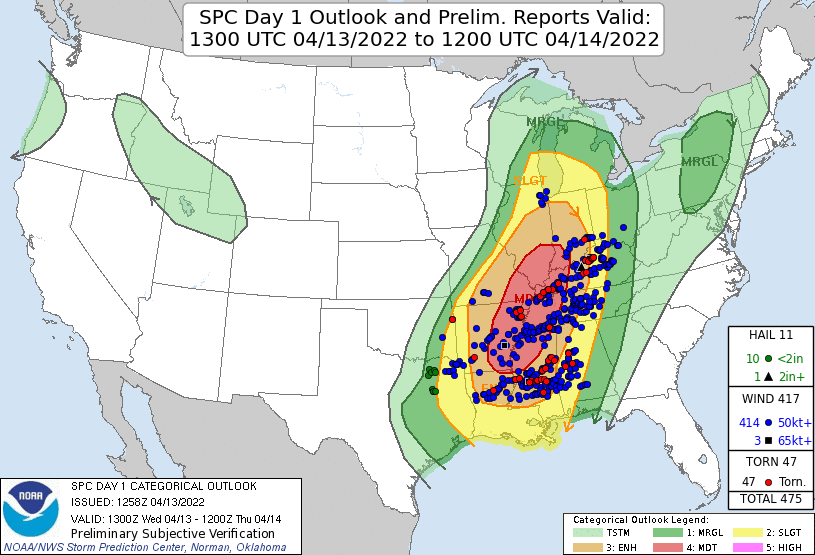
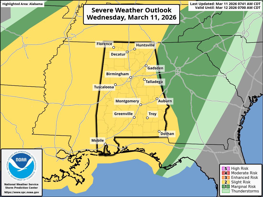
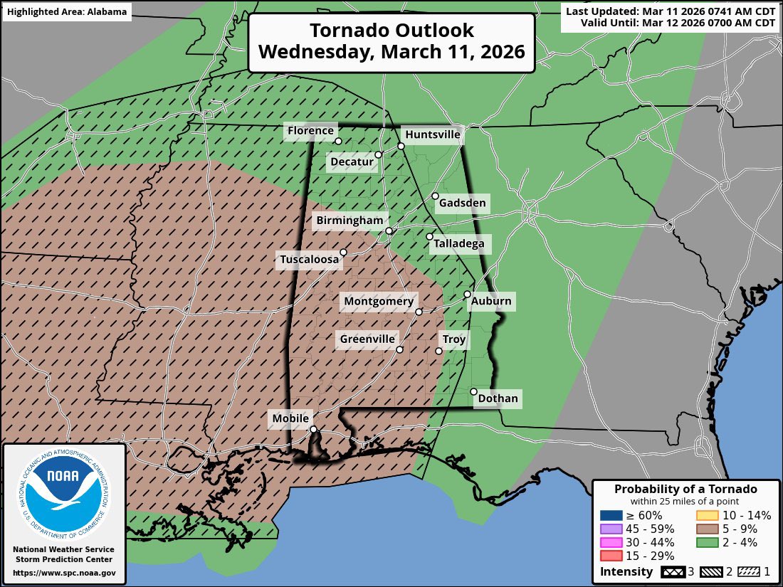
DANGEROUS SEVERE WEATHER EXPECTED MONDAY! We are waking up to a moderate risk upgrade this morning for Monday's severe weather event. All hazard risks have increased. I'll dive deep into this in this mornings video explaining everything. Individual outlooks per the SPC are below. Strong tornadoes & hurricane force 75+ MPH wind gust are possible with these storms.
English
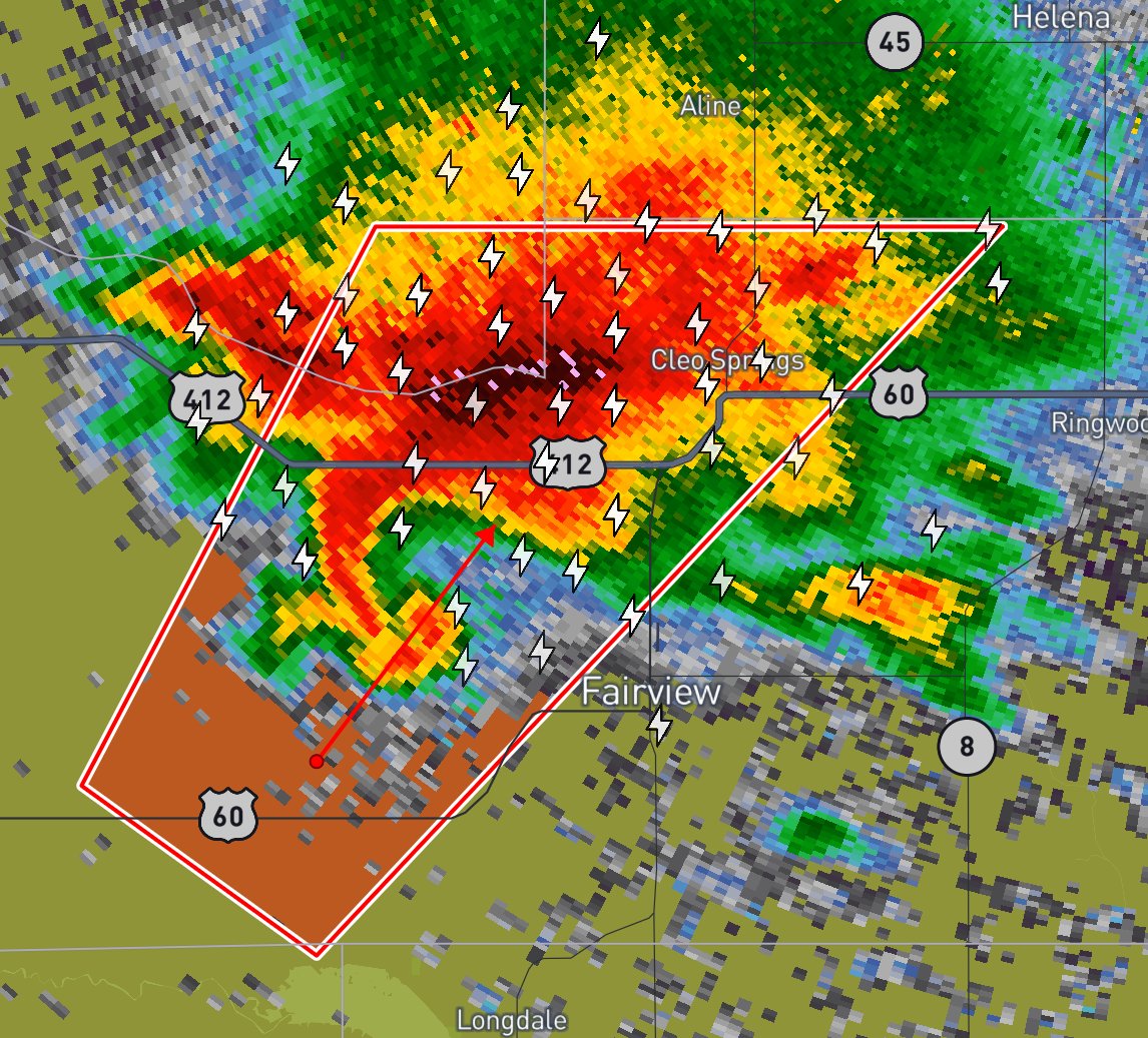
Severe weather is expected across Dixie Alley today .Stay weather aware and have multiple ways to receive alerts. I may not be able to post updates as often since I’ll be on call at the fire department, but I’ll share information when possible. Stay safe. ⚠️🌪️
#alwx #wxtwitter

English
@StarInBoxWx I think Al should have a more enhanced risk imo the parameters for tornadoes is definitely there
English

@BrandonCopicWx @UpperMidwestSC Awesome work yesterday brandon !
English
I do have to say for the amount of damage I am seeing from Kankakee, I legit didn’t see any debris flying from the tornado that you’d typically see when structures are impacted. There was also like a weird haze around the tornado as well which likely was precipitation and hail.
English
DixieChasing 리트윗함

@ChasingWConnor As a first responder my self I can attest it is best for the public to stay out of the way so we can do our jobs. Too many people like to get out and do sight seeing and it really hampers our abilities to move swiftly and efficiently.
English

For all the morons complaining I am all about myself and I don’t check on damage or help people, I have a torn ACL/meniscus. I can barely walk. I am not doing search and rescue when I can’t even walk. I have checked on countless hit structures live on my stream before. Thanks!
Also, as a storm chaser, don’t think you are required to do search and rescue. You are not and in most cases it’s better to just keep chasing and stay out of the way of the people who are properly trained. I am not trained nor of much help in the matter so unless I see a house destroyed right in front of me I keep chasing.
English
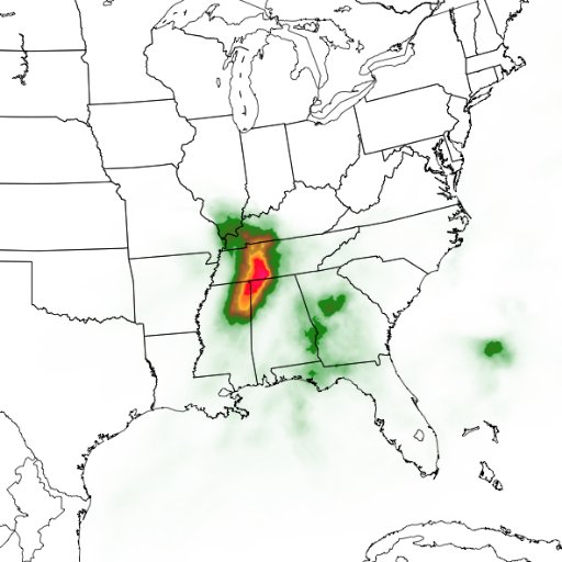
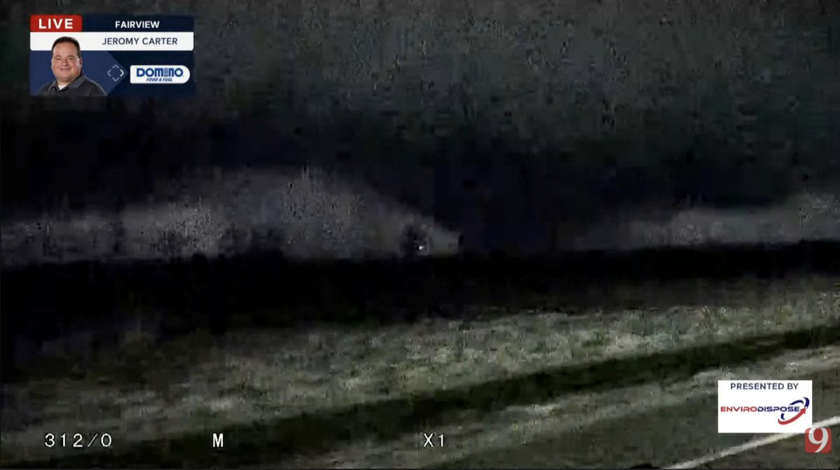
Active day ahead for the Deep South . Make sure you have multiple reliable ways to receive warnings and alerts. I will be watching radar like a hawk and keeping my friends down south updated 🌪️🚨#alwx
English
DixieChasing 리트윗함

Wow this is a picture-perfect supercell. This is what you see in a textbook. 🤯🤯🤯
English
DixieChasing 리트윗함

TODAY: I have been on the road since 6am today with programs in Geneva, Evergreen, and Thomasville. It was great to see so many Alabamians today!
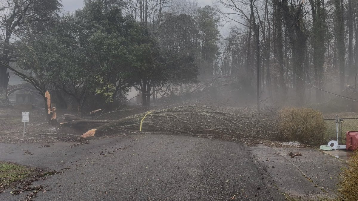
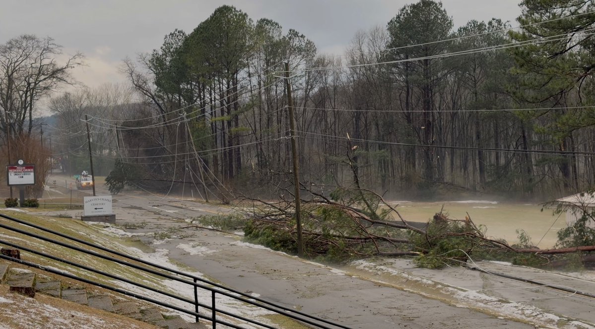
The weather today was more active than advertised… The storms clearly overperformed. Most of the issues involved hail, but there were two concentrated areas of wind damage in Jefferson County.
NWS Birmingham will conduct a storm survey tomorrow for the area near Bud Holmes Road in Pinson and Mary Taylor Road in Trussville.
Based on the initial reports it looks like the damage in Pinson was caused by a small tornado, and the damage in Trussville was caused by a gustnado.
A gustnado can form along the leading edge (the gust front) of a severe thunderstorm when strong outflow winds create a spinning column of air near the surface. Because their wind speeds can often reach the equivalent of an EF-0 or EF-1 tornado (roughly 60 to 110 mph), they pack enough punch to cause damage.
But we will know for sure tomorrow when the surveys are complete. Another reminder that when it comes to thunderstorms, expect the unexpected. 
Thanks to Drew McCombs for his excellent live coverage today on the Alabama Weather Network while I was on the road. 


English
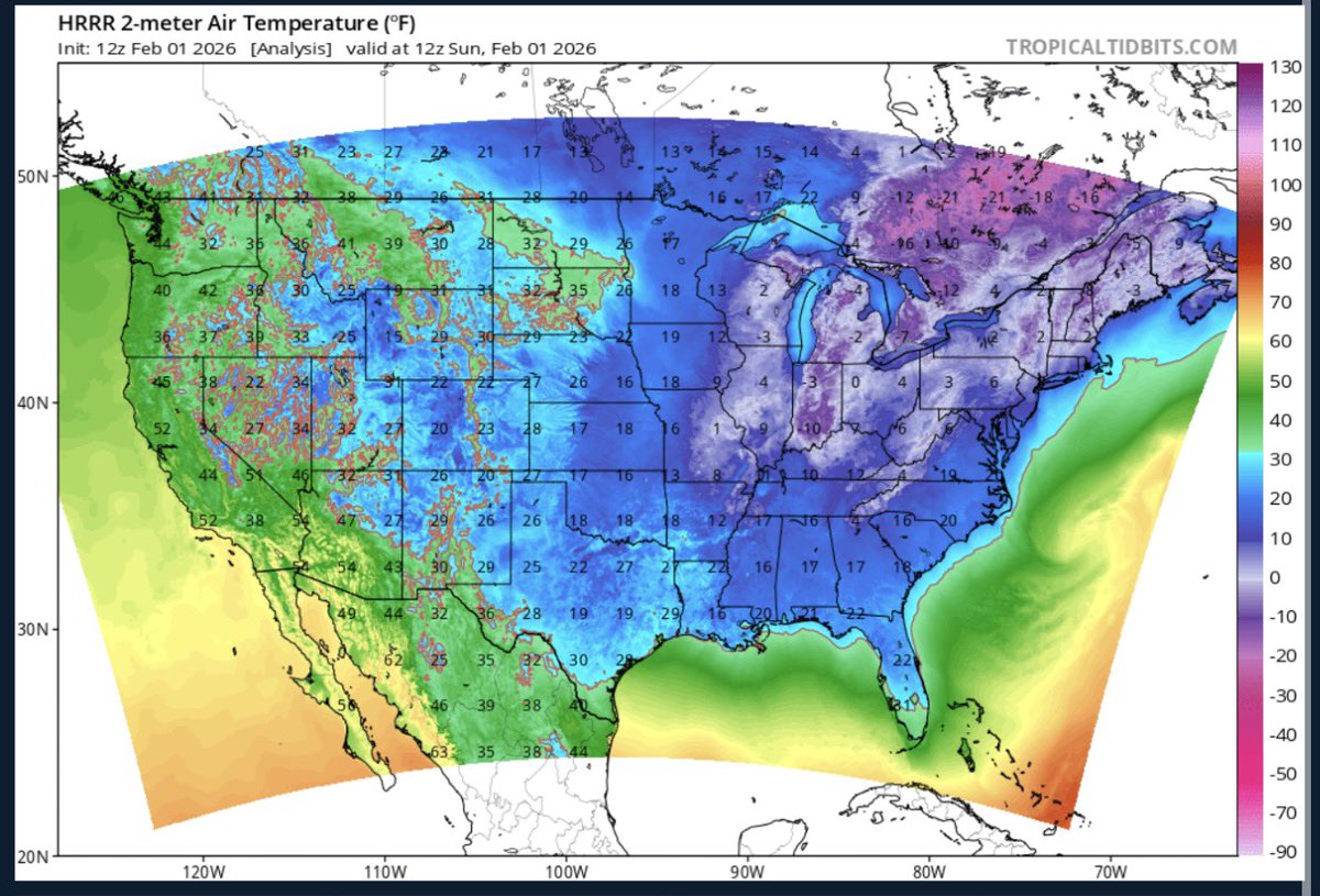
Everybody surviving the cold ? I know those wind chills are brutal🥶
English

How was this not blizzard warning criteria? Getting absolutely rocked out here on. OBX #NCwx
English
She is really getting her act together out there in the Atlantic Ocean. Look at all those lightning strikes, it's like a Snowicane.🌨️😲

English