
Allen
642 posts


@SheaSerrano Wife going to concert tonight so I finally get control of the remote. Recommend a newer movie for me please.
English

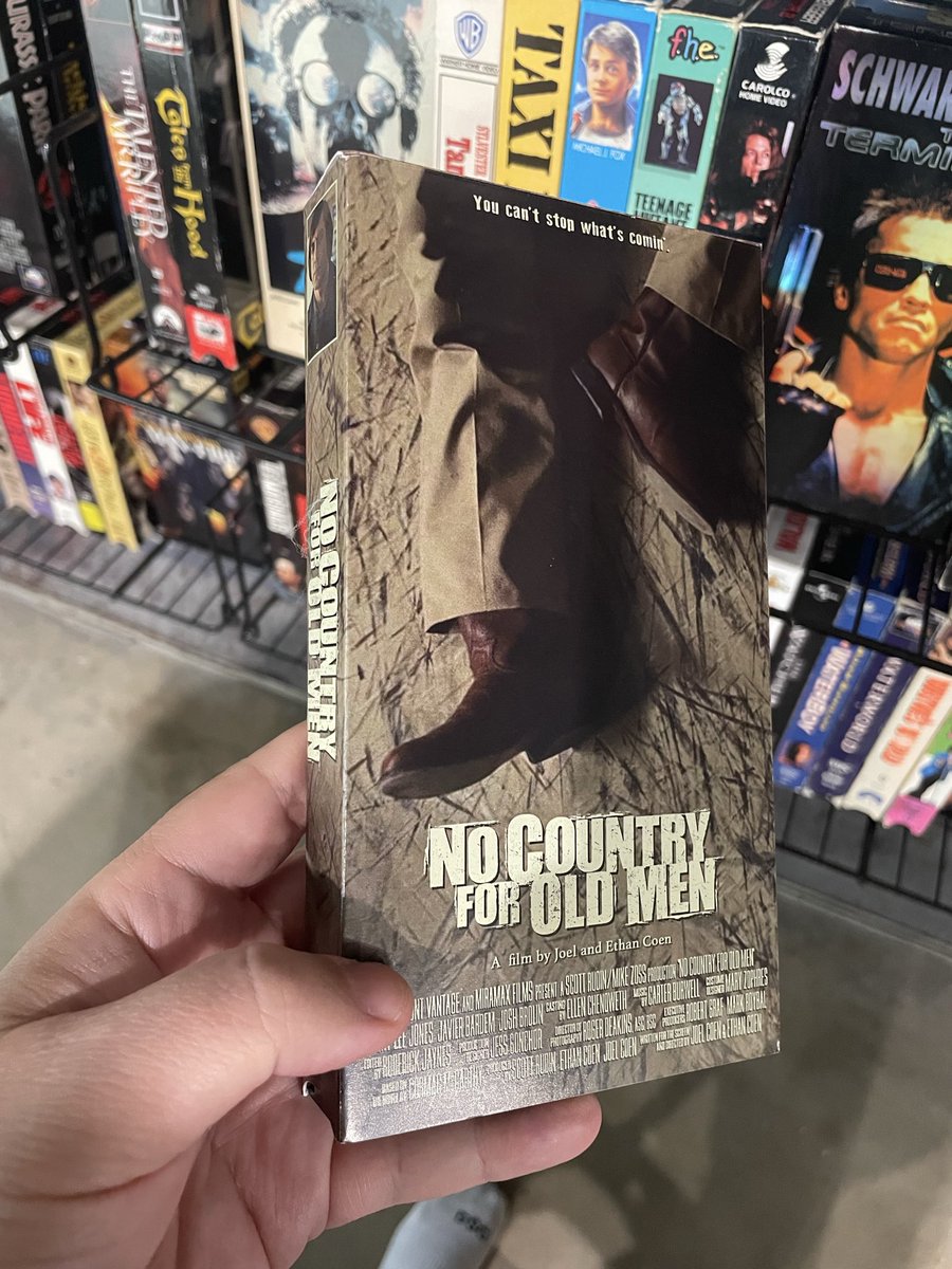
custom made VHS copy
Shea Serrano@SheaSerrano
here is an essay about No Country for Old Men this is the most important thing i’ve ever written goodmovie.substack.com/p/no-country-f… (it includes a complete breakdown of the “What’s the most you ever lost on a coin toss?” scene which is one of the finest movie scenes of the century)
English
@MichaelRyanRuiz Can’t wait for the Herbstreit rant to add additional pressure.
English


@BigEisy You wouldn’t be denying the results of a fairly contested game would you? Do you have any evidence to support your claim?
English
English
Most uncomfortable sunglasses ever and they were designed by Michael Jordan. Designed by MJ was the selling point we were supposed to push. @DarthAmin @CornPuzzle @CinephobePod
Outlander Magazine@StreetFashion01
The Oakley "MUZM Mars X-Metal Leather" (worn by Brad Pitt's Character in Fight Club) are Re-releasing tomorrow!🖤
English

I just had pumpkin pie for breakfast like I’m Mel Kiper or something what is wrong w me
English

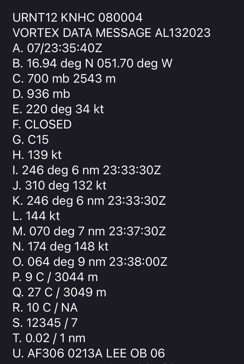
Peak is now 155 knots for #Lee
Although there are some indications that Lee might begin a northward turn around the middle of next week, it is still way to soon to focus on specific model scenarios that far out into the future.


English

So what does this mean? In terms of track, probably nothing. Lee was forecast to be at major hurricane status quickly. Unlike some storms where the strength/depth of a storm matters with respect to steering flow, this doesn't make a difference.
From an intensity point of view, it may be one of the fastest strengthening storms we've recorded in the modern hurricane era. And it was captured pretty well in our newest hurricane models (HAFS) so that's encouraging.
English

I’ve seen this ad every time I’ve been on the subway. I have no clue what it’s for. I can’t hear anything from it. Wouldn’t understand if I could. It’s compelling and this bird is ass off.
English

🧵Apologies for the sloppy graphic but this should explain the potential outcomes. The current trough depicted on both the EPS and GEFS attempts to propagate east, which would encourage a NE turn at some point away from the CONUS. Scenario 2 involves the trough more stationary.
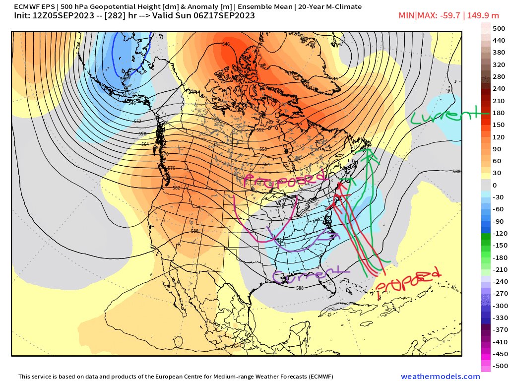
English
I would think future storms would be favored to recurve at some point given the weak Azores High and Fall approaching (even more troughing off the EC) but there have been late Sep MDR origin hurricanes that have been able to track westward so something to watch down the road.
English
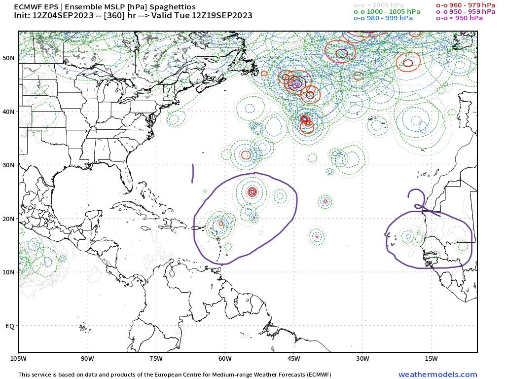
The climate models have been solid in their prediction of a large bomb of precipitation in the Central ATL, with quick recurves OTS or for other systems (Franklin, 95L), a hook north toward Bermuda. The 500mb heights suggested a pattern conducive for recurves east of the CONUS.

Andy Hazelton@AndyHazelton
Euro and EPS suggest the wave behind #95L could get pretty strong as it recurves quickly into the East Atlantic. Sam 2.0 and Lorenzo 2.0 at the same time? That would get our ACE numbers up in a hurry.
English

What an incredible tournament for amateur Sam Bennett.
Things still shaking out, but his amateur status will keep him from earning about $270,000 in prize money.
English
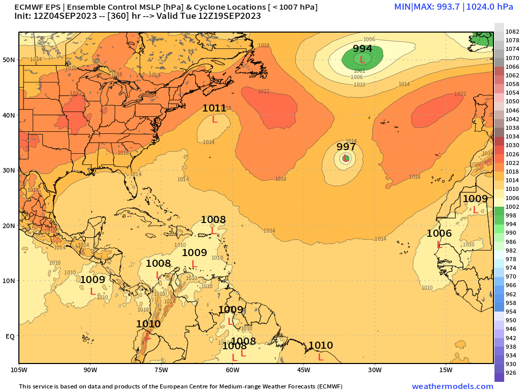
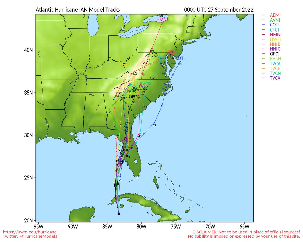
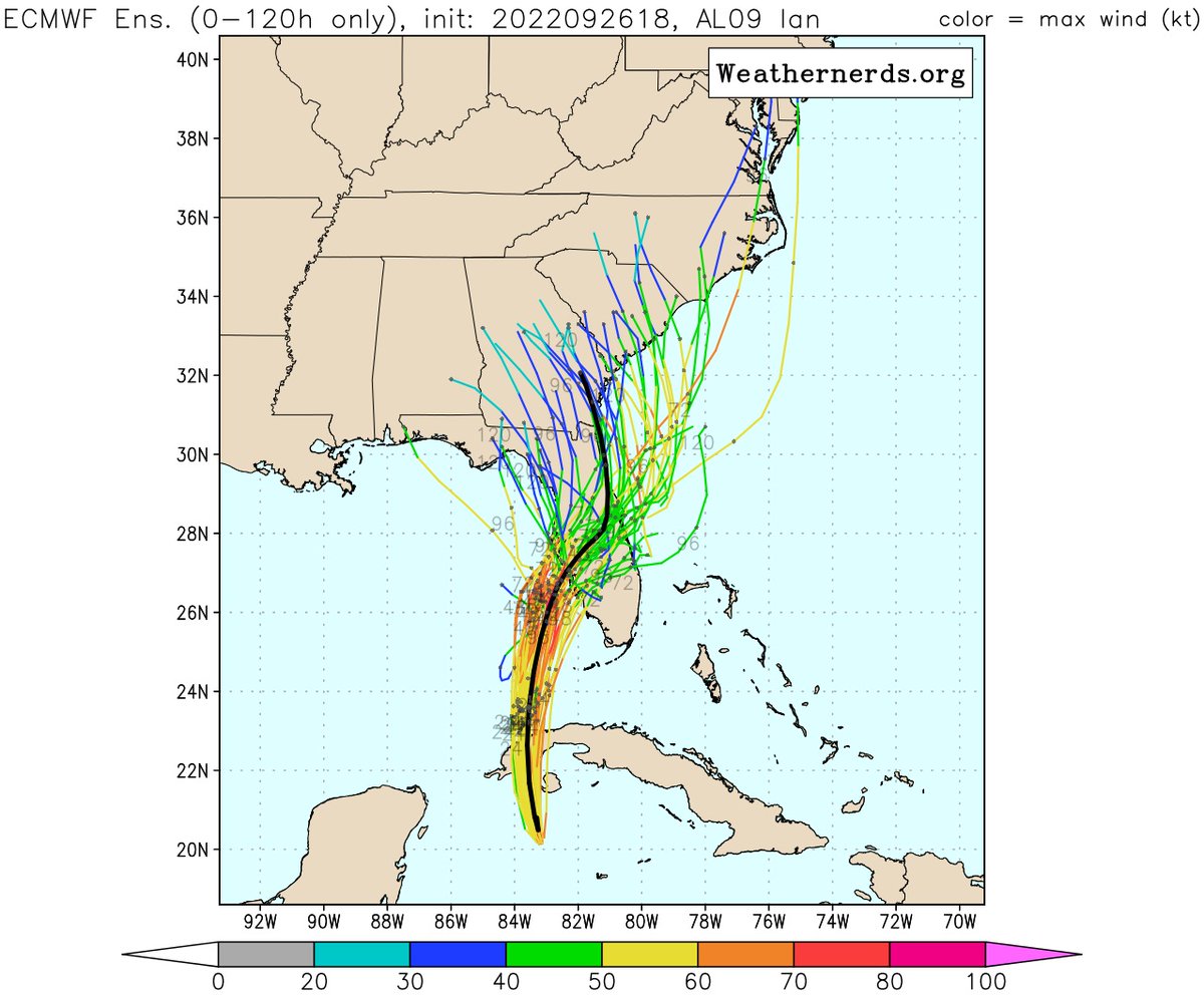
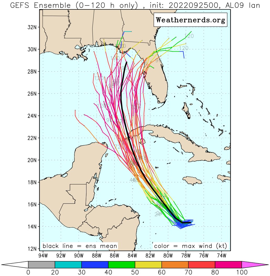
Large spread continues with 18z runs (00z interpolated from 18z). Dynamical insist it's up Fla west coast, GFS ens mean off coast toward Big Bend, & to make it more unsettling, Euro ens goes right. That's why if you are in storm surge zone, evacuate. Hurricane warning, shutter up
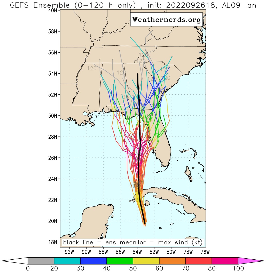
English
@JohnMoralesTV @Weathernerds Any more confidence to the storm’s effects on S. FL, one way or the other, with the morning runs?
English

If you add the half-dozen GFS ensemble members that bring #Ian in the general direction of #Tampa to the 40 or so from the EURO ensemble, there is plenty of reason for concern still for west-central #Florida
(graphics via @Weathernerds)

English