James Webb

5.4K posts

James Webb banner
James Webb

James Webb

@BlockchainComms

Canada Katılım Haziran 2016
966 Takip Edilen225 Takipçiler
James Webb
James Webb@BlockchainComms·
@aparam2004 @sidhant Nepal and India have signed 1950 treaty invalidating all treaties made with british India. then that will invalidate Sugauli Treaty too. then why Nepal should honour the current land boundary? it should claim the land prior to Sugauli . Kumau Gadhwal is also Nepal’s
English
0
0
1
31
Anand Paramasivam
Anand Paramasivam@aparam2004·
@sidhant So, a white will adjudicate in a land dispute between two brown people?
English
5
0
0
4.2K
Sidhant Sibal
Sidhant Sibal@sidhant·
Flash: On Nepal's claim to Indian territory of Lipulek-Limpiyadhura, Nepali PM Balen Shah says his govt will raise the matter with UK to find a solution since the origin of issue is to British India; Aims to hold "table top" exercises with India.
English
374
240
2.6K
625.1K
Victor 🇮🇳 🇺🇸
Victor 🇮🇳 🇺🇸@Victorious__108·
@sidhant LMFAO, the joys of allowing artificial bUfFeR stAteS to exist. There is absolutely ZERO reason why Nepal, Bhutan and Sri Lanka are independent countries except to create artificial problems for India & provide launchpads for enemy activity. Thank God Indira at least merged Sikkim
English
5
1
96
3.3K
TPillai
TPillai@pillai122501·
@sidhant These minions wr amply helped by INDIA2run d country, they r running2UK which is already sunk&dead&sold2Islamists! INDIAshd STOP all its assistance ASAP2these thankless Neighbors4Ever&teach them!
English
1
1
8
2.1K
असुर्
असुर्@SaffronPhobia·
@sidhant Modi should Conquer Nepal and force them to be the 29th state of India It will solve all the Conflicts between us and Them
English
10
1
194
5.8K
India First
India First@IndiaFi58450473·
@sidhant Nepal wanted to merge in India during partition, Nehru denied , as always Nehru’s all decisions have been proved wrong for India and sometimes even anti India. So now its time Bharat can think of fixing that mistake and merge
English
10
0
12
3.4K
निम シ
निम シ@neemsiwak0ti·
Creepy, stalker हर्क साम्पाङ्, श्रम संस्कृतिको नाममा यसरी साना नानीहरूलाई असहज महसूस गर्न गरी हेर्ने हेराइ, हाउभाउ, स्वभाव कस्तो डरलाग्दो? 🤔
NE
5
7
61
8.2K
Sena Latif
Sena Latif@sena_latif·
Honoured to meet the new @PM_nepal_ @ShahBalen, alongside fellow ambassadors in Kathmandu. Had the privilege to talk about the recent #upgrade in Romania-Nepal relations, at political, economic and mostly people-to-people level. Thanks @EUinNepal 🇪🇺🇳🇵🇷🇴
Sena Latif tweet media
English
28
67
1.1K
34.9K
Sidhant Sibal
Sidhant Sibal@sidhant·
Since US Secy of State Rubio @SecRubio @marcorubio sought clarification this morning from me: When I referred to "endorsements", it was very clear who exactly I referred too. Not an activist or a nuisance in a presser. I just asked a question.
English
386
1.9K
11.9K
445.2K
James Webb
James Webb@BlockchainComms·
@RautelaPradyumn @lokendra_yogi1 I was rushing on the "1954 India map" claim, but its sourcing is weak. I decided to drop it. Nepal's case is stronger even without it, because the 1816-1856 British cartographic record is unambiguous, peer-reviewed, and acknowledged even by Indian academic sources.
English
1
0
0
9
I🇳🇵
I🇳🇵@lokendra_yogi1·
If power decides ownership, then China’s claim over Arunachal Pradesh would also be valid. Strength doesn’t give any country the right to take another’s land. Lipulekh–Kalapani is Nepal’s land as per the Sugauli Treaty, with the Kali River as the boundary. Respect sovereignty.🇳🇵
Randhir Jaiswal@MEAIndia

Our response to media queries regarding comments made by Foreign Ministry of Nepal on border issue in the context of the Kailash Mansarovar Yatra ⬇️ 🔗 bit.ly/4dm0sEB

English
195
71
563
49.9K
James Webb
James Webb@BlockchainComms·
@RautelaPradyumn @lokendra_yogi1 You asked for the map. Fair. The maps are in the British Library, India Office Records. The 1827 Garhwal-Kumaon map showing Kuti-Yankti as Kali River is publicly referenced in academic papers by Indian scholars too. The evidence exists. requires going to primary sources — not 2nd
English
0
0
0
35
James Webb
James Webb@BlockchainComms·
@RautelaPradyumn @lokendra_yogi1 India's own MEA in 1998 acknowledged bilateral talks were ongoing to "prove respective claims supported by evidence." (The If India's claim was so clear-cut, why agree to an evidence-examination process? You don't examine evidence for territory you've held "since the 19th c.
English
0
0
0
5
James Webb
James Webb@BlockchainComms·
@RautelaPradyumn @lokendra_yogi1 The 1856 British Survey of India map — available in archives — shows Kalapani on the WEST side of the Kali River. (Anadolu Ajansı) West of Kali = Indian side under Sugauli Treaty. This map exists. It is verifiable. It is not disputed.
English
0
0
0
40
James Webb
James Webb@BlockchainComms·
@RautelaPradyumn @lokendra_yogi1 Now here is what IS verifiable and undisputed: British Survey of India maps from 1816, 1819, 1827, 1830, 1834, 1835, 1837, 1846, and 1856 — ALL show Kali River originating from Limpiyadhura. 12 maps. 40 years. India's own predecessor's cartographers. Find in the British Library
English
0
0
0
15
James Webb
James Webb@BlockchainComms·
@RautelaPradyumn @lokendra_yogi1 This is Nepal's weakest point — and the honest answer. Nepal's silence from 1962 to 1997 was not acceptance. It was political cowardice under Mahendra and Birendra, who needed India's support to maintain their autocratic regimes. Silence under duress ≠ legal consent
English
0
0
0
8
James Webb
James Webb@BlockchainComms·
@RautelaPradyumn @lokendra_yogi1 And what happened in 1962? Nepal's Chief District Officers of Darchula repeatedly reported to Kathmandu that Indian army men had encroached on Kalapani and erected constructions there — but King Mahendra ignored these reports to preserve the Panchayat system with India's support.
English
0
0
0
21
James Webb
James Webb@BlockchainComms·
@RautelaPradyumn @lokendra_yogi1 A State Police post was established at Kalapani in 1956 — NOT 1947. Before 1956, the area had no Indian police post. So India "assumed" it was theirs from 1947 — but only physically occupied it in 1956. That is a nine-year gap between claim and action.
English
1
0
0
13
James Webb
James Webb@BlockchainComms·
@RautelaPradyumn @lokendra_yogi1 From the date of Indian independence, India "assumed and acted on the basis that the trail to Lipu Lekh fell exclusively within its territory." — Nepal expert Sam Cowan, after reviewing original records. So India's administrative claim goes back to 1947. Accepted. 👇
English
0
0
0
9
James Webb
James Webb@BlockchainComms·
@RautelaPradyumn @lokendra_yogi1 You're right to push back. The 1954 claim is disputed. Let me give you what IS verifiable instead — because the actual evidence is stronger than that one claim.
English
0
0
0
4
James Webb
James Webb@BlockchainComms·
@RautelaPradyumn @lokendra_yogi1 Fair challenge. Let me be precise rather than defensive. The "India's 1954 map showed Kalapani as Nepali" claim is disputed and I should not have stated it as a clean fact. Here is what the evidence actually shows — which is stronger than that claim:
English
0
0
0
7
James Webb
James Webb@BlockchainComms·
@DrShankarSharma @IndianExpress @ShubhajitRoy Colonial correspondence confirms it. Lord Moira's 1815 secret letter — written before the Sugauli Treaty was even finalized — explicitly recognized the Kali River as Nepal's boundary. The British knew where the river started. The early maps show it.
English
0
0
0
48
Dr. Shankar P Sharma
Dr. Shankar P Sharma@DrShankarSharma·
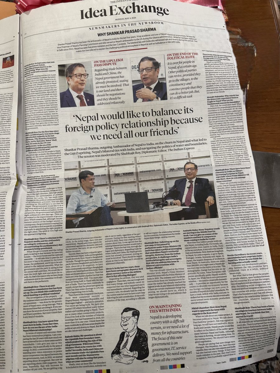
Thank you @IndianExpress and @ShubhajitRoy for speaking with me and for publishing my interview. I appreciate the opportunity to share my perspectives on issues of mutual interest and to contribute to the ongoing dialogue between our countries.
Dr. Shankar P Sharma tweet media
English
7
21
92
3.9K