
Eric
1.2K posts


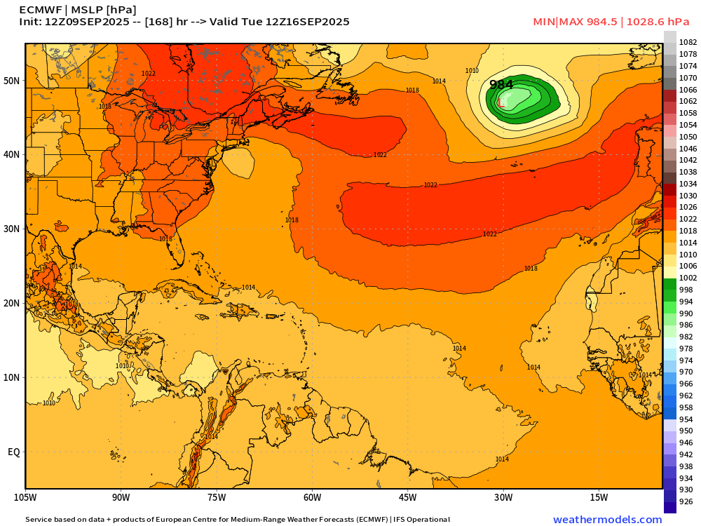
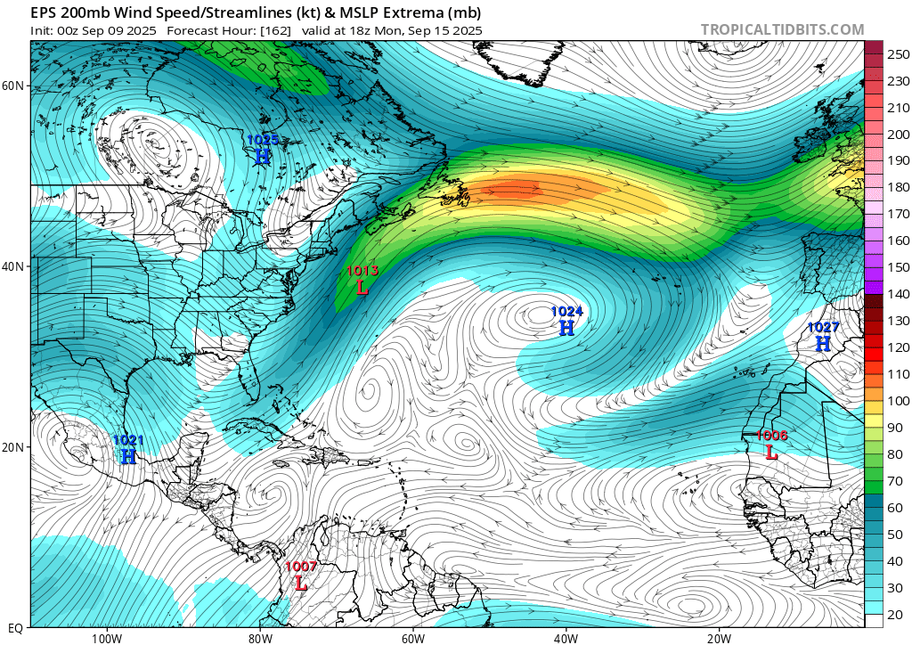
ECMWF 12z model update for Day 7 is less excited than GFS for a tropical wave.
Since Erin, the Main Development Region in the deep Atlantic tropics, has been "closed for business"
Ryan Maue@RyanWeather
In a week, we should have another tropical wave to watch in the central "Main Development Region" with decent potential. 🌀 GFS 12z update: +7 days
English


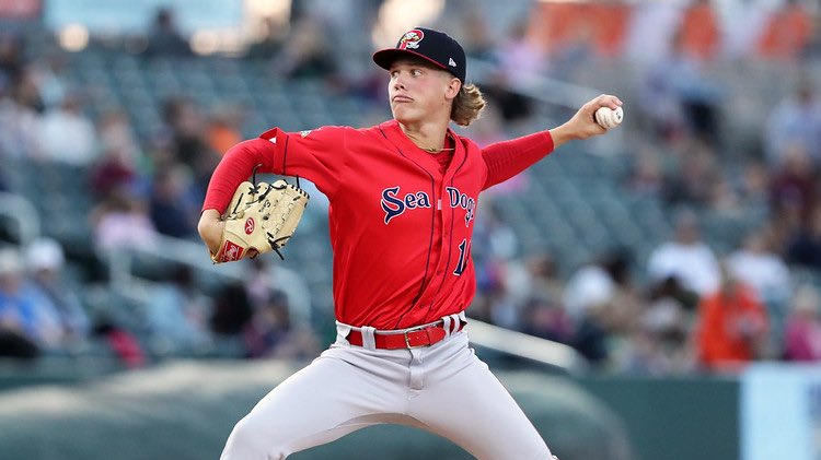
Connelly Early was the crux of what Arizona wanted in exchange for Merrill Kelly. Red Sox said no.
Right or wrong, Kelly has been nails for Texas since the deadline starting 7 games with a 2.98 ERA and a 126 ERA+ over 42.1 IP.
Front office will be a little anxious tonight.

English

@BOSSportsGordo @tommycassell44 What's wrong with Tolle now? The sox never should have cut Buehler
English

Kyle Harrison is on his way to Sacramento right now and is expected to be available to pitch in tomorrow’s series finale, according to @tommycassell44.

English
English

@hosel_rocket @BOSSportsGordo Sucks cause the rangers aren’t even making the postseason
English
This team’s pitching depth is being tested well beyond the point I thought possible.
Kutter, Houck, Dobbins, Fitts, Sandoval, Criswell all on the IL + Priester traded.
Gordo@BOSSportsGordo
The Red Sox are calling up top pitching prospect Connelly Early to make his MLB debut tonight, according to @FoulTerritoryTV. Dustin May is being placed on the IL.
English
English

@BOSSportsGordo @Asty_Mar @FoulTerritoryTV But he hasn't been called up, correct? It's a day game tomorrow and if he's gonna get on a plane to go cross country they should get him on one today.
English
The Red Sox are calling up top pitching prospect Connelly Early to make his MLB debut tonight, according to @FoulTerritoryTV.
Dustin May is being placed on the IL.

English
English

@Eric36660628 @FrankPOliver @AndyHazelton We had a front last weekend in Houston. Day time highs are in the mid 90s instead of the upper 90s, but dewpoints are in the 50s. Ensembles show NW or W flow in the Gulf through 15 days with most of the Gulf seeing 20 knot or above 250 mb winds.
English

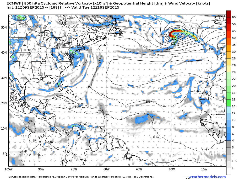
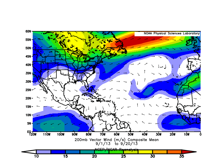
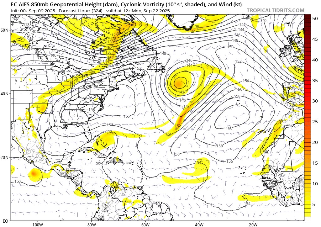
It's not a perfect match, but this pattern that we're in with a persistent trough off the East Coast and wavebreaking undercutting the Atlantic ridge does fit what happened in September of 2013.
The persistent TUTT around 40W is interfering with waves as they emerge from Africa, and the trough in the far SW Atlantic is preventing systems from developing further west. There may be a window in the Central Atlantic, but it's a pretty narrow one.
We may not see any significant tropical development in the Atlantic unless/until there's a notable shift away from this pattern.
English

@AndyHazelton And the Gulf becomes hostile once strong cold fronts drop south with the polar jet stream, leaving the Western Caribbean as the only area if anything were to form. Time will tell.
English


@tropicalupdate Let's keep this going for another 30 days!!
English

Tuesday AM EURO blend of ensembles for TS chances. Looking ahead 10 days. Not much confidence showing. Maybe that middle Atlantic wave. Been support of one with that eventual curve we have seen a lot this year. EURO/GFS still with a few ensemble members in the Gulf but no more no less than the past several days. Bottom line. Nothing to track. No reason to stress. spaghettimodels.com

English
@Weatherunited1 It’s over. Wait until season 2026, if there is no Nino year…
English

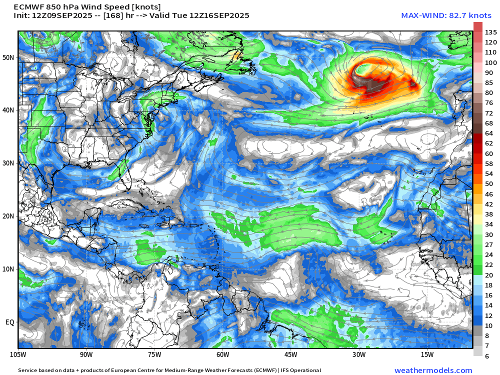
I’m only getting more impressed when I see signals like this that are so muted during what should be a very active peak of the Atlantic hurricane season.


English


WAIT BUT THEY TOLD ME HE SUCKED AFTER ONE BAD START ???
MLB on Real@MLBonReal
Garrett Crochet got back on track with this start tonight
English

@BostonStrong_34 Oh look another different FUCKING batting order!!! Cora the CLOWN!!! Redsox are not going to make playoffs
English

Red Sox @ A’s G1
Duran RF
Bregman 3B
Story SS
Lowe 1B
Gonzalez 2B
Yoshida DH
Rafaela CF
Sogard LF
Narváez C
Crochet LHP.
@TylerAppell @HurricaneManWx Gulf will get something later this month
English

@HurricaneManWx At this rate, I’ll believe it when I see it, background stability has been brutal this year
English

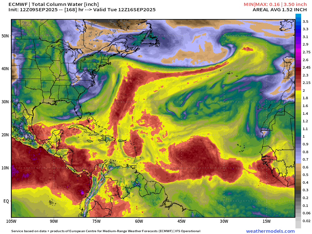
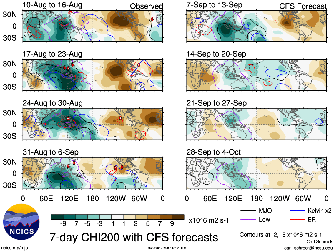
The Atlantic basin is currently experiencing a temporary lull in tropical activity, despite being at the climatological peak of the season.
However, atmospheric indicators suggest a transition to a more active period beginning in mid-September. This shift is expected to be driven by the arrival of a favorable phase of the MJO and the passage of a Kelvin wave, both of which will create a more conducive environment for tropical development.

English
English

@CelticsUnite18 @DrPepper21MD Florida Gator football fans have it worse
English

Patriots exist
Tatum achilles
Roman Anthony out
Bruins
Who has it worse than Boston Sports fans
English


@AndyHazelton When can we expect the Atlantic to finally get going?
English
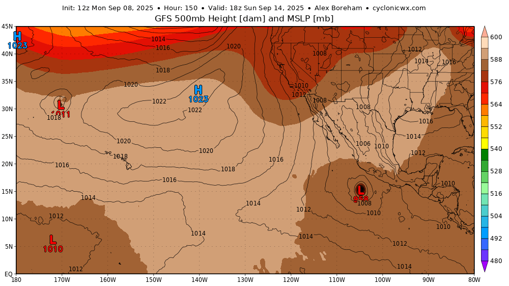
Based on model trends, it looks like the East Pacific is going to have another potentially strong hurricane developing by the weekend or early next week. A ridge to the north should keep it away from Mexico initially, although we'll have to watch for a turn back towards the Baja Peninsula later.
GIF
English
