D.Avery सुन्दर retweetledi

🚨 This was the Artemis II crew's view this morning from 41,756 miles (67,200 km) up
No human has seen a crescent Earth in full since 1972

English
D.Avery सुन्दर
29.4K posts


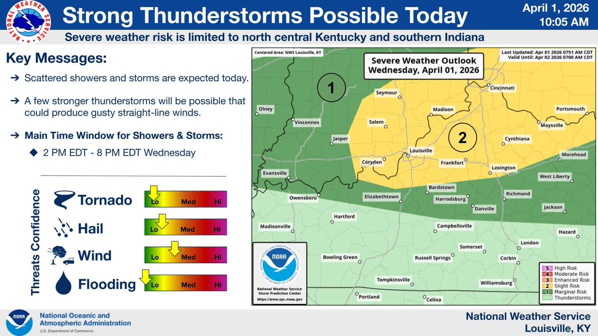
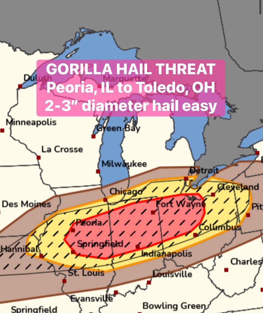
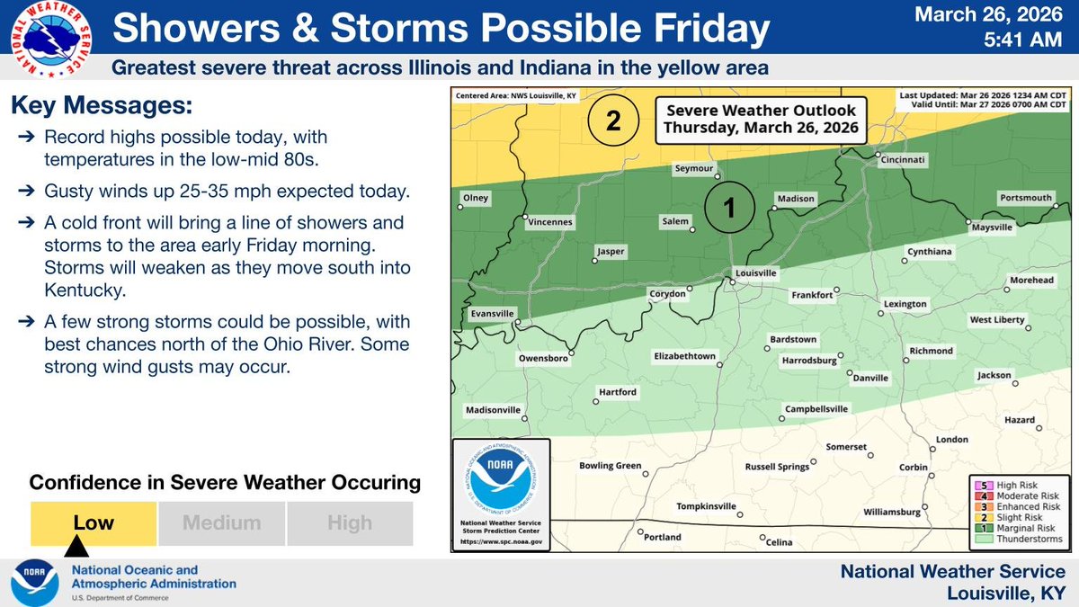
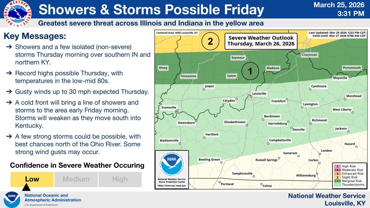
@Fireman18HVFD
👨🏾🚒⚡️🇮🇳⛑🇺🇸🌪🚒🚑 #kywx Follow me on Facebook for Kentucky, N. Tennessee, and Southern Indiana Severe Weather Reports.