
EpicLavaCarpet
236 posts
EpicLavaCarpet
@LavaCarpet
Interested in weather and space. Studying aerospace engineering.
Colorado Springs, Colorado Katılım Haziran 2019
70 Takip Edilen7 Takipçiler
@wxKobold It’s cool seeing someone else talk about this day! As someone who lives near this area, this is one of my favorite weather days since I’ve gotten into the hobby. This day is what really got me into weather.


English

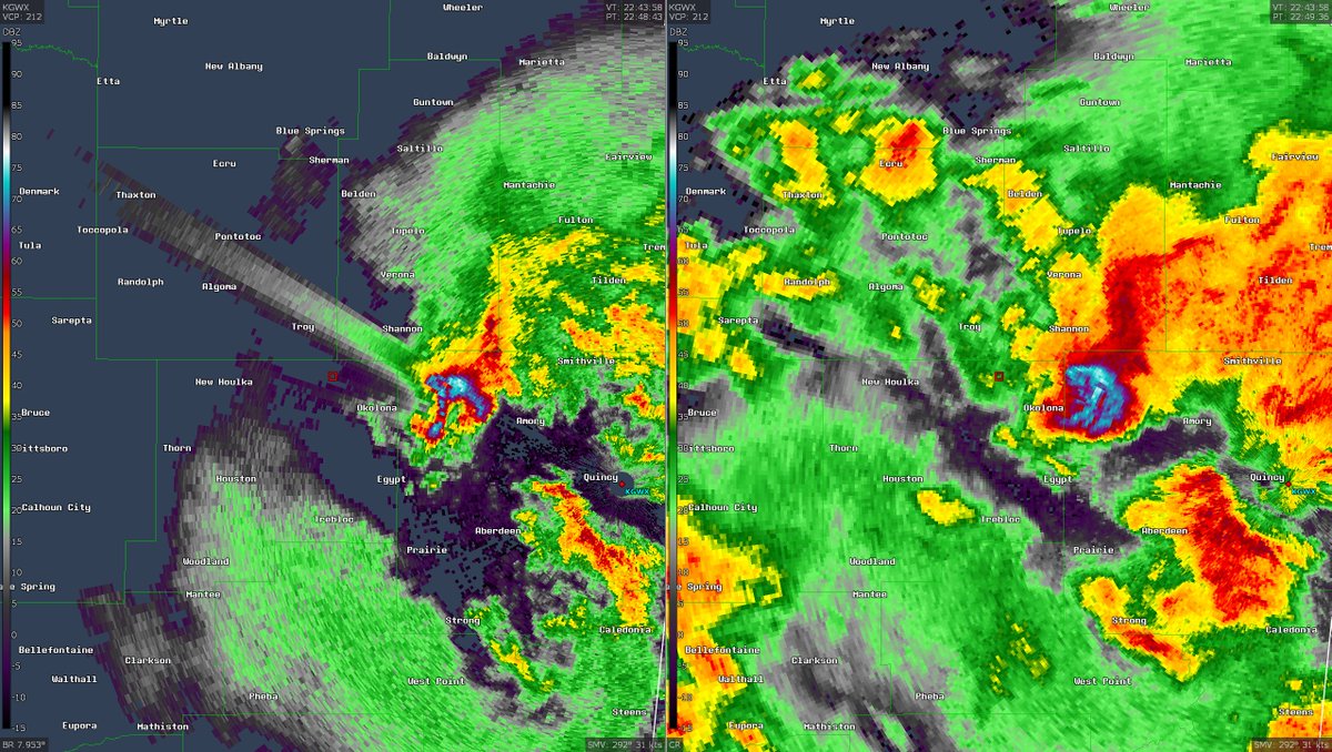
Storm-following radar loop of a peculiar storm near KPUX on 2023/06/21. In this loop we see a merger result in a quite large, dramatic hook echo, developing multiple small tornado-like circulations. No tornadoes surveyed from this, but the storm up north near Akron had ~37!
English
@Brady_Wx @StormNetWx 2025 is used for testing right? Could you show what the hail outlooks were like in Colorado for either June 15 or June 17? I’m curious about those days, there was even a tornado in the mountains on the 17th as wel
English

Lightning, tornado, hail, and damaging wind forecasts to 14 days into the future.
Can’t get that anywhere else! And it’s available in the @StormNetWx app for free.
StormNet@StormNetWx
Did you know that StormNet also predicts hail, lightning, and damaging winds in addition to tornadoes? Here's the latest large hail forecast for the splitting supercell in central #KSwx. Forecasts extend from present to 14 days into the future, and everywhere in-between.
English
@wxKobold What radar site and time? I’d like to look at this on OpenStorm
English


Nadocast has not been impressive this year to say the least.
Nadocast@nadocast
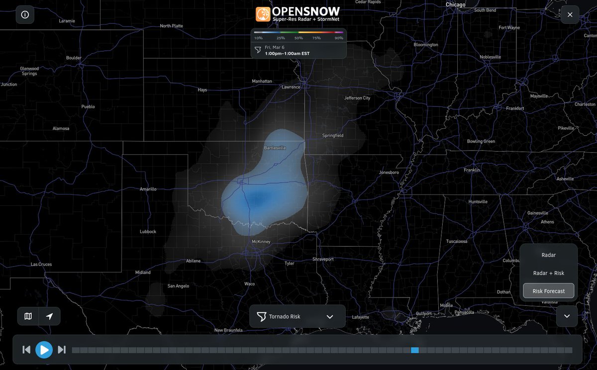
12Z Day 2 Tornado Forecast for 2026-3-10 (New New 2022 Models)
English
We've just updated the short-range StormNet component to v4!
- 10min outputs for the first hour.
- Improved accuracy!!!
- Quicker model runs.
A full article is coming soon giving the full technical breakdown of this update!
This data is freely available: @OpenSnow
GIF
English

English

Things that will make a comeback in 2026
Dixie :( (again)
NE Colorado-ing (@SNHWx moved)
Nebraska rare three-peat (@aresel_ moved)
SoDak Sigs
Western Kansas (daytime)
Return of the I-35 dryline (results may vary)
maybe: k*rk@oldscarf1stweek
Things that will comeback in 2025 Dixie :( Colorado-ing North Dakota Sigs Western* Kansasing Oklahoma (daytime) Book it
English
@Brady_Wx Hi! I’m very excited to use the newest StormNet. Is StormNet’s probability the same as the SPCs (within 25 miles of a point)? And what about for lightning?
English
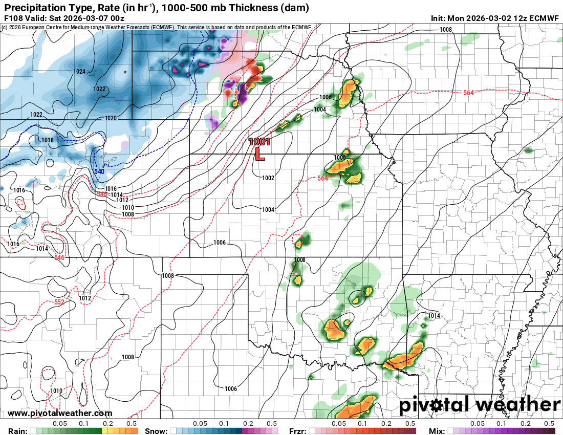
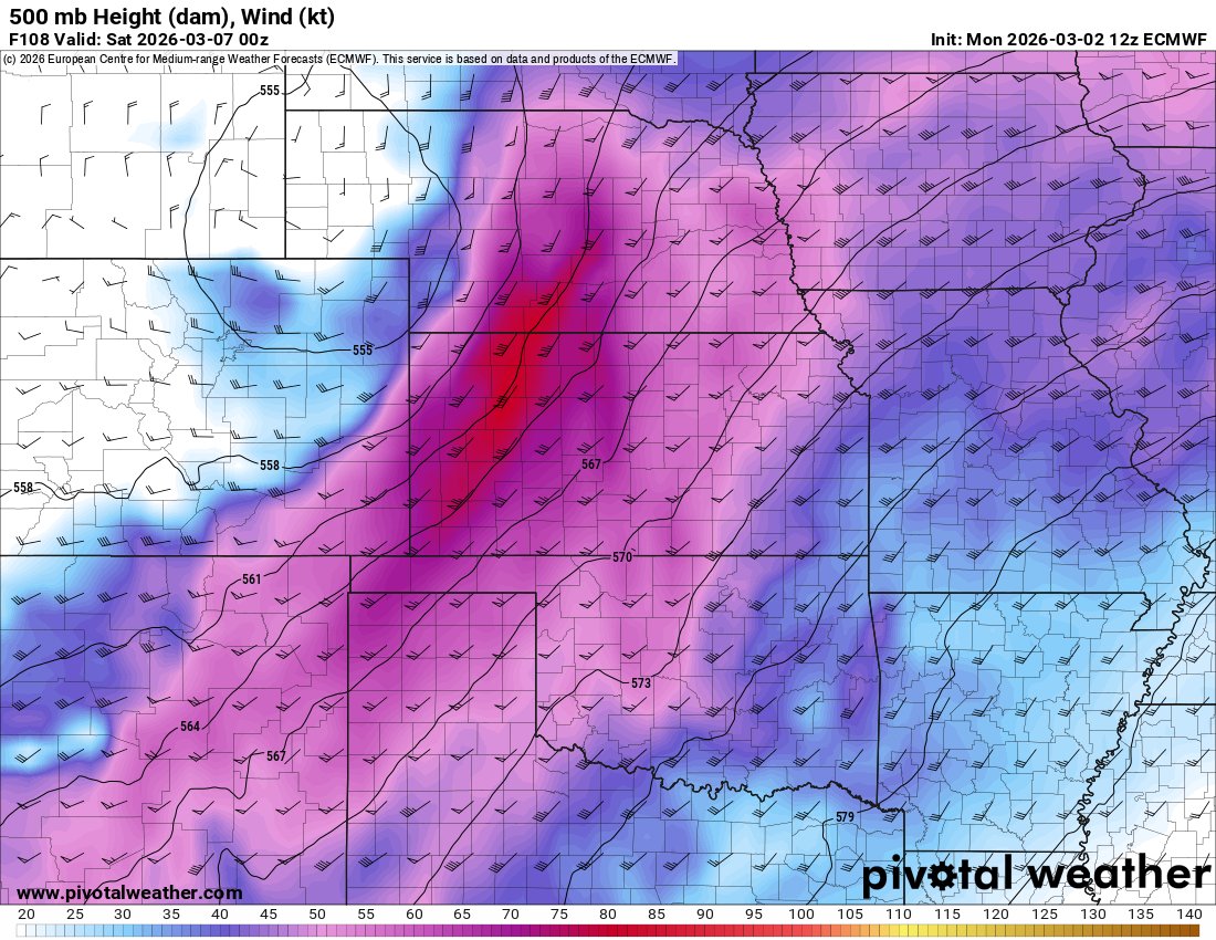
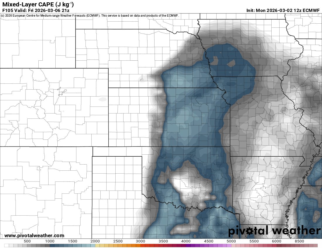
StormNet currently has the greatest tornado confidence in southeast/east OK
English
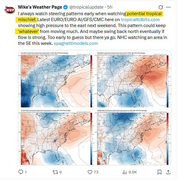
The 12z ECMWF initiates discrete convection on Friday across the dry line and along a upper level wave in Oklahoma.
Wouldn't be surprised to see more sloppy convection in SE OK while areas north into Kansas see more discrete activity.
Tornado threat picks up around 00z w/ LLJ

English
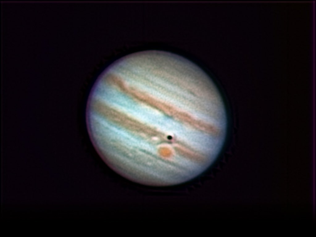
@AJamesMcCarthy What modifications do you do for solar viewing?
English

Telescope view of Jupiter tonight
This is the same telescope I use to photographed the Sun, just without the modifications to make it safe for solar photography
English


English

@Augustus_1814 @SolBrah when u look through a telescope at mars it looks exactly like the "planets" solbrah just posted. Stop making shit up
English

Sure man. That’s the one thing they’re telling the truth about. Spinning rock flying millions of miles per hour. Give more money to NASA for their CGI renders. Give me a break lol
English


Second update;
I haven’t sifted through every comment yet, but we’re making fantastic progress!
If you see your county still white…comment it!
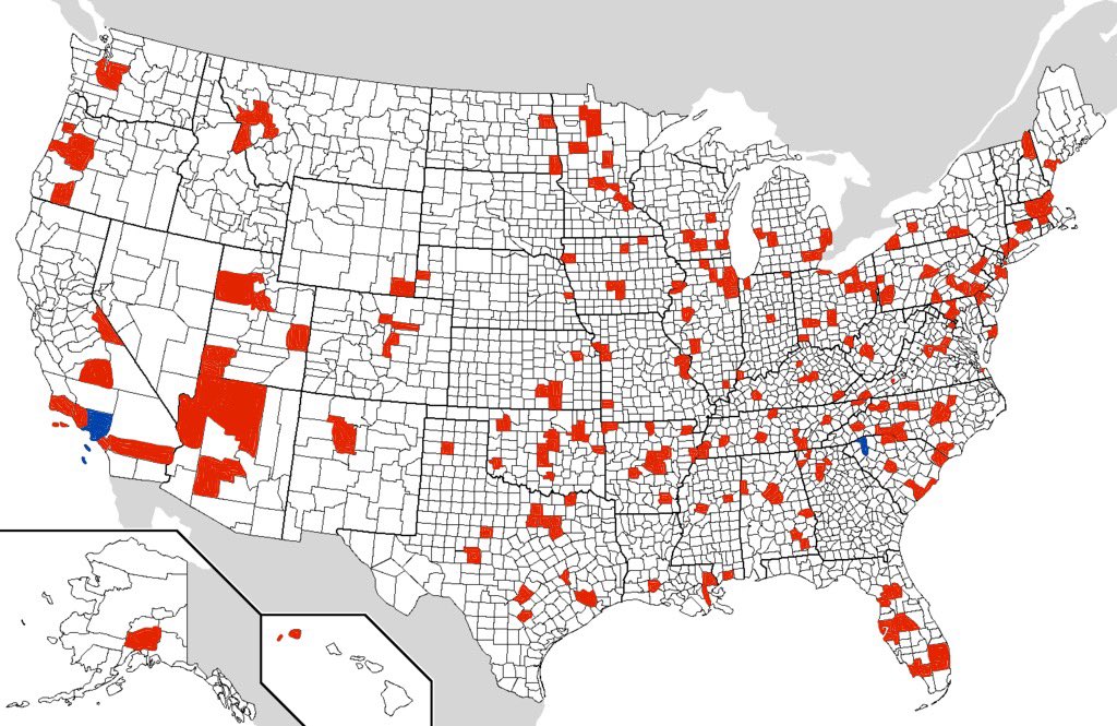
Brody Cowing@Brody_wx
First update; Attempting at a social experiment…if you don’t see your county highlighted in red, comment it!
English
@iMeganCorp @SuePearFL No, notice how those only appear once in the future radar. They’re just issues with Accuweather’s radar prediction.
English


@PettusWX Could be this but they didn’t include any observations in the warning x.com/kristin_mae/st…
Kristin Mae Photography@Kristin_Mae
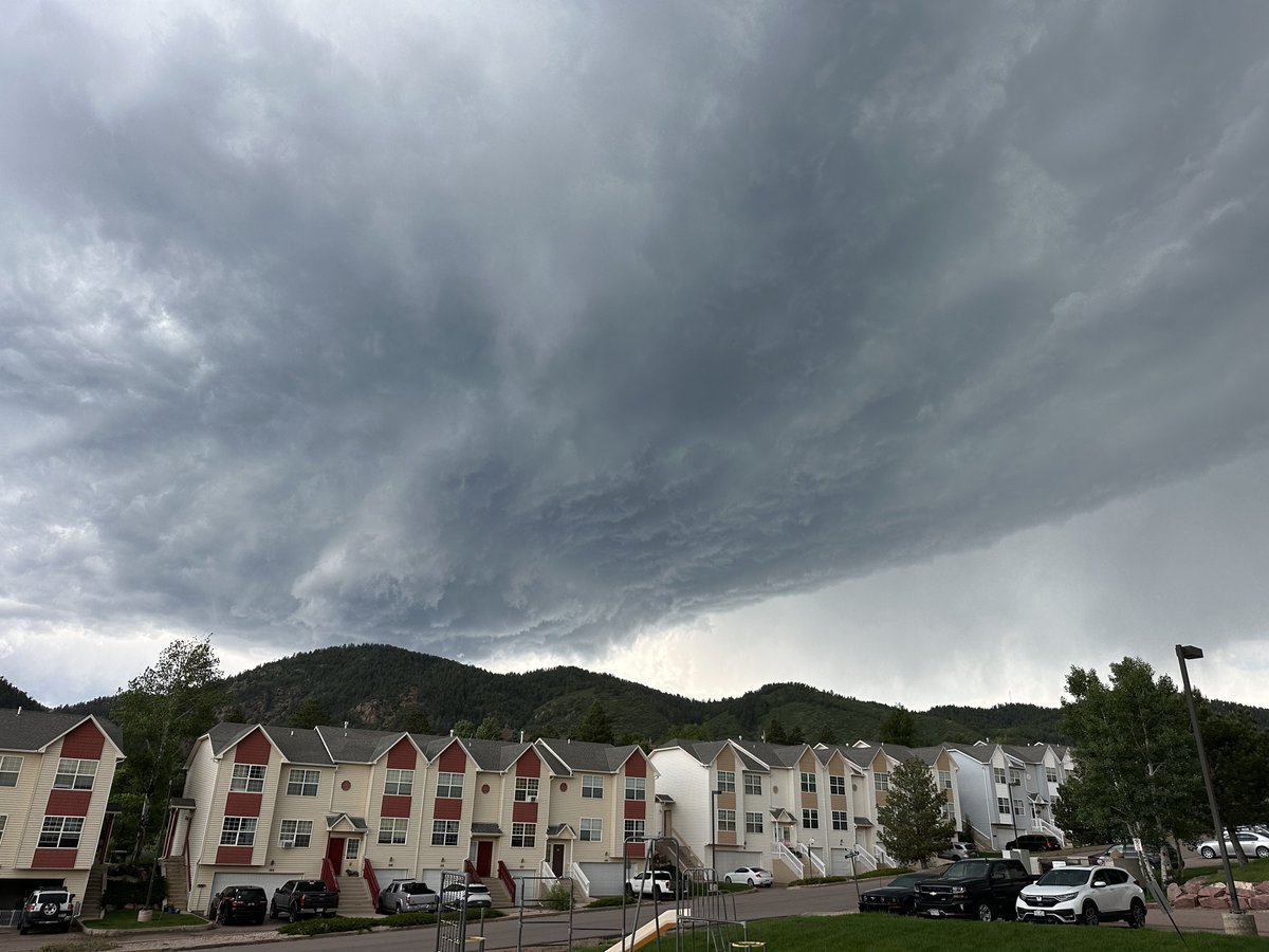
My husband recored this crazy spiraling cloud vortex just about an hour ago above Fountain, Colorado. 😎 I can’t believe I missed this. #COWX
English


@ChrisHallWx @NWSPueblo 🧐 Is this how you felt about the Whitman NE 2024 unwarned EF4? hmmmmm?

English

@WxFront Awesome! With every update, I get closer to exclusively using WeatherFront over other apps on my phone
English

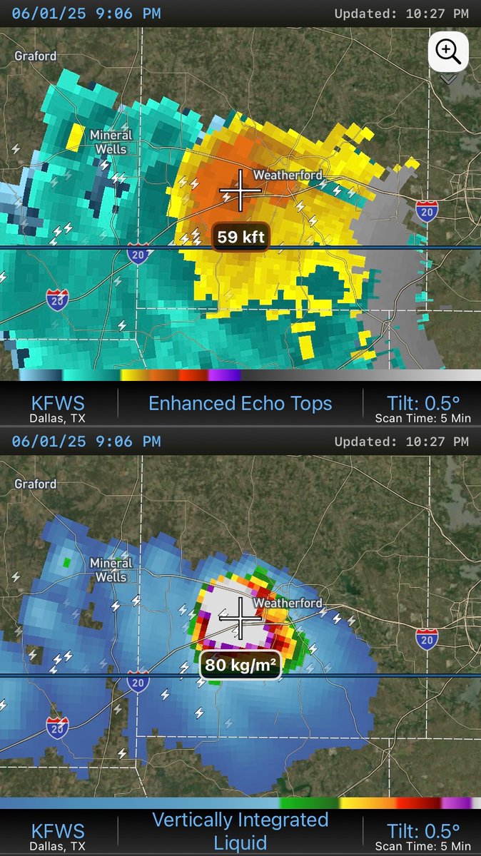
🚨 Another new update just dropped! 🚨
WF v1.4 includes the following new features inspired by user requests:
📡Enhanced Echo Tops
⛈️Vertically Integrated Liquid
🗓️Annual Subscription Option
In the weeks and months ahead, we’ll be working to implement other frequently-requested features so that WeatherFront can serve you for ALL seasons:
🌀Tropical Products & Models
🔥Fire Weather Tools & Visualizations
🌨️Radar Precipitation Type Depiction
Want other items added? Let us know by commenting below or sending an email to support@wxfront.com.

English
EpicLavaCarpet retweetledi
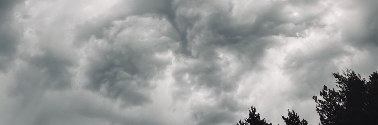
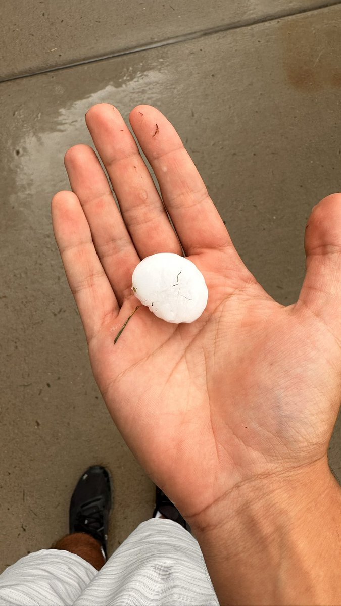
Stay weather aware today! Severe thunderstorms will be possible shortly after 1 PM along the I-25 corridor and as early as 3 PM across the eastern counties. Large hail and damaging winds will be possible. An isolated tornado risk exists near the CO/KS border. #cowx

English