Day 6 of the #30DayMapChallenge - Raster.
I made this animation showing the excessive rainfall from Storm Boris last month in Europe, using precipitation data from Nasa
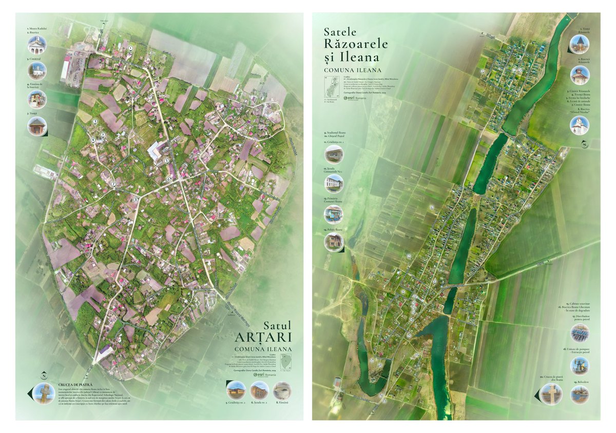
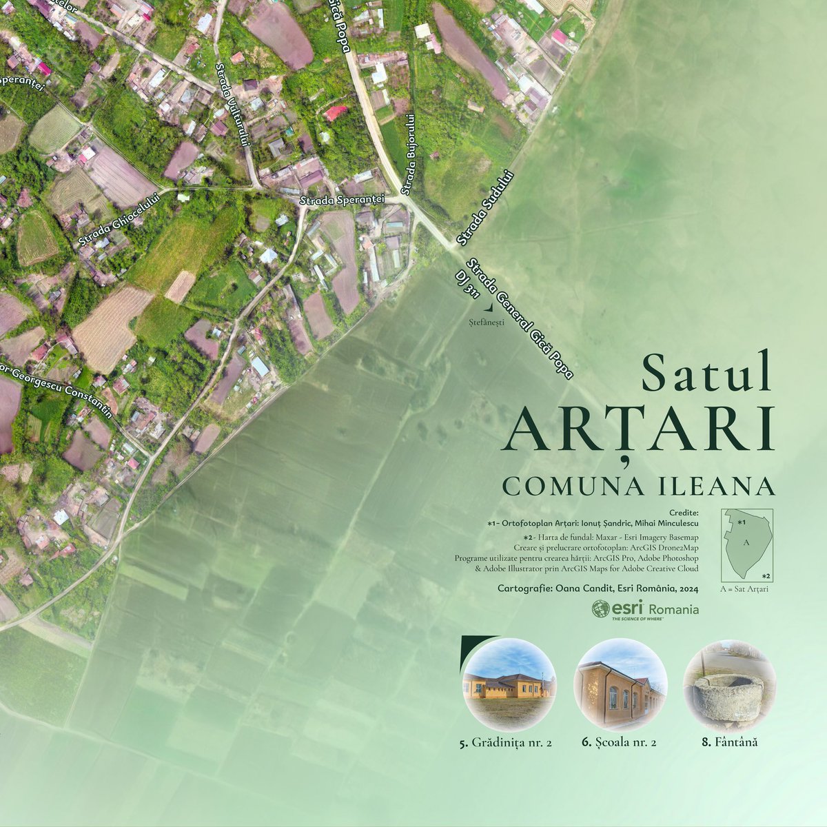
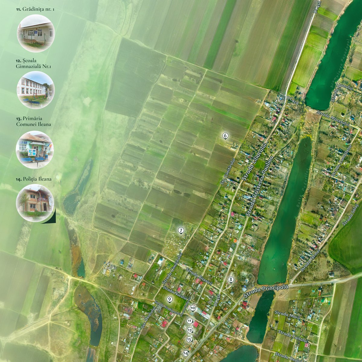
My talented colleagues Ionut Sandric and Mihai Minculescu from Esri Romania created these new and beautiful orthoimages. Using these datasets I used ArcGIS Maps for Adobe Creative Cloud to design a pair of maps showcasing two rural settlements in Romania.
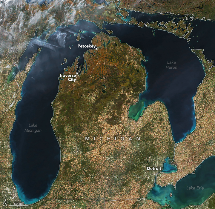
I am biased. But this is a beautiful satellite image of almost all of my favorite places (many not labeled).
Even where imagery suggests a rather drab landscape, things are quite fallish in the Lansing area.
earthobservatory.nasa.gov/images/153502/…
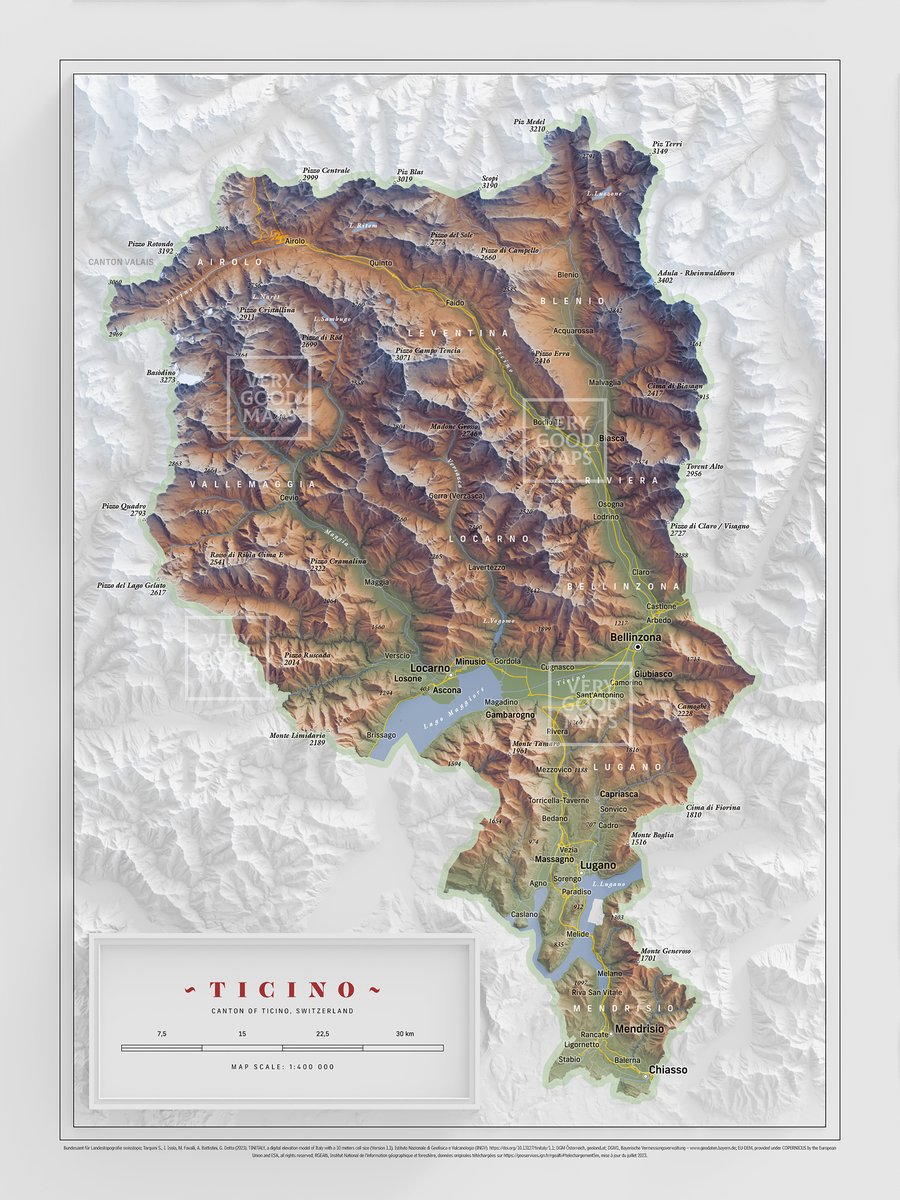
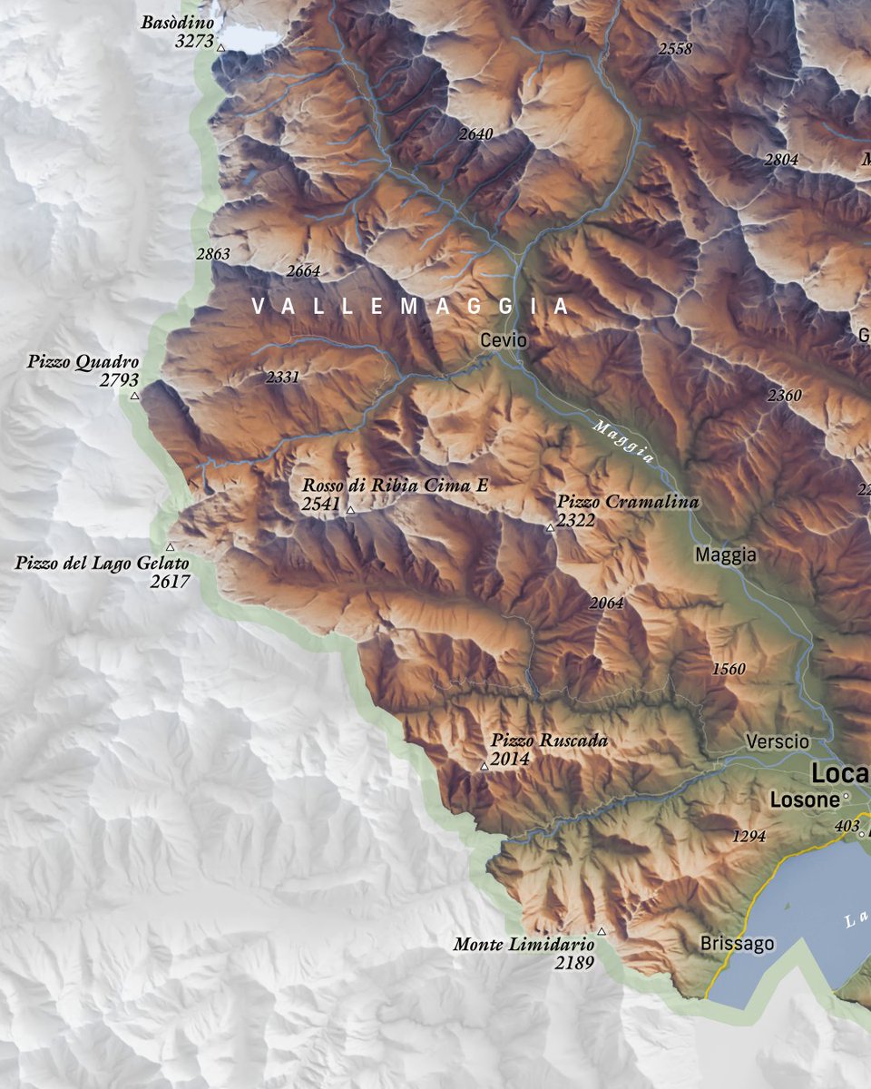
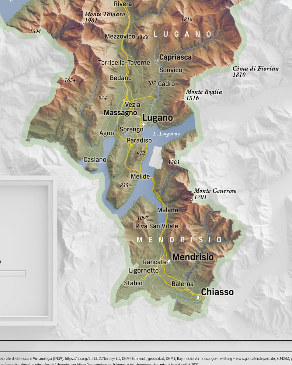
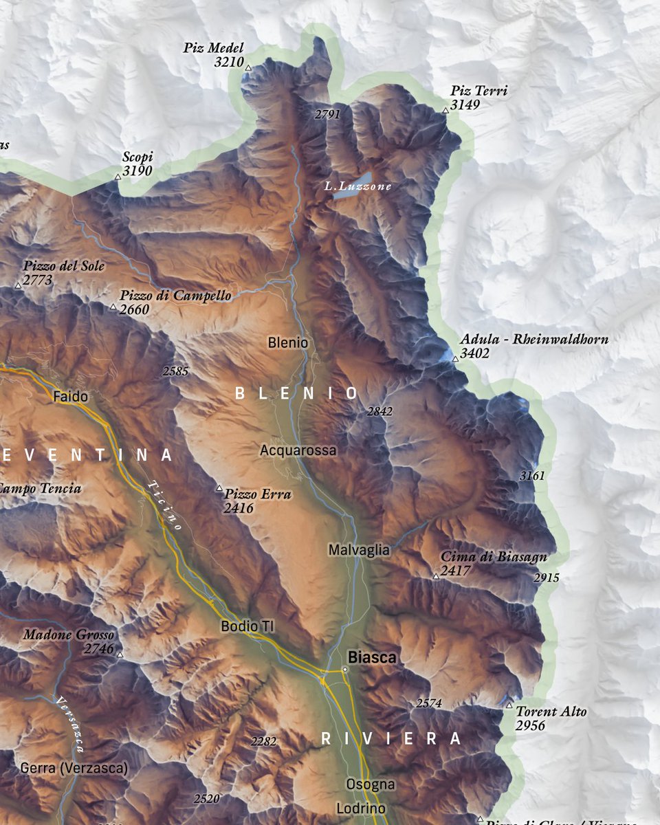
Canton of Ticino, Switzerland. I've noticed that typography is usually the one thing that bothers me about modern cartography. There are many nice maps out there but typography is usually meh. Personal opinion of course. #Switzerland#maps#cartography
@pokateo_maps@RockRobotic This happens all the time for me. Probably the worse was when they added their own title to my map 😂 and didn’t ask for permission. I usually just look the other way.
So I was doing my monthly search of what the heck is the diff b/n projections & coord sys, and I found my own map on @RockRobotic's website. Fortunately my name is in the graphic, but they didn't ask permission to use it. What would you do, if anything?
learn.rockrobotic.com/map-projection…
A bit late, but hope everyone had a joyful Mid-Autumn Festival! And of course, that means mooncake-shaped maps! 😅
The 6 places I've called home:
Echo Park | Hacienda Heights | Berkeley
Torrance | Sugar Land | Ottawa
Online version: tabsoft.co/3NcgK5a
@g_fiske Was the video filmed at Cape Cod? There’s an Olive Ridley sea turtle on my local aquarium’s live cam. He is basically an orange cat in a sea turtle body and is up to no good whenever he is awake lol m.youtube.com/watch?v=BLvr4K…
When you accidentally delete your whole demo 4 hours before a webinar, and so try to convince yourself that it will be a great anecdote for how creating beautiful maps doesn't have to take days.
Anywhoo, see if I rebuild it in time > go.carto.com/visualizing-ma…
#MapPromptMonday | Week 1: Region(s)
Did you know...that 80% of greenland consists of an ice cap and glaciers?
Data Source: lnkd.in/gsFdGQ5B
Tools Used: ArcPro, Photoshop, Illustrator
#gischat
@professorkao I had everything booked and approved! But with high Covid wastewater numbers, my partner and I made the decision to not go 😊 maybe next year!
Is there any beauty in chaos?
Rivers, meanders, water, vegetation, tundra & fire 🔥 Far, very far in the Arctic the wildfires situation continues being worrying. This one is only one of the many currently ravaging the region. 🔉🔊 on
#Copernicus#Sentinel2 2024-11-07