OpenStreetMap Alba / Scotland

615 posts

OpenStreetMap Alba / Scotland

OpenStreetMap Alba / Scotland

@OSMScotland

Katılım Mayıs 2011
1K Takip Edilen1.1K Takipçiler
OpenStreetMap Alba / Scotland
OpenStreetMap Alba / Scotland@OSMScotland·
Very late notice, but some of us are meeting in Diggers aka. Athletic Arms. this evening. We might resolve loc_name vs. alt_name Should be around from 7:30
OpenStreetMap Alba / Scotland tweet media
English
0
1
0
167
OpenStreetMap Alba / Scotland retweetledi
John Robson
John Robson@johnrobson87·
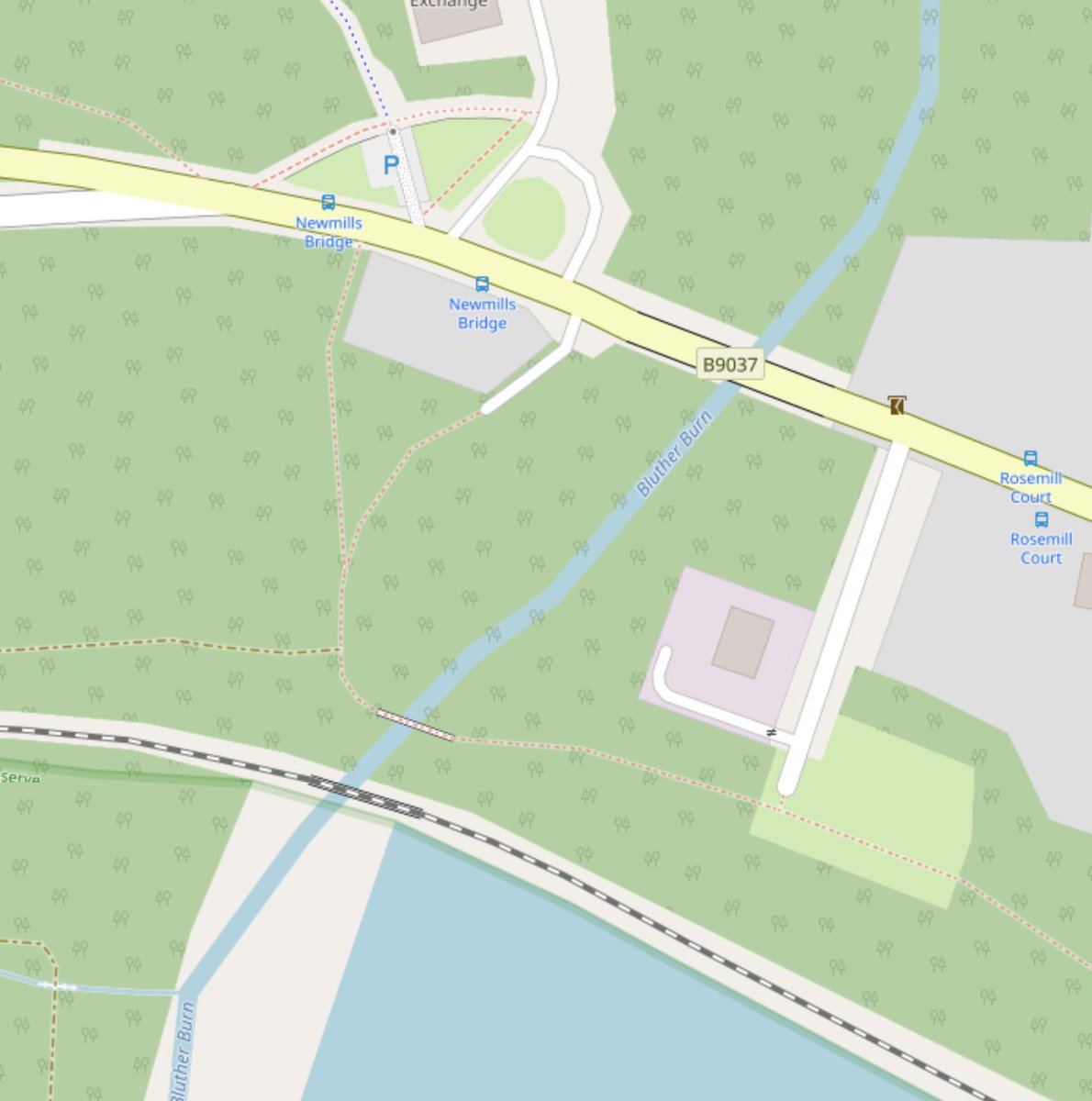
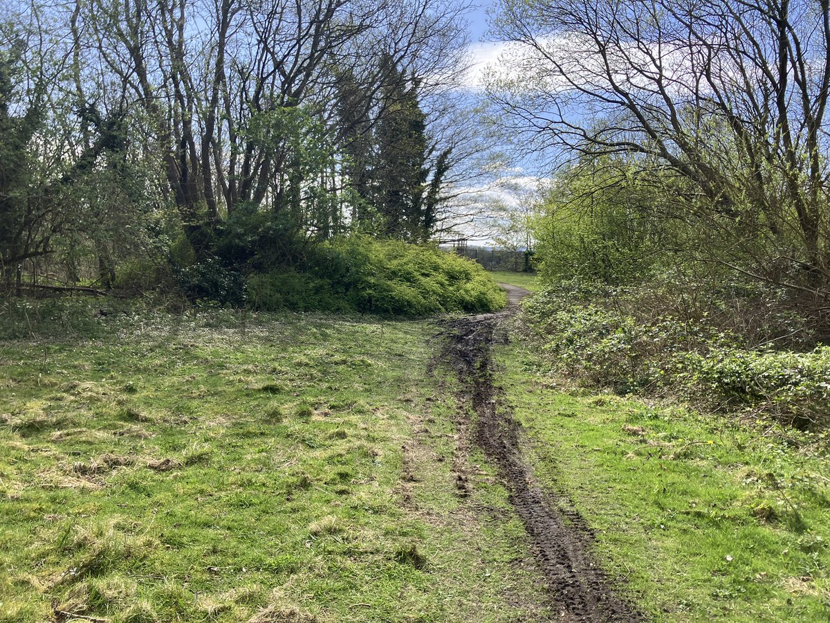
Twitter #HiveMind does anyone know the story of this path in Valleyfield Fife. Crosses the Bluther Burn then just stops even though indicated as a connection on @OSMScotland? Seems like a good missing link avoiding the main through road. @CyclingEdin @SpokesLothian
John Robson tweet mediaJohn Robson tweet mediaJohn Robson tweet mediaJohn Robson tweet media
Stirling, Scotland 🇬🇧 English
1
2
2
914
OpenStreetMap Alba / Scotland retweetledi
HaxRob
HaxRob@haxrob·
Andres Freund, the principal software engineer at Microsoft who discovered the xz backdoor really does deserve a big pat on the back. 👏 The outcome could have been much, much worse.
thaddeus e. grugq@thegrugq

@ResidentMemer The end game would be the ability to login to every Fedora, Debian and Ubuntu box on the internet. If it isn’t a state actor it should be…

English
44
1.1K
10.2K
2.1M
Highland Cycle Campaign
Highland Cycle Campaign@highlandcyclist·
For nearly 30 years the HCC has been campaigning for a safe route around the Beauly Firth. Now, at last, the section from Dunballoch to the Kiltarlity road junction ( Brockie's corner ) has been provided. Read our update from Ged Church. highlandcyclecampaign.org/beauly-inverne…
English
4
8
27
1.2K
OpenStreetMap Alba / Scotland
OpenStreetMap Alba / Scotland@OSMScotland·
@highlandcyclist Hi, is this the location of the cycle path - continuing from the other one, along the west side? As we can add it to our map. #map=15/57.4686/-4.4617&layers=C" target="_blank" rel="nofollow noopener">openstreetmap.org/directions?eng… If there's any other cycling infrastructure missing from the map feel free to tweet us or add a note to the map. ^M
English
1
1
2
136
Lewis Michie
Lewis Michie@LewisMichie0·
Temporary barriers are set to be installed to prevent drivers attempting to drive down a set of steps in Edinburgh. Some claim their satnavs are routing them across a pavement towards Greenside Lane. My report for @STVNews youtu.be/-rhOX-3w058
YouTube video
YouTube
English
2
0
2
618
OpenStreetMap Alba / Scotland
OpenStreetMap Alba / Scotland@OSMScotland·
A lovely note left by a blind OpenStreetMap user asking to add missing tactile paving and crossing information. In the end their daughter had added the info using @StreetComplete Great motivation to keep on adding these details. #map=18/55.94422/-3.19647" target="_blank" rel="nofollow noopener">openstreetmap.org/note/4093733#m
OpenStreetMap Alba / Scotland tweet media
English
1
9
17
994
oli
oli@oliphantly·
Apart from @scottechclub and perhaps Meetup what are the best newsletters / directories of startup events in Edinburgh?
English
2
3
2
736