Sabitlenmiş Tweet
Kevin
9.2K posts


If you would like to know if you will get snow tomorrow night, i will answer that! Send your town/city/county and drop a like and ill respond with your chances! (within reason)
GIF
English
Kevin retweetledi

The latest MOGREPS snow risk for Wednesday night has a broad swathe across the south, pockets of higher probability are definitely present over higher ground, i.e. over Dartmoor. Lack of any real 'definition' in this probably means there's still a fair amount of uncertainty.

English
@KennybillyO @Adasu_d_gr8 You are right!! That’s why Jesus died for sinners who have faith in Him :)
English

Stop normalizing premarital sex. It does not matter how the society paints it.
It does not matter how much you enjoy it.
It is not normal.
It is immoral
It is wrong,
It is a sin.
English

@LondonSnowWatch Woken up to not a single flake
Just windy and cold 🥶
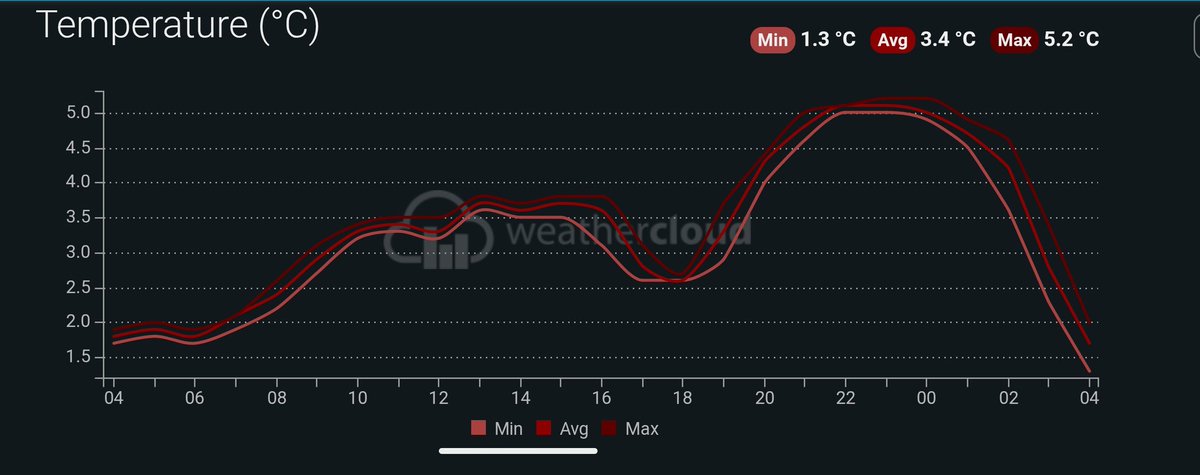
Temp 1.8C
Dew point 1.1C
Saint Albans, East 🇬🇧 English
My temp and dew point are heading in the right direction 📉
As the upper air temp continues to drop and patchy precipitation continues to pass through, I'm still hopeful for a little falling snow over here during Friday morning
Sᴏᴜᴛʜᴇʀɴ ᴇɴɢʟᴀɴᴅ ᴡᴇᴀᴛʜᴇʀ@LondonSnowWatch
Snow forecast Large blue shading: settling mainly favoured for higher ground but during heavier pulses of precip, evaporative cooling will allow snow to fall to lower levels & some settling Other areas self explanatory Winds: 50-60mph south coast & the sw. Up to 90mph far sw⚠️
English

@OfficialKevWx Luton/Letchworth areas NW/N parts of the county will have the greatest risk of backedge snowfall resulting in localized accumulations. Less chance Watford/M25 boundaries closer to London - where any falling wet snow on the backside will have less chance to accumulate.
English
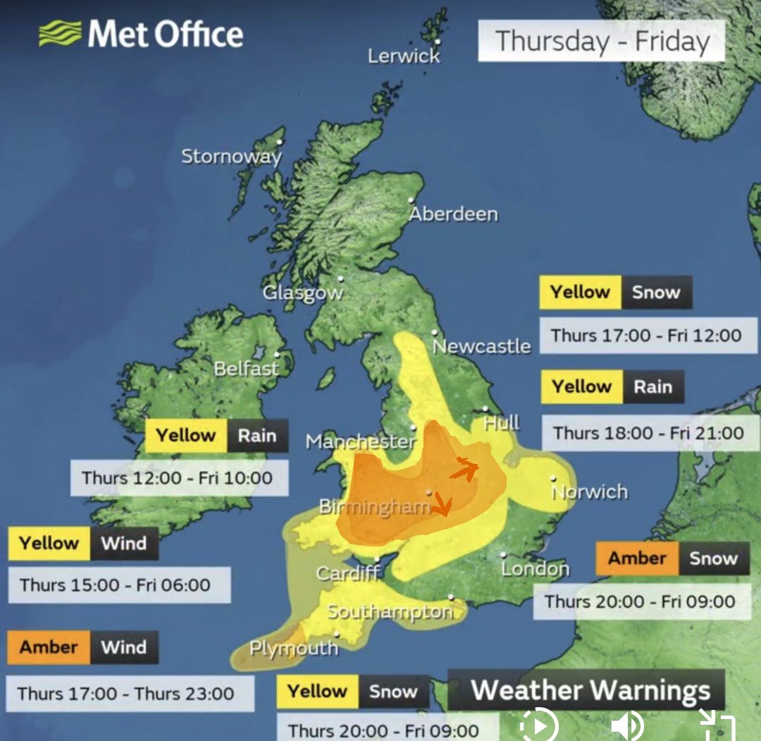
Slight shift in model guidance with some firming up on slight S shift and broadening and a continued strong signal further E. I have highlighted where I think the amber could be broadened. This is not a Met Office forecast but an annotation showing where I think the expansion of amber could plausibly occur.
English
@LondonSnowWatch @wanstead_meteo It took a good hour of heavy snowfall before it started settling here that evening. Although I am only at 280ft
English
@wanstead_meteo I think I see it much more regularly because of my elevation. 4th Jan last year was the last time for me
English
In all these years, if I had a quid for every time some genius tells me the snow won't stick because its rained first, I'd be currently on a luxury holiday buried in snow 😁
English
Kevin retweetledi
#StormGoretti will track across southern England tomorrow bringing strong winds, snowfall and rain. The main area of accumulating snow looks to be over parts of Wales and into the Midlands. Very strong winds look to affect the SW, gusting up to 80/90 mph in exposed areas.
GIF
English

🚨 WILL YOUR AREA SEE SNOW | FIND OUT HERE
✅FOLLOW this account
✅RETWEET so others can get involved
👇🏻Comment your town below
I will respond as follows
❌= Rain or no snow
❄️ = Snow possible / uncertain
❄️❄️ = Snow likely
❄️❄️❄️ = Significant snow likely (>5-10CM)
GIF
English
@LondonSnowWatch Was a very fun midnight walk in St Albans! A couple inches settled in the park before the rain hit
English
Talking of messy ones...
A year ago this evening, we had a battleground with rain ➡️ snow ➡️ rain
The snow part was mainly higher ground and was all gone by morning
But always nice to get my crunch on


English
Kevin retweetledi

There are 3 broad scenarios for the low 8th-10th period. I've gone through all the ensembles (a total of 122 members!) I could find and classified all the members into these, as you can see in the graphic below.
Models currently favour the ECM scenario - low through the Channel.

English
Band of sleet turning to snow now moving into London (and surrounding areas). Precip type will vary locally, though most areas should see at least some snow.
Dusting - 3cm possible, though C London will struggle to settle.
Enjoy for all those awake!
English
Kevin retweetledi
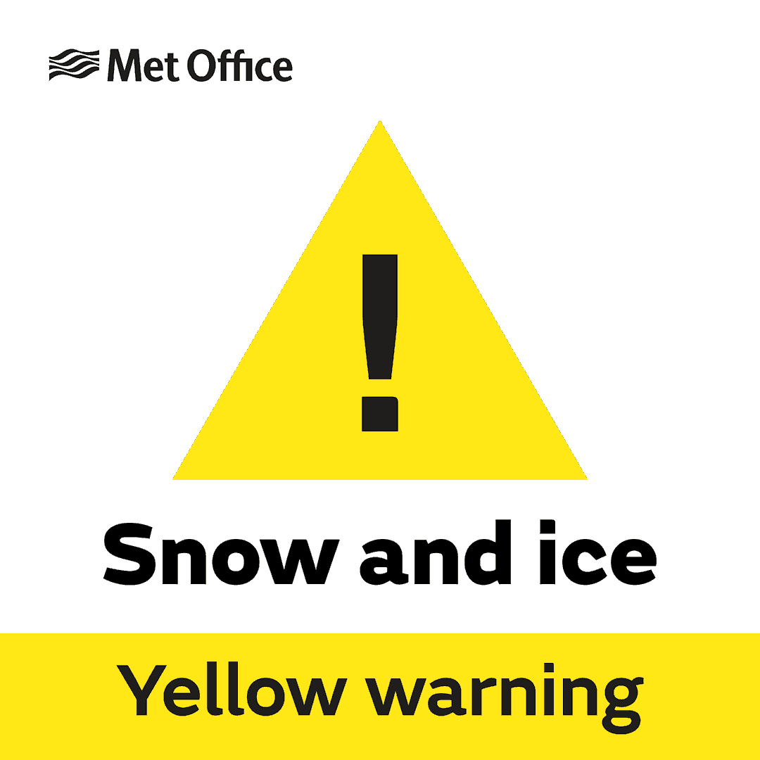
Yellow warning of snow, ice affecting London & South East England metoffice.gov.uk/weather/warnin…
English
@TheSnowDreamer Wonder how similar the timing is to when it went cold earlier this year. I do recall a bit of a snow event here around the 4th of Jan?
English

The momentum seems to be shifting to more marked cold to end 2025 and start of 2026. With increasing chance of wintriness.
Ultimately this does not deviate from my original thoughts. It feels like winter now and it will stay that way, but real winter could well be on the horizon.

English


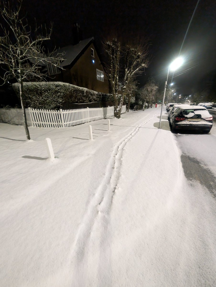
Just starting to turn to wet snow in Caterham-on-the-hill in NE Surrey
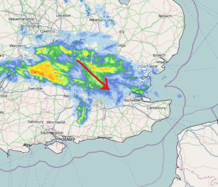
Nick's Weather Eye@NickJF75
Latest radar from Netweather.tv showing precipitation turning increasingly wintry to the north and west of London, Chilterns & Cotswolds standout with snow falling, but recent reports suggest snow has been falling at lower levels too, e.g. Northampton & Milton Keynes
English
@TWOweather As I left St Albans for work this morning, it was starting to settle on grass and cars
English

This was a decent call! It's snowing heavily here at the moment and even starting to settle. I'd imagine there's a decent covering at higher points in the Chilterns.

The Weather Outlook@TWOweather
FWIW, I’ll be disappointed if I don’t see at least a few flakes of snow tomorrow morning. Whether anything settles is another matter. Haddington Hill could be one of the better spots in the London/Home Counties area. nationaltrail.co.uk/en_GB/attracti…
English