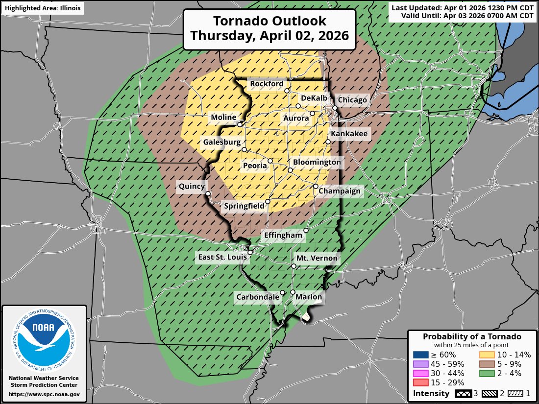
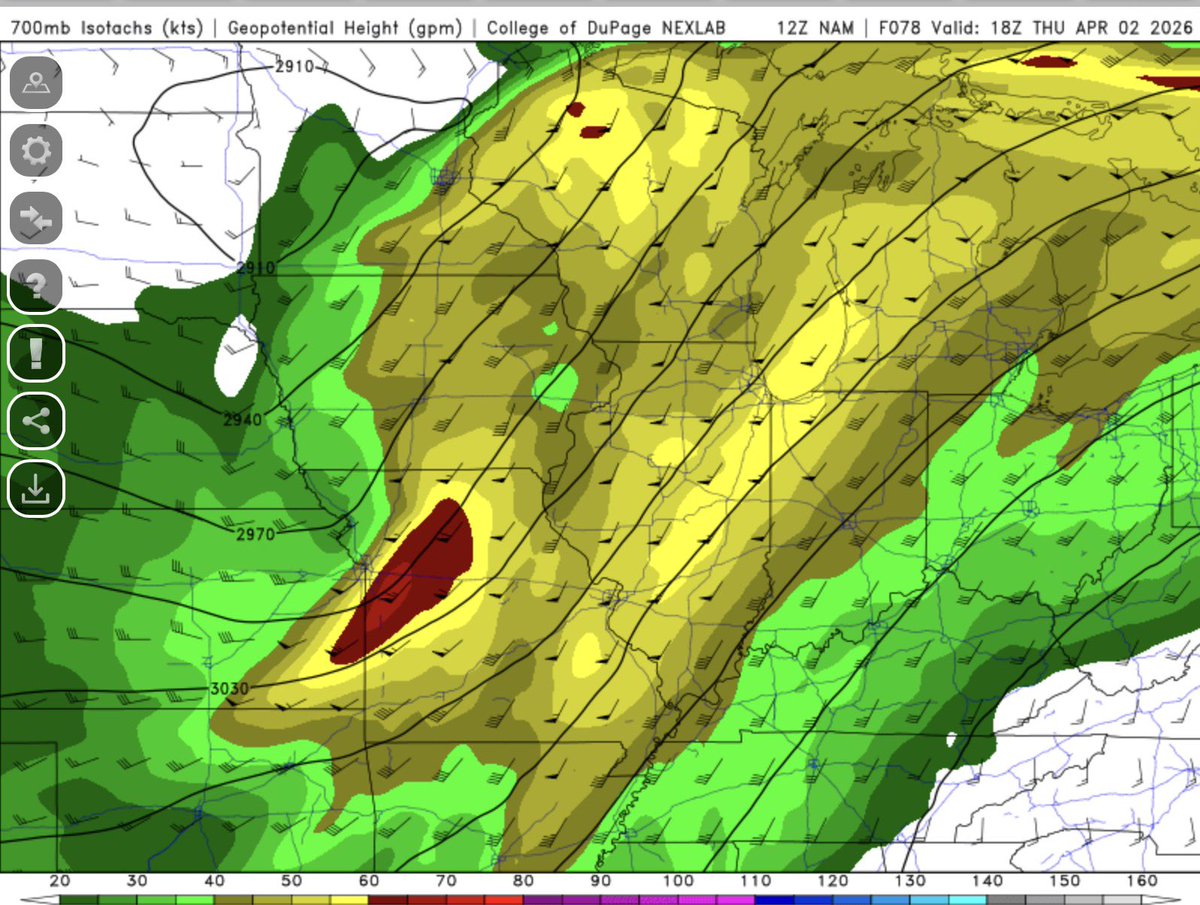
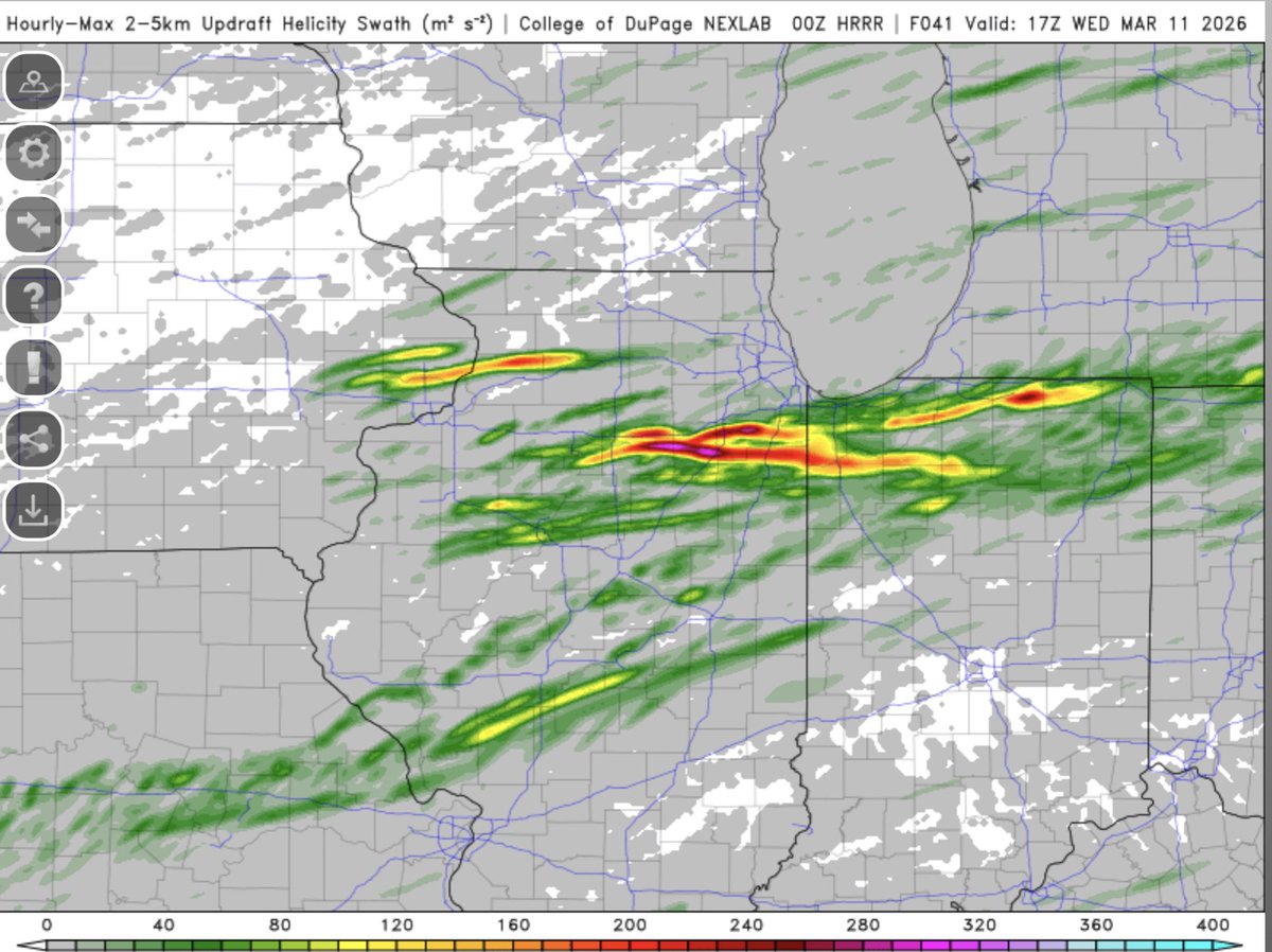
Going to be a busy day tomorrow as the storm prediction center has introduced a level 3 Enhanced risk upgrade for the majority of northern and central Illinois. A couple strong tornadoes are possible with significant wind gusts potentially up to 70+mph. As usual question marks still linger if we actually destabilize correctly after morning convection. #ilwx
Huge change in the forecast for this upcoming weekend ❄️ A major snowstorm is expected to move in late Friday night and last all day Saturday in the Midwest.
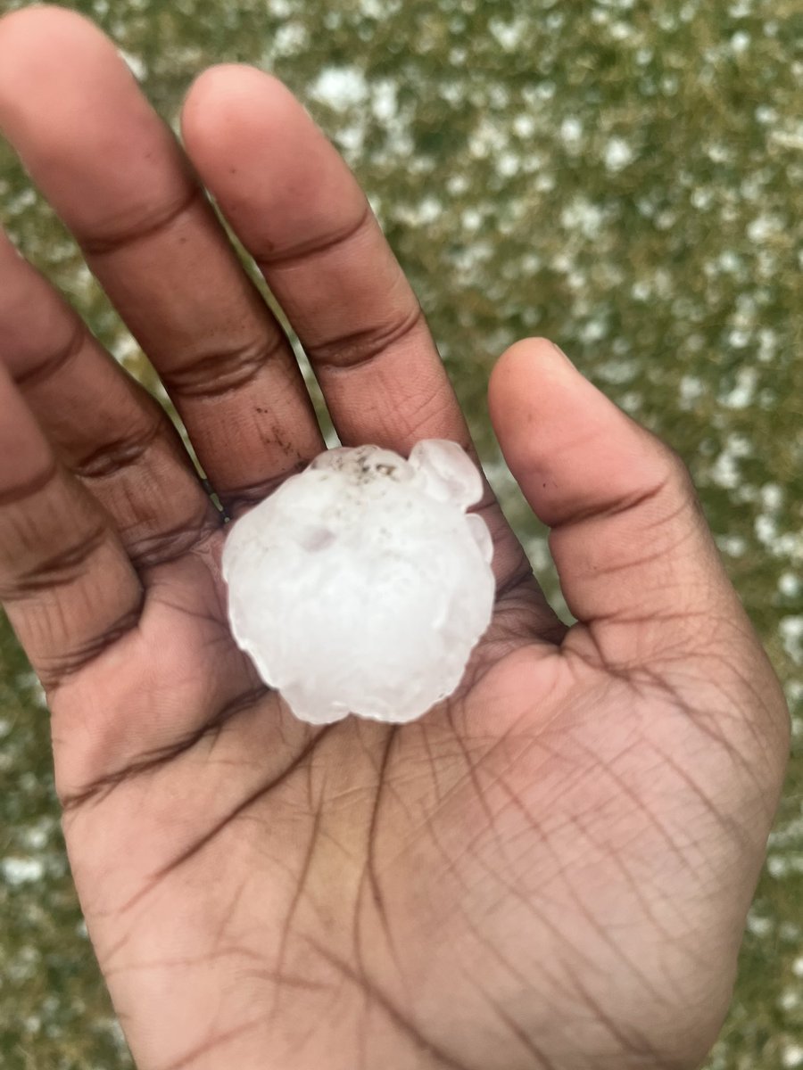
Storm tracking the Lake/Cook county line likely building some small hail will track east thru 10:30PM before rolling out onto Lake Michigan
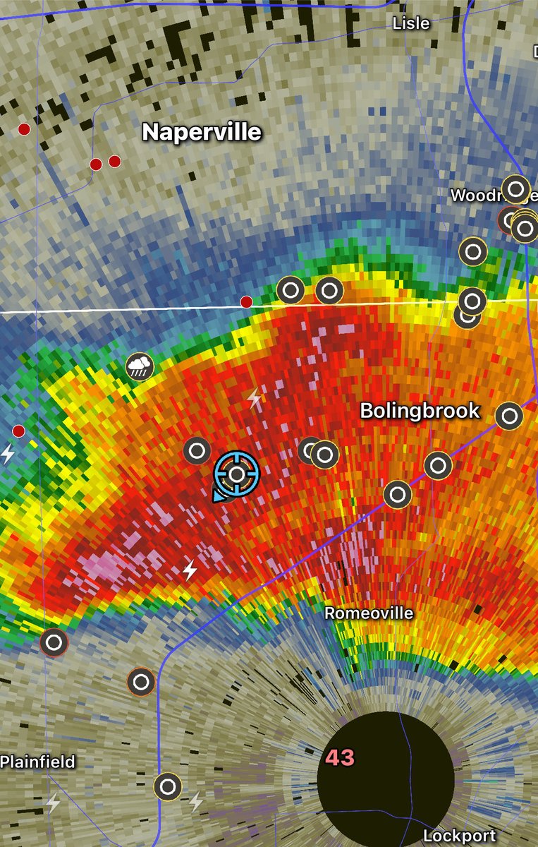
No warning … yet
@RFDSurge Very different setup than Kankakee 3/10. Definitely some similarities with the placement of the warm front and amount of shear, but the dynamics of the system are very different and will yield different results
If you're seeing this on the 15th/16th of March, this is a sign! Tonight, while you sleep EVERYTHING in your life is about to change. Your life will instantly be 100 times better! Do NOT risk the skip, because when you wake up you'll have a message on your phone. The one you've been waiting for is ready.
type '777' to claim!!
If you're seeing this on the 12th/13th of March, this is a sign! Tonight, while you sleep EVERYTHING in your life is about to change. Your life will instantly be 100 times better! Do NOT risk the skip, because when you wake up you'll have a message on your phone. The one you've been waiting for is ready.
Put '999'!!!
@RFDSurge@NWSChicago Hello , I hope you are fine . I am a journalist with a London based news agency . Is this your video ? We would like to use it for our coverage and to distribute it with our media partners with Credit to you . Can you please follow me back for DM . Thanks
@RFDSurge That's a lot of hail! May AccuWeather have your permission to use this video with credit to you on all platforms of @AccuWeather and its affiliates?
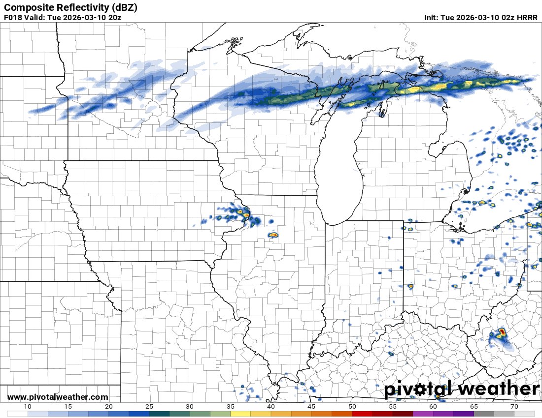
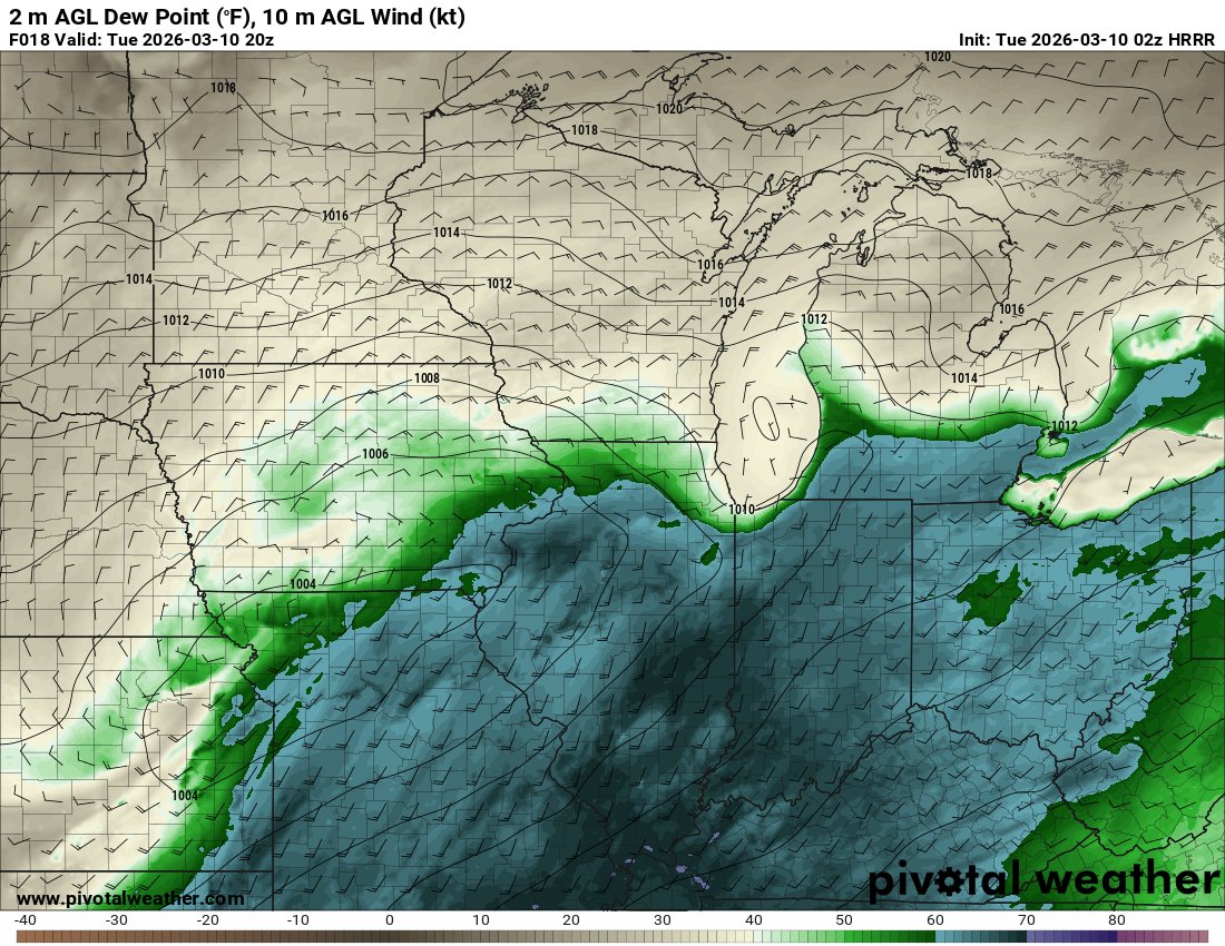
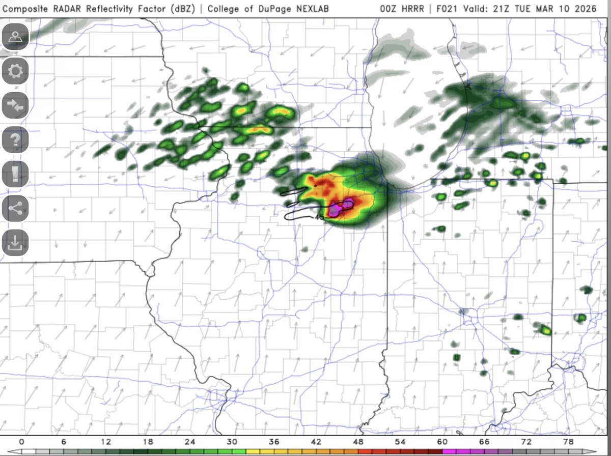
2z HRRR continues the trend of first storms developing around 2-3pm near I-80 west of Ottawa well into the warm sector. This storm has a very favorable environment for tornadoes and large hail over the next couple of hours as it tracks east. #ilwx