Sabitlenmiş Tweet

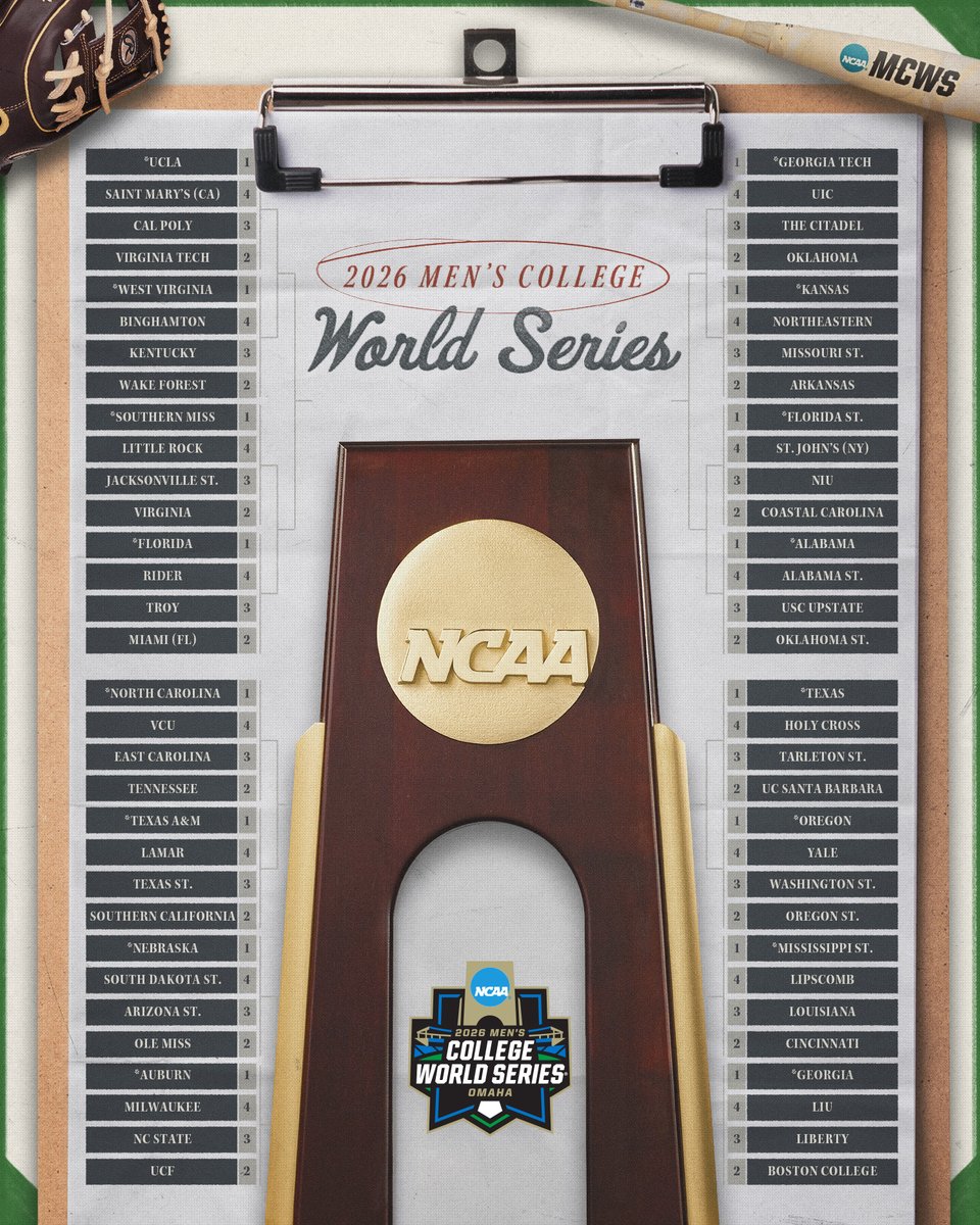
There’s something special about baseball. x.com/BBGreatMoments…
English
SoCal News Now
223 posts

@SoCal_NewsNow
Southern California Sports, Music & Entertainment News [email protected]

.@TromblyTribe 17u's Nick Davis (@NickDavis2009) collects his second hit of the game with a double down the third baseline. #FiveToolHitting Brea (CA) 2027 #uncommitted Profile: fivetool.org/players/fb0d52…

Followers — hope everyone is closing out spring on a good note and looking ahead to summer. I’ve been deep in @intouchLiveHQ work lately, and next week we’ve got @TahoeWeather on the podcast. We’ll get into @OpenSnow, AI in forecasting, app tech, and yes… the “Godzilla El Niño” hype cycle that’s absolutely running wild right now. So let’s talk about it — because the narrative online has gotten way ahead of the physics. 🌊 Summer 2026 Outlook: Cutting Through the El Niño Noise Seeing a lot of: “El Niño = locked-in summer pattern” “SoCal hurricane risk spikes dramatically” “historic outcomes are guaranteed” That framing is clean, viral… and mostly misleading. It’s trending toward what I’d call ENSO fear porn: simple, decisive, and detached from how the atmosphere actually behaves. So let’s reset expectations. 1️⃣ This is a transitional ENSO state We are not looking at a fully coupled ocean-atmosphere system. We’re in a transitional phase, where: SST anomalies are evolving, but the atmosphere hasn’t fully locked in And that mismatch matters. Because ENSO is not just ocean temperature — it’s a coupled system. 2️⃣ The Walker Circulation is the engine - climate.gov/news-features/… Under neutral conditions: Trade winds push warm water west Convection clusters near Indonesia Air rises west / sinks east That’s the Walker Circulation — the tropical overturning engine that organizes global atmospheric flow. When El Niño develops: that circulation weakens convection shifts eastward and the jet stream downstream responds But here’s the key: 👉 SST warming alone does NOT guarantee full atmospheric coupling. 3️⃣ Kelvin waves are the subsurface signal A lot of people watch SSTs. But the real “pre-conditioning” often happens below the surface via Kelvin waves: triggered by westerly wind bursts they move warm water eastward along the equator then surface later as SST warming So when people say “El Niño is strengthening,” part of that story was written weeks earlier underwater. 4️⃣ Niño 3.4 is the coupling zone that matters Most operational forecasts key off Niño 3.4 because it best represents basin-wide coupling, not local noise. Thresholds: +0.5°C = El Niño conditions -0.5°C = La Niña conditions But again — this is only the ocean side. The atmosphere still has veto power. 5️⃣ Why forecasts feel unstable right now This is the part people miss. In transitional ENSO states: model spread increases teleconnections weaken seasonal signals become noisy We can have warm anomalies without a clean atmospheric response. We’ve seen this before — including strong El Niño years that didn’t behave “textbook.” 6️⃣ What this means for Summer 2026 This is not a “locked pattern” summer. It’s more likely: high variability strong regional contrasts heat spikes followed by breakdowns and jet stream oscillations rather than persistence East: still dealing with lingering mid-latitude variability and Porlar Vortex Stretches northern stream intrusions are still on the table Southwest: subtropical ridge positioning becomes everything monsoon moisture transport could actually overperform if alignment is right flash flood + convective bursts become a bigger signal than steady heat short but intense heat-domes can appear, with moderate to strong winds, increasing brush fires. This will happen off an on, IMO, this summer. 7️⃣ Bottom line This is a coupled system still organizing itself. So expect: evolving ocean signal lagging atmospheric response high jet stream plasticity regional extremes > uniform outcomes Not a one-way “El Niño summer.” More like a volatility rollercoaster of sorts. 8️⃣ When we’ll get clarity My view: September is when the signal becomes much cleaner. By then we’ll know: if Niño 3.4 coupling is sustained if Walker circulation fully reorganizes if Kelvin wave activity is reinforcing or fading if the jet locks into a seasonal mode Until then: mixed signal + noise. 📊 For those tracking it themselves: NOAA CPC: cpc.ncep.noaa.gov IRI ENSO Forecasts: iri.columbia.edu/our-expertise/… NCEI SST Monitoring: ncei.noaa.gov/access/monitor… NOAA ENSO Blog: climate.gov/news-features/… In closing, I’ve included a map showing the current ENSO conditions and global sea surface temperatures. What stands out is that the Pacific Ocean is acting uneven right now. Some areas are running warmer than normal, while other areas—like the Gulf of Alaska—are cooler. That cooling is mainly due to more upwelling, where deeper cold water rises to the surface. We are also still in what’s called a negative PDO pattern. You can think of that as a longer-term background ocean setup that influences how the Pacific behaves overall (more context here: ncei.noaa.gov/access/monitor…). The key point is this: the ocean pattern is still developing. It’s not locked in yet, and it’s too early to draw strong conclusions from a single snapshot of sea surface temperatures. That’s why I’m not comparing this to past years yet. Those year-to-year comparisons can be misleading this early in the season. I’ll start looking at those more seriously closer to the end of August, once the pattern has had time to fully organize. And on some of the louder claims out there—like using old extreme years as direct comparisons or making very specific hurricane predictions for Southern California—those are not how these systems actually work. The ocean and atmosphere don’t follow a fixed script. This is noise folks and click bait!!! Bottom line: the Pacific is clearly active, but it’s still evolving. We’re watching a pattern form, not a finished outcome. More later this week as I take a deeper dive into other teleconnection patterns. For now, enjoy! #ENSO #ElNino #LaNina #Climate #Weather #ClimateScience #Meteorology #PacificOcean #SST #PDO #OceanPatterns #ClimateOutlook #WeatherAnalysis #cawx #california
Dana White: "Can’t stand soccer, I think is the least talented sport on earth. There’s a reason 3 year olds can play soccer."




UFC structure going up on the White House South Lawn for June 14 fight

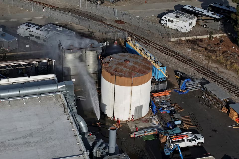
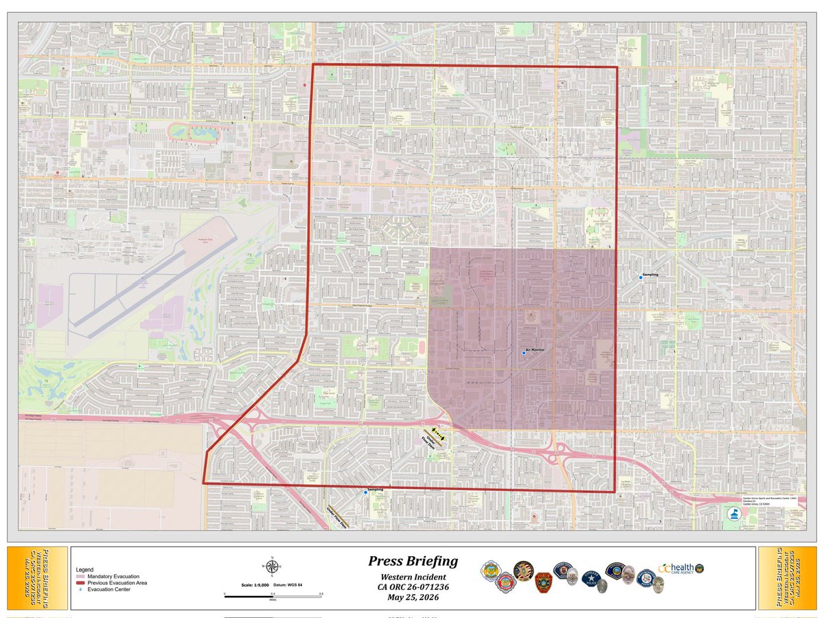
🇺🇸 California Garden Grove chemical crisis just got WAY worse: The massive tank of volatile methyl methacrylate is now over 100°F, and the gauge is completely maxed out. They’ve lost precise internal temp monitoring. 50,000 people still evacuated… Source: LA Times