An emergency network maintenance action by my provider is currently blocking access to the Tropical Tidbits webpage, estimated to only last about 20 minutes (fingers crossed).
English
Dr. Levi Cowan
11.5K posts

@TropicalTidbits
Owner/developer of https://t.co/hrCHBENMTB. PhD in meteorology from FSU. Opinions are mine alone. Follow for expert, factual, no-hype hurricane analysis


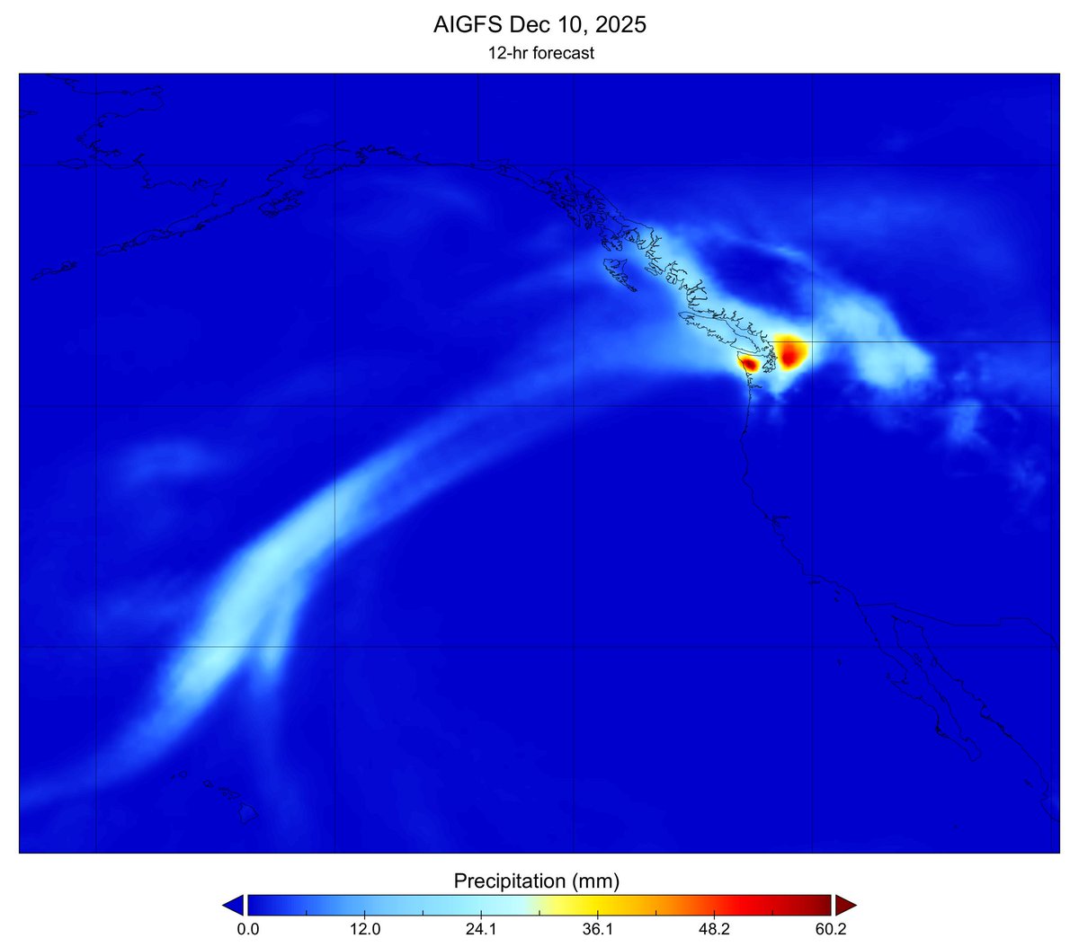
The @NWSEMC released an AI version of the GFS model and its ensemble system, based on GraphCast. This is NOAA's first operational foray into the era of machine-learning based weather prediction. Plots for AIGFS are now available on Tropical Tidbits: tropicaltidbits.com/analysis/model… I will eventually integrate some AI-GEFS products as well. Read more about NOAA's new generation of AI models here: noaa.gov/news-release/n…

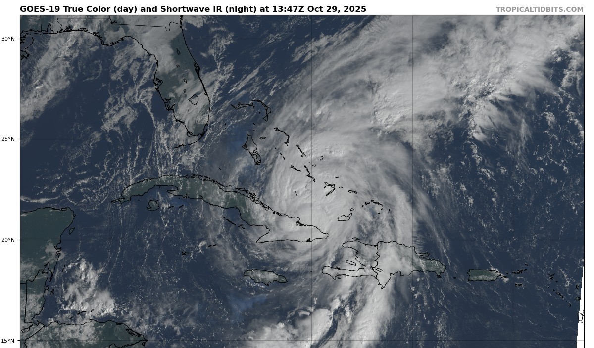
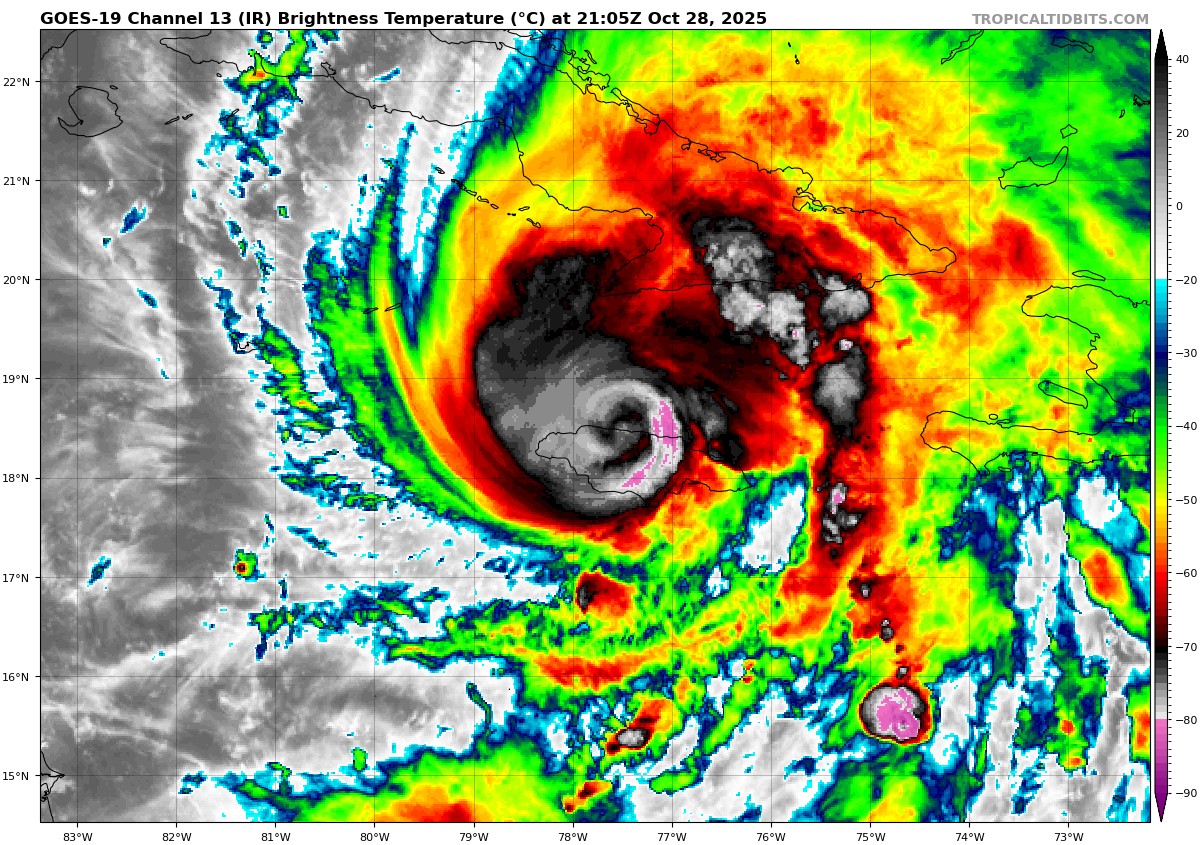
NEW: Devastating imagery from Jamaica, before & after Category 5 Hurricane Melissa. White House — Landfall point.