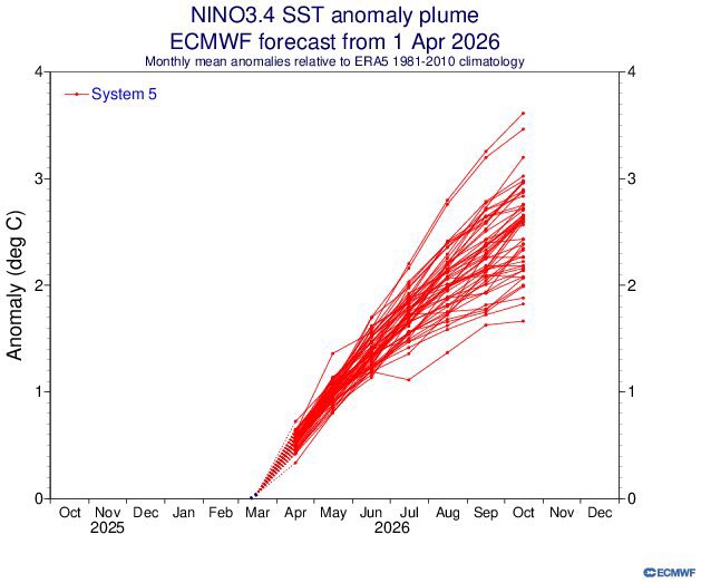
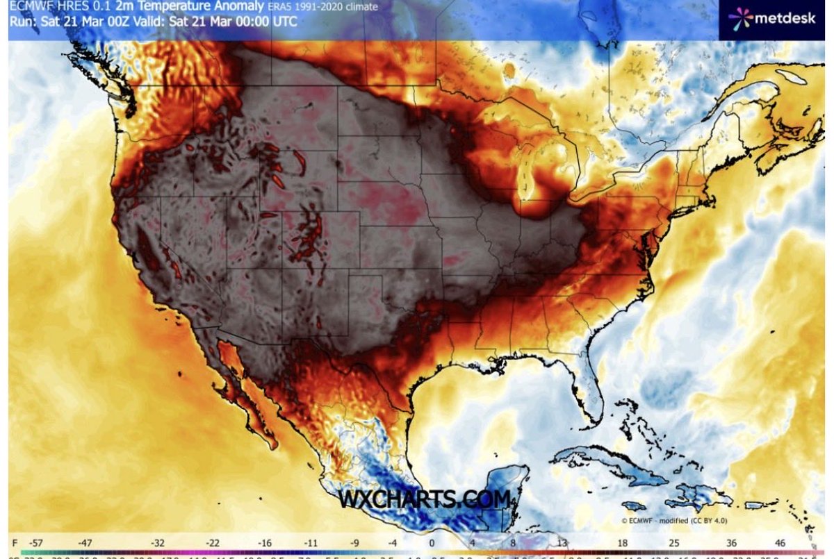
Antonio Sánchez Sánchez retweetledi

😎➡️🧣«Del verano al invierno»
En primavera es normal que la temperatura varíe bruscamente de un día para otro. Pero este fin de semana el descenso térmico será extraordinario.
El viernes será un día más propio de junio; el domingo tendrá temperaturas de febrero o marzo.
Español