Bane Sullivan retweetledi
Bane Sullivan
251 posts

Bane Sullivan
@banesullivan
archived: Twitter isn’t cool anymore, find me elsewhere visualization geek & software engineer. Helped create #PyVista.
USA Katılım Eylül 2018
235 Takip Edilen786 Takipçiler
Bane Sullivan retweetledi

If you do a lot of #numpy in your day to day scientific work, it's time to give #JAX a shot. Almost a like for like drop in replacement for numpy, with 40-60% speedups (on CPU). A short benchmark is below:
github.com/Unidata/MLscra…
English

#GeoVista by @billjameslittle continues to impress!! Fantastic demo of how #PyVista can handle global datasets with cartographic projections vimeo.com/898453869
English
Bane Sullivan retweetledi

Using GDAL for data visualization. Wherein I try to explain the difference between "imagery" and "data", with the help of two radically different pictures of the same place with the *exact* same instrument: @robsimmon/a-gentle-introduction-to-gdal-part-6-1-visualizing-data-8e6e7d6ef641" target="_blank" rel="nofollow noopener">medium.com/@robsimmon/a-g…


English

Loved seeing @billjameslittle share GeoVista for #cartographic #3D #visualization as an @SciPyConf lightning talk!! ⚡️ #PyVista #VTK


English

We've published a demo here: pyvista.github.io/pyvista-docs-d…
English

#PyVista v0.40 has arrived! So many new features to try out. My favorite: embedding #3D visualizations in #Python documentation with sphinx-gallery github.com/pyvista/pyvist…
English

@zzsylvester @BasinResearch Awesome!! What software are you using for the 3D viz?
English

Not all COGs are COGs. Learn more about Cloud Optimized GeoTIFFs and some of the challenges my team at @Kitware faced. #cog #geospatial #CloudNative #geotiff
kitware.com/deciphering-cl…
English
Bane Sullivan retweetledi

I am very honored to be featured in the 1st edition of “Geoawesome People in EO”. Thank you @geoawesomeness for featuring me 🌎
geoawesomeness.com/geoawesome-peo…
#geospatial #eo #opensource

English

@JuliusBusecke PyVista+VR is one of my longest running, yet incomplete side projects… this might just motivate to finally push it
English

Wrote up a little blog on why I created #localtileserver for #geospatial #visualization of raster data in #jupyter
link.medium.com/kFfzKSsilAb
English

📣 We’re having a "3D Visualization with PyVista" 4-hour tutorial at #SciPy this July!
We'll showcase the forefront of 3D visualization with #VTK and #PyVista — such as diving into using @Kitware's #Trame for #Jupyter and web #3D #visualization
cfp.scipy.org/2023/talk/LZPD…
English
Bane Sullivan retweetledi

I'm excited to share a first glimpse of jupyter-tldraw! This project will bring the whiteboard @tldraw to @ProjectJupyter. 1/4
English
Bane Sullivan retweetledi

and Best Practices for Communication of Project, Resources, Governance, and Culture
doi.org/10.5281/zenodo…

English

@ThomasM_geo @rafaelotinoco @IsamarCortes1 In Python? Enter #PyVista
import pyvista as pv
import numpy as np
a = np.arange(-1.4,1.4,0.02)
X,Y,Z = np.meshgrid(a, a, a)
F=((X**2)+(9/4)*(Y**2)+(Z**2)-1)**3-(X**2)*(Z**3)-(9/80)*(Y**2)*(Z**3)
volume = pv.wrap(F)
heart = volume.threshold(0, invert=True)
heart.plot(color='red')

English

and now I need this in Python
Rafael Tinoco@rafaelotinoco
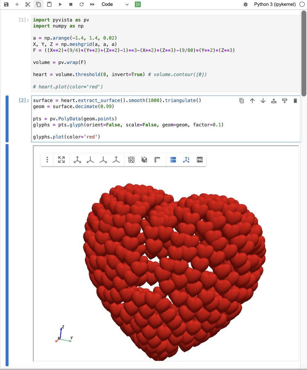
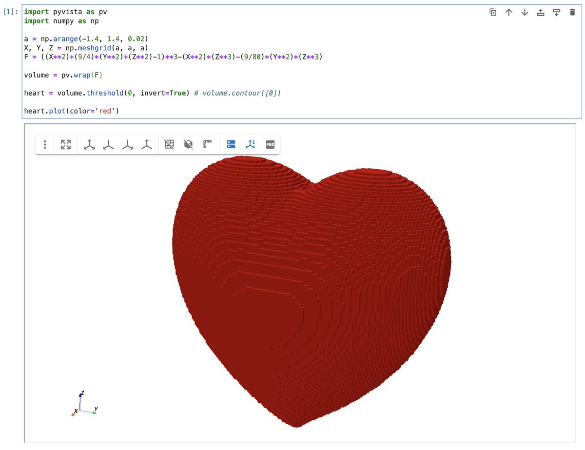
All you need is code. @MATLAB on #ValentinesDay. a=-1.4:0.02:1.4; [X,Y,Z] = meshgrid(a); F =((X.^2)+(9/4).*(Y.^2)+(Z.^2)-1).^3-(X.^2).*(Z.^3)-(9/80).*(Y.^2).*(Z.^3); patch(isosurface(X,Y,Z,F,0),'EdgeColor','r') axis equal view([-43 13]);
English

@banesullivan @Kitware Pretty amazing!! Can you also do DEMs?
English

We've been working hard @Kitware to build a new #Jupyter #3D viewer for #PyVista built on #Trame. I think this takes 3D visualization in Jupyter (and the web) to a whole new level. docs.pyvista.org
#Python #visualization #vtk
English
Bane Sullivan retweetledi

#Leafmap now supports visualizing raster datasets in #AWS SageMaker Studio Lab and SageMaker EC2 notebook instance, including locally stored raster datasets, Cloud Optimized GeoTIFF (#COG), #STAC. Try it out:
Notebook: leafmap.org/notebooks/65_s…
#geospatial #dataviz
English


