
Sabitlenmiş Tweet
Bud
665 posts

Bud
@bud9wx
21 / 🇬🇧 / Thunderstorm Enthusiast, Occasional Storm Chaser / Thunderstorms this year: 3 / Funnels: 1
Katılım Mart 2025
41 Takip Edilen81 Takipçiler
@ElsieOnComms Rippp, it wouldn’t be the lenses fault it would just be that the settings weren’t right, if you want some advice there I’d be happy to help
English


@bud9wx @BostonWeatherUK Im not sure if the South West of Ireland warrants a moderate, cape is high but sheer is not great, mostly hail/wind risk.
English

Am I weird for thinking today is probably going to bust. I see maybe weak stuff on models but not enough for HIGH, maybe just SLGHT evem.
Mesocast@MesocastUK
WED 27 MAY - THU 28 MAY 06Z - 2026: mesocast.uk/forecast/?date… UPDATE 27 MAY 2026 at 11:00am to expand slight risk polygon across Ireland and introduce a conditional lower confidence moderate for large parts of SW England, Wales and parts of the Midlands and South for later today and especially overnight tonight into the early hours of Thursday AM. Where models are firming up on plume destabilisation an active moderate is in place where strong/locally severe thunderstorms are possible, frequent to very frequent/prolific lightning (especially a cross the W Country into Soutern/Central Wales. A few active thunderstorms quite likely to break out across Southern and South West Wales through the rest of today could be locally surface based and an isolated LT supercell is possible. Main threats include large hail in stronger cells 2-3cm, locally damaging wind gusts to 55mph, torrential downpours and localised flash flooding and very frequent lightning. Thunderstorms will be predominiately elevated later this evening and overnight with storm coverage beginning to increase across Dorset/W Country/SW England migrating into Wales and with time expanding into the Midlands and Central Southern England through the early hours of Thursday AM. Close to issuing a conditional moderate for Wed., however confidence in consistency remains low. A few strong or even severe thunderstorms are possible again on Wednesday, perhaps less intense in coverage. An advancing short-wave should engage with a high theta-e plume advecting N from France through Wed. Timings of engagement are uncertain and therefore whether maximum convergence occurs during peak heating or later which dictates storm mode and coverage, however a few strong thunderstorms are likely. Main threats will be slow moving torrential downpours with the attendant risk of flash flooding, 1-2cm hail, possibly larger, gusty locally damaging winds upto 55mph, frequent lightning and the possibility of an isolated tornado. The situation will be monitored tomorrow morning with the possibility of an upgrade to a conditional moderate for favourable areas or an active moderate if confidence increases sufficiently.
English
Slight adjustment to the south east because I realise I was careless there

Bud@bud9wx
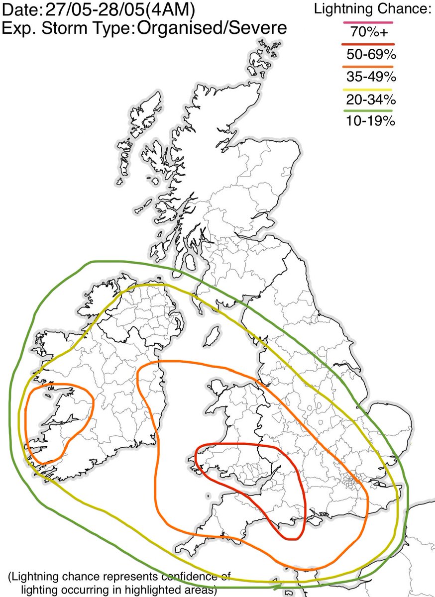
My personal risk for today, a moderate risk for areas of South Wales and South West England, plus a large enhanced risk across much of the left half of the UK, mainly for frequent lighting and heavy rainfall. A high risk was considered for areas between Cardiff and Bristol.
English
Bud retweetledi

Convective outlook has been issued ⛈️
Valid: Today 12:00 - Thursday 11:59
KEY MESSAGES - Thundery showers are likely to develop across western parts of UK and parts of Ireland, potentially bringing some large hail in palces
Details:
handry-outlook.github.io/Thunderstorms/…

English
My personal risk for today, a moderate risk for areas of South Wales and South West England, plus a large enhanced risk across much of the left half of the UK, mainly for frequent lighting and heavy rainfall. A high risk was considered for areas between Cardiff and Bristol.
English
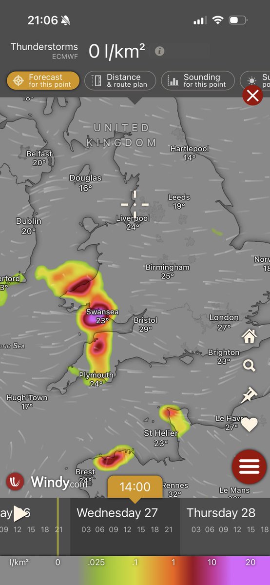
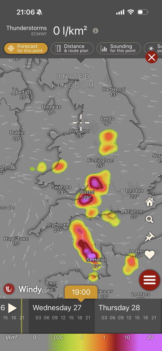
Today could see almost the same level of activity as yesterday, given another high ceiling set up, but storms are expected to be elevated, and model confidence certainly lesser than yesterday, hence why no high risk. Either way, I would expect many areas here to hear thunder.
English
Gained a bunch of followers today, that’s cool. I want to be clear, this account will try to be strictly weather related, and mainly my own thoughts and experiences. However, this is not a professional account, I am not a meteorologist. I’m just here to enjoy this hobby. Cheers!
English
Bud retweetledi

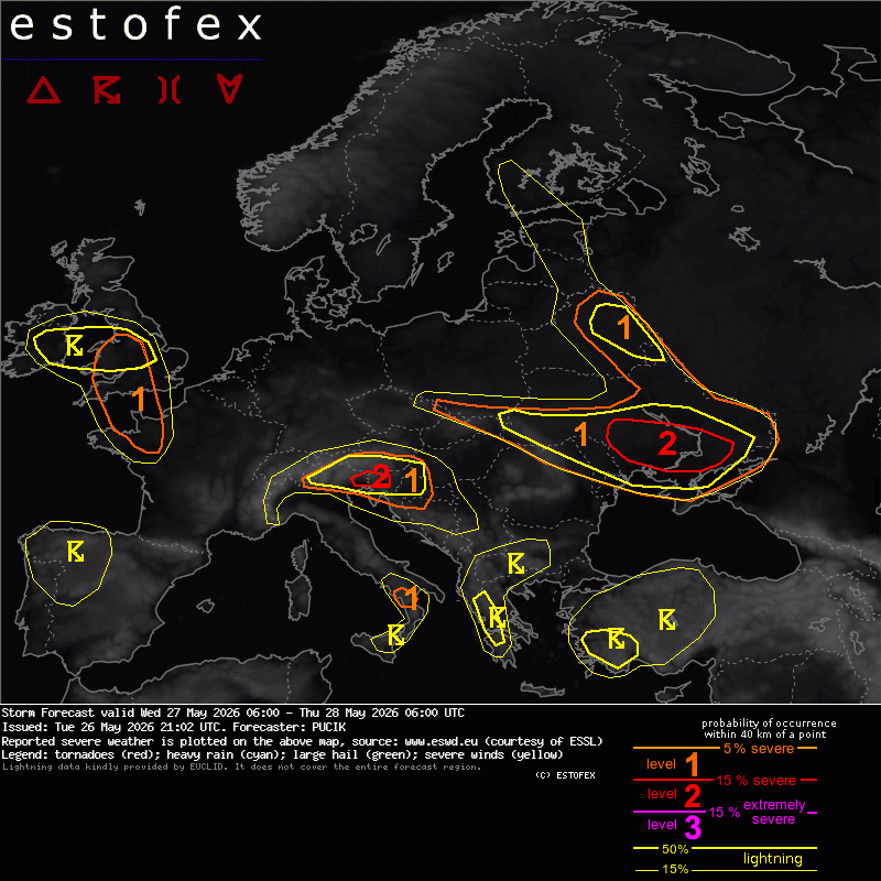
ESTOFEX for tomorrow. Interesting situation at a couple of locations. The highest risk of large hail will be over NE Italy/W Slovenia, the highest risk of severe wind gusts and tornadoes over Ukraine.
English
@BostonWeatherUK Weather was like “hey Boston made the effort today, let’s give him some desert”
English
Bud retweetledi



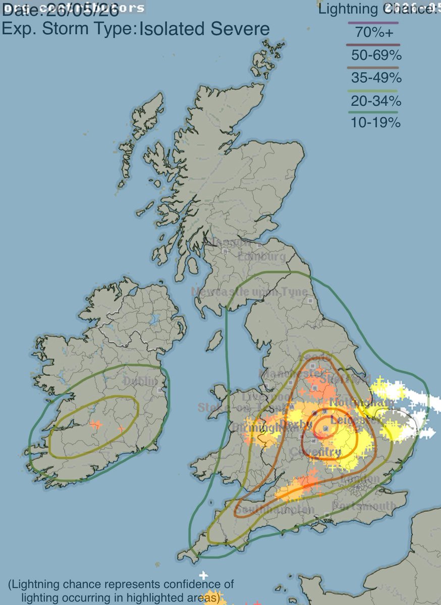
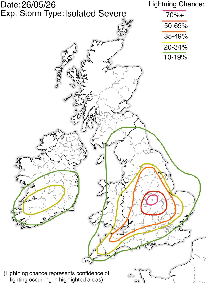
After careful consideration, I have placed a HIGH RISK over Leicester and surrounding areas as the risk of storms in the area seems very likely as long as no fail modes occur.
The risk for isolated intense or possibly severe thunderstorms is present throughout the afternoon.
English
While we’re all here, anyone know??
Bud@bud9wx
Question for the more knowledgable people, is this a mesocyclone on the front of a storm that moved into Benidorm in 2024? Easily the most convincing structure I’ve seen, but the storm didn’t look like it should have a meso in person or on radar. Thoughts?
English