
Dimitris A. Herrera retweetledi

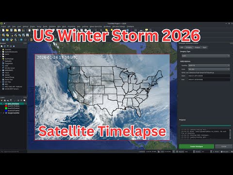
2026 US Winter Storm Seen from Space – Stunning Satellite Timelapse Using QGIS
Watch the 2026 U.S. Winter Storm unfold from space in this stunning satellite timelapse created with just a few clicks using the QGIS Timelapse Plugin.
In this step-by-step tutorial, I’ll show you how to visualize powerful weather events using NOAA’s GOES-18 satellite imagery inside QGIS, without needing to code. Perfect for geospatial analysts, educators, or curious weather enthusiasts!
Pluging page: plugins.qgis.org/plugins/timela…
GitHub repo: github.com/opengeos/qgis-…
Video tutorial: youtu.be/G1MnIGBdruA
#QGIS #geospatial #python #EarthEngine #WinterStorm
YouTube
GIF
English