
HEO

502 posts

HEO banner
HEO

HEO

@heospace

On-demand non-Earth imaging and insights of spacecraft that matter.

Sydney, New South Wales Katılım Mayıs 2016
199 Takip Edilen6.6K Takipçiler
Sabitlenmiş Tweet
HEO
HEO@heospace·
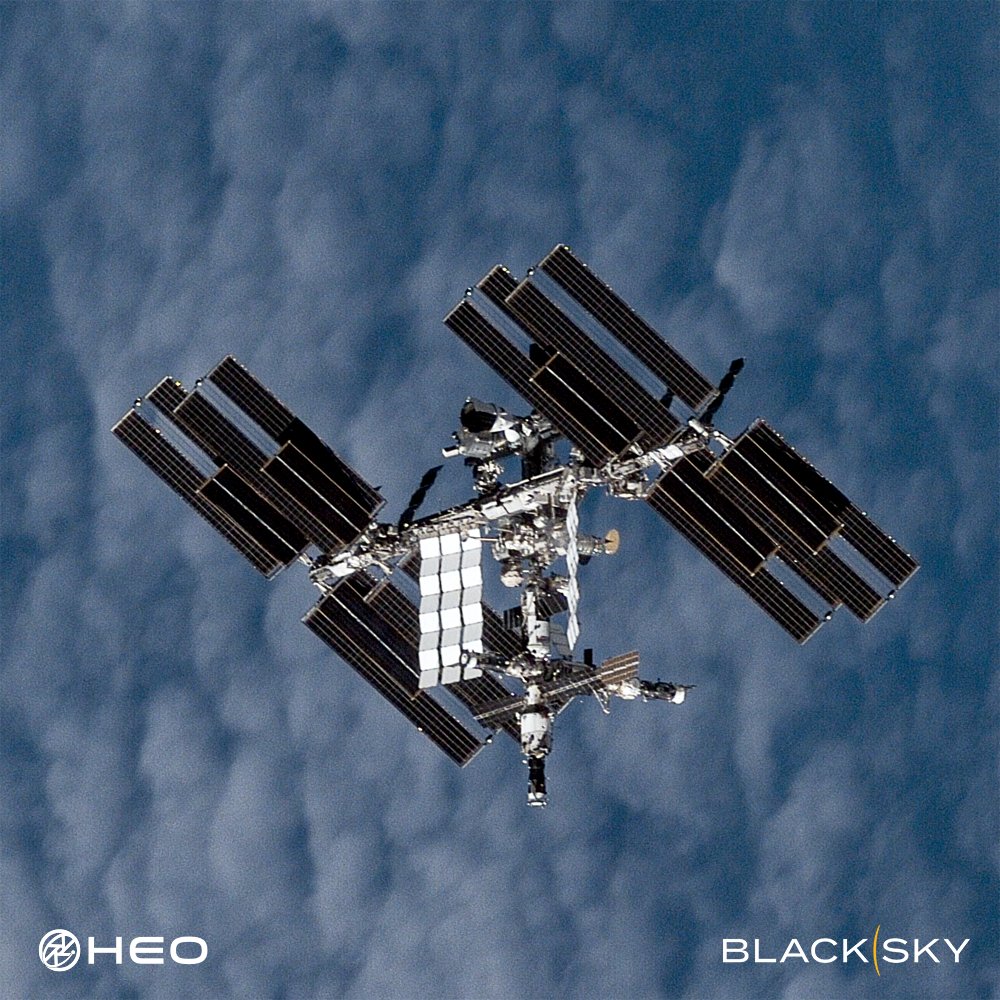
We’ve captured one of our best images of the @Space_Station yet. The number of satellites in orbit is set to increase tenfold in the next decade. At the same time, space-to-space threats are rising and the need to inspect and maintain satellites is accelerating faster than anyone expected. Resolution alone won't deliver what's needed. True understanding comes from observing satellites frequently, from multiple angles and orbits, so you can see how they behave, respond to their environment, and what they're capable of across time and geography. That's why HEO focuses on high-frequency Non-Earth Imaging. Our technology is built for speed, scale, and adaptability, operating across multiple orbits with diverse satellite providers to deliver more coverage, more data, and faster insights into thousands of satellites. This approach will get us to a future where satellite inspection is truly on-demand. You tell us you want an image of your satellite and we deliver imagery and analysis when you need them. Image of the ISS captured with our partner @BlackSky_Inc.
HEO tweet media
English
36
196
1.2K
89.6K
HEO
HEO@heospace·
Object B (67647), imaged across multiple frames by HEO's Continuum-1 satellite. Using our autonomous tasking and analytics software, HEO assessed that this unidentified object is the Long March 2C upper stage left in orbit after China's launch of AlSat-3B from Jiuquan on January 31, 2026. HEO measured the object at approximately 11.5m in length and characterised its engine, propellant tank, and payload adaptor. Captured in six distinct frames, this NEI mission also showed the object's natural motion in orbit. NEI like this is a vital information source for active debris removal missions, from planning and operations through to observation of the manoeuvre itself, delivering critical information to de-risk missions. The same characterisation supports in-orbit servicing and manufacturing missions, where knowing exactly what physical state a target is in and how it is moving determines whether rendezvous is viable.
HEO tweet media
English
1
14
68
2.6K
HEO
HEO@heospace·
For when you need to look deeper. Every satellite operator faces the same blind spots after launch: confirming they are communicating with the right satellite, whether the spacecraft deployed as designed, and what operational mode it is in. This image of ALOS-4 is an example of how HEO helps close that gap when the stakes are highest. Through non-Earth imaging, we identify the satellite, confirm the solar arrays and PALSAR-3 antenna are fully deployed, and verify its operational state, all from another satellite flying by. We're routinely expanding this capability, partnering with more satellites and launching proprietary sensors to extend coverage and improve image quality to read finer detail on configuration and behaviour.
HEO tweet media
English
0
21
93
8.1K
HEO
HEO@heospace·
ISRO's Cartosat 2D is seen here orbiting Earth, set against the backdrop of deep space. The object spans roughly 3.5 metres across its deployed solar panels, yet HEO resolved the main body, attitude, and solar panels from 52 kilometres away, with the vectors showing the arrays oriented toward the sun and the satellite holding a stable attitude.
HEO tweet media
GIF
English
1
28
119
4.3K
HEO
HEO@heospace·
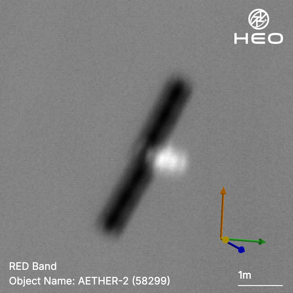
Satellite-to-satellite imaging meets satellite-to-satellite relay. Aether-2 is one of Kepler Communications' original two pathfinder satellites, launched in 2023 to validate the optical inter-satellite links that now underpin a growing mesh architecture designed to route data satellite-to-satellite using IP networking rather than relying on ground station passes, including at high latitudes where terrestrial coverage is thin. HEO's non-Earth image, captured as the satellite passed over the Arctic Ocean north of Canada, shows its solar arrays fully deployed and oriented toward the Sun.
HEO tweet media
English
2
15
82
3.9K
HEO
HEO@heospace·
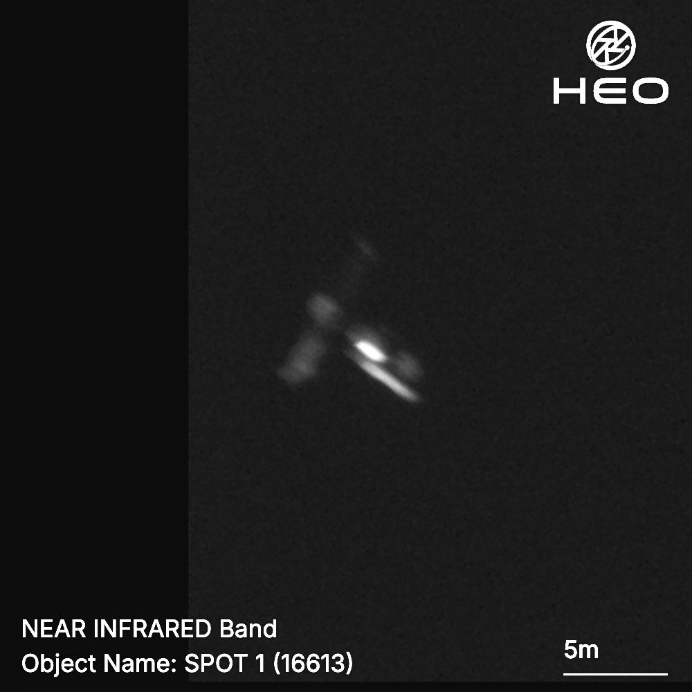
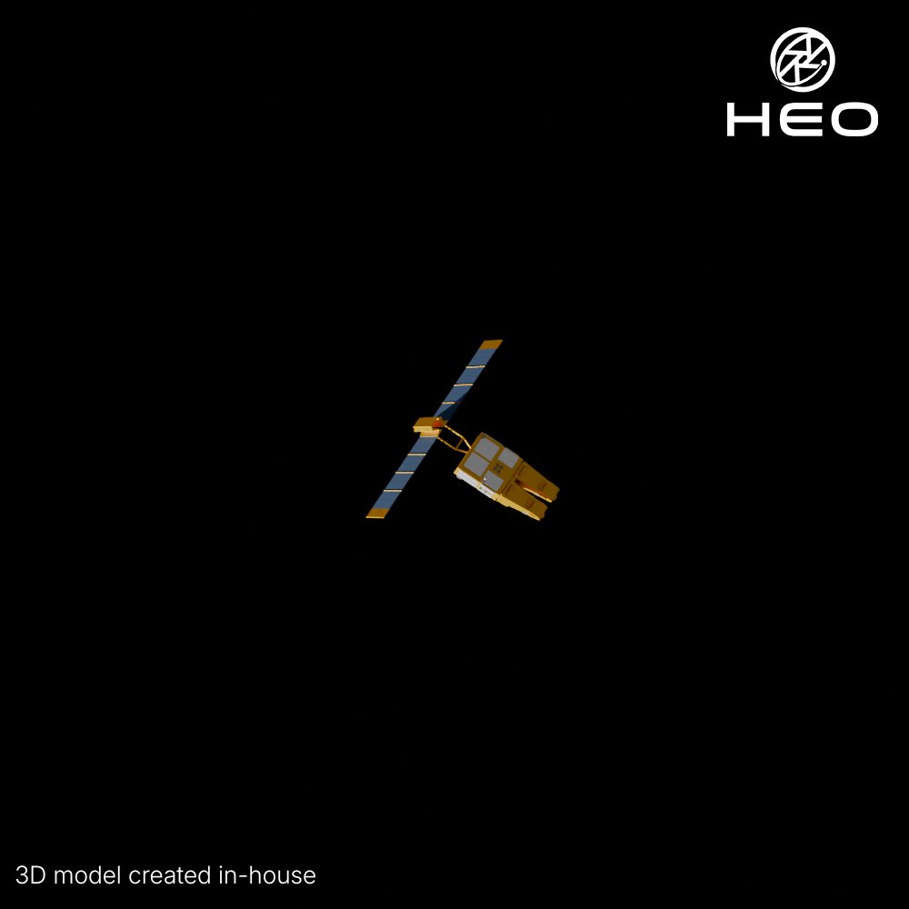
In 1986, this satellite provided the highest-resolution civilian view of the Chernobyl exclusion zone available at the time, captured within days of the disaster. SPOT 1, launched by CNES two months earlier, gave analysts imagery to begin understanding the scale of what had happened, at a moment when a 30 kilometre radius around the plant had been evacuated, 115,000 people displaced, and the ground itself too contaminated to survey on foot. SPOT 1 was one of the most capable Earth observation satellites of its time, delivering a sharp 10-meter ground resolution in panchromatic mode and 20 meters in multispectral mode. Its two-pass stereoscopic correlation technique produced usable elevation data for large portions of the planet's landmass, a capability that proved essential for reading terrain in a landscape where ground access was not an option. The story did not end with the disaster. In 1988, SPOT 1's near-infrared sensor captured some of the earliest evidence of recovery, photosynthetic activity returning to the exclusion zone. The SPOT series kept observing the area for years afterward, tracking decontamination work, new construction and reforestation as the region slowly changed. Nearly 40 years after launch, HEO imaged SPOT 1 in orbit, checking in on the state of the asset. The solar panels remain fully deployed and the satellite appears largely intact. Beyond physical condition, the imagery also offers a read on the object's behaviour, whether it is tumbling, stable, or holding a fixed orientation, information that is critical for space domain awareness on the growing population of aging, non-manoeuvrable objects in orbit.
HEO tweet mediaHEO tweet media
English
3
34
185
6.7K
HEO
HEO@heospace·
One rocket family carries two of China's most closely watched space programmes. CZ-2F R/B is the spent rocket body from a Long March 2F launch, China's only operational human-rated launch vehicle family. The rocket's 2F/T variant launched the Tiangong-1 and Tiangong-2 prototype stations. A modified 2F/T configuration has since launched every mission of the Shenlong reusable spaceplane, most recently its fourth flight in February 2026. The 2F/G variant has launched every crewed Shenzhou mission to China's operational Tiangong space station, most recently Shenzhou-23 in May 2026. In this NEI mission, we characterised a CZ-2F/T rocket body over the North Pacific from 71.65 km away, resolving insights at 15 cm/pixel.
HEO tweet media
English
2
24
111
7.4K
HEO
HEO@heospace·
@rory_bushell We do it all in-house, combining our NEI and open source information
English
0
0
9
816
HEO
HEO@heospace·
Space debris. Space stations. Unknown objects. Satellites. Asteroids. If it's in the solar system, we are going to image it and unlock the intelligence hidden within it. This non-Earth image reveals one of the H-2A upper stages in orbit at centimetre level clarity. The stage itself launched in May 2012, carrying Japan's GCOM-W1 satellite into orbit. It's part of the H-2A family, a rocket that first flew in 2001 and, after overcoming an early launch failure, completed every mission that followed. That run built a 98 percent success rate over 50 launches and almost 25 years, making the H-2A one of the world's most reliable heavy-lift rockets. The H-2A launched some of Japan's most significant space missions, from the Hayabusa2 asteroid sample return mission and the SLIM lunar lander to critical Earth observation and national security satellites, before retiring after its final launch in June 2025 in favour of Japan's H3 rocket. Every image, whether debris, space station or natural space object, adds one more verified entry to a working map of the orbital environment, not a one-off snapshot but an accumulating record anyone operating in orbit can draw on.
HEO tweet mediaHEO tweet media
English
13
136
737
59.2K
HEO
HEO@heospace·
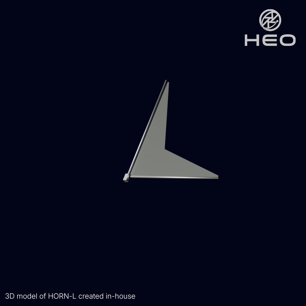
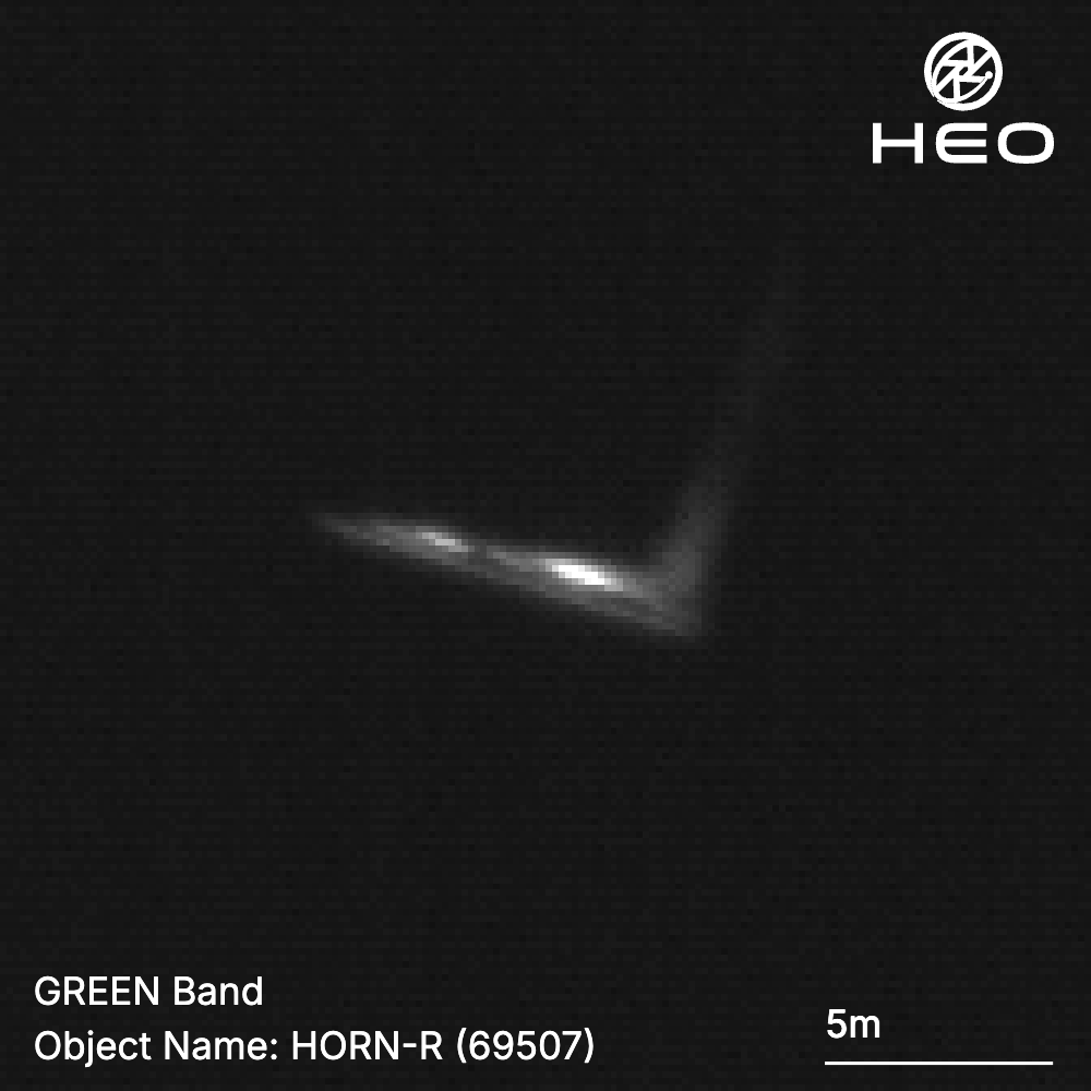
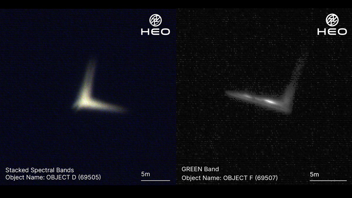
Full sail ahead on @BULL20221107's post-mission disposal device, HORN. We partnered with BULL to image and characterise the HORN satellites in orbit following their launch on June 12, 2026, capturing the deployed membrane of HORN-L and HORN-R as their mission began. HORN is a membrane-deployment device designed to accelerate the de-orbit of retired satellites and rocket stages by increasing atmospheric drag, with a full-scale deployment area of 50 m², among the largest of its kind. For this demonstration, the membrane areas were scaled to the orbital lifetime of the demonstration vehicles, set at approximately 20 m² for HORN-L and 10 m² for HORN-R. BULL is using our imagery and analysis to resolve the two demonstration units from one another and verify that their novel mechanism performed as designed. As the demonstration continues, HEO’s high-revisit imaging lets BULL track how the membrane behaves in orbit over time and evaluate its effect on de-orbit performance. Congratulations to the BULL team on a significant step toward addressing the space debris problem. Read BULL's statement: bull-space.com/pr/pr_20260703
HEO tweet mediaHEO tweet mediaHEO tweet mediaHEO tweet media
English
4
54
196
12.4K
HEO retweetledi
株式会社 BULL / BULL CO., LTD.
\ご報告|プレスリリース🚀/ 株式会社BULL、宇宙デブリ化防止装置「HORN」の軌道上実証に成功 〜 H3ロケット6号機で実証中の「HORN-L」「HORN-R」共に、膜面展開の軌道上撮影に成功し、大気抵抗を用いた軌道降下を実証 〜 BULL初の軌道上実証に成功しました🐂🎉 🔗 prtimes.jp/main/html/rd/p…
株式会社 BULL / BULL CO., LTD. tweet media
日本語
3
104
256
30.1K
HEO
HEO@heospace·
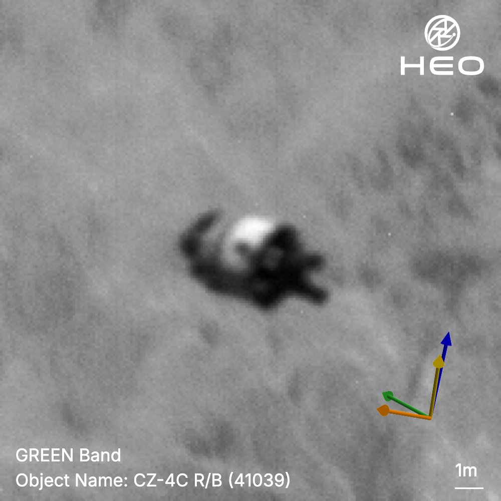
Fly-by NEI with HEO’s Continuum-1 satellite of a Long March 4C upper stage as it crossed the sea ice in the high Arctic. Every one of these passes adds to HEO's rich dataset on what is in space, what it is doing, and what needs to be known, building the information layer for space. The black lines seen are the separation between the four spectral bands of the sensor.
GIF
HEO tweet media
English
0
25
112
2.9K
HEO
HEO@heospace·
@shanksteroflove If it's in the solar system, it is on the roadmap!
English
3
2
11
1.2K
Shanks
Shanks@shanksteroflove·
@heospace I’m curious, with the great images you get, have y’all been considered for lunar reconnaissance missions? You’d get some pretty detailed photos of the lunar surface depending on the orbit you’d use.
English
1
0
3
1.3K
HEO
HEO@heospace·
As more satellites reach orbit, the population of poorly characterised objects grows with it. This satellite launched in July 2022 on the maiden flight of the Lijian-1 (Kinetica-1) rocket from Jiuquan Satellite Launch Centre, carrying the designation Object A (53299), and it remained under that same designation in public catalogues through to deorbit. HEO identified and characterised it as SATech 01 (Kongjian Xinjishu Shiyan 01). The satellite carried the Lobster Eye Imager for Astronomy (LEIA), a pathfinder for the Wide-field X-ray Telescope aboard the Einstein Probe mission. In this Non-Earth Imaging mission, the deployed solar arrays, the nonmagnetic telescopic tubular mast, and the central bus carrying the LEIA payload are all resolvable. Non-Earth Imaging gives operators and analysts a way to stay current on what is actually in orbit, not just where it is, but what it is built to do. The image was collected over Greenland from a range of 40km at 8cm/px resolution.
HEO tweet mediaHEO tweet media
English
5
45
204
11.7K
HEO
HEO@heospace·
@planet4589 Appreciate your work! We can confirm that it is the upper stage
English
0
0
9
204
Jonathan McDowell
Jonathan McDowell@planet4589·
@heospace loving your work as always. Have you had a look at 68753 2026-083A? USSF says this is a Soyuz third stage, but that doesn't seem consistent with the launch profile and I wonder if it's actually a large rideshare adapter or something like that.
English
1
1
53
6.6K
HEO
HEO@heospace·
Imaged: ZK-1A R/B (64093), a spent Kinetica-1 upper stage, imaged on a fly-by and shown here across successive frames with a stable attitude. HEO accesses over 40 sensors in low-Earth orbit to conduct fly-by Non-Earth Imaging, characterising objects from space. A spent stage is inert: it cannot manoeuvre and cannot be contacted. Knowing what an object is and what it is doing sharpens the operating picture and contributes to space safety, and it builds the knowledge base operators and debris removal companies will draw on when the time comes to interact with an object.
English
1
32
131
7.5K
HEO
HEO@heospace·
This rocket body has dropped approximately 20 kilometers in altitude over the past year. HEO characterised Object H (51953) as a Long March 2C rocket body, the upper stage from a launch on March 5, 2022 out of the Xichang Satellite Launch Center. The vehicle carried six demonstration satellites for GalaxySpace, a Chinese commercial operator building toward a low-Earth orbit broadband constellation, alongside a secondary passenger, a 6U remote sensing CubeSat. The GalaxySpace cluster was intended to validate broadband data relays, in-space networking, and integrated remote sensing and communications technologies. Non-Earth Imaging (NEI) lets us monitor and characterise an object as its orbit decays, and it resolves the ambiguity that follows any launch, separating active payloads from spent stages and debris, establishing not just which object is which but what it is capable of and what it is doing in orbit. In this NEI mission, the payload adapter is visible, the structure that mated the satellites to the rocket. From the image, HEO derived an engine length of 3.38 metres, a tank section of 7.08 metres, and a payload adapter length of 4.67 metres. Collections like this one carry high image plane velocities, so we applied our proprietary deblurring tool to recover details for characterisation. *Measured in the 2D image plane. Any extension into the image plane is not captured, so this figure represents a minimum. The true length may be greater.
HEO tweet media
English
0
24
99
4.4K
HEO
HEO@heospace·
Trust in orbit depends on evidence, not assumption. At the International Space Summit 2026, HEO's Co-Founder and CTO Hiranya Jayakody joined a conversation with LEOLabs, SPACEMAP, and Spaceflux on how collecting evidence and information will create transparency and move us all forward in space. Make space transparent.
HEO tweet mediaHEO tweet mediaHEO tweet media
English
0
0
14
1.3K
HEO
HEO@heospace·
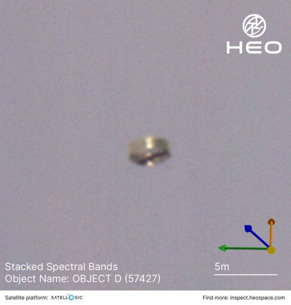
Running rings around Earth. HEO identified and characterised Object D as the CZ-2D interstage ring, the structural section that holds the two stages of a Long March 2D together and is cast off during ascent once the stages separate. This Non-Earth Imaging mission was taken from 59 km away at an average image resolution of 13 cm/px.
HEO tweet media
English
3
32
189
8.1K
HEO
HEO@heospace·
The age of a satellite has no bearing on our ability to image it. What matters more is its position in orbit and its size. The constraint with something like Vanguard 1 is that there is very little structure to resolve at that size. That said, we continue to launch cameras into diverse orbits to widen coverage, so that we have both the proximity and resolution required to image anything.
English
1
0
6
503
WeylandsWings
WeylandsWings@WeylandsWings·
@heospace What is the oldest satellite you could image. Could you get NEI of Vangaurd?
English
1
0
1
507
HEO
HEO@heospace·
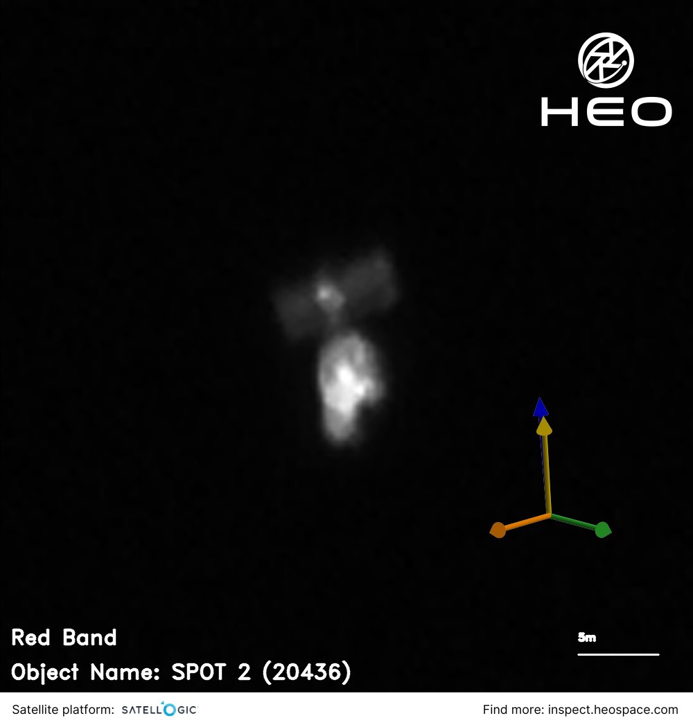
A satellite from before the first website existed. SPOT 2 launched in January 1990 as the second satellite in CNES's SPOT series, France's pioneering civil Earth-observation programme. It carried two High Resolution Visible imagers and introduced steerable mirrors that let it look to either side of its ground track, a real advance over the nadir-only systems of the era. When CNES ended the mission in 2009, it lowered the orbit so the satellite would reenter on a shorter timeline. HEO characterised the object at 22 cm/px from roughly 147 km away as it passed off the coast of Russia. Non-Earth Imaging, where one space object images another, is how a satellite designed to look down at Earth can itself be inspected in orbit decades after its mission ended, and long after the people who operated it stopped communicating with it.
HEO tweet mediaHEO tweet media
English
3
24
128
11.5K