Matt Hay

5.4K posts

Matt Hay banner
Matt Hay

Matt Hay

@matthay44

Ex-weatherman, mountain leader and aspiring author. Put the planet first and the rest will follow.

Edinburgh, Scotland Katılım Nisan 2011
839 Takip Edilen584 Takipçiler
Sabitlenmiş Tweet
Matt Hay
Matt Hay@matthay44·
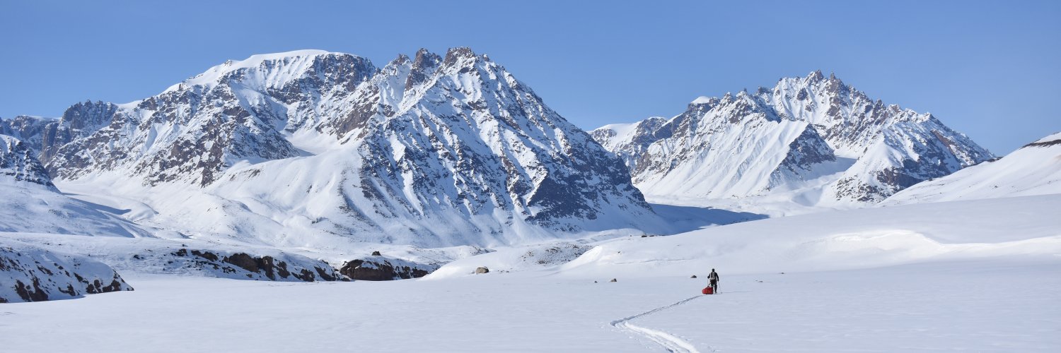
I'm an unapologetic advocate of reintroducing wolves to the Highlands but acutely aware how culturally difficult that will be and how much would have to change, land management wise, for co-existence to work. But it's nice to dream, eh? So I did just that inkcapjournal.co.uk/wolf-watching-…
English
4
7
44
5.1K
Matt Hay
Matt Hay@matthay44·
@theiaincameron No ropes required, Iain? One axe or two? And how did you know there wouldn't be a big cornice at the top. Only asking because it's a winter ascent I'd love to emulate one year.
English
1
0
0
72
Iain Cameron
Iain Cameron@theiaincameron·
Six years ago today, topping out on Central Gully of Ben Lui. What a fantastic ascent on bullet-hard névé.
Iain Cameron tweet media
English
5
2
193
4.4K
Matt Hay
Matt Hay@matthay44·
@DeeWardRottal Sounds like they're linnets. Wonderful work, Dee. I'd love to see a bit more upland arable. Our ancestors had pockets of cropland in every glen...to the benefit of birds, small mammals and countless insects.
English
0
0
1
45
Dee Ward
Dee Ward@DeeWardRottal·
We plant a lot of wild bird mixes that really attract a lot of small birds over the winter, keeping them alive during the “hungry gap”
English
6
14
167
2K
Matt Hay
Matt Hay@matthay44·
@Met4CastUK EC46 not worth the digital paper it's printed on. Just look at what it was forecasting three weeks ago
English
0
0
2
191
Met4Cast - UK Weather
Met4Cast - UK Weather@Met4CastUK·
Todays EC46 update; Yet another step away from high latitude blocking with a strong trough remaining out in the Atlantic causing high pressure to the east to sink south. I've ordered in a new supply of red flags..
Met4Cast - UK Weather tweet mediaMet4Cast - UK Weather tweet media
English
9
2
45
5.3K
James Peacock
James Peacock@peacockreports·
With 42.2 hours in the past 10 days, November 2025 has managed to claw its back back to the long-term average for sunshine to-date here in NE Dorset. It's also managed to be very near the long-term average for rainfall. Seems only the temperatures will be noteworthy this month.
James Peacock tweet mediaJames Peacock tweet media
English
1
1
9
1.8K
Matt Hay
Matt Hay@matthay44·
@Met4CastUK I feel more bullish than you about the second half of December. sPV isn’t going to be above average strength, some signs it won’t couple effectively to the tPV and lots of telecons in our favour. Could be spot on with peak cold around Xmas time. We shall see.
English
1
0
1
675
Met4Cast - UK Weather
Met4Cast - UK Weather@Met4CastUK·
I am starting to question now how sustained any (if there is any) blocking might end up being now. Clear signal within models to weaken the MJO into a very low amplitude phase 7 as we progress through December with the signal likely becoming entirely incoherent. This, coupled with a fall in AAM as we lose MJO forcing will create a fairly sharp inflection point, a significant Pacific Jet retraction following a fall in both FT and MT promoting a more mobile / westerly pattern within the Atlantic later in December. It looks like we might have a window of opportunity for blocking in the 15th-24th range before a more westerly regime takes over again. Beyond that, into January the weakening of the -IOD coupled with La Nina suggests any MJO events being stronger / focused across the Indian Ocean rather than the Pacific leading to more broad -AAM regimes, i.e unsettled / milder, though this is in line with broader winter expectations. Despite recent more favourable teleconnections, SUMMARY: The window of opportunity for blocked weather patterns and cold weather risks is shortening. Background drivers will become increasingly unfavourable for blocking patterns and steadily more favourable towards wetter, Atlantic driven patterns. Blocking / colder weather remains a plausible option between the 15th-24th (rough timing, may shift a few days) before the Atlantic begins to take over.
Met4Cast - UK Weather tweet mediaMet4Cast - UK Weather tweet media
English
21
1
83
30.9K
Matt Hay
Matt Hay@matthay44·
@Met4CastUK Thanks very much! What influences whether and to what extent the sPV and tPV couple? Does the fact this wave was reflected suggest things are not conducive for linkage between the two? Interesting that even with strat zonal winds only average for the ToY it can still dominate.
English
1
0
0
136
Met4Cast - UK Weather
Met4Cast - UK Weather@Met4CastUK·
It's a tricky one. The wave reflection event is mostly to blame, this reflection back into the troposphere essentially kills of the wave 1 breaking into the stratosphere which allows it to strengthen quickly, largely unhindered by tropospheric forcing, if this strengthening then couples with the troposphere below it will likely override any attempts at blocking by flattening the pattern out, despite otherwise favourable tropospheric drivers, -IOD, MJO etc But.. equally, if the energy from the wave reflection dissipates (studies show this tends to happen after 2 weeks in the Atlantic sector) then it may allow MJO forcing to start amplifying blocks again, but.. much is dependent on the stratosphere, that is the biggest driver.
English
1
0
4
1.1K
Met4Cast - UK Weather
Met4Cast - UK Weather@Met4CastUK·
🚩 🚩 🚩 James May has even deployed. Anticipated blocking through the first half of December now looks unlikely with milder & wetter weather favoured across the UK. However, tropospheric drivers will remain favourable for blocking patterns which may begin to materialise during the second half of December assuming the strengthening stratosphere doesn’t imprint onto the troposphere. The red flags are in effect until December 15th. A lot going on and there’s a lot of uncertainty.
GIF
English
17
8
90
17.9K
Matt Hay
Matt Hay@matthay44·
@Met4CastUK Final point. Do you think the models’ inability to forecast the tPV at sub-seasonal timescales makes a mockery of the whole sub-seasonal forecasting business? ECM monthlies will be way off what they were predicting a month ago, because of the primacy of the tPV.
English
2
0
2
1.3K
Matt Hay
Matt Hay@matthay44·
@Met4CastUK I'm always baffled by why NWP doesn't predict these dynamics? Surely trade winds are part of what should feed into predictive forecasts about the MJO/ longitudinal progression of tropical convection?
English
0
0
0
47
Met4Cast - UK Weather
Met4Cast - UK Weather@Met4CastUK·
SECOND FLAG ISSUED 🚩 🚩 This is a slightly longer / technical update, summary at the bottom. I think we need to keep level headed, there’s a lot going on in respect of broader background drivers and I would expect NWP modelling to be showing a lot of variation as a result. Poleward fluxing of positive anomalies is now evident on the plot above and this is the signal for the pattern change to +NAO and +AO and the increased zonal flow across the Atlantic now well advertised across NWP modelling but also previously across the drivers. A reduction in +EAMT and associated weakening of the Pacific jet extension coupled with a delay in MJOpropagation being the main cause. The second arrow on the plot below depicts negative anomalies and with a recent (albeit small) +EAMT event last weekend coupled with now increasing +FT in response to the re-amplification of the MJO through phase 6 into 7, we are expecting a surge in AAM tendency bringing total AAM up to an expected 1 / +1.5SD. This increase in westerly momentum into the atmosphere from the tropics & sub-tropics will shift the atmosphere more to an El Niño state, de-coupling the atmosphere from the La Niña base state in the Pacific & will promote a meridional jet stream and increased likelihood of blocking moving towards the poles. So.. tropospherically, the atmosphere is moving towards a setup where high latitude blocking is generally favoured. But, we have to factor in the stratosphere and winds associated with that. It’s clear that the picture here has shifted markedly in recent days with what was looking like an absorption event and a weakening of u-winds from top to bottom now looks like a reflection event followed by a rapid acceleration, this shift mean we have to now shift out expectations and evolve the forecast. The Canadian vortex isn’t a separate entity, disconnected from other base drivers and the wave reflection has intensified the zonal signal that was already there, previously expected to be a short lived affair, now likely to be more intense and longer lasting as a result of the wave reflection. This also needs to be accounted for. It’s reasonable to assume that blocking through Europe will amplify northwards towards Scandinavia, but the extra energy injected into the Canadian tropospheric vortex lobe will probably over power any attempts of retrogression / amplification far enough north to advert cold air in across Europe and the UK. There is a chance that tropical forcing (MJO) will arrive before the stratosphere forcing and this is still a plausible outcome but given the recent MJO delay, it seems like a less likely one overall. SUMMARY: So.. the most likely outcome for me is a Scandi high that doesn’t my quite manage to disconnect from a European ridge resulting in milder air across the UK during the opening half of December. There remains the possibility that MJO forcing arrives in time to allow for that amplification and an undercutting of the strengthening Atlantic jet, IF this happens we’d be looking at some potentially high impact snow events along wherever that boundary may lay, this is a lower likelihood outcome but cannot yet be discarded or ruled out. It’s not game over for cold potential yet as far as I’m concerned, but evidently the likelihood has decreased.
Met4Cast - UK Weather tweet mediaMet4Cast - UK Weather tweet media
English
16
9
80
18.5K
Iain Cameron
Iain Cameron@theiaincameron·
Unsurprisingly, the hardy guys at British Backcountry were on Cairn Gorm this morning for sunrise, putting in some turns on fresh champagne powder. british-backcountry.co.uk
Iain Cameron tweet media
English
10
37
370
29.8K
Matt Hay
Matt Hay@matthay44·
@Met4CastUK Scandi highs always worry me. The WAA required to build them nukes cold to our north and if there is then too much energy for them to be truly high latitude we end up with uninspiring SE’lies. For me it’s a good strong HP to the NW/N that delivers. Much like the past cold snap!
English
1
0
2
1.1K
Met4Cast - UK Weather
Met4Cast - UK Weather@Met4CastUK·
Growing signs of high pressure building up into Scandi on the 00z GFS. Despite the last day or two I still believe blocking patterns are more likely by week 2 of December. Whether that aligns for cold or not however remains to be seen.
Met4Cast - UK Weather tweet media
English
11
12
138
16.3K
Matt Hay
Matt Hay@matthay44·
@Met4CastUK So what’s the next period of interest on your radar?
English
1
0
0
54
Met4Cast - UK Weather
Met4Cast - UK Weather@Met4CastUK·
Almost a month and a half ago I flagged the 15th-30th as a “period of interest” for cold weather. Today many areas have seen sleet and snow and multiple weather warnings for snow & ice have been issued. I think we can count this one as a success!
Met4Cast - UK Weather tweet mediaMet4Cast - UK Weather tweet media
Met4Cast - UK Weather@Met4CastUK

PERIOD OF INTEREST: 15th - 30th November The latest CFS has strengthened the signal for the MJO through November as it pushes east. This increases the likelihood of blocked & colder patterns later in November. The cold chase has begun! ❄️

English
6
4
167
13.2K
Matt Hay
Matt Hay@matthay44·
@DeeWardRottal @LesleyRiddoch @ChrisGPackham Agree with your sentiment, Dee. But there was likely far more native woodland and scrub when the Romans were in Scotland, several millennia ago. Also wolves, bears, beavers, boar, possibly aurochs and probably lynx.
English
1
0
0
84
Dee Ward
Dee Ward@DeeWardRottal·
Scotland had less tree cover in Roman times than it does today. That was approximately 1800 years before grouse shooting and extensive sheep grazing. We all want more trees and to build a more biodiverse and climate resilient Scotland but making up stuff and polarising debate really doesn’t help us move forward, yet you seem to keep doing it ? It’s really not helping us move forward so why are you doing it? It just put people’s backs up and then we get no where.
English
14
6
37
1.5K
Lesley Riddoch
Lesley Riddoch@LesleyRiddoch·
Centuries of overgrazing & muirburn for grouse moors mean Highland Scotland looks treeless & desolate. But it doesn't have to be this way. New film Scotland's Missing Forests went online y'day. Chuffed to see almost 10k views. Pls share youtube.com/watch?v=MuTV1S… @ChrisGPackham
YouTube video
YouTube
Lesley Riddoch tweet media
English
21
221
373
15.1K
Matt Hay
Matt Hay@matthay44·
@judah47 Why are they called Rex blocks?
English
2
0
0
1.4K
Judah Cohen
Judah Cohen@judah47·
Unlike Vegas, what happens in #Siberia doesn't stay in Siberia. Rex block across Siberia looks to support rapid expansion of #cold & #snow across the region mid to late November. I like to say that December should lose its status as a #winter month, this year could be different.
Judah Cohen tweet mediaJudah Cohen tweet mediaJudah Cohen tweet media
English
17
35
235
65.1K
Carl Bovis
Carl Bovis@CarlBovisNature·
What is this bird of prey called? 🤔 Kestrel? 🐦 Buzzard? 🐦 Sparrowhawk? 🐦 Hobby? 🐦 Merlin? 🐦 Peregrine Falcon? 🐦
Carl Bovis tweet media
English
128
73
677
31.8K
Matt Hay
Matt Hay@matthay44·
@herdyshepherd1 I disagree. Rewilding is simply an aspiration to make a system more 'wild', i.e. reinstate as many natural processes as are feasible, practicable, legal, etc. You are rewilding by returning cattle to your land in greater numbers - the direction of travel is the important bit.
English
0
0
0
48
James Rebanks
James Rebanks@herdyshepherd1·
Creating landscapes with more nature is a great and necessary idea - we try and do our bit But ‘rewilding’ as an ideology is struggling in practice… it quickly runs up against legal and ethical boundaries in human landscapes This is worth a read… bbc.co.uk/future/article…
English
14
45
187
10.3K
Matt Hay
Matt Hay@matthay44·
@peacockreports We’ll be in with a shout at one of the driest on record if the latest ECM run verifies !
English
0
0
0
23
James Peacock
James Peacock@peacockreports·
With a v. dry outlook for potentially a fortnight or so, this October has a shot at being the first widely drier than average one in southern England since 2018. Yes, it's really been that long! 2019: Wet 2020: Very wet 2021: Very wet 2022: Near average 2023: Very wet 2024: Wet
English
3
2
19
3.5K
Matt Hay
Matt Hay@matthay44·
@stuartpengs Couldn’t agree more. Plus it’s likely going into bioenergy not food.
English
1
0
1
26
Stuart 🏴󠁧󠁢󠁷󠁬󠁳󠁿
Maize - I fcking *HATE* seeing this crop planted near water. A valley prone to flooding and a field that has had herbicide/pesticide treatments, will be left bare all winter and will get repeated coverings of slurry onto the bare soil. More environmental madness in my home valley
John Walker@earthFgardener

Given that around 30cm of rain has fallen here in the last week, this example of ill-conceived, inappropriate and frankly reckless #farming needs some light shining on it. This is a large area of forage maize growing in the Conwy Valley, between Betws-y-Coed and Llanrwst.🧵1/6

English
6
3
17
1.3K
Matt Hay
Matt Hay@matthay44·
@numenini Brilliant thread, what a treat for you!
English
1
1
1
185
nicola crockford
nicola crockford@numenini·
DREAM COME TRUE! Slipped into the Lowther in #Cumbria and immediately found the clear, sun-dappled waters of this limestone river packed with enchanting Atlantic SALMON parr! The first I have swum with. New favourite river for me! Thank you Jim Lowther. #MySwim #TeamFish 1/21
English
3
10
74
4.8K