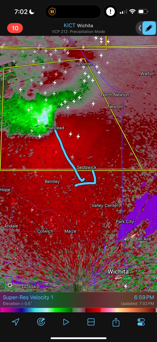
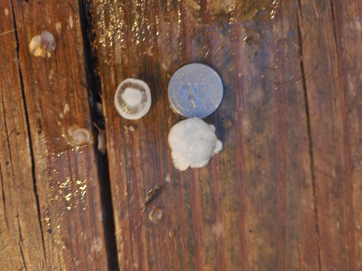
#Wichita and Sedgwick Co. can expect hail up to 2.5" inches in diameter and wind gusts to 70 mph.
71 mph winds just reported near Halstead with 1.8" hail in southern McPherson Co.
#KSwx#Kansas
Massive GORILLA HAIL producing supercell has matured and is diving southeast toward Newton and North Wichita, Kansas long term! If you are heading north on I35 from Wichita, you may end up wearing your windshield like a tuxedo!
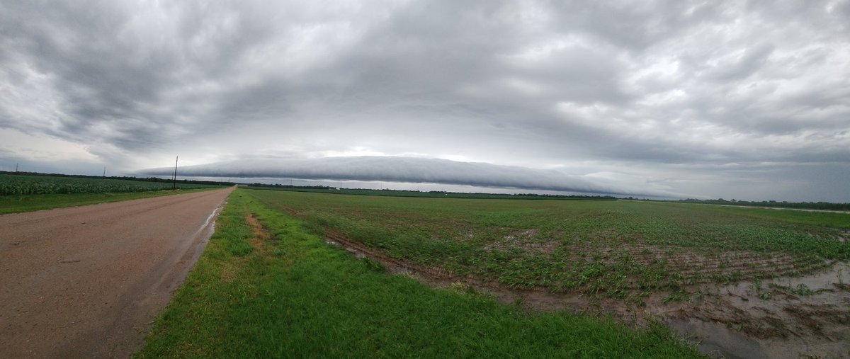
@NWSWichita view of the storm presently over Cheney Resevior. My location is 5mi NW of Halstead looking SW. 8:11pm CST. Lots of lightning. Got that cauliflower structure. Pretty storm.
@NWSWichita The wxcoder website seems to be down, so here is my report. HAL5NW reporting 1.17" of rain at 7:00am CST. I'll keep trying to report throughout the day.
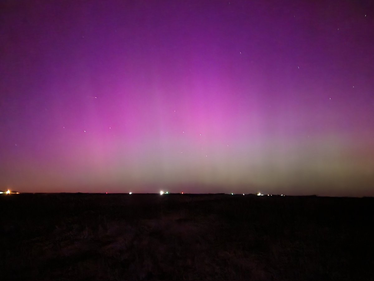
@rgmetoyer This photo is gorgeous; did you take it? If so, may WeatherNation have your permission to share this on-air and online with full credit to you?
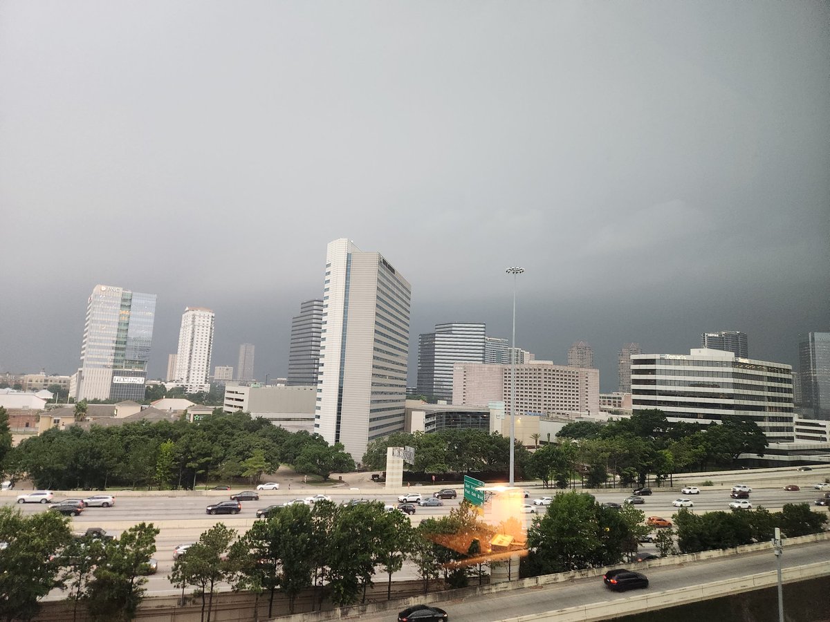
Traveling for business in Houston and just got the #tornadowarning here's an image from the oncoming storm from the 7th floor of the Springhill Suites near the Galleria. #txwx