Sidney Abramson

2.8K posts

Sidney Abramson banner
Sidney Abramson

Sidney Abramson

@sidabramson

Community Engagement Specialist at Tempest + Destination Signals

Louisville, KY Katılım Aralık 2009
564 Takip Edilen305 Takipçiler
Sidney Abramson
Sidney Abramson@sidabramson·
@chrisweather I most def think WAA is involved here but think HRRR has a good handle on just how deep it is. We’ll see
English
0
0
0
163
Chris Phillips
Chris Phillips@Chrisweather·
@sidabramson This happens every big storm. And I always bet on the warmer solution winning lol
English
1
0
0
196
Sidney Abramson
Sidney Abramson@sidabramson·
@chrisweather Going to be such a fine line. But that fine line will be the jackpot for snow.
English
0
0
0
189
Sidney Abramson
Sidney Abramson@sidabramson·
@RyanHokeWAVE3 I have to fly out at 7:30 tonight… oh boy!!! Hope one of these gusts don’t hit us on take off 🌬
English
0
0
1
0
Gathan D. Borden
Gathan D. Borden@GathanDBorden·
ATL is the worst airport. No such thing as a short walk to a connecting flight. 🙄
English
2
0
0
0
Claydar
Claydar@clay_dar·
Hey look, the ensembles are MUCH colder across northern Kentucky than the production run. There may be hope yet!
English
2
0
12
0
Sidney Abramson
Sidney Abramson@sidabramson·
@BGoodeWAVE3 Think they’ll push it another row north? Saw HRRR showed some bands further north
English
1
0
1
0
Brian Goode ❄️
Brian Goode ❄️@BGoodeWAVE3·
SPC indicating heavy snow of 1-2" per hour pushing into Central KY through midday.
Brian Goode ❄️ tweet media
English
2
4
20
0
Aaron Ellis
Aaron Ellis@aaronellis01·
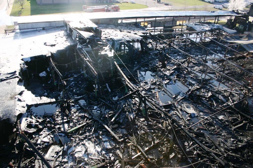
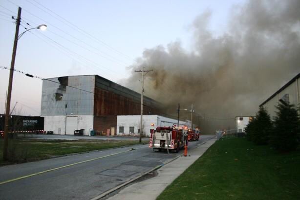
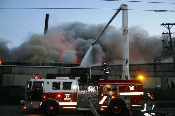
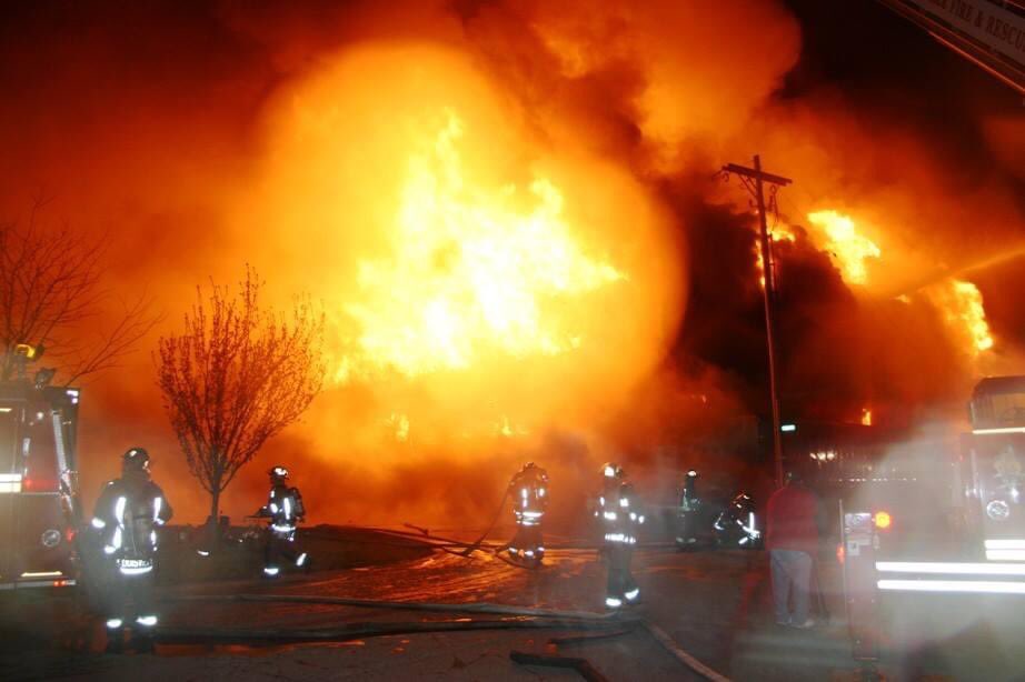
My friend JT shared this memory on his FB page & wanted to share a few pictures. My friends from @loukyfire fought one of the worst 🔥 in their history on this date in 2006 that covered 2 city blocks. If I remember correctly it was a 7 alarm fire in #louisville. Wanted to share:
Aaron Ellis tweet mediaAaron Ellis tweet mediaAaron Ellis tweet mediaAaron Ellis tweet media
English
1
1
7
0
Chris Phillips
Chris Phillips@Chrisweather·
Overnight data trended cooler and shifted the track slightly east. This would cut back on the sleet/mixing in the area. #cincywx
English
3
0
3
0
Chris Phillips
Chris Phillips@Chrisweather·
With 1-2" snowfall rates Monday evening. Double digit snowfall totals are going to likely happen. Right now the propobalities are around 20%. #cincywx
English
1
0
4
0
Jude Redfield
Jude Redfield@JudeRedfield·
Next weeks forecast snow maps might break the internet the next couple of days 🤣 🤣 😂 😂
GIF
English
20
15
124
0
Sidney Abramson
Sidney Abramson@sidabramson·
@cooperwx00 Would NOT be surprised to see more a phasing/interaction this weekend since the arctic front isn't coming in as strong early. They're hinting at it.
English
0
0
1
0
Ryan Hoke ⚡️
Ryan Hoke ⚡️@RyanHokeWAVE3·
Me looking at weather data for next week’s cold & wintry weather:
Ryan Hoke ⚡️ tweet media
English
2
0
21
0
Jude Redfield
Jude Redfield@JudeRedfield·
This is about to make it real slick for some areas tonight. Use caution if heading out.
Jude Redfield tweet media
English
3
4
19
0
Sidney Abramson
Sidney Abramson@sidabramson·
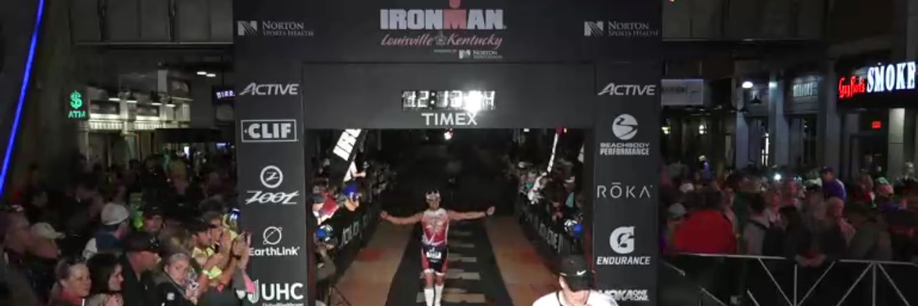
@cooperwx00 Ha! It was a hell of a year.. especially having back to back snows of almost 12” in Louisville! Pattern looks ripe and similar to say the least, but it’ll be a headache im sure!
English
0
0
1
0