Sabitlenmiş Tweet

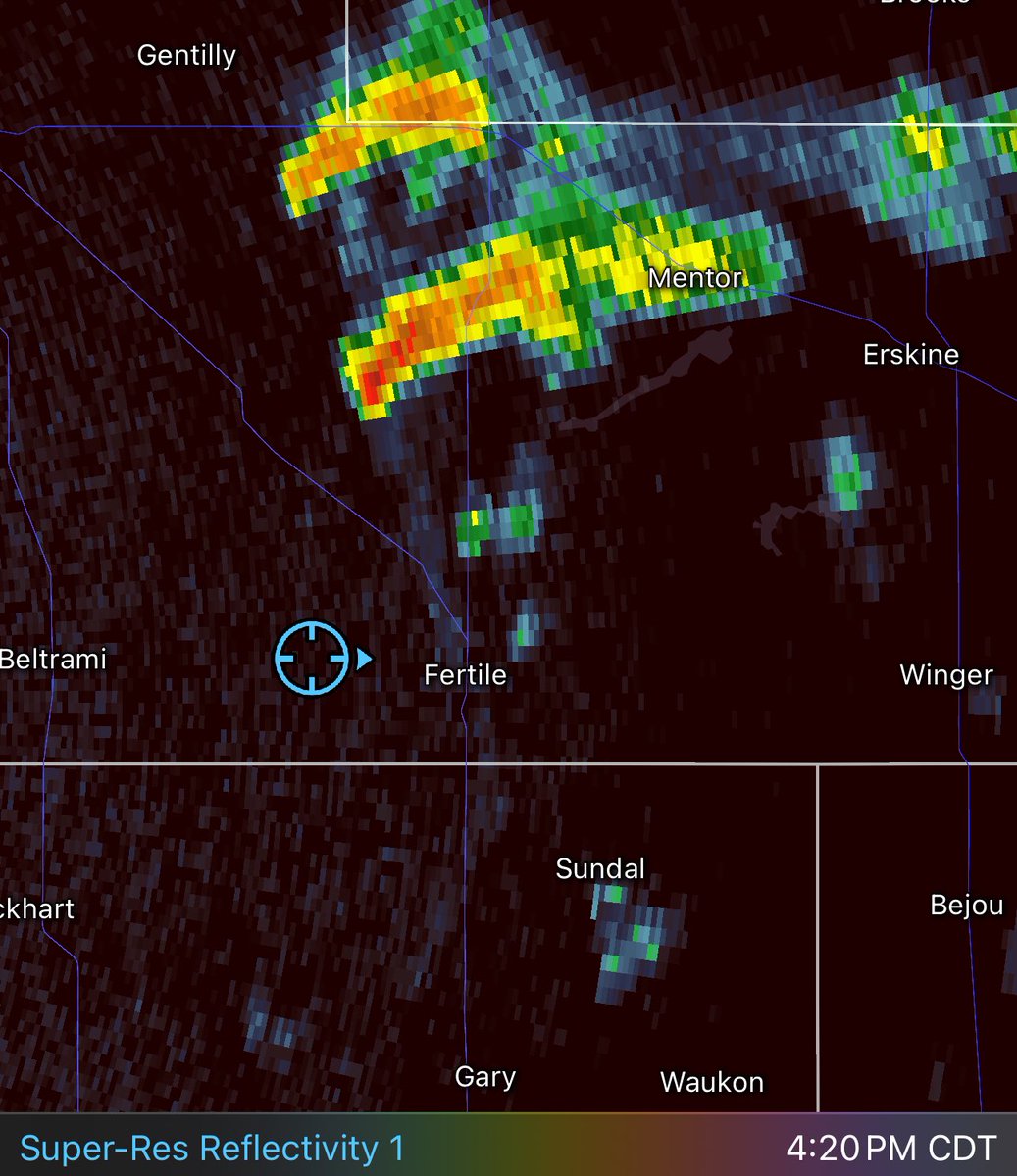
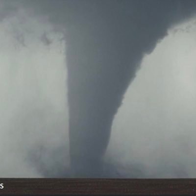
Floyd, NM tornado sequence. Estimated start time was 5:18 p.m. and rope out at 5:40 p.m. Photos captured at 5:21, 5:25, 5:31 and 5:38 p.m. this evening. @NWSAlbuquerque


English
Quincy Vagell
22.9K posts
@stormchaserQ
Meteorologist, storm chaser; photographer. Media inquiries: stormchaserQ @ gmail . com Instagram: stormchaserQ


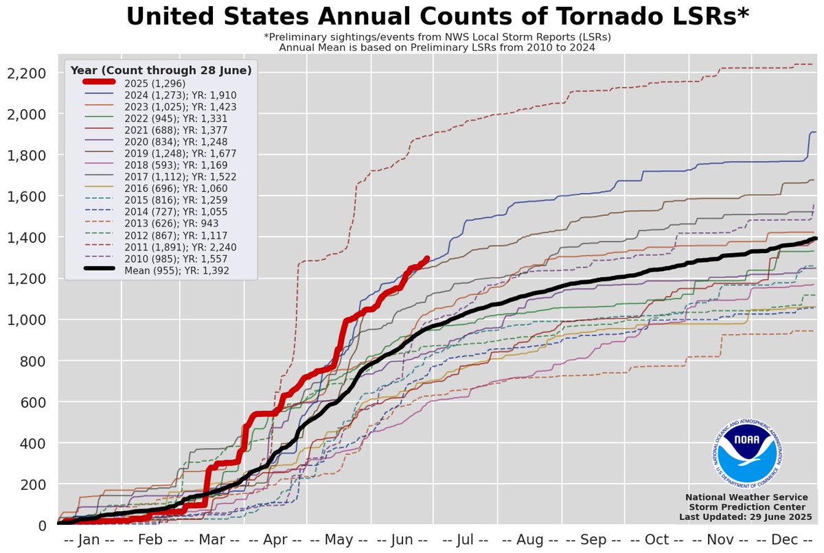

Best season, overall


Unfortunate truth nuke for the TL
Awful idea. The RRFS can't handle low-level cold air masses nearly as well as the NAM. There are also a litany of problems running the FV3 on a convection-allowing grid, some of which are outlined here x.com/VORTEXJeff/sta…
It's official! The NAM, HRW & HREF will be completely discontinued, and replaced with the RRFS in early 2026. The RRFS is almost an all-in-one high-resolution forecast system, with multiple high-res 3km members, which will also be a part of the REFS, with a 60hr Ensemble, aiming to replace the HREF.
It's official! The NAM, HRW & HREF will be completely discontinued, and replaced with the RRFS in early 2026. The RRFS is almost an all-in-one high-resolution forecast system, with multiple high-res 3km members, which will also be a part of the REFS, with a 60hr Ensemble, aiming to replace the HREF.