Ben Iglesia retweetledi
Ben Iglesia
102.2K posts


Ben Iglesia retweetledi

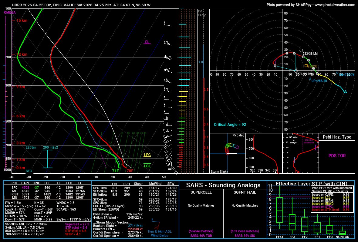
Still watching two areas for development after 4-5PM.
One west ahead of dry line. Sct'd storms (hail risk) still possible esp N of I-20.
2nd is in southern OK near old front. bigger concerns there. Those form and move ESE or SE with large hail and tor risks (orange) after 7-8 PM

English

At the very least, tomorrow will be a very significant hail day across parts of Oklahoma, Arkansas & far North Texas. Wouldn't be surprised to see an upgraded risk, mainly for hail.
Tornadoes will also be a concern (some strong), mainly with any cells that can interact with the differential heating boundary.

English
Ben Iglesia retweetledi

Major Accident (Fort Worth) Rescue 14, Engine 5, Truck 1, Battalion 2, multiple FWFD ambulances and FWPD are working a major accident on Harwood Street at Lancaster Avenue. Initial reports indicate a vehicle crashed off the bridge and onto Harwood Street. Scanner reports indicate two critical patients. A total of three ambulances have been requested to the scene. Avoid this area.
English
Ben Iglesia retweetledi
Tornado Warning continues for Gilmer TX, Glenwood TX and Diana TX until 11:00 PM CDT

English
@FalcnStormChase Ntx’s first tornado of the season was today @wastornadotoday
English
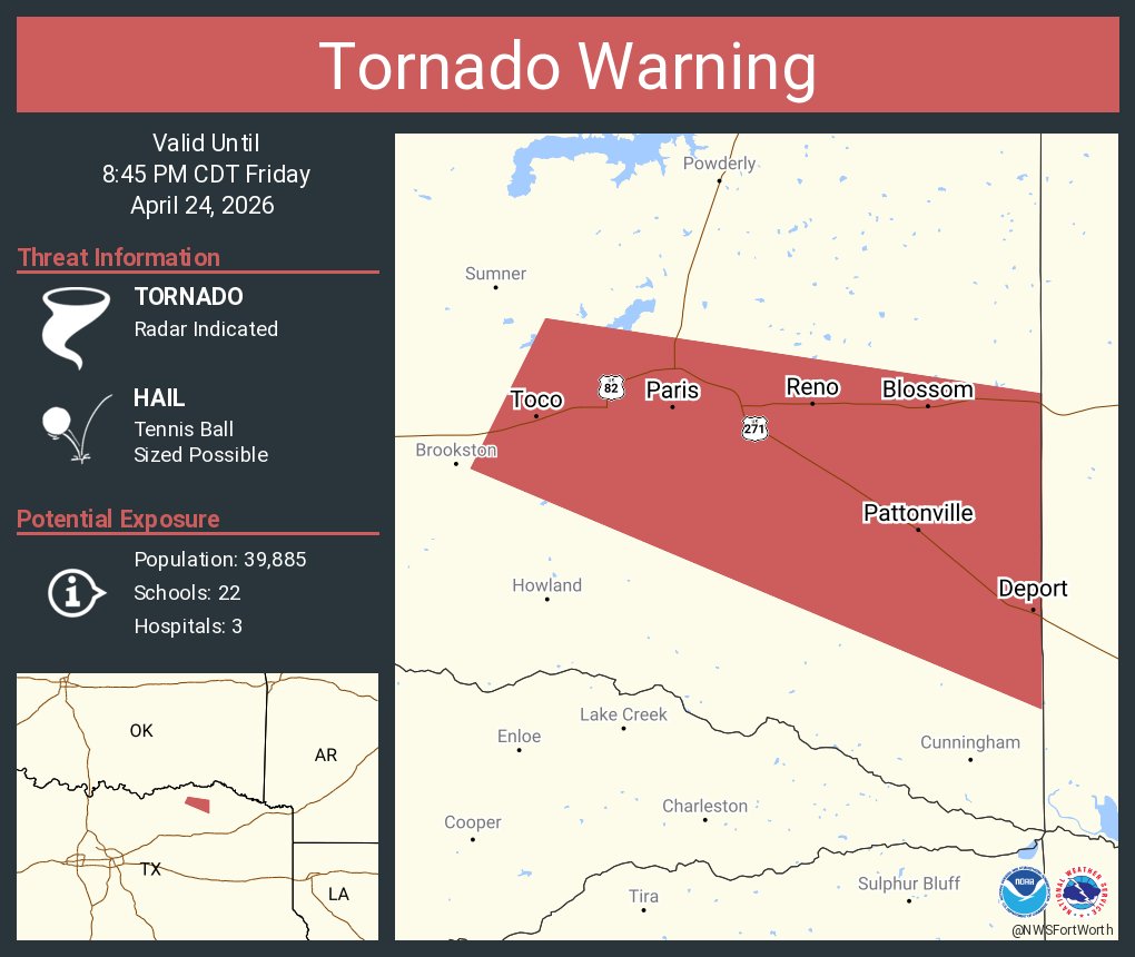
Ben Iglesia retweetledi

Tornado Warning including Paris TX, Reno TX and Blossom TX until 8:45 PM CDT
English
Ben Iglesia retweetledi
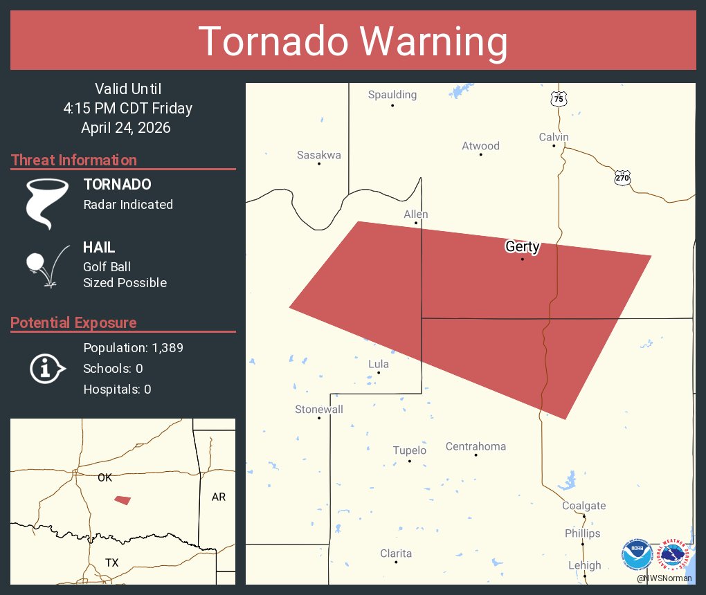
Tornado Warning including Pittsburg County, OK, Pushmataha County, OK until 6:30 PM CDT

English
Ben Iglesia retweetledi

Ben Iglesia retweetledi
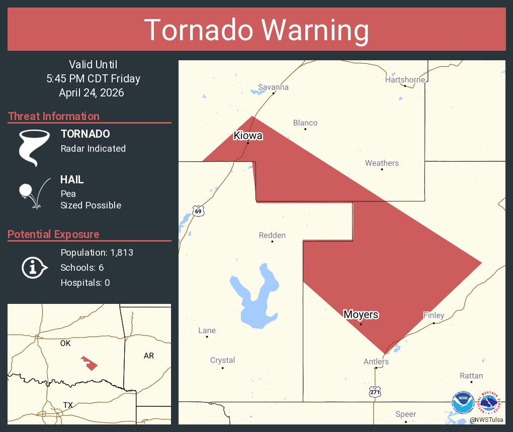
Tornado Warning including Kiowa OK, Pittsburg OK and Moyers OK until 5:45 PM CDT
English
@FalcnStormChase Time will tell, hopefully they dont, nobody wants the damage from these
English

Ben Iglesia retweetledi

Ben Iglesia retweetledi
Ben Iglesia retweetledi
Tornado Warning continues for Davis OK, Wynnewood OK and Joy OK until 4:15 PM CDT

English
Ben Iglesia retweetledi
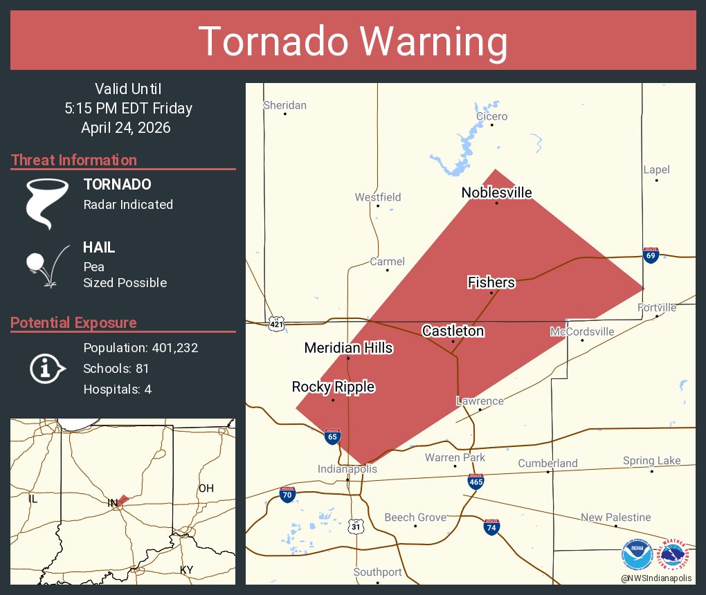
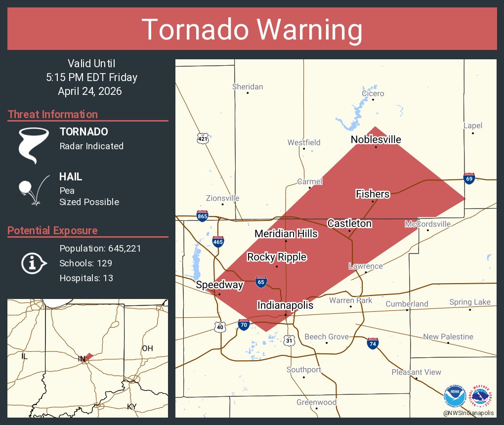
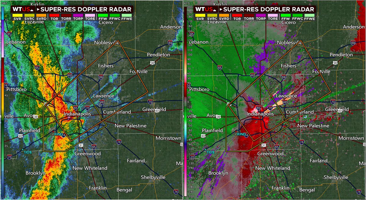
Tornado Warning continues for Fishers IN, Noblesville IN and Meridian Hills IN until 5:15 PM EDT
English
Ben Iglesia retweetledi
Tornado Warning including Indianapolis IN, Fishers IN and Noblesville IN until 5:15 PM EDT
English
Ben Iglesia retweetledi
Destructive Severe Thunderstorm Warning for downtown Indianapolis, IN.
Seek shelter now! These storms are packing wind gusts up to 80mph! A spin-up tornado may also occur.
English