Thorkill@Thorkill65
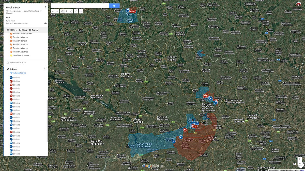
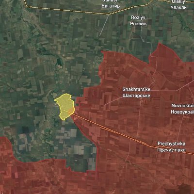
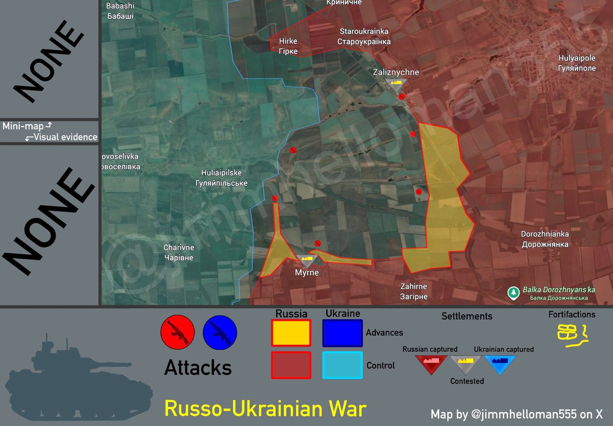
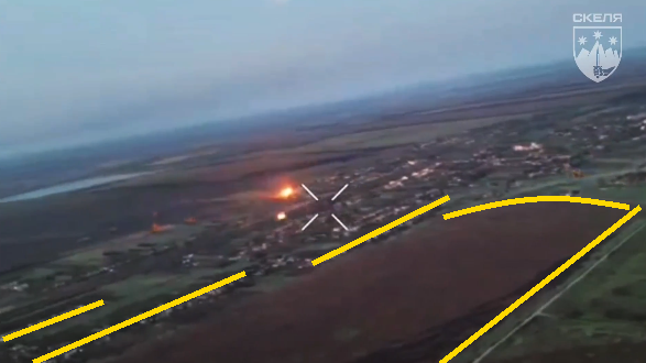
Sytuacja w rejonie Myrne - Zaliznyczne (Hulajpole).
W cieniu trwającej od kilku dni na Ukrainie burzy medialnej wokół niektórych pułków szturmowych tzw. Armii Syrskiego, jeden z nich - 225 Pułk Szturmowy dowodzony przez Oleha Szyriajewa - próbuje opanować poważny kryzys w swoim pasie odpowiedzialności, rozciągającym się od Myrne po Verkha Tersa na zach od Hulajpola. Ostatnie geo wskazują że w rejonie Myrne rus pododdziały należące prawdopodobnie do 38 Brygady Strzelców Zmot przełamały obronę 3 bat 108 Brygady OT podporządkowanemu 225 Pułkowi i zajęły ważne taktycznie wzg. 132 na płn-zach od tej wsi.
Tym samym okrążona operacyjnie została inna grupa bojowa podporządkowana 225 Pułkowi, składająca się z 2 bat 154 BZ oraz elementów 1 bat zmech 61 BZ, broniąca rejonu: wzg. 147 - wzg.136 frontem na wsch. Od mniej więcej 20 marca po utracie ważnego taktycznie wzg. 163 (Hagarowa Mohyła) wycofywała się ona powoli w kierunku Huliajpilskie, opóźniając rus 57 Brygadę Strzelców Zmot na kolejnych pośrednich liniach obrony. Okrążona operacyjnie została także jedna z komp 3 bat 108 Brygady OT broniąca samego Myrne oraz umocnień wzdłuż pasma wzgórz na wsch od niego. Dowództwo 225 Pułku w celu ratowania sytuacji oraz zapewne aby uniemożliwić samowolne opuszczanie pozycji przez żołnierzy ot, wysłało w rejon Myrne elementy bat szturmowego "Morok", złożonego ze skazańców. Zajął on pozycje za plecami 3 bat 108 Brygady OT i przeprowadza obecnie kontrataki w celu odzyskania kontroli nad szczytem wzg. 132.
Podobny kryzys wystąpił także na lewej flance Grupy Taktycznej 225 Pułku Szturmowego na płn od drogi: Huliajpolskie - Hulajpole. Utworzona tam ponad dwa miesiące temu długa na ponad 10 km i szeroką na około 1,5 km ukr pozycja ryglowa - ciągnącą się od Hulajpilskie po Zaliznyczne i sięgająca zach krańców Hulajpola - została ponownie zagrożona odcięciem w rejonie na zach od Zaliznyczne, przez koncentryczny atak 114 Pułk Strzelców Zmot z rejonu na płd od Zaliznyczne i 60 Brygadę Strzelców Zmot z rejonu Staroukrainki. Broniąca od wielu tygodni tej pozycji ryglowej ukr grupa bojowa składająca się z 1 bat piech 225 Pułku, 4 bat 5 Brygady Szturmowej i 1 bat zmot 154 BZ jest już tak wyczerpana i przemieszana, że nie jest w stanie sama odeprzeć kolejnych rus ataków w rejonie Zaliznyczne. W tej sytuacji Ołeh Szyriajew rzucił tam swój najlepszy odwodowy 1 bat szturmowy. Przeprowadza on obecnie kontrataki w rejonie Staroukrainki w celu odrzucenia rus grup szturmowych z pasów zalesień przy linii kolejowej na płn od Zaliznyczne.
Reasumując: trwający ponad dwa miesiące okres w którym grupa taktyczna 225 Pułku Szturmowego skutecznie powstrzymywała przy zach krańcach Hulajpola ataki niemal całej 5 Armii dobiegł końca. Pomimo że ukr grupa liczy obecnie 15 bat liniowych - jak sam przyznał w jednym z wywiadów Szyriajew - jest już tak wyczerpana, że nie jest w stanie utrzymywać nadal frontu na linii: Myrne -Zaliznycze. Przykładowo 2 bat zmech 154 BZ obecnie jest uzupełniany kompaniami z 61 BZ, pozostającej od niecałego roku w odwodzie strategicznym. W rezultacie elementy kolejnej jw na zasadzie "podporządkowani podporządkowanym" trafiają pod skrzydła 225 Pułku Szturmowego. W efekcie Grupa Taktyczna 225 Pułku coraz bardziej "puchnie" i Szyriajew - sierżant rezerwy przed lutym 2022 r. - niedługo będzie dowodził de facto korpusem.